 Arctic SDI catalogue
Crustaceans
Type of resources
Topics
Keywords
Contact for the resource
Provided by
Formats
Representation types
Update frequencies
status
-

PURPOSE: These data have been updated following a Canadian Science Advice Secretariat (CSAS) Regional Science Advisory Process. Associated publications are available in the citation section below or will be posted on the Fisheries and Oceans Canada (DFO) Science Advisory Schedule as they become available. DESCRIPTION: Provide a record of commercial and mature female snow crab abundance and biomass in the southern Gulf of St. Lawrence. Female snow crab represents an index of reproductive stock. Snow crab in the southern Gulf are treated as a single stock in the annual assessments. Abundance and biomass estimates for the commercial and female reproductive stock are produced using kriging, a type of spatial analysis. The time series starts in 1997. USE LIMITATION: To ensure scientific integrity and appropriate use of the data, we would encourage you to contact the data custodian.
-

PURPOSE: Trawl survey data used primarily for assessing the status of snow crab stocks in the southern Gulf of St. Lawrence. DESCRIPTION: Tow, catch, and biological information for snow crab and other species caught during the annual snow crab research vessel trawl survey in the southern Gulf of St. Lawrence. Currently, the survey uses a stratified random design that divides the area into 355 square grids, each measuring 12.7 km by 12.7 km. The survey area spans the majority of snow crab habitat in the southern Gulf, at depths ranging from 20 to 200 fathoms. Sampling stations are trawled during civil twilight hours using a Bigouden Nephrops bottom trawl net. The vessel operates at a target speed of 2 knots for a duration of 5 minutes, maintaining a warp-to-depth ratio of 3:1, with a maximum warp length of 575 fathoms. PARAMETERS COLLECTED: Snow crab: sex, carapace width, height of male crab claw, shell condition, gonad colour, egg colour, eggs remaining, and missing legs. Other species: counts, and weights Other: GPS coordinates; swept area; depth; temperature; CTD profile; NOTES ON QUALITY CONTROL: Data are checked for irregularities and errors. SAMPLING METHODS: Survey catches are sorted by species or taxonomic groups and measured directly on board. All snow crab are measured, while select fish species are measured only for a subset of survey stations. USE LIMITATION: To ensure scientific integrity and appropriate use of the data, we would encourage you to contact the data custodian.
-
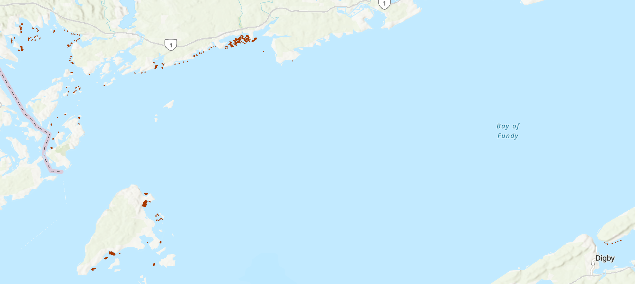
This dataset reports on lobster abundance and individual biological characteristics (size, sex, shell hardness, egg status), along with seabed substrate information, collected at various coastal sites in the Bay of Fundy, Canada. Surveys were conducted over a 40-year period between 1982 and 2021. Survey areas and SCUBA dive sites were located around Grand Manan Island, Deer Island, Campobello Island, and along the Bay of Fundy’s New Brunswick shore stretching from Passamaquoddy Bay, east to Maces Bay. One survey area was located on the Bay of Fundy’s southern shore (Nova Scotia) in the Annapolis Basin (Lawton et al. 1995). The data represent a compilation of SCUBA diving surveys (1003 belt transects) conducted directly by Fisheries and Oceans Canada (DFO) scientific SCUBA divers (1982-2019), or by contracted commercial divers funded in association with outside collaborating organizations; Department of Fisheries and Agriculture (DFA; 1990 – 1993), the Grand Manan Fishermen’s Association (GMFA; 2013-2015), and the University of New Brunswick (UNB; 2019-2021). Cite this data as: Lawton P, Dinning K, Rochette R, Teed L. American lobster (Homarus americanus) abundance and biological characteristics collected from SCUBA dive surveys in the Bay of Fundy from 1982-2021. Published August 2024. Coastal Ecosystems Science Division, Fisheries and Oceans Canada, St. Andrews, N.B. For additional information please see: Campbell, A. 1990. Aggregations of berried lobsters (Homarus americanus) in shallow waters off Grand Manan, eastern Canada. DFO Can. J. Fish. Aquat. Sci. 47: 520-523. Denton, C.M. 2020. Maritimes Region Inshore Lobster Trawl Survey Technical Description. DFO Can. Tech. Rep. Fish. Aquat. Sci. 3376: v + 52 p. Lawton, P. 1993. Salmon aquaculture and the traditional invertebrate fisheries of the Fundy Isles region: habitat mapping and impact definition: Cooperation Agreement on Fisheries and Aquaculture Development. Submitted by Peter Lawton to the New Brunswick Department of Fisheries and Aquaculture, 84 p. Unpublished monograph. Available from Fisheries and Oceans Canada Library, Dartmouth, NS (Monographs: SH 380.2 .C2 .L39 1992). https://science-catalogue.canada.ca/record=3943769~S6 Lawton, P., Robichaud, D.A., and Moisan, M. 1995. Characteristics of the Annapolis Basin, Nova Scotia, lobster fishery in relation to proposed marine aquaculture development. DFO Can. Tech. Rep. Fish. Aquat. Sci. 2035: iii + 26 p. Lawton, P., Robichaud, D.A., Rangeley, R.W., and Strong, M.B. 2001. American Lobster, Homarus americanus, population characteristics in the lower Bay of Fundy (Lobster Fishing Areas 36 and 38) based on fishery independent sampling. DFO Can. Sci. Advis. Sec. Res. Doc. 2001/093. Wentworth, C.K. 1922. A Scale of Grade and Class Terms for Clastic Sediments. The Journal of Geology 30(5): 377-392. Dinning, K.M., Lawton, P., and Rochette, R. 2025. Increased use of mud bottom by juvenile American lobsters (Homarus americanus) in Maces Bay and Seal Cove, Bay of Fundy, after three decades of population increases and predator declines. Canadian Journal of Fisheries & Aquatic Sciences 82; https://doi.org/10.1139/cjfas-2023-0312
-

PURPOSE: The SCUBA survey was designed to assess the density of small lobsters (1-3 years of age) in rocky reefs, in the nearshore habitat. DESCRIPTION: Total number of transects surveyed and total number of lobsters measured for each site in each year. There are some sites that do not have any coordinates identified, therefore these have not been included in the Web Map Services (WMS). PARAMETERS COLLECTED: Size measurement (biological); species counts (ecological); substrate (geological) SAMPLING METHODS: Transects are laid out from a small vessel using buoys, anchors, and a 100 m leaded rope along the bottom, marked at 5 m intervals. A strip transect survey method is used whereas two divers sample a 1 or 2 m strip (dependent on lobster density) alongside either side of the leaded rope. All captured lobsters are measured (carapace length) and all lobsters of ≥20 mm carapace length are sexed. The complexity and suitability of the habitat is assessed in the 5 m sections (e.g. rocky reefs, sand, large boulders). USE LIMITATION: To ensure scientific integrity and appropriate use of the data, we would encourage you to contact the data custodian.
-

This project was completed by the Shellfish Section in the Newfoundland and Labrador Science Branch of Fisheries and Oceans Canada (DFO), in collaboration with industry partners. The Coastal Environmental Baseline program supported the Placentia Bay portion of project work for an ongoing industry-DFO collaborative post-season trap survey for Snow Crab that was initiated in 2003 and has occurred each year. This survey is conducted by Snow Crab harvesters accompanied by at-sea observers and takes place in NAFO Divisions 2J3KLNOP4R. Historically the survey focused on commercial fishing grounds but began transitioning to a partly random stratified design in 2017. Since 2018, approximately 50% of survey stations are randomly allocated while 50% remain fixed. At each station, six (for inshore stations) or ten (for offshore stations) commercial traps are set in a fleet. To gather data on non-commercial sized Snow Crab, including females, many fleets also include one small-mesh trap. The coverage of small-mesh traps has been expanding in recent years with the aim of one small-mesh trap for every station in the coming years. Biological sampling is undertaken on at least one commercial trap and the small-mesh trap at each station. The data from this survey is incorporated into the annual stock assessment for Snow Crab in the Newfoundland and Labrador region. This record contains trap locations for Placentia Bay, and information on the types of data collected. More detailed information can be found in Pantin et al. (2022). https://publications.gc.ca/collections/collection_2023/mpo-dfo/fs70-5/Fs70-5-2022-076-eng.pdf
-

PURPOSE: The objective of the sea scallop survey is to obtain fishery independent data on the abundance, size distribution and location of scallops in the southern Gulf of St. Lawrence and to provide science advice on stock status to fishery managers, decision makers and industry stakeholders. DESCRIPTION: The sea scallop research survey is conducted on CCGS MPerley (or chartered vessels) and has stratified random sampling. For each tow (or sample), data is recorded on tow, all specimens caught, geolocation, shell height frequency and biological samples. This monitoring program is currently on-hold. It will resume if a survey is deemed necessary to provide a new or updated science advice in the future. Stock status is currently (2024) in the critical zone. Rebuilding plan to follow. PARAMETERS COLLECTED: Catch number (biological), catch weight (biological), individual lengths (biological), age (biological), meat weight (biological). PHYSICAL SAMPLE DETAILS: A sub-sample of scallop shells is retained and analysed for age determination in the lab. SAMPLING METHODS: From 2012 to 2016, an annual, rotational, multispecies research survey program for scallop in the sGSL was conducted to obtain fishery independent indices of abundance, biomass estimates, and biological characteristics information (shell height, meat weight, sex, clappers). One section of a SFA or the SFA in its entirety was surveyed per year, with the exception of SFA 23 which was excluded because of the low scallop fishing effort reported from this area in recent years. From 2019 to 2023, annual surveys were conducted on the three major beds in the Northumberland Strait (West Point and Cape Tormentine in SFA 22, Pictou in SFA 24), using a similar methodology as the previous surveys. Methodology can be found in the Science Advisory Report and the Research Document listed in the citations list. USE LIMITATION: To ensure scientific integrity and appropriate use of the data, we would encourage you to contact the data custodian.
-

This layer details Important Areas (IAs) relevant to key invertebrate species (which are not corals or sponges) in the Strait of Georgia (SOG) ecoregion. This data was mapped to inform the selection of marine Ecologically and Biologically Significant Areas (EBSA). Experts have indicated that these areas are relevant based upon their high ranking in one or more of three criteria (Uniqueness, Aggregation, and Fitness Consequences). The distribution of IAs within ecoregions is used in the designation of EBSAs. Canada’s Oceans Act provides the legislative framework for an integrated ecosystem approach to management in Canadian oceans, particularly in areas considered ecologically or biologically significant. DFO has developed general guidance for the identification of ecologically or biologically significant areas. The criteria for defining such areas include uniqueness, aggregation, fitness consequences, resilience, and naturalness. This science advisory process identifies proposed EBSAs in Canadian Pacific marine waters, specifically in the Strait of Georgia (SOG), along the west coast of Vancouver Island (WCVI, southern shelf ecoregion), and in the Pacific North Coast Integrated Management Area (PNCIMA, northern shelf ecoregion). Initial assessment of IA's in PNCIMA was carried out in September 2004 to March 2005 with spatial data collection coordinated by Cathryn Clarke. Subsequent efforts in WCVI and SOG were conducted in 2009, and may have used different scientific advisors, temporal extents, data, and assessment methods. WCVI and SOG IA assessment in some cases revisits data collected for PNCIMA, but should be treated as a separate effort. Other datasets in this series detail IAs for birds, cetaceans, coral and sponges, fish, geographic features, and other vertebrates. Though data collection is considered complete, the emergence of significant new data may merit revisiting of IA's on a case by case basis.
-

This project was completed by the Productive Capacity group (Coastal and Freshwater Ecology Section) in the Newfoundland and Labrador Science Branch of Fisheries and Oceans Canada (DFO). American lobster (Homarus americanus) is a commercially important decapod crustacean species along the east coast of North America, ranging from the Labrador coast south to Cape Hatteras. Juvenile lobster < 40 mm CL (carapace length) recruitment has been studied extensively in the southern portions of their range. However, investigations of settlement habitat association and recruitment of juvenile lobster in the northern extremes along the Newfoundland coast have been largely unsuccessful. We investigated juvenile lobster density, habitat, and depth associations in three areas of Newfoundland, using scuba – Port Saunders area, 8 dives conducted 28 September - 2 October 2017, and Burin Peninsula 10 dives (7 Placentia Bay, 3 Fortune Bay) conducted 30 September - 4 October 2018 over a total seabed area of 9,138 m2, within 200 meters of shore. Port Saunders and Fortune Bay had relatively higher lobster density (0.09 and 0.40 m-2, respectively); >65% were juveniles, in contrast to Placentia Bay where lobster densities of all size groups were low (mean 0.01 m-2) and no juvenile lobsters were observed at all. Where observed all juvenile lobster were significantly associated with shallow (<6 m) habitat and showed no overlap with distribution of adults (>82.5 mm CL) which we observed at depths 6 to 17 m. Our sites were dominated by varying mixes of cobble and pebble (77%); rock/bedrock (12%) and mud/sand/small pebble (11%) substrates interspersed with overlying kelp (32%) and eelgrass (11%) vegetation. We observed no significant associations with substrate or vegetation. This record contains the geographic locations of the 7 Placentia Bay sites surveyed, and information on the timing and type of data collected at each site, which was one component supported by Coastal Environmental Baseline Program of a larger collaborative project.
-

PURPOSE: The primary objective of this survey is to obtain an index of the abundance and biomass of American lobster (Homarus americanus) in the Northumberland Strait. This research survey also provides fisheries-independent information for all of the species captured by the trawl. DESCRIPTION: Catch weight, length frequencies, and biological information for crustaceans and fish caught during the annual July-August research vessel trawl survey in Northumberland Strait (NAFO Division 4T). Abundance indices and spatial distribution patterns of commercial and non-commercial crustaceans and other groundfish. PARAMETERS COLLECTED: The full catch is sorted to species, or lowest taxonomic group possible, and weighed. For lobster, carapace length, sex and carapace condition (i.e. stage of moult) are recorded. For female lobster, the presence or absence of eggs is noted and, starting in 2010, the stage of development of the eggs (i.e. new or old) when present was also recorded. Similarly, for crabs, the carapace width, sex and carapace condition (i.e. stage of moult) is recorded as is the presence or absence of eggs (for females). Fish sampling varied over the years but, starting in 2005, length has been recorded for all fish captured. For large catches, the complete catch is sorted and weighed, but sub-sampling, by species, is used for the other measurements. NOTES ON QUALITY CONTROL: Data are checked for irregularities. SAMPLING METHODS: The Northumberland Strait multi-species survey began in 2001 using a stratified random sampling plan. A random selection of sampling sites within the study area is now used. Sampling is completed annually over a 4-week period in July and August. One hundred ten (110) stations are sampled in Northumberland Strait in water depths greater than 4 m at the lowest normal tide. The survey has employed a 286 Rockhopper trawl for all years from 2001 to 2018, except in 2010 and 2011, when a Nephrops trawl was used. In 2019, a new trawl (called the Northumberland trawl) was used in addition to the Rockhopper trawl. The Northumberland trawl is similar to the 286 Rockhopper trawl, but with a smaller footgear and smaller mesh sizes. At each station, the trawl is towed for a set period of time (recently 15 minutes with the rockhopper trawl and 10 minutes with the Northumberland trawl). USE LIMITATION: To ensure scientific integrity and appropriate use of the data, we would encourage you to contact the data custodian.
-

PURPOSE: The research survey provides a fisheries-independent source of information about all marine living organisms that are captured by the fishing trawl used to obtain samples in the southern Gulf of St. Lawrence. DESCRIPTION: Tow, catch, length frequency, and biological information for fish caught during the annual September research vessel trawl surveys in the southern Gulf of St. Lawrence (NAFO Division 4T). Abundance indices and spatial distribution patterns of commercial and non-commercial groundfish. The catch data that appear in this dataset SHOULD NOT BE USED FOR ECOLOGICAL ANALYSES INVOLVING CATCH RATES. Important factors such as vessel, fishing gear and diurnal periods must be accounted for to use these data in analyses. Please contact the data custodians if you are interested in using this data for any kind of ecological analyses involving catch rates. PARAMETERS COLLECTED: Abundance estimates (ecological); distribution (ecological); species counts (ecological); gear (fishing); vessel information (fishing); point (spatial) NOTES ON QUALITY CONTROL: Scientific names listed in the survey species list have been mapped to recognized standards - marine taxa have been mapped to the World Register of Marine Species (WoRMS) using their online taxon match tool. All sampling locations were plotted on a map to perform a visual check confirming that the latitude and longitude coordinates were within the described sampling area. In 2003, because of a fire aboard the Alfred Needler, the Wilfred Templeman was used for the survey. However, no comparative fishing experiments have been conducted between the Alfred Needler and the Wilfred Templeman. We are therefore unable to integrate the indices derived for 2003 to the remainder of the survey time-series. SAMPLING METHODS: Sampling Method: Consult the "Protocols for research vessel cruises within the Gulf Region (dermersal fish) (1970-1980)" report, link provided in the citations list. USE LIMITATION: To ensure scientific integrity and appropriate use of the data, we would encourage you to contact the data custodian.