 Arctic SDI catalogue
60 m
Type of resources
Available actions
Topics
Keywords
Contact for the resource
Provided by
Years
Formats
Resolution
-

This is the metadata covering the Sentinel-1 and Sentinel-2 Snow Phenology (SPS1S2) product. It is generated once a year over high-mountain areas at European scale, based on daily cumulative Gap-Filled Fractional Snow Cover (GFSC) products calculated from Sentinel-2 optical and Sentinel-1 radar data. This product describes the snow season in terms of temporality as it provides, for each pixel, the number of days with snow cover, as well as the first and the last day of the longest observed snow period. It has a spatial resolution of 60 m x 60 m, as does the input GFSC product. Each product is composed of separate files corresponding to the different layers of the product, and another metadata file." The product is also available in another projection as tiles aligned with the Pan-European High-Resolution Layers in the European grid (ETRS89 LAEA - EPSG: 3035) at 60 m x 60 m and 100 m x 100 m. SP S2+S2 is one of the products of the pan-European High-Resolution Water Snow & Ice portfolio (HR-WSI), which are provided at high spatial resolution from the Sentinel-2 and Sentinel-1 constellations data from September 1, 2016 onwards.
-

The Wet/Dry Snow (WDS) product is generated in near real-time at European scale based on C-band SAR satellite data from the Sentinel-1 constellation within the fractional snow cover on top of canopy (FSCTOC) derived from overlapping optical satellite data from the Sentinel-2 constellation. The product provides the snow state condition (wet / dry) for surfaces covered by snow (FSCTOC >= 90%) for non-forested land areas with a spatial resolution of 60 m x 60 m. Urban areas, forest and water bodies as well as clouds and cloud shadows from the S2 based FSCTOC product of the same date are masked. WDS is one of the products of the pan-European High-Resolution Water Snow & Ice portfolio (HR-WSI), which are provided at high spatial resolution from the Sentinel-2 and Sentinel-1 constellations data from September 1, 2016 onwards. The WDS product is distributed in raster files covering an area of 110 km by 110 km with a pixel size of 60 m by 60 m in UTM/WGS84 projection, which corresponds to the Sentinel-2 input L1C product tile. Each product is composed of separate files corresponding to the different layers of the product, and another metadata file.
-
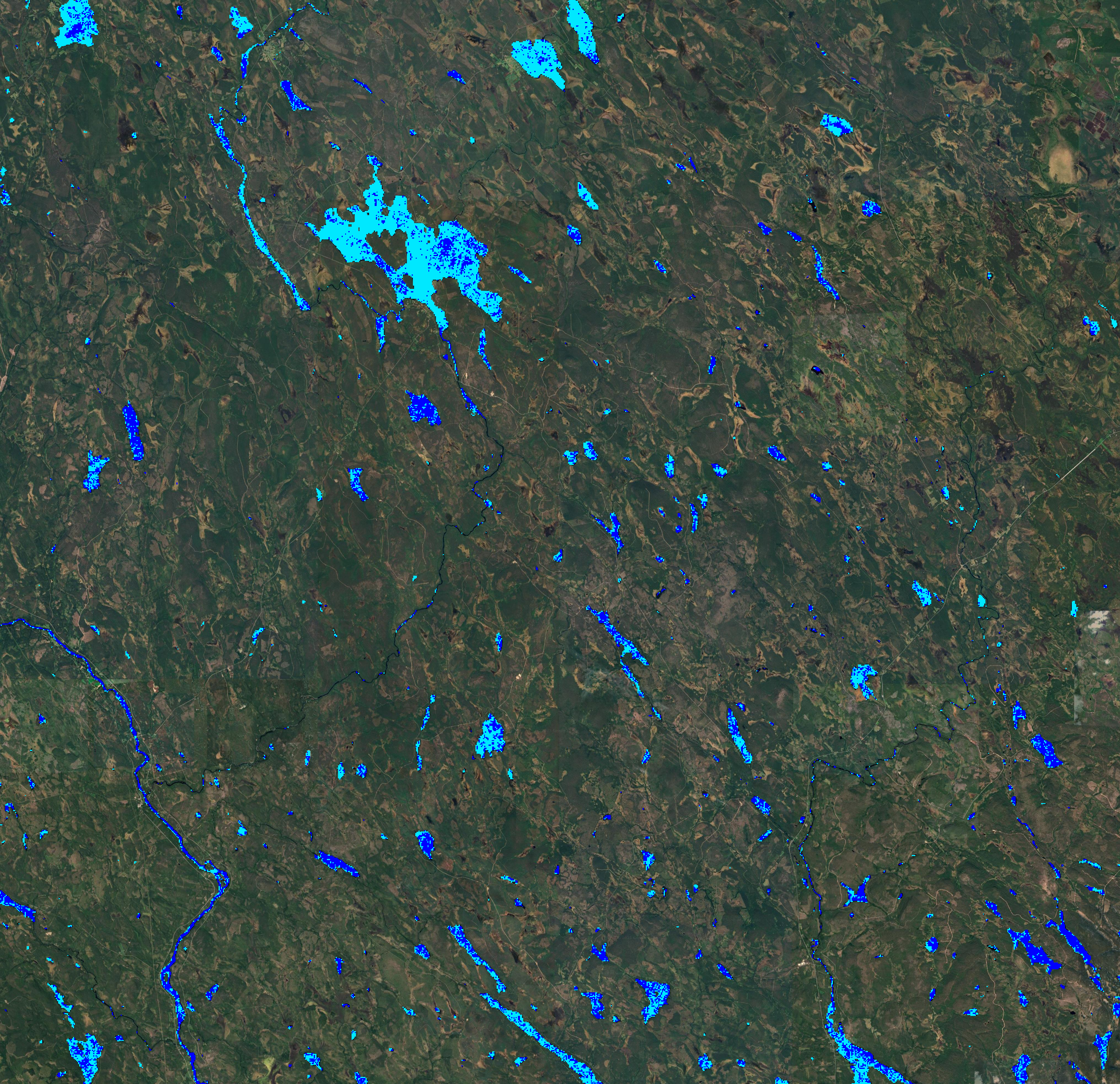
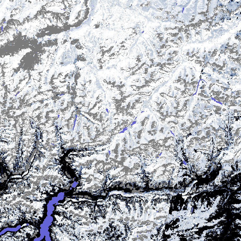
The Sentinel-1 Water and Ice Cover (WIC S1) product is generated in near real-time at European scale, based on radar data from the Sentinel-1 constellation. The product provides the water and ice extent on water bodies (rivers and lakes), at a spatial resolution of 60 m x 60 m. WIC S1 is one of the products of the pan-European High-Resolution Water Snow & Ice portfolio (HR-WSI), which are provided at high spatial resolution from the Sentinel-2 and Sentinel-1 constellations data from September 1, 2016 onwards. The WIC S1 product is distributed in raster files covering an area of 110 km by 110 km with a pixel size of 60 m by 60 m in UTM/WGS84 projection, which corresponds to the Sentinel-2 input L1C product tile. Each product is composed of separate files corresponding to the different layers of the product, and another metadata file.
-
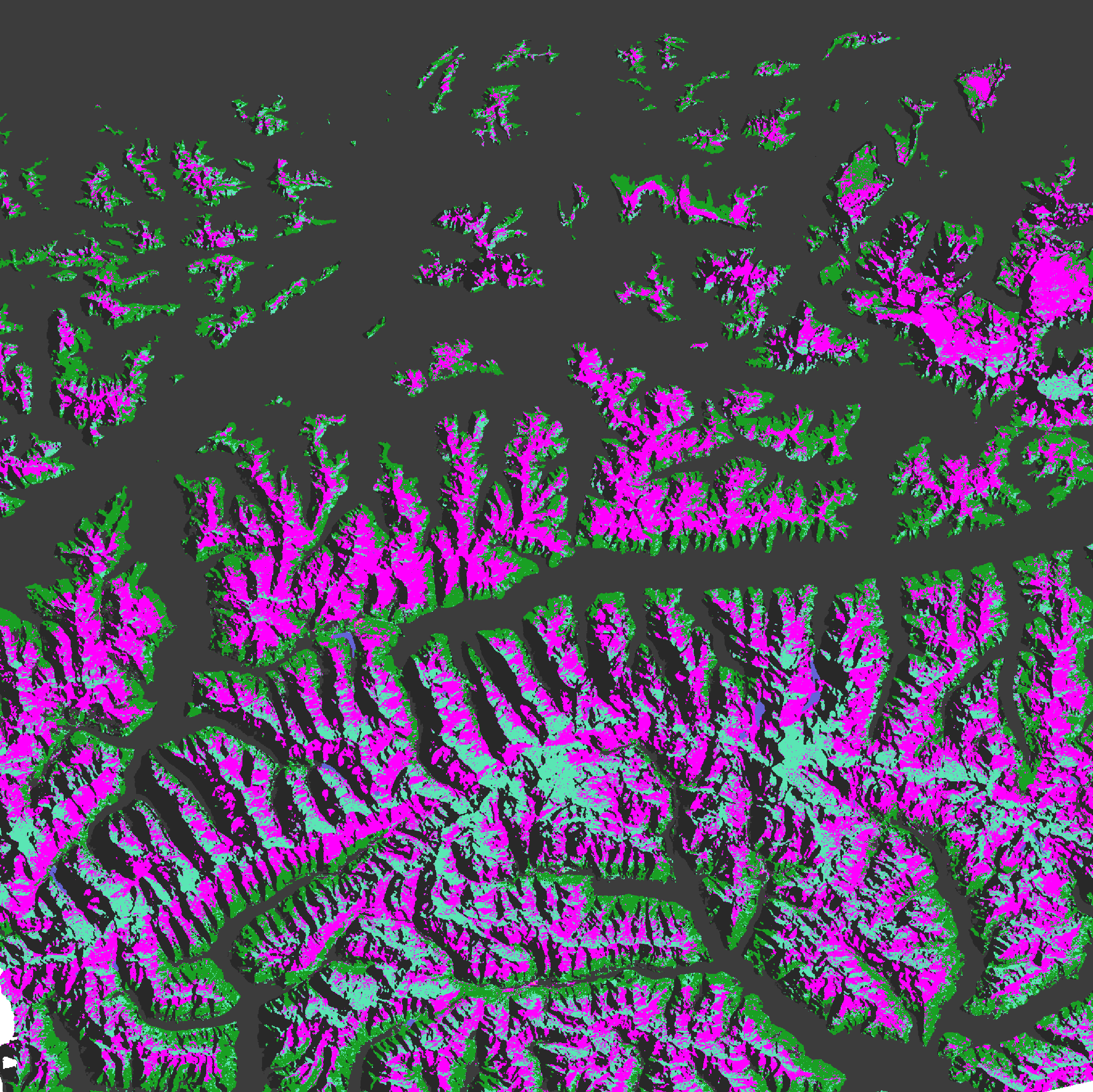
The SAR Wet Snow (SWS) product is generated in near real-time for selected high mountain areas at European scale based on C-band SAR satellite data from the Sentinel-1 constellation. The product provides the wet snow extent for high mountain areas with a spatial resolution of 60 m x 60 m. Dry snow cannot be discriminated from patchy snow or snow free areas by the means of C-band SAR data only and are thus combined in one class. Radar shadow / layover / foreshortening, water bodies, forests, urban areas, and non-mountain regions are masked. SWS is one of the products of the pan-European High-Resolution Water Snow & Ice portfolio (HR-WSI), which are provided at high spatial resolution from the Sentinel-2 and Sentinel-1 constellations data from September 1, 2016 onwards. The SWS product is distributed in raster files covering an area of 110 km by 110 km with a pixel size of 60 m by 60 m in UTM/WGS84 projection, which corresponds to the Sentinel-2 input L1C product tile. Each product is composed of separate files corresponding to the different layers of the product, and another metadata file.
-
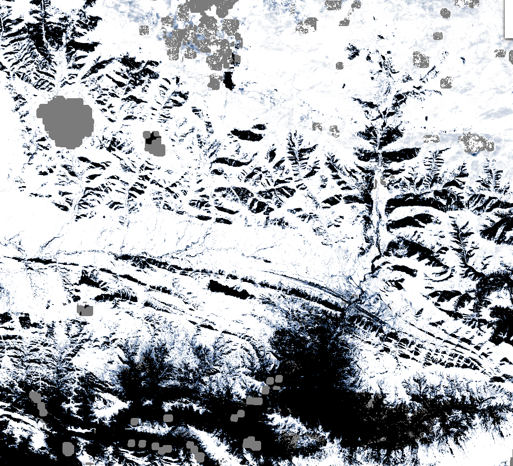
The Copernicus Daily Cumulative Gap-filled Fractional Snow Cover (GFSC) product is generated in near real-time for the entire EEA38 and the United Kingdom, based on radar satellite data from the Sentinel-1 constellation and on optical data from the Sentinel-2 constellation. The product uses Copernicus FSC (Fractional Snow Cover), WDS (Wet/Dry Snow) and SWS (SAR Wet Snow) products along with DEM data as input to form a spatially complete composite of snow conditions, to reduce observational gaps due to clouds and lack of sensor coverage on a daily basis. The product provides the extent of the snow cover per pixel as a percentage (0% – 100%) with a spatial resolution of 60 m x 60 m. The GFSC product is distributed in raster files covering an area of 110 km by 110 km with a pixel size of 60 m by 60 m in UTM/WGS84 projection, which corresponds to the Sentinel-2 input L1C product tile. Each product is composed of four separate GeoTIFF files corresponding to the different layers of the product, and a metadata file. The GF layer provides the gap-filled fractional snow cover, while the QC layers (AT, QCFLAGS, QC) provide information on the quality of the GF layer at the pixel level . The GFSC is one of the products of the pan-European High-Resolution Snow & Ice service (HR-S&I), which are provided at high spatial resolution (20 m x 20 m and 60 m x 60 m), from the Sentinel-2 and Sentinel-1 constellations data from September 1, 2016 onwards.
-

The Copernicus SAR Wet Snow (SWS) product is generated in near real-time for the entire EEA38 and the United Kingdom, based on radar satellite data from the Sentinel-1 constellation. The product provides binary information on the wet snow extent and the snow free or patchy snow or dry snow extent in high mountain areas with a spatial resolution of 60 m x 60 m. The SWS product is distributed in raster files covering an area of 110 km by 110 km with a pixel size of 60 m by 60 m in UTM/WGS84 projection, which corresponds to the Sentinel-2 input L1C product tile. It is available in several mountainous regions in Iceland, the Pyrenees, the Alps, Eastern Türkiye and Scandinavia. Each product is composed of two separate GeoTIFF files corresponding to the different layers of the product, and a metadata file.The WSM (Wet Snow classification in high Mountainous areas) layer provides the wet snow extent derived from S1 Level 1 GRD data over high montainous areas, and the QCWSM (Quality) layer provides the per-pixel accuracy information associated with the WSM layer for all pixels with detected snow areas. The SWS is one of the products of the pan-European High-Resolution Snow & Ice service (HR-S&I), which are provided at high spatial resolution (20 m x 20 m and 60 m x 60 m), from the Sentinel-2 and Sentinel-1 constellations data from September 1, 2016 onwards.
-
The Daily Cumulative Gap-filled Fractional Snow Cover (GFSC) product is generated on a daily basis at European scale based on synthetic aperture radar data from the Sentinel-1 constellation and optical imaging data from the Sentinel-2 constellation. The product provides the extent of the snow cover per pixel as a percentage (0% – 100%) with a spatial resolution of 60 m x 60 m. GFSC is one of the products of the pan-European High-Resolution Water Snow & Ice portfolio (HR-WSI), which are provided at high spatial resolution from the Sentinel-2 and Sentinel-1 constellations data from September 1, 2016 onwards. The GFSC product is distributed in raster files covering an area of 110 km by 110 km with a pixel size of 60 m by 60 m in UTM/WGS84 projection, which corresponds to the Sentinel-2 input L1C product tile. Each product is composed of separate files corresponding to the different layers of the product, and another metadata file.