 Arctic SDI catalogue
2018 3.6.2
Type of resources
Available actions
Topics
Keywords
Contact for the resource
Provided by
Years
Formats
Resolution
-

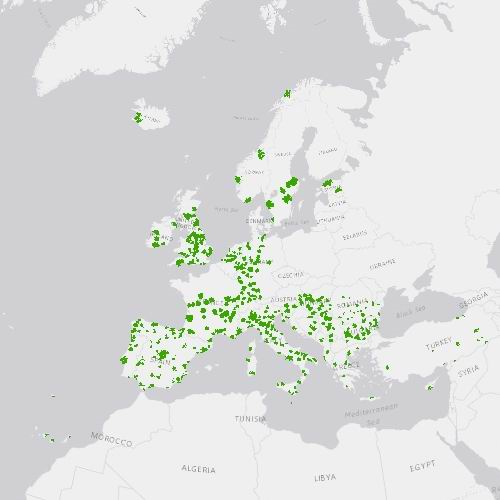
The Urban Atlas provides pan-European comparable land use and land cover data for Functional Urban Areas (FUA). The Street Tree Layer (STL) is a separate layer from the Urban Atlas 2012 LU/LC layer produced within the level 1 urban mask for each FUA. It includes contiguous rows or a patches of trees covering 500 m² or more and with a minimum width of 10 meter over "Artificial surfaces" (nomenclature class 1) inside FUA (i.e. rows of trees along the road network outside urban areas or forest adjacent to urban areas should not be included). Urban Atlas is a joint initiative of the European Commission Directorate-General for Regional and Urban Policy and the Directorate-General for Enterprise and Industry in the frame of the EU Copernicus programme, with the support of the European Space Agency and the European Environment Agency.
-
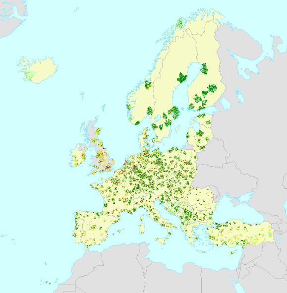
The Urban Atlas provides pan-European comparable land use and land cover data for Functional Urban Areas (FUA) across EEA38 countries (EU, EFTA, Western Balkan countries as well as Türkiye) and United Kingdom. The Street Tree Layer (STL) is a separate layer from the Urban Atlas 2018 LU/LC layer produced within the level 1 urban mask for each FUA. It includes contiguous rows or a patches of trees covering 500 m² or more and with a minimum width of 10 meter over "Artificial surfaces" (nomenclature class 1) inside FUA (i.e. rows of trees along the road network outside urban areas or forest adjacent to urban areas should not be included). Urban Atlas is a joint initiative of the European Commission Directorate-General for Regional and Urban Policy and the Directorate-General for Defence Industry and Space in the frame of the EU Copernicus programme, with the support of the European Space Agency and the European Environment Agency. You can read more about the product here: https://land.copernicus.eu/en/products/urban-atlas/street-tree-layer-stl-2018.
-
The Urban Atlas provides pan-European comparable land use and land cover data for Functional Urban Areas (FUA). The Urban Atlas Change layers have become available from 2012 and only for all FUAs that have been covered in both 2006 and 2012 reference years. Urban Atlas is a joint initiative of the European Commission Directorate-General for Regional and Urban Policy and the Directorate-General for Enterprise and Industry in the frame of the EU Copernicus programme, with the support of the European Space Agency and the European Environment Agency.
-
The European Urban Atlas provides reliable, inter-comparable, high-resolution land use and land cover data for 785 Functional Urban Area (FUA) for the 2012 reference year in EEA38 countries (EU, EFTA and Western Balkan countries as well as Türkiye) and United Kingdom. The spatial data can be downloaded together with a map for each FUA covered and a report with the metadata for the respective area. Urban Atlas is a joint initiative of the Commission Directorate-General for Regional and Urban Policy and the Directorate-General for Defence Industry and Space (DEFIS) in the frame of the EU Copernicus programme, with the support of the European Space Agency and the European Environment Agency. You can read more about the product here: https://land.copernicus.eu/en/products/urban-atlas/urban-atlas-2012.
-
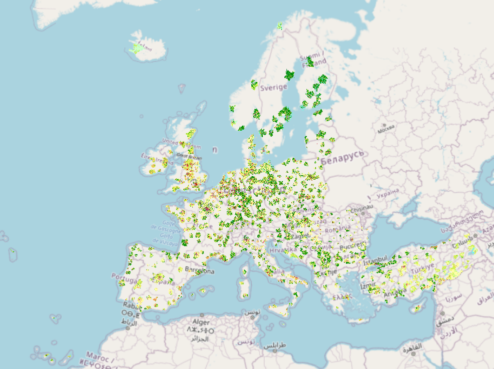
Urban Atlas 2018 provides reliable, inter-comparable, high-resolution land use and land cover data with integrated population estimates for 788 Functional Urban Areas (FUA) with more than 50,000 inhabitants for the 2018 reference year in EEA38 countries (EU, EFTA, Western Balkans countries, as well as Türkiye) and the United Kingdom. Urban Atlas is a joint initiative of the European Commission Directorate-General for Regional and Urban Policy and the Directorate-General for Defence Industry and Space in the frame of the EU Copernicus programme, with the support of the European Space Agency and the European Environment Agency. Per each of the FUAs, a ZIP is provided which includes: (1) the vector data in OGC GeoPackage SQLite format (ETRS89-LAEA, EPSG:3035); (2) PDF document with a high-resolution map of the area; (3) PDF document with the delivery report; (4) symbology files in .lyr, .qml and .sld formats; and (5) a xml document with metadata.