 Arctic SDI catalogue
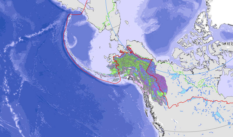
Alaska
Type of resources
Available actions
Topics
Keywords
Contact for the resource
Provided by
Years
Formats
Representation types
Update frequencies
status
Service types
Scale
-
AqSpringChemistry in the state of Alaska
-
AqueousChemistry1_10 in the state of Alaska
-
Bird and distance transect biodiversity GRID data from Barrow, Alaska-
-
We summarize available information on Pacific walrus haulouts from available reports, interviews with coastal residents and aviators, and personal observations of the authors. We provide this in the form of a georeferenced database that may be queried and displayed with standard geographic information system and database management software. The database contains 150 records of Pacific walrus haulouts, with a summary of basic characteristics on maximum haulout size, age-sex composition, season of use, and decade of most recent use. Citations to reports are provided as a bibliographic database.
-
Well Logs in the state of Alaska
-
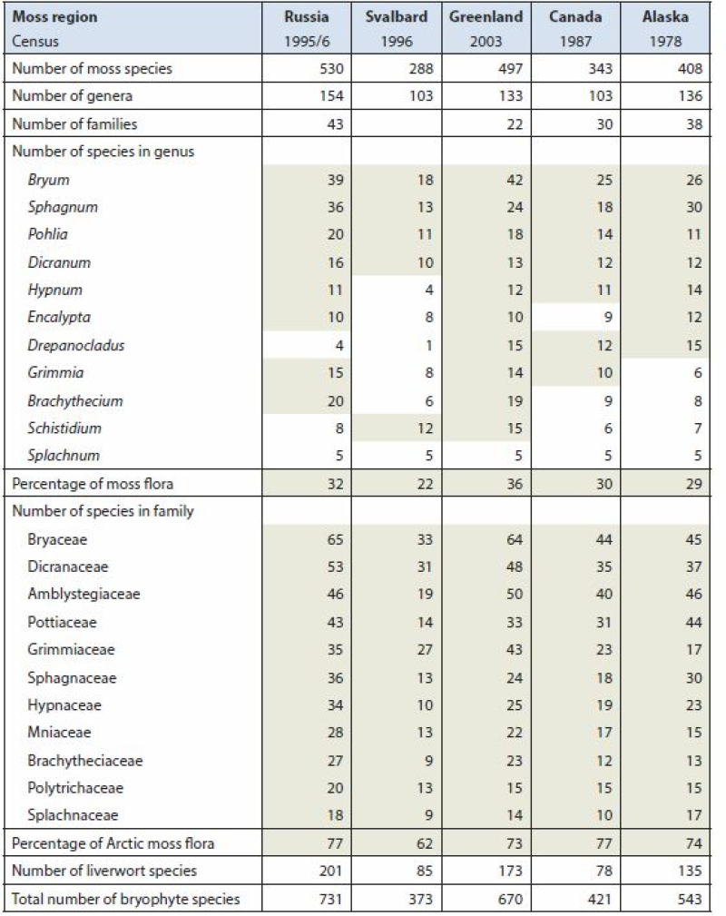
Arctic Biodiversity Assessment (ABA) 2013. Table 9.5. Species numbers of species-rich moss genera and families. Numbers highlighted in grey fields are used in calculating the percentage of the total moss flora. Listed are Splachnum, genera with at least 10 species and families with at least nine species. Conservation of Arctic Flora and Fauna, CAFF 2013 - Akureyri . Arctic Biodiversity Assessment. Status and Trends in Arctic biodiversity. - Plants(Chapter 9) page 333
-
<a href="http://caff.is/strategies-series/359-the-alaska-yukon-region-of-the-circumboreal-vegetation-map-cbvm" target="_blank"> <img width="150px" height="150px" alt="logo" align="left" hspace="10px" src="http://geo.abds.is/geonetwork/images/flora_logo.png"> </a>A map of boreal vegetation for the Alaska-Yukon region was developed to contribute to the circumboreal vegetation mapping (CBVM) project. The effort included developing a map of bioclimates with 12 bioclimate zones, a map of biogeographic provinces with Alaska-Yukon and Aleutian provinces, and a map of geographic sectors with six sectors that provided the basis for classification of boreal vegetation. Vegetation mapping was done at 1:7.5 million scale using the mapping protocols of the CBVM team. Mapping used MODIS imagery as the basis for manual image interpretation and an integrated-terrain-unit approach, which included classifications for bioclimate, physiography, generalized geology, permafrost, disturbance, growth from, geographic sector, and vegetation. Vegetation was mapped at two hierarchical levels: (1) formation group differentiating zonal and azonal systems; and (2) geographic sectors based on bioclimatic zonation and dominant species that characterize broad longitudinal regions or biogeographic provinces. Each of the 19 map units was described by identifying the dominant and characteristic species and its climatic and landscape characteristics, as well as references that relate to the unit.
-
PhysicalSample in the state of Alaska
-
BoreholeTemperatures in the state of Alaska
-

Fisheries and Oceans Canada (DFO) has been conducting surface water trawl surveys since 1992 in the coastal waters of British Columbia, Washington, Oregon and Alaska and in the high seas of the Gulf of Alaska. These surveys initially focused on determining the migratory patterns (1992-2002) and on the growth and physiology (2003-2016) of juvenile Pacific Salmon. Since 2016, these surveys have been broadened to monitor the whole pelagic ecosystem, retaining a focus on juvenile Pacific Salmon. Surveys were conducted in central north coast and inlets of British Columbia from Southern Queen Charlotte Sound to Northern Haida Gwaii, including the west coast of Haida Gwaii and Hecate Strait, from 1995 to 2020. All records are from shelf waters shallower than 400 meters.