 Arctic SDI catalogue
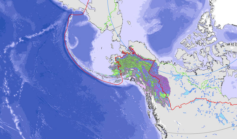
Yukon
Type of resources
Available actions
Topics
Keywords
Contact for the resource
Provided by
Years
Formats
Representation types
Update frequencies
status
Service types
Scale
-
Overview map of the Yukon
-
A WMS compliant Internet resource for thematic planning data hosted by Yukon Land Use Planning Council as part of the Yukon Planning Atlas project.
-
Mining Class 1 notification areas
-
Location of Major Infrastructure, Resource, Oil and Gas Projects in Nunavut, Northwest Territories and Yukon. Data and maps for illustrative purposes only.
-
Emplacement des grandes infrastructures, de ressources, projets pétroliers et gaziers au Nunavut, Territoires du Nord-Ouest et du Yukon. Les données et les cartes sont pour des fins d'illustration seulement.
-

Location of Major Infrastructure, Resource, Oil and Gas Projects in Nunavut, Northwest Territories and Yukon. Data and maps for illustrative purposes only. Users understand that, although all efforts have been made to accurately and exhaustively compile, locate and classify projects, the authors do not guarantee the accuracy and/or the comprehensiveness of the data and assume no responsibility for errors or omissions. CanNor does not assume responsibility for errors or omissions. In support of this initiative, proponents and partners are encouraged to contact CanNor should they identify any errors or omissions.
-
<a href="http://caff.is/strategies-series/359-the-alaska-yukon-region-of-the-circumboreal-vegetation-map-cbvm" target="_blank"> <img width="150px" height="150px" alt="logo" align="left" hspace="10px" src="http://geo.abds.is/geonetwork/images/flora_logo.png"> </a>A map of boreal vegetation for the Alaska-Yukon region was developed to contribute to the circumboreal vegetation mapping (CBVM) project. The effort included developing a map of bioclimates with 12 bioclimate zones, a map of biogeographic provinces with Alaska-Yukon and Aleutian provinces, and a map of geographic sectors with six sectors that provided the basis for classification of boreal vegetation. Vegetation mapping was done at 1:7.5 million scale using the mapping protocols of the CBVM team. Mapping used MODIS imagery as the basis for manual image interpretation and an integrated-terrain-unit approach, which included classifications for bioclimate, physiography, generalized geology, permafrost, disturbance, growth from, geographic sector, and vegetation. Vegetation was mapped at two hierarchical levels: (1) formation group differentiating zonal and azonal systems; and (2) geographic sectors based on bioclimatic zonation and dominant species that characterize broad longitudinal regions or biogeographic provinces. Each of the 19 map units was described by identifying the dominant and characteristic species and its climatic and landscape characteristics, as well as references that relate to the unit.
-

The dataset consists of maps detailing the boundaries of the designatable units for conservation considerations as defined by the Committee on the Status of Endangered Wildlife in Canada (COSEWIC) for species of Pacific Salmon in British Columbia and the Yukon. Designatable units represent geographical areas that support groups of individuals with a unique genetic heritage makes them discrete and evolutionarily significant units of the taxonomic species, where “significant” means that the unit is important to the evolutionary legacy of the species as a whole and if lost is unlikely to be replaced through natural dispersion.
-
Water wells dynamically extracted from various provincial and territorial databases (Yukon, British Columbia, Alberta, Saskatchewan, Manitoba, Ontario, Quebec, Nova Scotia, Newfoundland and Labrador. Also, Hydrostratigraphic units from 30 key aquifers in Canada. Puits dynamiquement extraits de bases de données provinciales et territoriales (Yukon, Colombie-Britannique,Alberta, Saskatchewan, Manitoba, Ontario, Québec, Nouvelle-Écosse et Terre-Neuve-et-Labrador). Aussi, Unités stratigraphiques de 30 aquifères clés du Canada
-

This dataset corresponds to daily snow cover percentage at 1km resolution grid over land areas of Canada from 2006-2010. The data are subsampled by 4km to reduce data volumes and considering the geolocation uncertainty of the input satellite imagery. The daily maps are generated by assimilation of daily cloud screened NOAA AVHRR satellite imagery and Canadian Meteorological Centre (CMC) snow depth analysis snow depth and density fields within an off-line version of the CMC daily snow depth model. The snow depth model is modified to include snowpack reflectance model and a surface radiative transfer scheme that relates vegetation and snowpack reflectance to top-of-canopy bi-directional reflectance. A logistic vegetation phenology model is used to parameterize temporal dynamics of canopy leaf area index. A per-pixel particle filter with a 30 day moving window is applied to assimilation observations corresponding to 1km resolution visible band directional reflectance and normalized difference vegetation index and 24km CMC daily snow depth and monthly snow density fields. The assimilation is forced using daily air temperature and precipitation fields. Validation of the datasets has been performed by comparison to MODIS snow cover maps and in-situ snow depth stations across Canada. Validation suggests similar accuracy to MODIS snow cover products over relatively flat terrain. Validation over mountainous regions is ongoing.