 Arctic SDI catalogue
Fruit crops
Type of resources
Topics
Keywords
Contact for the resource
Provided by
Years
Representation types
Update frequencies
status
Service types
-
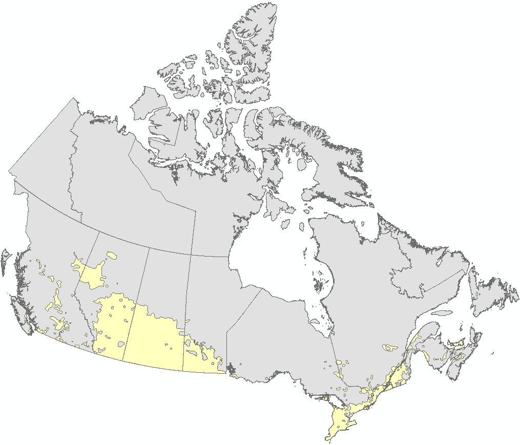
The national agricultural ecumene includes all dissemination areas with 'significant' agricultural activity. Agricultural indicators, such as the ratio of agricultural land on census farms relative to total land area, and total economic value of agricultural production, are used. Regional variations are also taken into account. The ecumene is generalized for small-scale mapping. A new version of the agricultural ecumene was generated every census years (2001, 2006, 2011). Previous versions are no longer available.
-
The national agricultural ecumene includes all dissemination areas with 'significant' agricultural activity. Agricultural indicators, such as the ratio of agricultural land on census farms relative to total land area, and total economic value of agricultural production, are used. Regional variations are also taken into account. The ecumene is generalized for small-scale mapping. A new version of the agricultural ecumene is generated every census years (in vector format) since 1986. This file was produced by Statistics Canada, Agriculture Division, Remote Sensing and Geospatial Analysis section, 2017, Ottawa.
-
The national agricultural ecumene includes all dissemination areas with 'significant' agricultural activity. Agricultural indicators, such as the ratio of agricultural land on census farms relative to total land area, and total economic value of agricultural production, are used. Regional variations are also taken into account. The ecumene is generalized for small-scale mapping. A new version of the agricultural ecumene was generated every census years (2001, 2006, 2011). Previous versions are no longer available.
-
The national agricultural ecumene includes all dissemination areas with 'significant' agricultural activity. Agricultural indicators, such as the ratio of agricultural land on census farms relative to total land area, and total economic value of agricultural production, are used. Regional variations are also taken into account. The ecumene is generalized for small-scale mapping. A new version of the agricultural ecumene was generated every census years (2001). Previous versions are no longer available.
-

The national agricultural ecumene includes all dissemination areas with 'significant' agricultural activity. Agricultural indicators, such as the ratio of agricultural land on census farms relative to total land area, and total economic value of agricultural production, are used. Regional variations are also taken into account. The ecumene is generalized for small-scale mapping. A new version of the agricultural ecumene is generated every census years (in vector format) since 1986. This file was produced by Statistics Canada, Agriculture Division, Remote Sensing and Geospatial Analysis section, 2017, Ottawa.
-

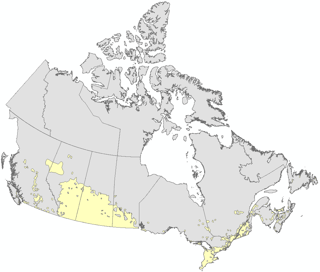
The national agricultural ecumene includes all dissemination areas with 'significant' agricultural activity. Agricultural indicators, such as the ratio of agricultural land on census farms relative to total land area, and total economic value of agricultural production, are used. Regional variations are also taken into account. The ecumene is generalized for small-scale mapping. A new version of the agricultural ecumene is generated every census year (in vector format) since 1986. This file was produced by Statistics Canada, Agriculture Division, Remote Sensing and Geospatial Analysis section, 2022, Ottawa.
-
The national agricultural ecumene includes all dissemination areas with 'significant' agricultural activity. Agricultural indicators, such as the ratio of agricultural land on census farms relative to total land area, and total economic value of agricultural production, are used. Regional variations are also taken into account. The ecumene is generalized for small-scale mapping. A new version of the agricultural ecumene is generated every census years (in vector format) since 1986. This file was produced by Statistics Canada, Agriculture Division, Remote Sensing and Geospatial Analysis section, 2017, Ottawa.
-
The national agricultural ecumene includes all dissemination areas with 'significant' agricultural activity. Agricultural indicators, such as the ratio of agricultural land on census farms relative to total land area, and total economic value of agricultural production, are used. Regional variations are also taken into account. The ecumene is generalized for small-scale mapping. A new version of the agricultural ecumene was generated every census years (2001, 2006). Previous versions are no longer available.
-
These files from Statistics Canada present Census of Agriculture data allocated by standard census geographic polygons: Provinces and Territories (PR), Census Agricultural Regions (CAR), Census Divisions (CD) and Census Consolidated Subdivisions (CCS). Five datasets are provided: 1. Agricultural operation characteristics: includes information on farm type, operating arrangements, paid agricultural work and financial characteristics of the agricultural operation. 2. Land tenure and management practices: includes information on land use, land tenure, agricultural practices, land inputs, technologies used on the operation and the renewable energy production on the operation. 3. Crops: includes information on hay and field crops, vegetables (excluding greenhouse vegetables), fruits, berries, nuts, greenhouse productions and other crops. 4. Livestock, poultry and bees: includes information on livestock, poultry and bees. 5. Characteristics of farm operators: includes information on age, sex and the hours of works of farm operators. Note: For all the datasets, confidential values have been assigned a value of -1. Correction notice: On January 18, 2023, selected estimates have been corrected for selected variables in the following 2021 Census of Agriculture domains: Direct sales of agricultural products to consumers (Agricultural operations category), Succession plan for the agricultural operation (Agricultural operators category), and Renewable energy production (Use, tenure and practices category).