 Arctic SDI catalogue
Geochemistry
Type of resources
Available actions
Topics
Keywords
Contact for the resource
Provided by
Formats
Representation types
Update frequencies
status
Scale
Resolution
-

The "Canadian Database of Geochemical Surveys" has two long-term goals. Firstly, it aims to catalogue all of the regional geochemical surveys that have been carried out across Canada, beginning in the 1950s. Secondly, it aims to make the raw data from those surveys available in a standardised format. Over 1,500 surveys have been catalogued. Of these, the raw data for over 300 have been converted to a standardised format. The catalogue can be searched at https:\\geochem.nrcan.gc.ca
-

Geochemistry includes information related to rock samples and sediment samples.**This third party metadata element was translated using an automated translation tool (Amazon Translate).**
-
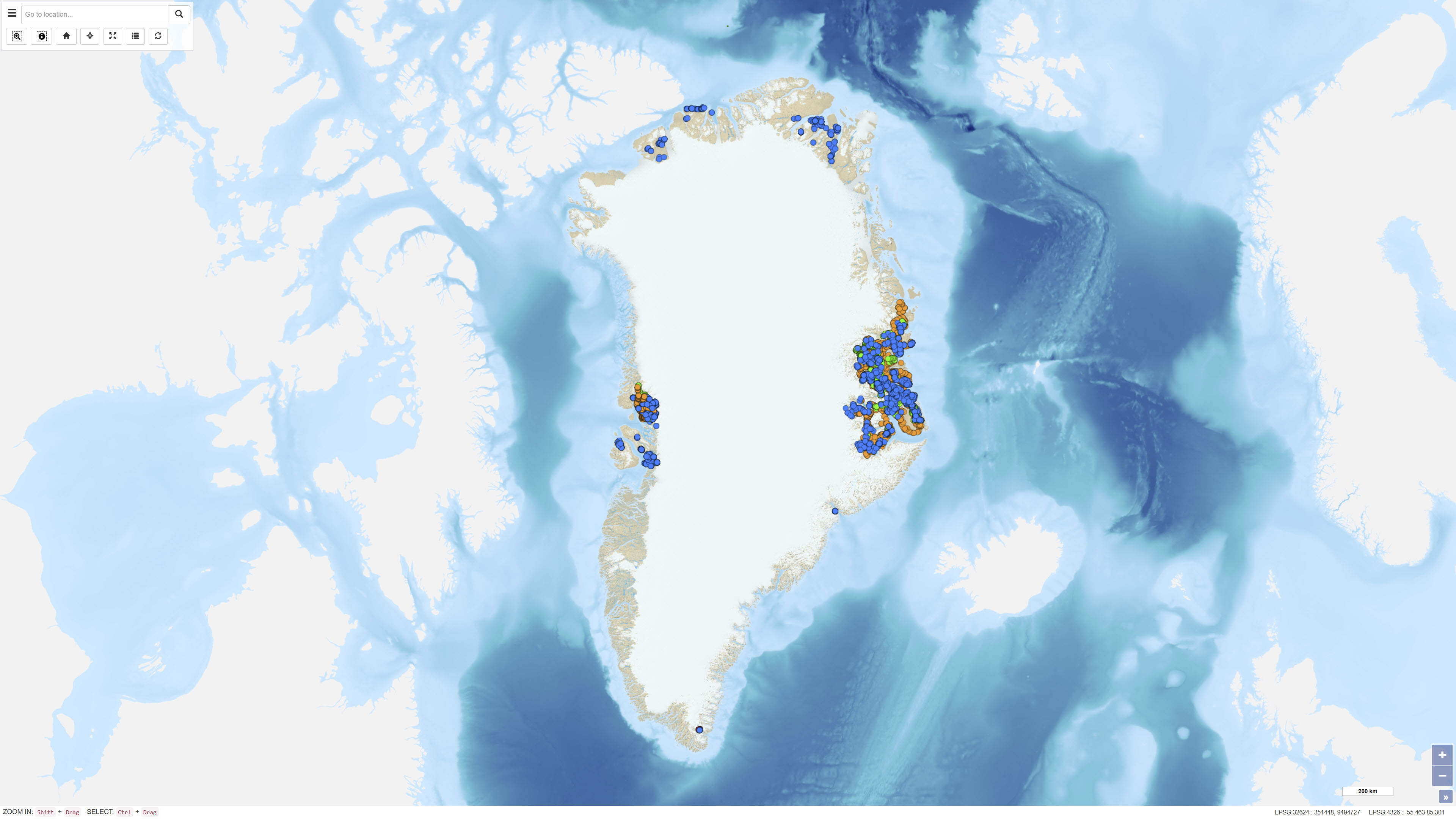
The dataset comprises geochemical analyses of 1,269 soil samples collected in Greenland from 1974 onwards as part of systematic geochemical mapping and mineral exploration programmes. Soil samples were primarily collected in areas lacking developed stream channels where stream sediment sampling was not feasible. The samples represent surface material and have been analysed for major and trace elements using various laboratory methods including X-ray Fluorescence Spectrometry (XRF), Instrumental Neutron Activation Analysis (INA), Inductively Coupled Plasma Emission Spectrometry (ICP), and Atomic Absorption Spectrometry (AAS). The dataset contains the original analytical results as received from the laboratories together with administrative information on sample location and analysed grain-size fraction. The data form part of the analytical basis for the Geochemical Atlas of West and South Greenland.
-
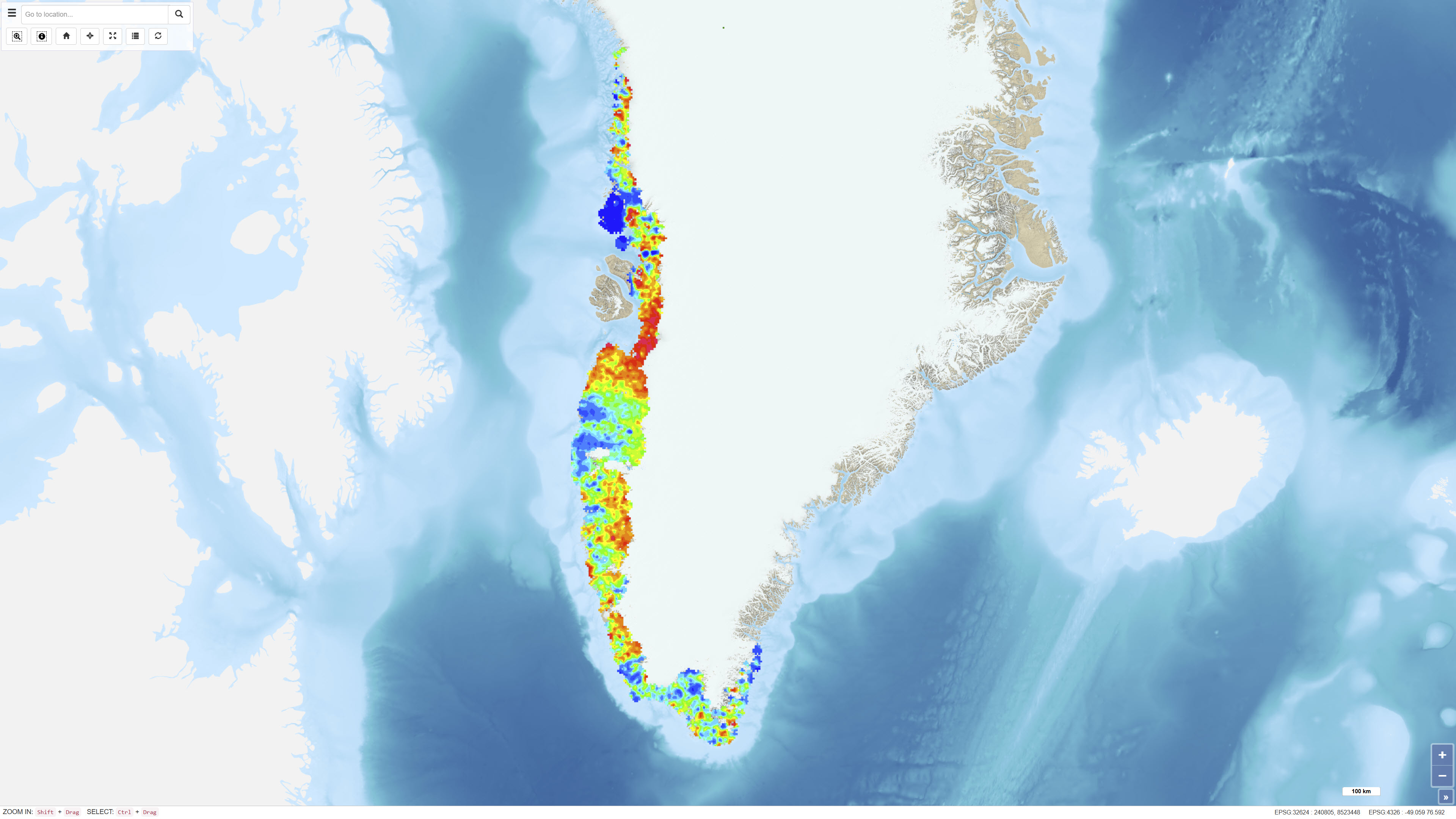
The dataset comprises digital element distribution maps based on geochemical analyses of stream sediments collected in West and South Greenland. The maps were produced as part of the geochemical mapping programme underlying the Geochemical Atlas of West and South Greenland. The data represent analyses of various elements in defined grain-size fractions and provide a regional overview of geochemical variations.
-
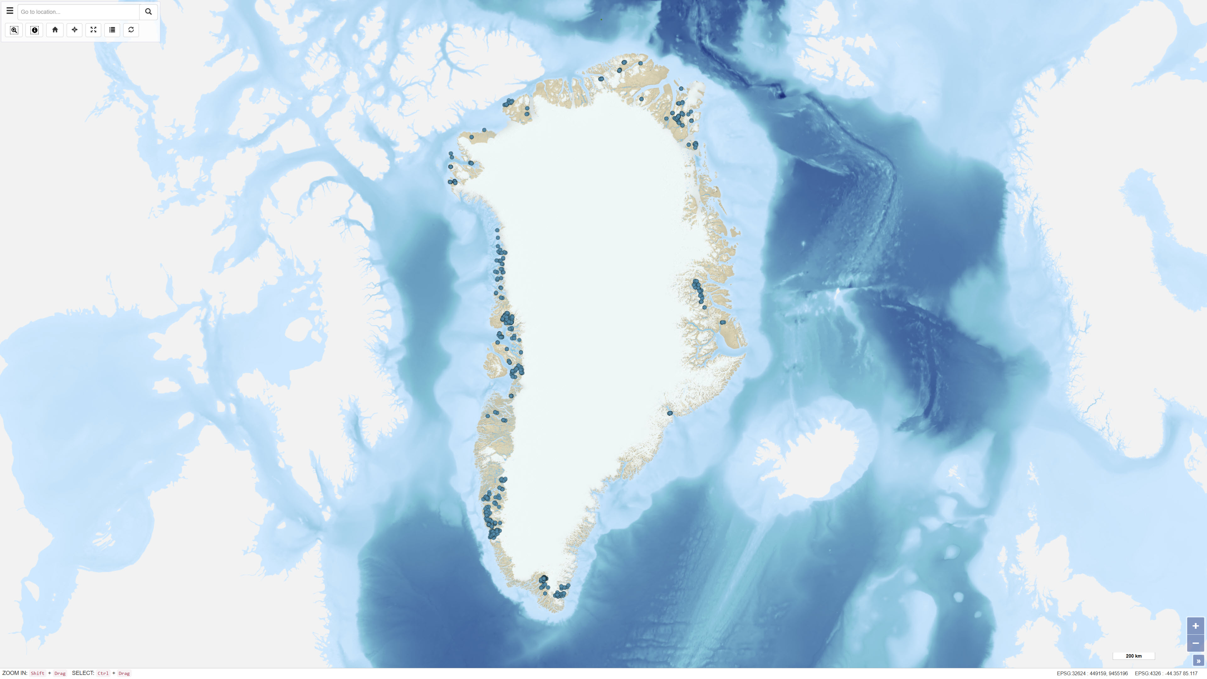
The dataset contains geochemical analytical results for 725 heavy mineral concentrate samples collected by GEUS in Greenland as part of various geological mapping and mineral exploration activities. The samples originate from several campaigns, including a regional campaign conducted between 1982 and 1986 in the Nuuk area, a 1991 campaign in the southern Nuuk region, and samples collected in 2003 in the Qaanaaq region. Additional samples derive from smaller projects and campaigns with limited documentation. Analyses were carried out at different laboratories, including Activation Laboratories and Bondar-Clegg in Canada and Risø National Laboratory in Denmark. The dataset contains raw analytical results, and metadata concerning sampling procedures and analytical quality are not complete for all samples.
-
This dataset comprises calibrated geochemical data from stream sediment and soil samples collected in North Greenland between 1978 and 1999, supplemented by extensive reanalyses in 2011. The dataset includes selected elements relevant for the evaluation of zinc mineralisation: CaO, K₂O, Ba, Cu, Sr and Zn. A total of 2,469 stream sediment samples and 204 soil samples were included. The analytical values represent the most reliable results following systematic quality control and calibration procedures designed to eliminate bias between analytical methods and analytical periods, as described in Thrane et al. (2011). All values below detection limit are coded as 0 in the dataset. The dataset supports regional assessment of geochemical patterns and mineral potential in North Greenland.
-
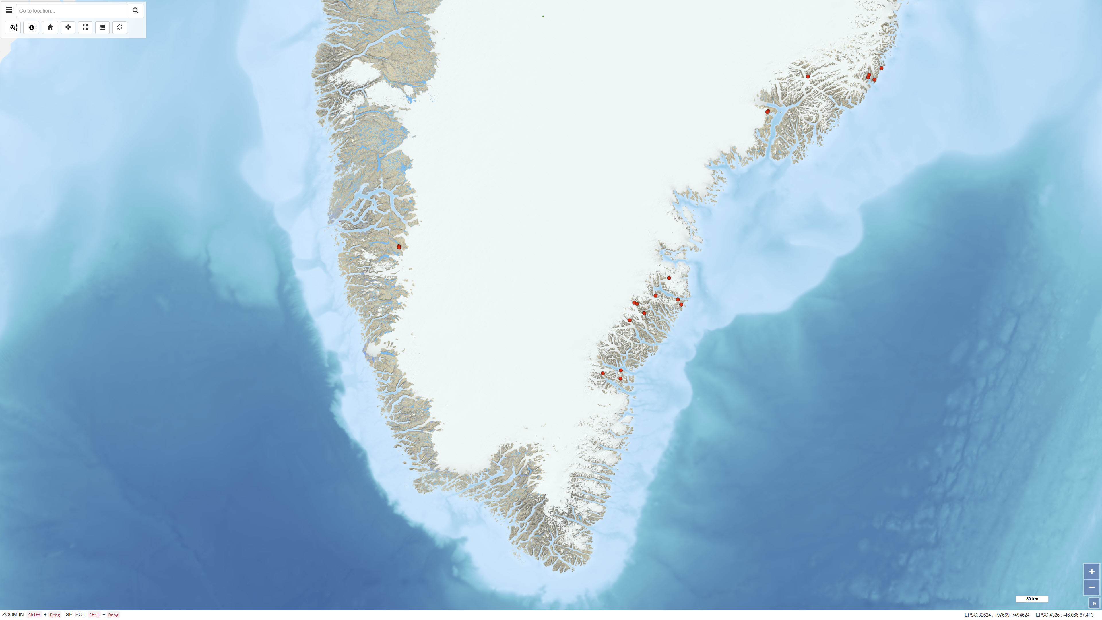
The dataset contains geochemical analyses of 49 scree (talus) samples collected in Greenland as part of regional geochemical mapping programmes conducted by the Geological Survey of Greenland (GGU), later GEUS, between 1977 and 1997. Scree samples were collected in areas where neither stream sediment nor soil sampling was feasible. The samples represent near-surface material derived from local bedrock and were analysed for major and trace elements using laboratory methods available at the time of collection. The dataset supplements regional geochemical data from stream sediment and soil samples and forms part of the overall basis for geochemical mapping in Greenland.
-
%20-%20datas%C3%A6t.jpg)
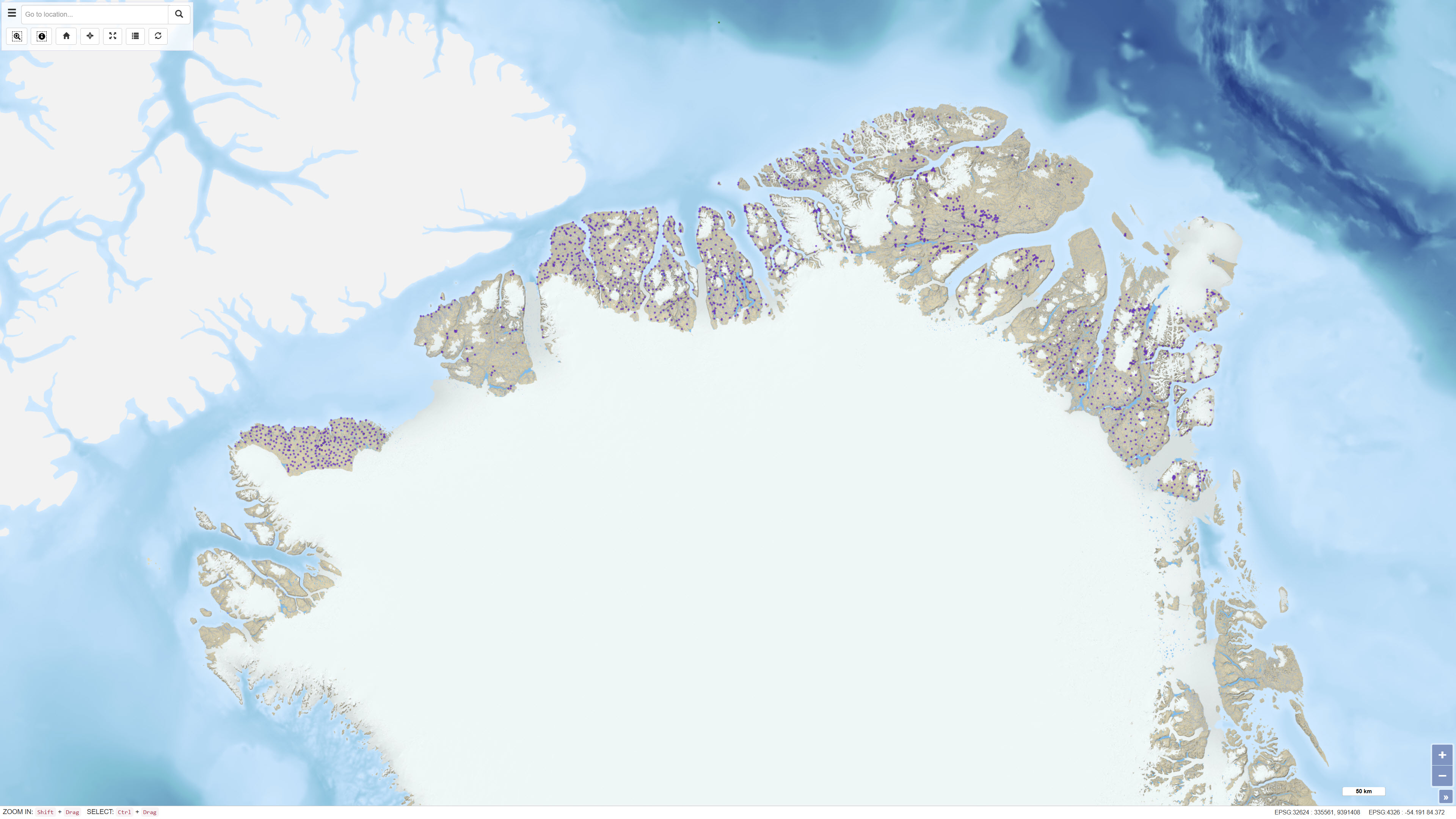
The dataset contains geochemical analytical results for rock samples from Greenland, collected through GEUS field and project activities and made available as an extract from GEUS’ information system GimmeX. Samples were collected for various purposes including geological mapping, geochemistry, ore geology and mineral exploration, and no systematic rock sampling was undertaken. Analytical data are organised by analytical type/method and accompanying tables document the analytical results. Sample location accuracy varies, in particular for samples collected before 1997, and older positions may have been adjusted between different map bases.
-
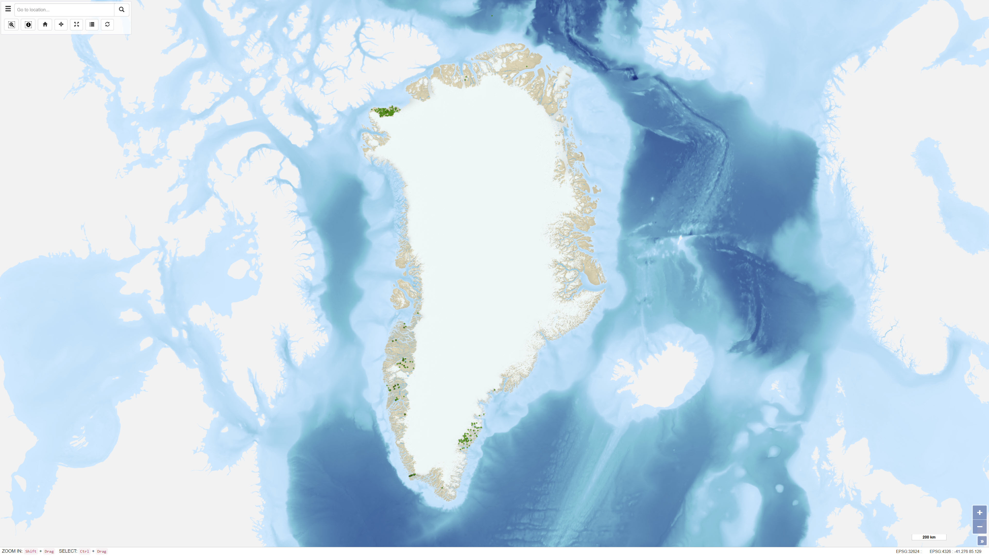
This dataset comprises regional geochemical stream sediment data from West and South Greenland and forms the basis of the Geochemical Atlas of West and South Greenland (Steenfelt, 2001). The Geochemical Atlas of West and South Greenland presents the results of a regional stream sediment geochemical mapping programme conducted between 1979 and 1998. A total of 7,122 stream sediment samples were collected from low-order streams with near-uniform spatial coverage across West and South Greenland. The <0.1 mm grain-size fraction of 500 g samples was analysed for major and trace elements using X-ray fluorescence spectrometry (XRF), instrumental neutron activation analysis (INAA), delayed neutron counting (DNC) and loss on ignition (LOI). After systematic calibration and quality control to eliminate analytical bias between different methods and time periods, a harmonised and internally consistent dataset was established containing up to 43 elements per sample. The atlas provides a regional overview of the geochemical composition of the minerogenic fraction of stream sediments and constitutes a geochemical baseline dataset for geological mapping and mineral exploration in Greenland.
-
The dataset contains geochemical sample data from four company reports submitted to the Ministry of Mineral Resources (MMR) and previously to the Geological Survey of Denmark and Greenland (GEUS). The reports were originally delivered in paper format and later scanned. The geochemical data have been digitally restored through optical character recognition of scanned documents and georeferencing of sample locations. The dataset has been uploaded to the GEUS sample database with necessary adjustments to sample names and metadata. The dataset includes samples with coordinates but without geochemical analyses, as well as samples with analyses lacking unambiguous coordinates.