Inland Waters
Type of resources
Available actions
Topics
Keywords
Contact for the resource
Provided by
Years
Formats
Service types
Scale
-
The Agriculture and Agri-Food Canada's (AAFC) Watersheds Project level series supplies a number of watershed and watershed related datasets for the Prairie Provinces. The levels are greater or smaller assemblages of hydrometric areas, or the components defining them. The Project is organized by the hydrometric gauging station which are sourced from Environment Canada, the United States and Canadian provinces. Additional stations were generated to address structural issues, like river confluences or lake inlets. Collectively, they are referred to as the gauging stations, or simply, the stations. The drainage area that each station monitors, between itself and one or more of its upstream neighbours, is called an 'incremental gross drainage area'. The incremental gross drainage areas are collected into larger or smaller groupings based on size or defined interest to generate the various 'levels'of the series. For more information, visit: http://open.canada.ca/data/en/dataset/c20d97e7-60d8-4df8-8611-4d499a796493
-

Lagið sýnir helstu vatnaskil á Reykjanesskaga. Gögn eru frá VÍ og eru uppfærð eftir þörfum.
-

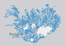
EN: River waterbodies in Iceland as reported to WISE on 22.12.2018. "River" means a body of inland water flowing for the most part on the surface of the land but which may flow underground for part of its course.For further description of dataset fields and field values see GML schema here: http://dd.eionet.europa.eu/schemas/WFD2016/GML_SurfaceWaterBodyLine_2016.xsd IS: Straumvatnshlot á Íslandi miðað við skil inn í WISE upplýsingakerfið þann 22.12.2018. Straumvatn er vatnsfall sem flæðir eftir og á yfirborði lands að mestu en getur að hluta til flætt neðanjarðar. Nánari lýsing á eigindum og gildum gagnasettsins má finna í GML skema hér: http://dd.eionet.europa.eu/schemas/WFD2016/GML_SurfaceWaterBodyLine_2016.xsd
-

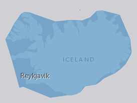
EN: Boundary of River Basin District(s) of Iceland as reported to WISE on 22.12.2018."River basin district" means the area of land and sea, made up of one or more neighbouring river basins together with their associated groundwaters and coastal waters, which is identified under Article 3(1) as the main unit for management of river basins.For further description of dataset fields and field values see GML schema here. http://dd.eionet.europa.eu/schemas/WFD2016/GML_RiverBasinDistrict_2016.xsd IS: Vatnaumdæmi Íslands miðað við skil inn í WISE upplýsingakerfið þann 22.12.2018. Vatnaumdæmi er stjórnsýslueining sem nær til íslenskra vatnasvæða ásamt árósavatni og strandsjó sem þeim tengjasteins og það er skilgreint í lögum nr. 35/2011 og reglugerð nr.935/2011 um Stjórn vatnamála. Nánari lýsing á eigindum og gildum gagnasettsins má finna í GML skema hér: http://dd.eionet.europa.eu/schemas/WFD2016/GML_RiverBasinDistrict_2016.xsd
-
Vatnsföll eru gjarnan flokkuð í þrjá flokka, dragár, lindár og jökulár eftir rennslisháttum. Mörg eru vatnsföllin þó af blönduðum uppruna vegna margbreytileika vatnasviða þeirra. Gagnasettið sýnir greiningu vatnasvæða í vatnafarsflokka, eftir því hvernig svæðið bregst við úrkomu og miðlar henni, og rennslisháttum vatnsfalla sem eiga uppruna sinn á viðkomandi svæði.
-

EN: Groundwaterbodies in Iceland as reported to WISE on 22.12.2018. "Groundwater" means all water which is below the surface of the ground in the saturation zone and in direct contact with the ground or subsoil. For further description of dataset fields and field valuessee GML schema here: http://dd.eionet.europa.eu/schemas/WFD2016/GML_GroundWaterBody_2016.xsd IS: Grunnvatnshlot á Íslandi miðað við skil inn í WISE upplýsingakerfið þann 22.12.2018. "Grunnvatn" merkir vatn, kalt eða heitt, sem er neðan jarðar í samfelldu lagi, kyrrstætt eða rennandi, og fyllir að jafnaði allt samtengt holrúm í viðkomandi jarðlagi. Nánari lýsing á eigindum og gildum gagnasettsins má finna í GML skema hér. Um er að ræða grunnvatnshlot sem notuð eru til að gefa upp ástand vatns á Íslandi. Nánari lýsing á eigindum og gildum gagnasettsins má finna í GML skema hér: http://dd.eionet.europa.eu/schemas/WFD2016/GML_GroundWaterBody_2016.xsd
-

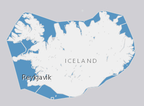
EN: Lake and coastal waterbodies in Iceland. "Lake" means a body of standing inland surface water. "Coastal water" means surface water on the landward side of a line, every point of which is at a distance of one nautical mile on the seaward side from the nearest point of the baseline from which the breadth of territorial waters is measured, extending where appropriate up to the outer limit of transitional waters. For further description of dataset fields and field values see GML schema here: http://dd.eionet.europa.eu/schemas/WFD2016/GML_SurfaceWaterBody_2016.xsd IS:Stöðuvatns- og strandsjávarhlot á Íslandi. "Stöðuvatn" er kyrrstætt yfirborðsvatn. "Strandsjór" er yfirborðsvatn landmegin við línu sem dregin er einni sjómílu utan grunnlínu landhelginnar og nær inn að ytri mörkum árósavatns. Nánari lýsing á eigindum og gildum gagnasettsins má finna í GML skema hér: http://dd.eionet.europa.eu/schemas/WFD2016/GML_SurfaceWaterBody_2016.xsd
 Arctic SDI catalogue