 Arctic SDI catalogue
50000
Type of resources
Available actions
Topics
Keywords
Contact for the resource
Provided by
Years
Formats
Representation types
Update frequencies
status
Scale
Resolution
-
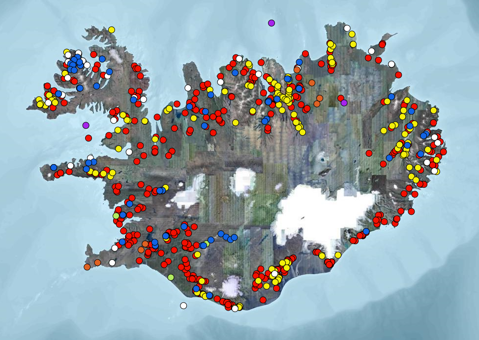
Staðsetningarhnit og upplýsingar um þau raforkuver / virkjanir á Íslandi sem selja raforku inn á landskerfið, auk díselstöðva sem framleiða allt árið. Vatnsafl, jarðvarmi, vindorka, eldsneyti og varaafl, auk upplýsinga um virkar og aflagðar heimarafstöðvar.
-

Hydrography (HY) Iceland is one of 12 themes in the European Location Project (ELF). The purpose of ELF is to create harmonised cross-border, cross-theme and cross-resolution pan-European reference data from national contributions. The goal is to provide INSPIRE-compliant data for Europe. A description of the ELF (European Location Project) is here: http://www.elfproject.eu/content/overview Encoding: INSPIRE version 4
-

ELF Geographical Names (GN) Iceland is one of 12 themes in the European Location Project (ELF). The purpose of ELF is to create harmonised cross-border, cross-theme and cross-resolution pan-European reference data from national contributions. The goal is to provide INSPIRE-compliant data for Europe. A description of the ELF (European Location Project) is here: http://www.elfproject.eu/content/overview Encoding: INSPIRE version 4
-

ELF Transport Networks (TN) Iceland is one of 12 themes in the European Location Project (ELF). The purpose of ELF is to create harmonised cross-border, cross-theme and cross-resolution pan-European reference data from national contributions. The goal is to provide INSPIRE-compliant data for Europe. A description of the ELF (European Location Project) is here: http://www.elfproject.eu/content/overview. The transport layer contains both line and polygons. The linelayer shows the transport network but the polygon layer contains the airports. Encoding: INSPIRE version 4
-

Administrative Units (AU) is one of 12 themes in the European Location Project (ELF). The purpose of ELF is to create harmonised cross-border, cross-theme and cross-resolution pan-European reference data from national contributions. The goal is to provide INSPIRE compliant data for Europe. A description of the ELF (European Location Project) is here: http://www.elfproject.eu/content/overview Encoding: INSPIRE version 4
-

ELF Elevation (EL) Iceland is one of 12 themes in the European Location Project (ELF). The purpose of ELF is to create harmonised cross-border, cross-theme and cross-resolution pan-European reference data from national contributions. The goal is to provide INSPIRE-compliant data for Europe. A description of the ELF (European Location Project) is here: http://www.elfproject.eu/content/overview Encoding: INSPIRE version 4
-

Eldissvæði er svæði sem úthlutað er rekstarleyfishafa. Rekstrarleyfishafi hefur þá heimild til að hafa eldisbúnað til að ala fisk innan þess svæðis skv. skilyrðum rekstrarleyfisins.
-

Línurnar sýna friðunarsvæði, þar sem eldi laxfiska (fam. salmonidae) í sjókvíum er óheimilt skv. auglýsingu nr. 460/2004.
-
Þann 16. mars 2011 gáfu Landmælingar Íslands út í fyrsta sinn sameiginlegt hæðarkerfi fyrir Ísland. Kerfið er kallað Landshæðarkerfi Íslands og er viðmiðunin ISH2004. Tilkoma sameiginlegs hæðarkerfis markaði stór tímamót í sögu landmælinga á Íslandi. Á sama hátt og viðmiðunin ISN93 skapaði grundvöll fyrir alla til að vinna í sama hnitakerfi mun ISH2004 skapa grundvöll fyrir alla til að vinna í sama hæðarkerfi. Eitt samræmt hæðarkerfi er mikilvægt fyrir ýmsar framkvæmdir s.s. vegagerð og jarðgangnagerð og á ýmsum sviðum umhverfisvöktunar, skipulags og áætlanagerðar. Auk þess munu gögnin nýtast við rannsóknir á jarðskorpuhreyfingum eða breytingum á yfirborði sjávar. Mælingar á Landshæðarkerfinu eru standa ennþá yfir og frá fyrstu útgáfu þess árið 2011 hafa bæst við eftirfarandi línur hallamælilínur. • Flókalundur-Bolungavík • Reykjavík-Keflavík • Endurmæling á Suðurlandi vegna jarðskjálftans 2008 • Hellisheiði • Reykjanesbraut-Grindavík • Þjóðvegur 1-Akranes • Kjölur Niðurstöður nýrra mælinga verður bætt inn í þetta gagnasett um leið og þær liggja fyrir.
-
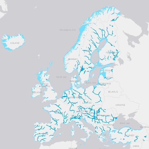
EU-Hydro is a dataset for all EEA38 countries and the United Kingdom providing photo-interpreted river network, consistent of surface interpretation of water bodies (lakes and wide rivers), and a drainage model (also called Drainage Network), derived from EU-DEM, with catchments and drainage lines and nodes. The EU-Hydro dataset is distributed in separate files (river network and drainage network) for each of the 35 major basins of the EEA38 + UK area, in GDB and GPKG formats. The production of EU-Hydro and the derived layers was coordinated by the European Environment Agency in the frame of the EU Copernicus programme.