 Arctic SDI catalogue
Terrain model
Type of resources
Available actions
Topics
Keywords
Contact for the resource
Provided by
Formats
Representation types
Update frequencies
status
Scale
-
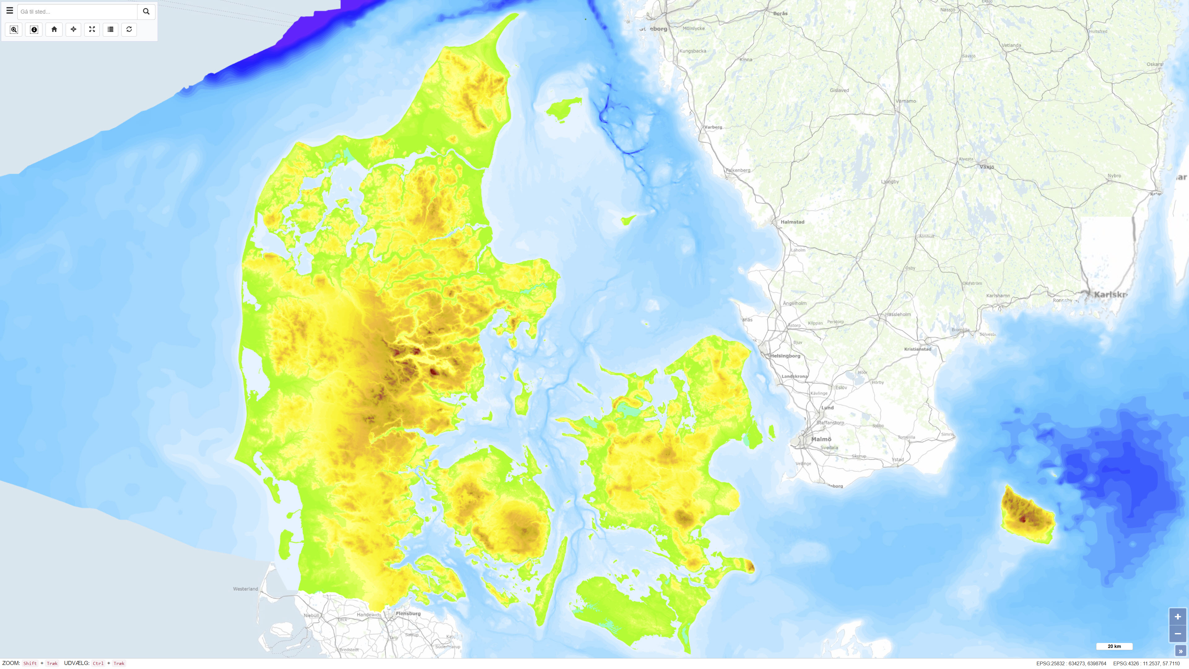
The Height and Depth Map of Denmark is a coherent map showing both land elevation above sea level and sea depth within the Danish area. The map is based on elevation and bathymetric data represented by 5-metre contour intervals closed to polygons and provides continuous coverage across the land–sea boundary. The dataset offers an integrated overview of terrain and bathymetry in Denmark and surrounding waters. The terrestrial elevation component is derived from topographic data suitable for use at scales down to approximately 1:25.000, while the bathymetric component is compiled from datasets of varying origin and resolution. The map was originally assembled around 1997, with subsequent updates to the Danish land areas carried out during 2005–2006. The dataset is primarily intended for regional visualisation and analysis.
-
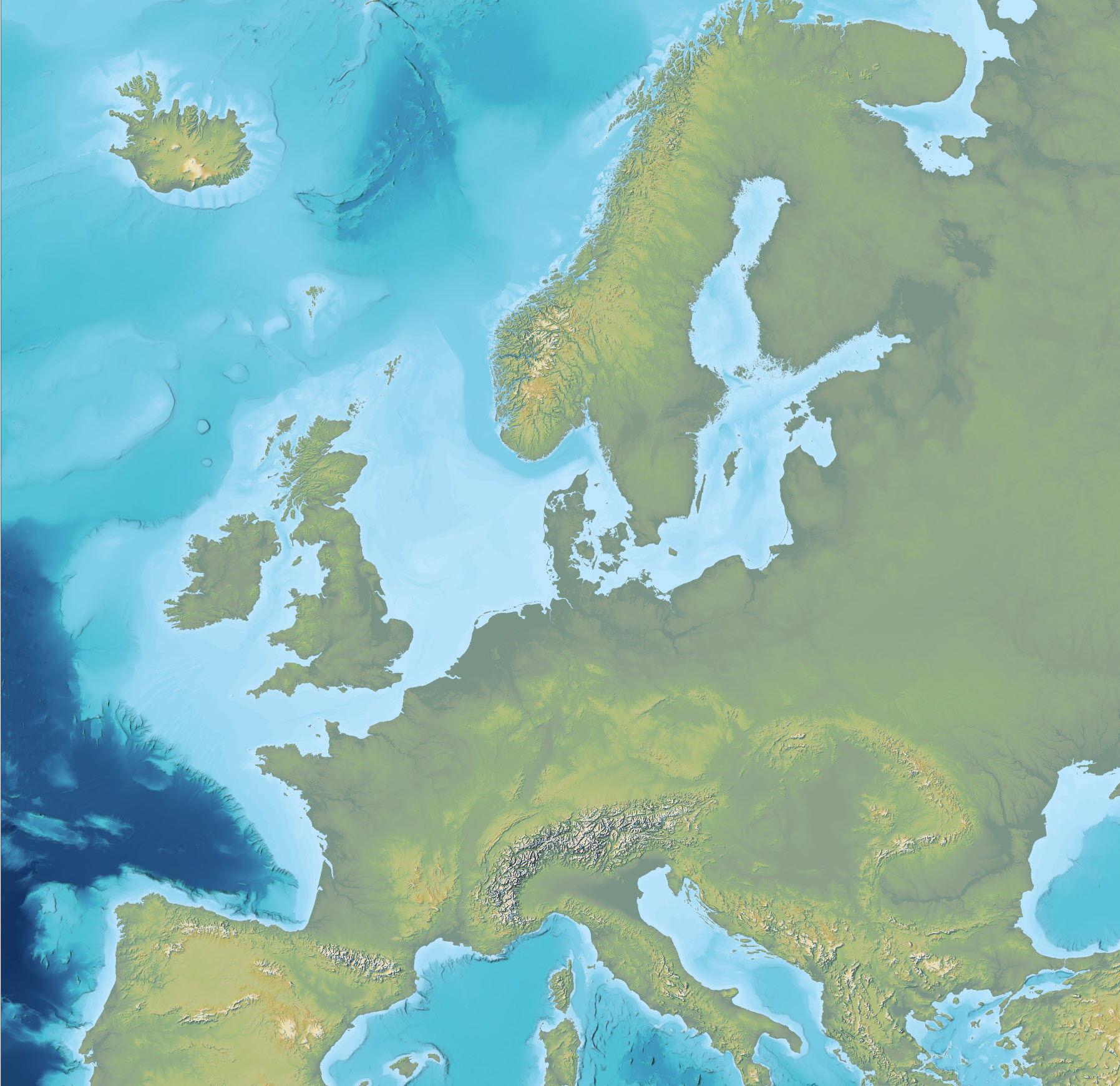
The dataset is an Imhof-inspired cartographic base map combining topography and bathymetry, covering European countries and adjacent marine areas. The map has been constructed by merging several existing digital elevation models, with topography primarily based on EU-DEM v1.1 and the Shuttle Radar Topography Mission (SRTM), and bathymetry derived from the General Bathymetric Chart of the Oceans (GEBCO). The dataset provides a continuous surface integrating land and marine areas and has been developed with a focus on visual quality and regional applications.
-
%20-%20datas%C3%A6t.jpg)
The dataset represents a hillshade derived from the Danish Digital Terrain Model 2007 (DHM/Terrain 2007). The hillshade is produced as a cartographic overlay layer designed to enhance terrain forms and topographic structures in the Danish landscape. The dataset is suitable for visual analysis and map presentation and can be used as a background layer together with other thematic datasets. The hillshade is based on the DHM/Terrain model, which represents terrain elevation relative to mean sea level (DVR90), with buildings, vegetation and other surface objects removed. The original terrain model is based on nationwide airborne LiDAR surveys collected during 2005–2007 and subsequently processed and quality assured.