 Arctic SDI catalogue
25000
Type of resources
Categories
Available actions
Topics
Keywords
Contact for the resource
Provided by
Years
Formats
Representation types
Update frequencies
status
Scale
-
%20-%20datas%C3%A6t.jpg)
The dataset represents a hillshade derived from the Danish Digital Terrain Model 2007 (DHM/Terrain 2007). The hillshade is produced as a cartographic overlay layer designed to enhance terrain forms and topographic structures in the Danish landscape. The dataset is suitable for visual analysis and map presentation and can be used as a background layer together with other thematic datasets. The hillshade is based on the DHM/Terrain model, which represents terrain elevation relative to mean sea level (DVR90), with buildings, vegetation and other surface objects removed. The original terrain model is based on nationwide airborne LiDAR surveys collected during 2005–2007 and subsequently processed and quality assured.
-

This group of maps, which includes the CanMatrix and CanTopo collections, is now a legacy product that is no longer maintained. It may not meet current government standards. Natural Resources Canada's (NRCan) topographic raster maps provide a representation of the topographic phenomena of the Canadian landmass. Several editions of paper maps have been produced over time in order to offer improved products compared to their predecessors in terms of quality and the most up to date information possible. The georeferenced maps can be used in a Geographic Information System (GIS). In all cases, they accurately represent the topographical data available for the date indicated (validity date). The combination of CanMatrix and CanTopo data provides complete national coverage. • CanMatrix - Print Ready: Raster maps produced by scanning topographic maps at scales from 1:25 000 to 1:1 000 000. This product is not georeferenced. Validity dates: 1944 to 2005 (1980 on average). Available formats: PDF and TIFF • CanMatrix - Georeferenced: Raster maps produced by scanning topographic maps at scales of 1:50 000 and 1:250 000. These maps are georeferenced according to the 1983 North American Reference System (NAD 83). Validity dates: 1944 to 2005 (1980 on average). Available format: GeoTIFF • CanTopo: Digital raster maps produced mainly from the GeoBase initiative, NRCan digital topographic data, and other sources. Approximately 2,234 datasets (maps) at scale of 1:50 000, primarily covering northern Canada, are available. CanTopo datasets in GeoPDF and GeoTIFF format are georeferenced according to the 1983 North American Reference System (NAD 83). Validity dates: 1946 to 2012 (2007 on average). Available formats: PDF, GeoPDF, TIFF and GeoTIFF
-
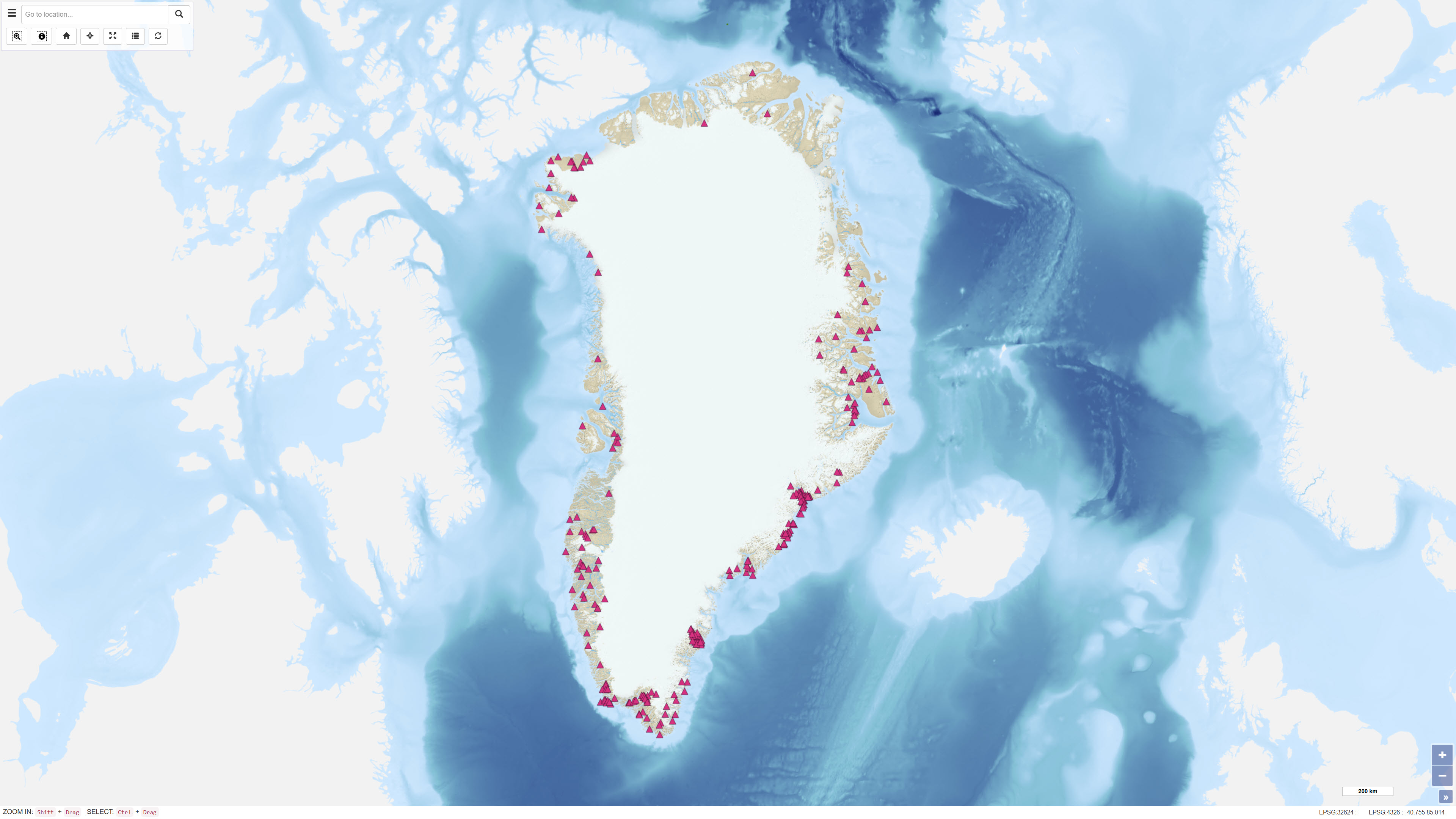
This dataset describes the intrusions and magmatic complexes of Greenland, forming a dedicated information layer within the GEUS GMOMDB2 database, displayed via the Greenland Mineral Occurrence Map (GMOM2). It includes 194 registered intrusions and complexes grouped into 23 magmatic provinces. The data are compiled from GEUS geological maps, published sources, and company reports. The Palaeogene intrusions and complexes of East Greenland (66–75°N) are related to the opening of the North Atlantic and the influence of the ancestral Icelandic mantle plume. The magmatic evolution includes flood basalts, dyke swarms, and intrusive activity from 61 to 13 Ma. Economic mineralisation is documented in several complexes, including the Skaergaard palladium deposit and the Malmbjerg porphyry molybdenum deposit, representing classic examples of rift- and post-rift-related mineral systems. The dataset provides harmonised, quality-controlled geological information to support exploration and research activities in Greenland.
-
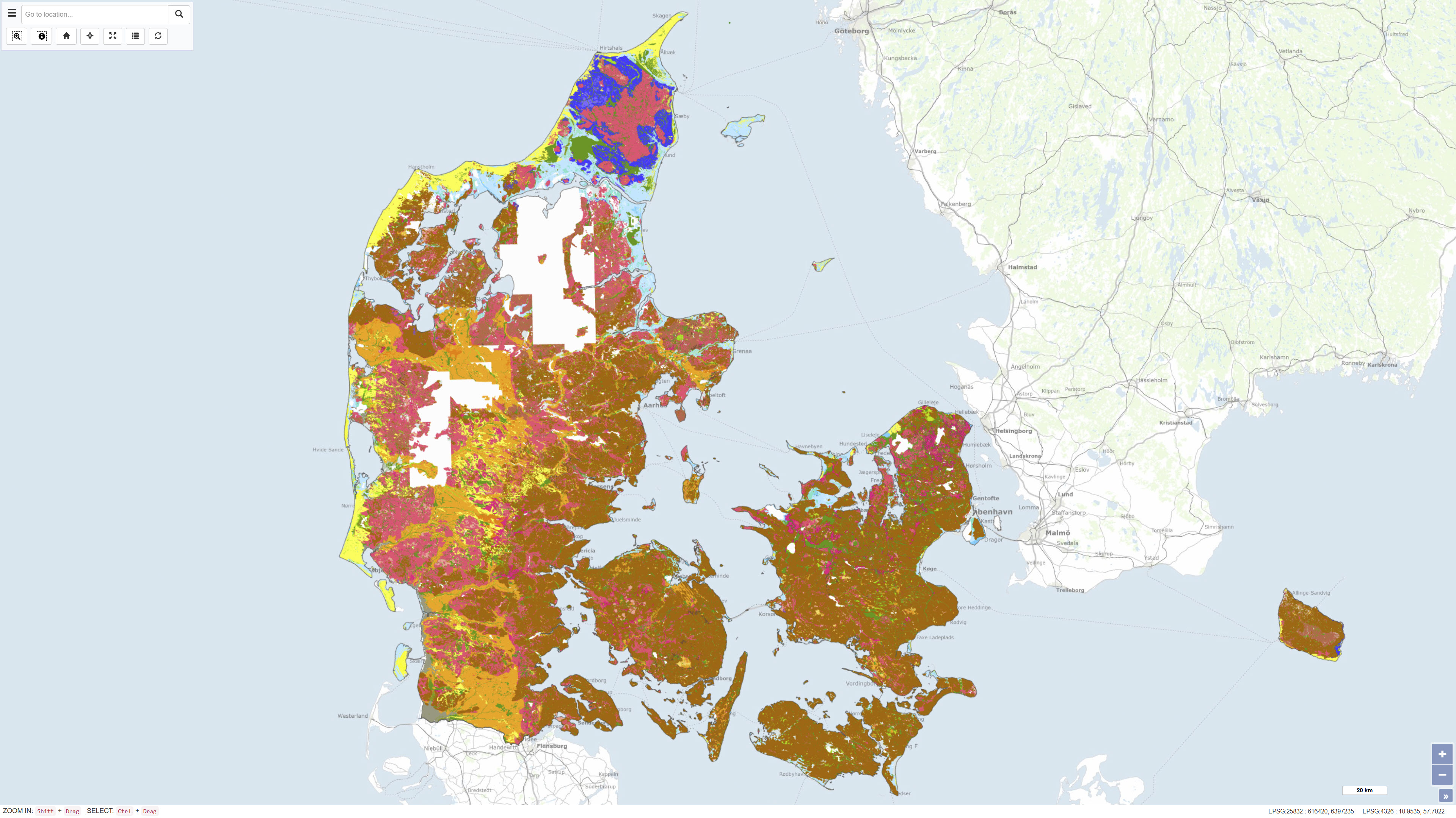
The Digital Geological Map of Denmark 1:25,000, version 7.0, is a nationwide geological dataset describing the distribution of near-surface soil and sediment types across Denmark. The dataset is produced and maintained by the Geological Survey of Denmark and Greenland (GEUS) and represents the latest version of the digital soil and sediment map at a scale of 1:25,000. The map is based on an integrated interpretation of geological field observations, borehole data, historical analogue maps, and more recent digital datasets. Soil and sediment units are classified according to their lithological and genetic characteristics and represent the dominant materials in the uppermost geological layers. The dataset is continuously updated, and version 7.0 includes both revisions of previously mapped areas and newly mapped regions. The dataset is widely used as a foundation for geological analysis, land-use planning, environmental assessment, groundwater protection, raw material management, research, and education. In version 7 from 2023, 93% of Denmark's land area is classified, and the map is continuously supplemented. The map and sediment type description are published in GEUS report 2023/29, where further information is available.
-
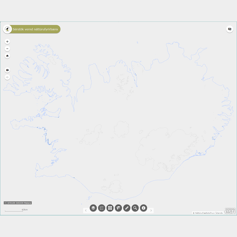
Þekja (layer) n25v_sjavarfitjar_fl: Sjávarfitjar á Íslandi. (Salt marshes.) Sjávarfitjar njóta sérstakrar verndar samkvæmt 61 gr. í lögum um náttúruvernd. Náttúrufræðistofnun Íslands heldur skrá yfir þessi náttúrufyrirbæri og birtir í kortasjá sem jafnframt er viðauki við náttúruminjaskrá.
-
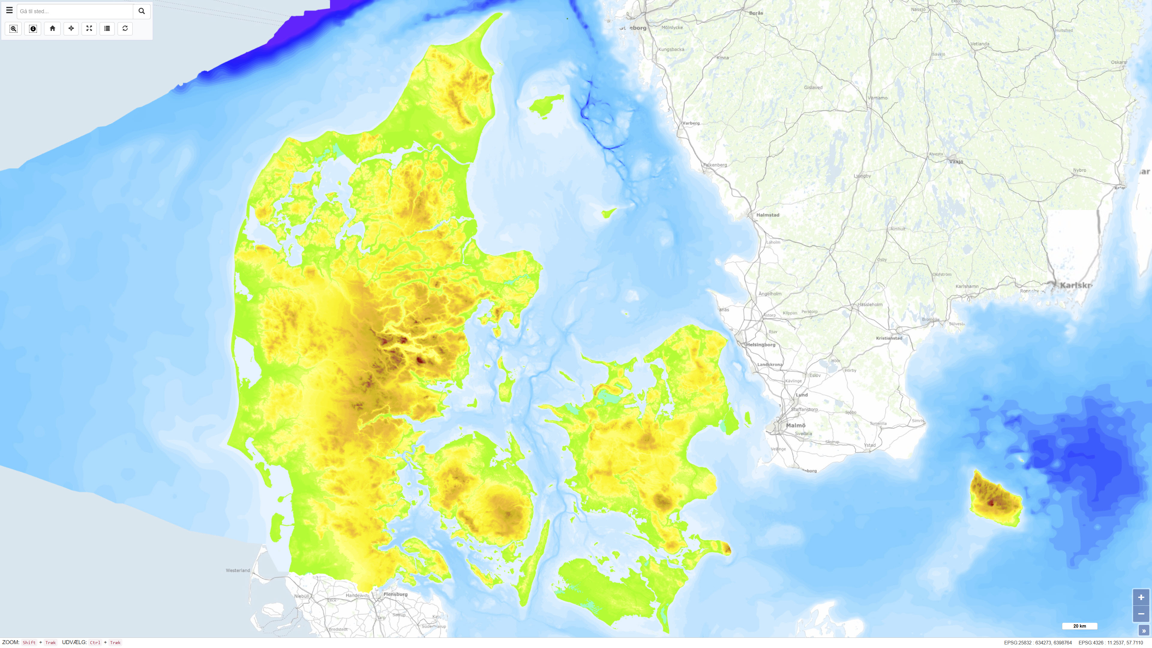
The Height and Depth Map of Denmark is a coherent map showing both land elevation above sea level and sea depth within the Danish area. The map is based on elevation and bathymetric data represented by 5-metre contour intervals closed to polygons and provides continuous coverage across the land–sea boundary. The dataset offers an integrated overview of terrain and bathymetry in Denmark and surrounding waters. The terrestrial elevation component is derived from topographic data suitable for use at scales down to approximately 1:25.000, while the bathymetric component is compiled from datasets of varying origin and resolution. The map was originally assembled around 1997, with subsequent updates to the Danish land areas carried out during 2005–2006. The dataset is primarily intended for regional visualisation and analysis.
-
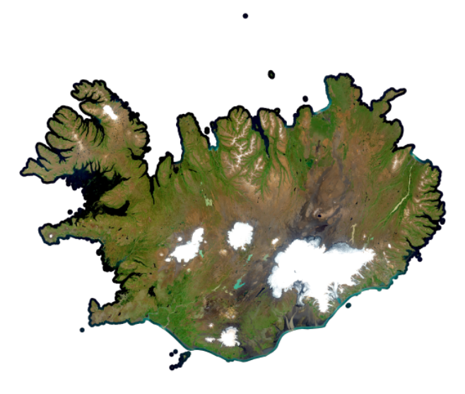
[IS] Skýjalaus miðgildismósaík úr Sentinel-2 myndum frá júlí og ágúst árin 2023 til 2025, í 10 m upplausn, með böndunum B2, B3, B4, B5, B6, B7, B8, B8A, B11 og B12. 60 m böndum var sleppt. [EN] Cloudless median mosaic of Sentinel 2 in July and August of the year 2023 to 2025 in 10m resolution with bands B2, B3, B4, B5, B6, B7, B8, B8A, B11, B12. Skipped were 60m bands.
-
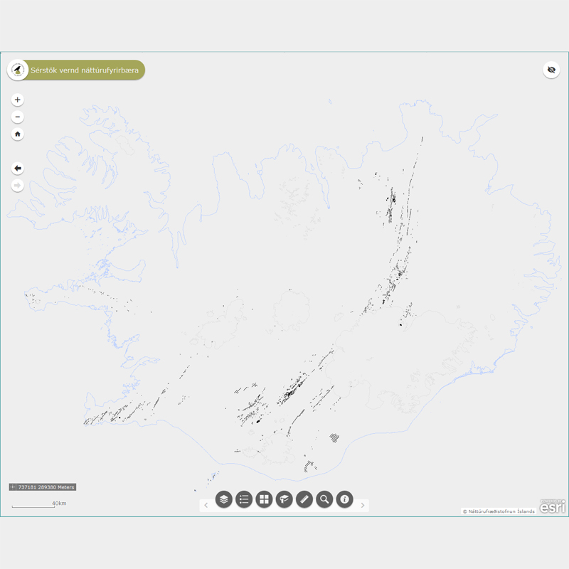
Þekjur (layers) n25v_gigarNutima_li og n25v_gigarNutima_fl: Eldvörp (gígar) og gervigígar sem myndast hafa eftir að jökull hvarf af landinu á síðjökultíma. (Volcanic craters and rootless vents formed after last Iceage [12.000 years ago].) Eldvörp og gervigígar sem myndast hafa eftir að jökull hvarf af landinu á síðjökultíma njóta sérstakrar verndar samkvæmt 61 gr. í lögum um náttúruvernd. Náttúrufræðistofnun Íslands heldur skrá yfir þessi náttúrufyrirbæri og birtir í kortasjá sem jafnframt er viðauki við náttúruminjaskrá. Heimildaskrá fylgir (n25v_gigarOgHraunNutima_heimildir).
-
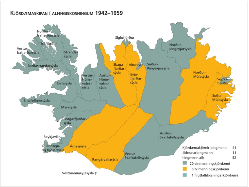
Kjördæmi eru afmörkuð landsvæði sem mynda einn af grunnþáttum kosningakerfisins. Framboðslistar eru lagðir fram fyrir hvert og eitt kjördæmi þannig að kjósendur í sama kjördæminu geta valið á milli sömu framboðslistanna og kjörnir fulltrúar hljóta þar umboð sitt til þingsetu. Kjördæmaskipulagið og fjöldi kjósenda í hverju þeirra liggur til grundvallar þegar þingsætum er úthlutað eftir þingkosningar. Þar sem kjördæmaskipulagið er ráðandi fyrir vægi atkvæða kjósenda hefur það mikil áhrif á það hvaða frambjóðendur fá sæti á þingi að loknum kosningum. Kjördæmaskipulagið er því meðal þess sem oft hefur orðið að deiluefni. Þegar gerðar voru á því verulegar breytingar kostuðu þær jafnan pólitísk átök og allar hafa þær þýtt málamiðlanir milli ólíkra sjónarmiða. Tekið af vef Alþingis: https://www.althingi.is/thingmenn/althingiskosningar/kosningar-og-kosningaurslit/kjordaemaskipulagid/
-
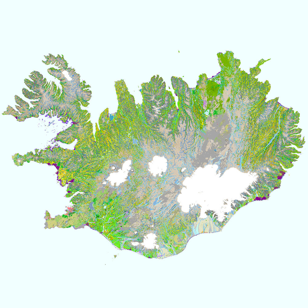
Gagnaset (data set) ni_vg25v_1.1utg og ni_vg25r_3utg: Vistgerðir á Íslandi (Habitat types of Iceland). Vistgerðakortið sýnir útbreiðslu vistgerða á Íslandi. Vistgerðum á Íslandi er skipt upp í land, ferskvatn og fjörur. Alls hafa verið ákvarðaðar 64 vistgerðir á landi, 17 vistgerðir fyrir ferskvatn og 24 vistgerðir fyrir fjörur. Landvistgerðir skiptast í 12 meginflokka (vistlendi). Innan landvistgerða eru fjórar jarðhitavistgerðir sem finnast á háhita- og lághitasvæðum landsins. Land- og ferskvatnsvistgerðir skiptast í tvö þrep, en fjöruvistgerðir í fimm þrep. Við skilgreiningu og flokkun vistgerða á Íslandi var tekið mið af EUNIS-flokkunarkerfinu (European Environment Agency 2012). Landupplýsingaþekjan fyrir landvistgerðir er á rastaformi (ni_vg25r_3utg), en þekjur fyrir jarðhita, ferskvatns- og fjöruvistgerðir er á vektorformi (ni_vg25v_1.1utg). Vektorþekjurnar eru flestar flákaþekjur, en fyrir ferskvatn er einnig línu- og punktaþekja. Gögn fyrir stöðuvötn (vg2 = V1) eru fjarlægð tímabundið úr niðurhalsþjónustu vegna ágreinings um grunnkort Loftmynda ehf. en þekjan er sýnileg í kortasjá. Náttúrufræðistofnun Íslands leggur með ritinu Vistgerðir á Íslandi fram tillögur að flokkun vistgerða sem á sér fyrirmynd í samræmdri og viðurkenndri flokkun vistgerða í Evrópu. Flokkunin byggir á rannsóknum víða um land með fyrirvara um að bæta mætti í þá þekkingu. Athuga skal að aðgreining landvistgerða með fjarkönnun reyndist erfið, bæði fyrir lítið grónar vistgerðir sem og vel grónar, einkum innan vistlenda. Því má búast við verulegum skekkjum þótt þær séu mismiklar eftir vistgerðum. Nánari útlistun og mat á skekkjum má finna í aðferðalýsingu og á staðreyndasíðum vistgerða í ritinu „Vistgerðir á Íslandi“. Frekari upplýsingar um flokkun og skilgreiningu vistgerða má sjá í ritinu (Jón Gunnar Ottósson, Anna Sveinsdóttir og María Harðardóttir, ritstj. 2016. Vistgerðir á Íslandi. Fjölrit Náttúrufræðistofnunar nr. 54. Garðabær: Náttúrufræðistofnun Íslands) og á vef Náttúrufræðistofnunar Íslands. Í 3. útgáfu vistgerðakortsins 2024 eru eingöngu landvistgerðir endurskoðaðar.