 Arctic SDI catalogue
Time
Type of resources
Categories
Topics
Keywords
Contact for the resource
Provided by
Years
Formats
Representation types
Update frequencies
status
Service types
-
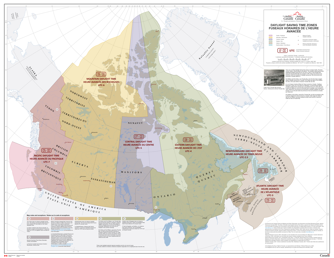
There are six official time zones in Canada: Pacific, Mountain, Central, Eastern, Newfoundland, and Atlantic. All time zone boundaries in Canada are regulated by the provinces and territories. This record contains maps and data for both legislated Standard Time and Daylight Saving Time boundaries. Daylight Saving Time occurs every year; it starts on the second Sunday in March and ends on the first Sunday in November. However, the Yukon, Saskatchewan and parts of British Columbia, Quebec and Nunavut do not observe Daylight Saving Time. The changes to Pacific time announced on March 2, 2026, by the Government of British Columbia are not reflected in this dataset. Please consult the [Government of British Columbia's announcement](https://news.gov.bc.ca/releases/2026AG0013-000209#:~:text=B.C.%27s%20new%20time%20zone,%20Pacific%20time,%20will,and%20other%20regions%20observing%20mountain%20standard%20time) for more information. The maps and data were produced by the Canada Centre for Mapping and Earth Observation (CCMEO) at Natural Resources Canada. The time zone boundary lines were created from information provided by the National Research Council who are responsible for official time in Canada.
-
This time-enabled map shows the expansion of Canadian Railways, higlighting the rapid expansion of the CPR in the late nineteenth century.