 Arctic SDI catalogue
AEM
Type of resources
Available actions
Topics
Keywords
Contact for the resource
Provided by
Formats
Representation types
Update frequencies
status
Scale
-
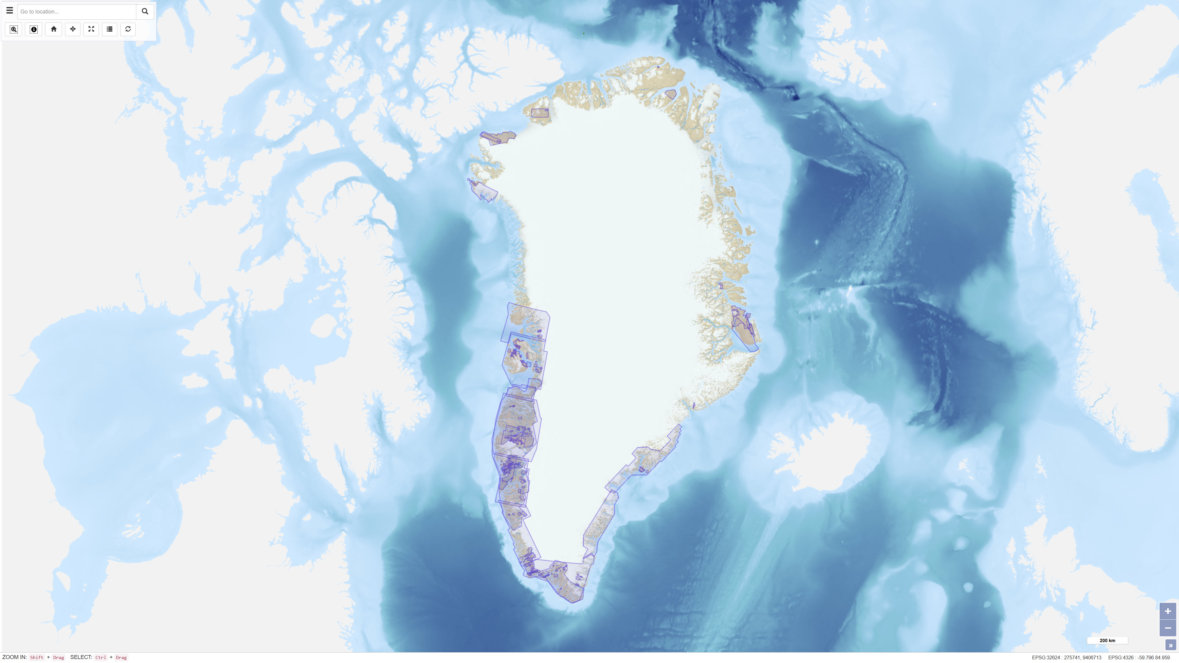
The dataset comprises geophysical survey data available through the Greenland Mineral Resources Portal. The data include both released company data and publicly funded survey data, primarily airborne electromagnetic (AEM) and aeromagnetic (Aeromag) surveys. The AEM Greenland 1994–1998 project encompassed high-resolution, multi-parameter airborne surveys including electromagnetic, magnetic and partly radiometric measurements conducted between 1994 and 1998, producing approximately 75,000 line kilometres of data. The Aeromag projects included high-resolution airborne magnetic surveys conducted in 1992, 1995, 1996, 1997, 1998, 1999, 2001, 2012 and 2013, producing more than 550,000 line kilometres of data. The projects were financed by the governments of Greenland and Denmark. The dataset provides regional geophysical coverage supporting geological interpretation, mineral exploration and geoscientific research in Greenland.
-
%20-%20datas%C3%A6t.jpg)
The dataset comprises airborne electromagnetic (AEM) measurements acquired in Greenland during 1994–1998 as part of GEUS’ regional geophysical mapping programme. The surveys were conducted using helicopter- and fixed-wing electromagnetic systems and include electromagnetic response measurements as well as magnetic data. The dataset is used for regional mapping of subsurface electrical conductivity and for identifying structural and lithological variations relevant to geological interpretation and mineral exploration.