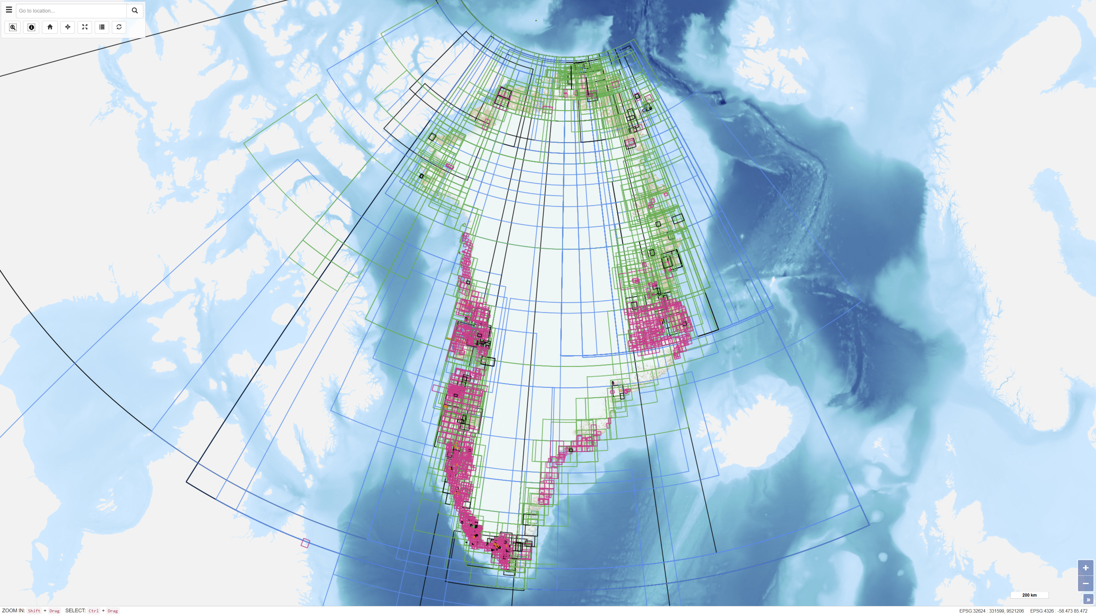
 Arctic SDI catalogue
GeoJSON
Type of resources
Available actions
Topics
Keywords
Contact for the resource
Provided by
Years
Formats
Representation types
Update frequencies
status
Scale
-
Klimadata omfatter kvalitetskontrollerede meteorologiske observationer. Klimadata er tilgængelig som: 1. Stationsdata både for Danmark og Grønland 2. Arealdata kun for Danmark
-
DMI foretager en lang række punktmålinger på sine målestationer i Danmark og Grønland. Målingerne er en automatisk proces, hvor vind, nedbør, temperatur, og vandstand måles, og data videresendes til DMI. Observationsdata er såkaldte rå-data, hvilket betyder, at de ikke er kvalitetskontrollerede eller på anden vis behandlede. Der kan således forekomme fejlbehæftede målinger, hvilket typisk skyldes, at måleinstrumenter er blevet slidte eller ødelagte af vind og vejr, i sjældne tilfælde har været udsatte for hærværk. DMI arbejder løbende med kvalitetssikring og vedligeholdelse af sine måleinstrumenter med henblik på at leve op til anbefalingerne fra WMO. Man skal derfor være opmærksom på risikoen for fejlbehæftede målinger, hvis man anvender DMI’s meteorologiske observationsdata. De meteorologiske observationer angives i UTC-tid, og målingerne følger anbefalingerne fra FN's organisation for meteorologi, World Meteorological Organization (WMO) og den internationale oceanografiske kommision (IOC - UNESCO).
-
The dataset represents an index layer showing the geographic extent of archived and unpublished historical geological maps and sections from Greenland. The layer functions as a search and reference tool and does not contain the original map material. The dataset supports identification and access to historical geological archive documents.
-
Nationwide geophysical database for environmental and raw material data, also known as GERDA (GEophysical Relational DAtabase). The database contains various types of geophysics, including geoelectrics, electromagnetics, borehole logs and seismic. All data is freely available for download on the GEUS website. The database is updated continuously.
-
%20-%20datas%C3%A6t.jpg)
The database contains information on deep drilling, carried out under a permit, cf. the Subsoil Act, as well as geophysics (especially seismic), licenses and reports. These are exploration, estimation, delineation and production drillings concerning oil/gas, geothermal energy, gas storage and salt, as well as scientific drillings. The dataset contains technical, administrative and geological information from the drillings and about geophysical measurements in the drillings.
-
The dataset contains terrain models of towns and settlements across Greenland delivered by Asiaq and prepared in connection with the Landslide Project 2022. The dataset includes recorded infrastructure such as roads, buildings and administrative boundaries, as well as a comprehensive raster mosaic of elevation models covering all towns and settlements.
-
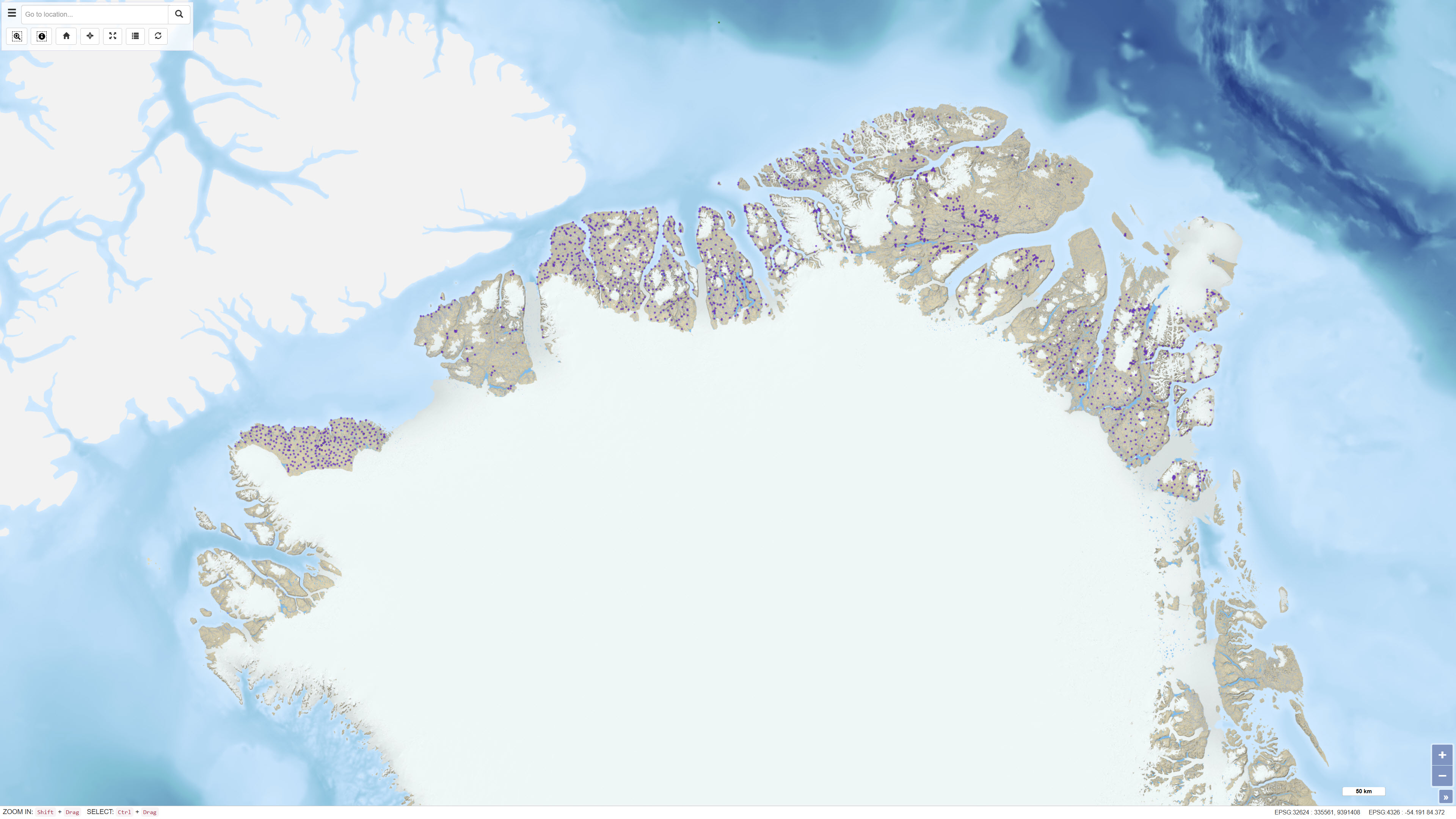
The dataset contains geographic polygons representing the areas of Greenland covered in GEUS publications and in the DODEX report database. Each publication is associated with metadata including title, authors, year of publication and reference information as well as a link to the digital publication where publicly available. The dataset includes publication series such as GEUS Bulletin, Geological Survey of Denmark and Greenland Bulletin, Bulletin Grønlands Geologiske Undersøgelse, report series and geological map descriptions. The polygons are based on the geographic extent described in each publication and serve as a spatial index for search and visualisation purposes.
-
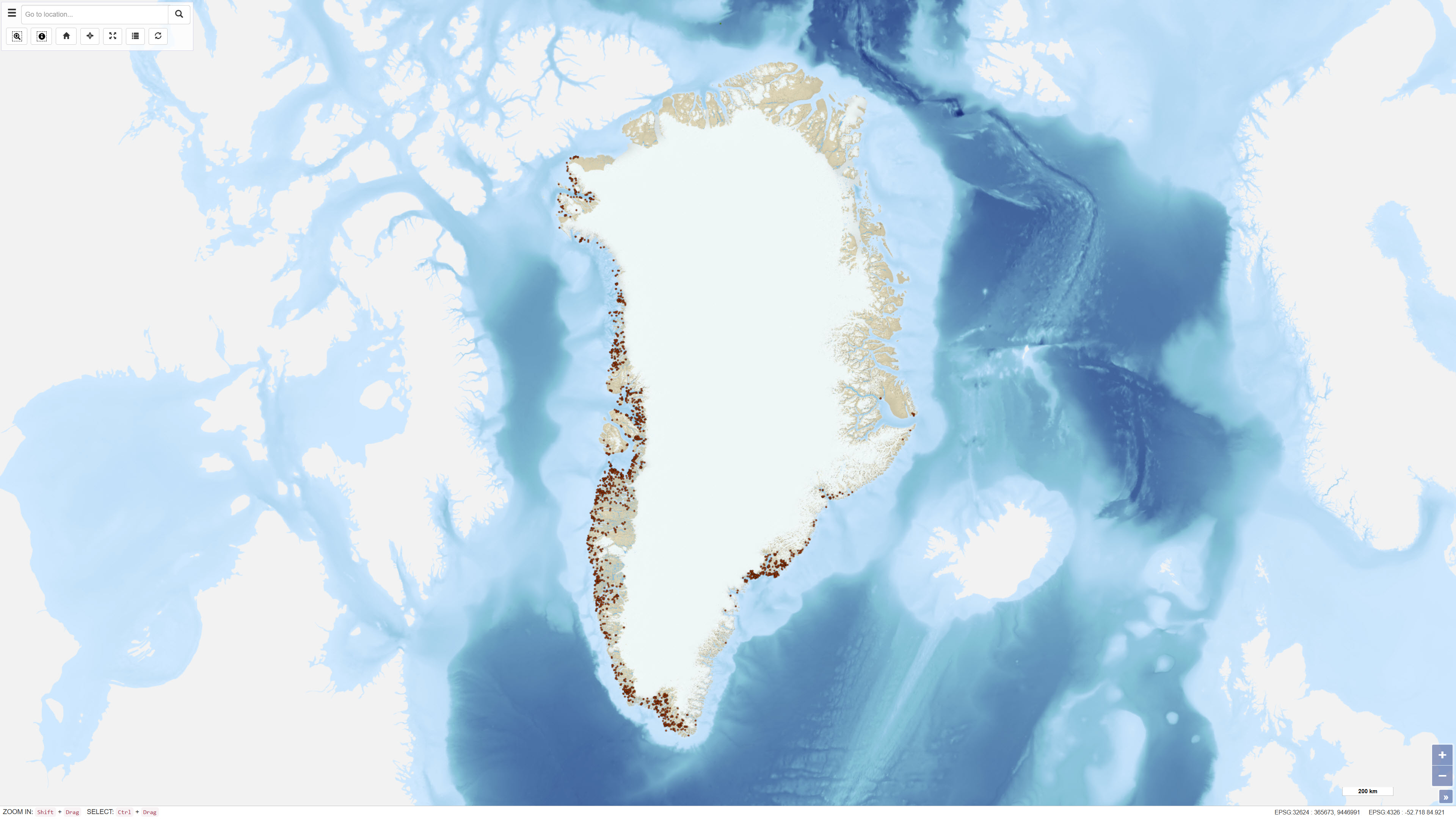
This dataset comprises calibrated geochemical data from stream sediment and soil samples collected in North Greenland between 1978 and 1999, supplemented by extensive reanalyses in 2011. The dataset includes selected elements relevant for the evaluation of zinc mineralisation: CaO, K₂O, Ba, Cu, Sr and Zn. A total of 2,469 stream sediment samples and 204 soil samples were included. The analytical values represent the most reliable results following systematic quality control and calibration procedures designed to eliminate bias between analytical methods and analytical periods, as described in Thrane et al. (2011). All values below detection limit are coded as 0 in the dataset. The dataset supports regional assessment of geochemical patterns and mineral potential in North Greenland.
-
Ujarassiorit is Greenland’s national mineral hunt, a public competition open to residents of Greenland. The initiative encourages participants to collect and submit rock samples from anywhere in Greenland to the Ministry of Mineral Resources for geological evaluation. Submitted samples are assessed by geologists, and selected participants may be awarded prizes. The purpose of Ujarassiorit is to increase public awareness of Greenland’s mineral resources and to support mineral exploration by identifying areas of geological interest through public participation. The initiative contributes to the collection of geological information and promotes engagement with geoscience among the population.
-
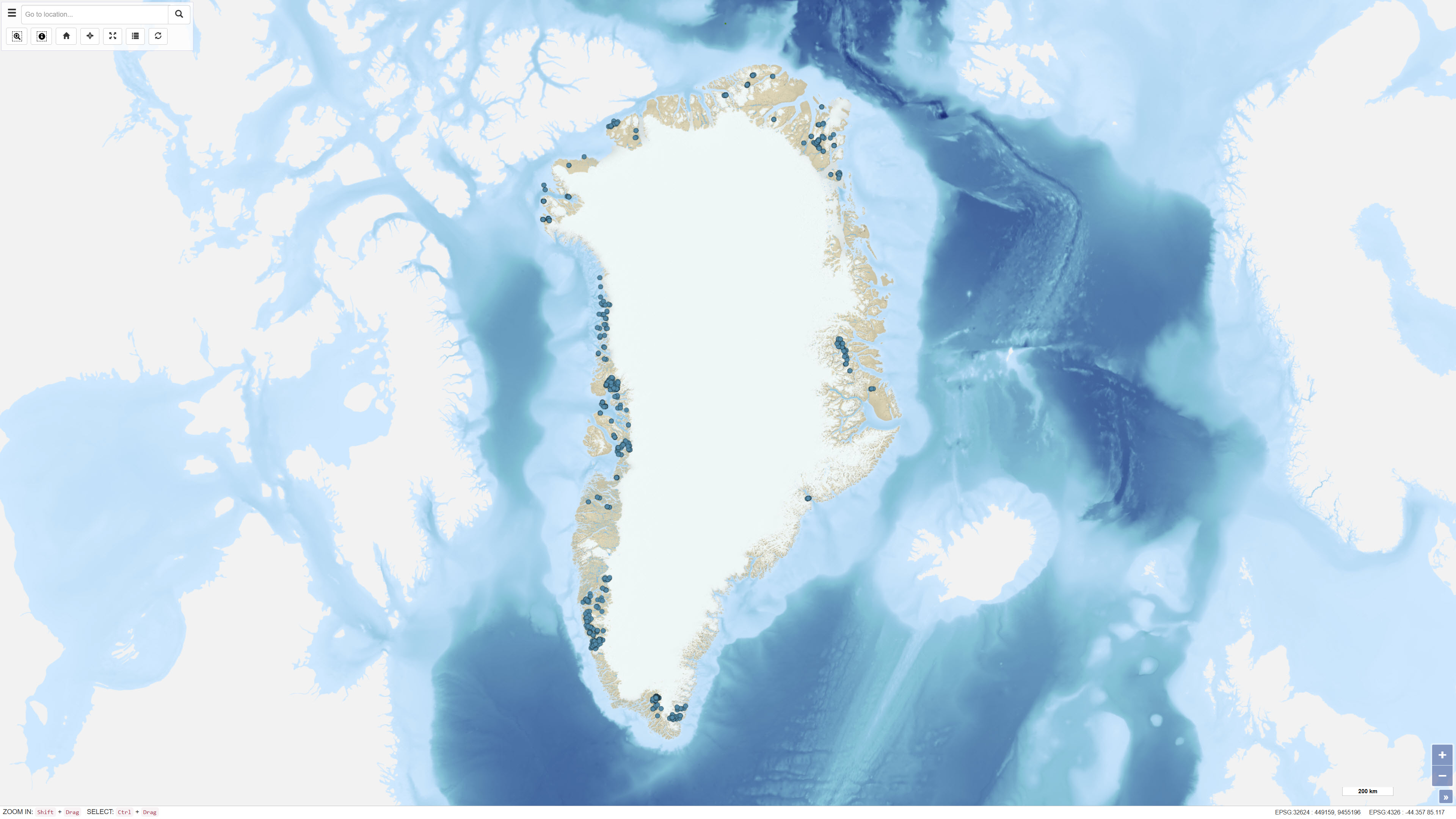
The dataset contains geochemical analytical results for 725 heavy mineral concentrate samples collected by GEUS in Greenland as part of various geological mapping and mineral exploration activities. The samples originate from several campaigns, including a regional campaign conducted between 1982 and 1986 in the Nuuk area, a 1991 campaign in the southern Nuuk region, and samples collected in 2003 in the Qaanaaq region. Additional samples derive from smaller projects and campaigns with limited documentation. Analyses were carried out at different laboratories, including Activation Laboratories and Bondar-Clegg in Canada and Risø National Laboratory in Denmark. The dataset contains raw analytical results, and metadata concerning sampling procedures and analytical quality are not complete for all samples.