 Arctic SDI catalogue
Gravity
Type of resources
Available actions
Topics
Keywords
Contact for the resource
Provided by
Formats
Representation types
Update frequencies
status
Scale
-
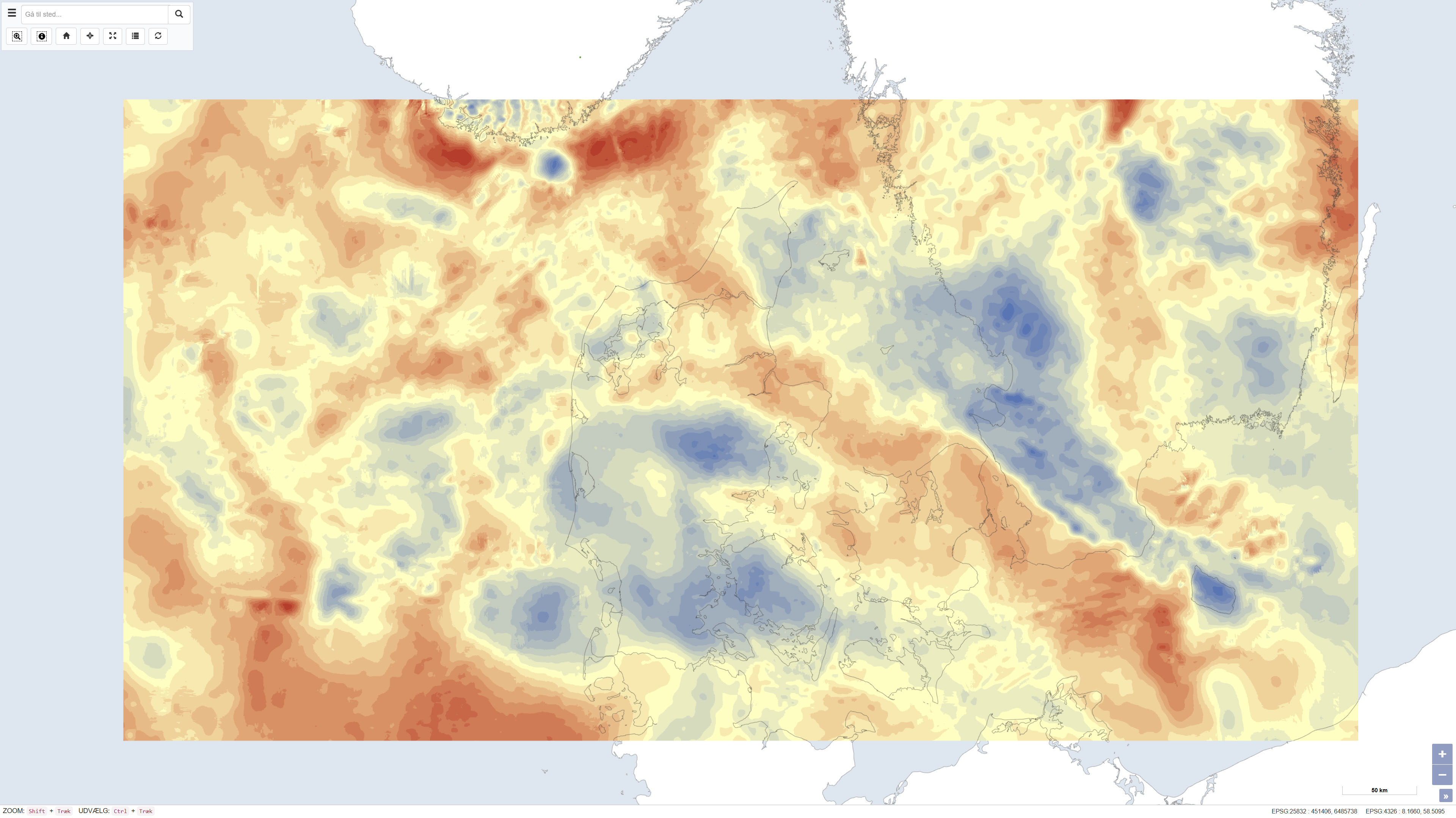
The dataset presents Bouguer gravity anomalies on land and free-air gravity anomalies in Danish marine areas based on gravity measurements from the national gravity database. The Bouguer anomaly is terrain corrected and is used to investigate variations in subsurface mass distribution, while the free-air anomaly at sea reflects variations in the gravity field without full terrain correction. Gravity anomalies are expressed in milligals (mGal). The dataset was produced by DTU Space and represents a consolidated gravimetric foundation for geological and geophysical analyses in Denmark.
-
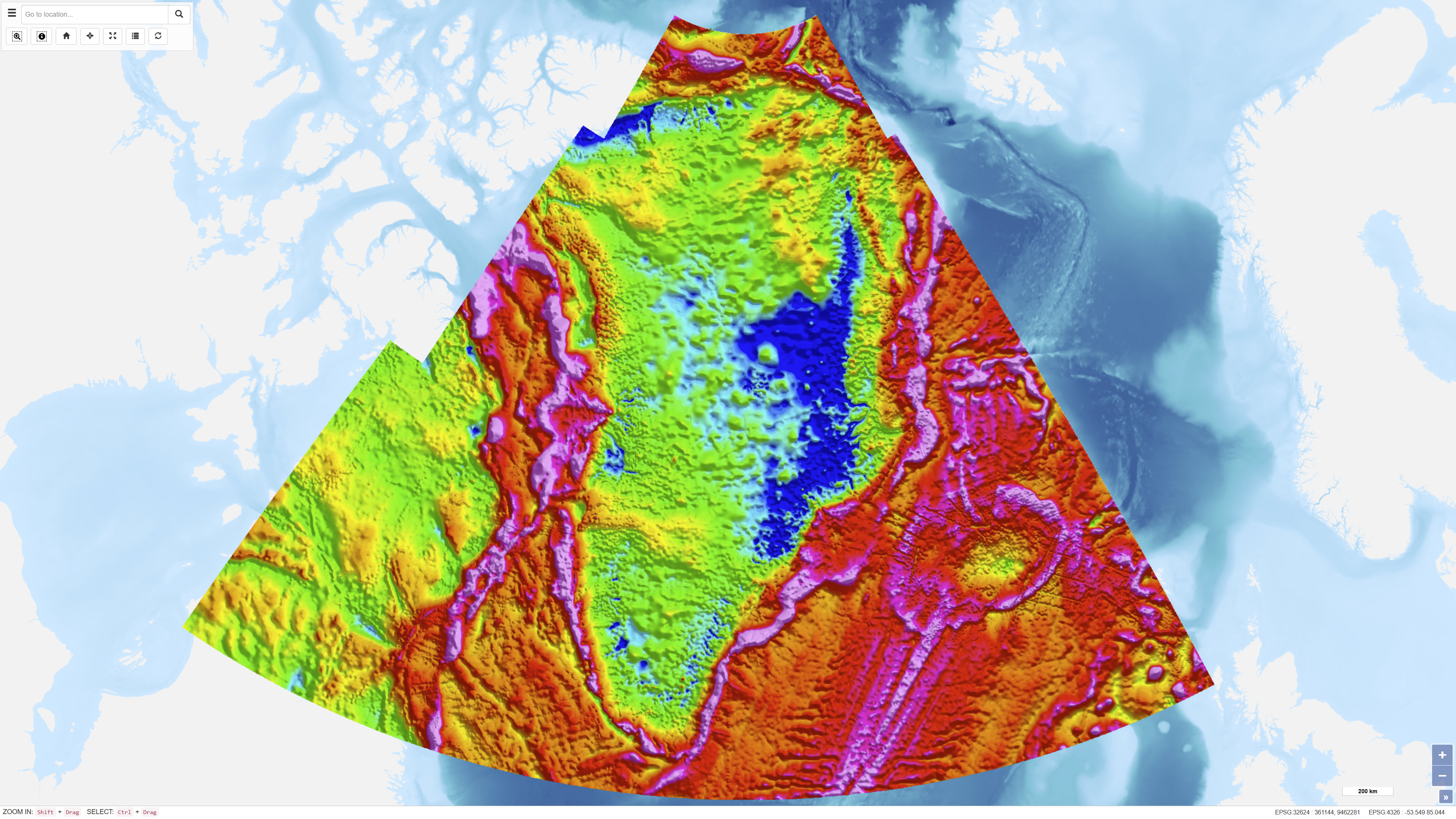
The dataset represents a regional compilation of terrestrial, marine, airborne and satellite-derived gravity data for Greenland, prepared by DTU Space. The compilation includes calculation of free-air (Faye) and terrain-corrected Bouguer anomalies based on homogenised gravity observations. In areas lacking direct measurements, satellite-derived gravity models have been applied as supplementary data. Over the Greenland Ice Sheet, Bouguer anomalies are calculated using an ice thickness model based on Bamber et al. (2013). The dataset provides a regional gravity framework for geological and geophysical interpretation.