 Arctic SDI catalogue
Subsurface
Type of resources
Available actions
Topics
Keywords
Contact for the resource
Provided by
Formats
Representation types
Update frequencies
status
Scale
-
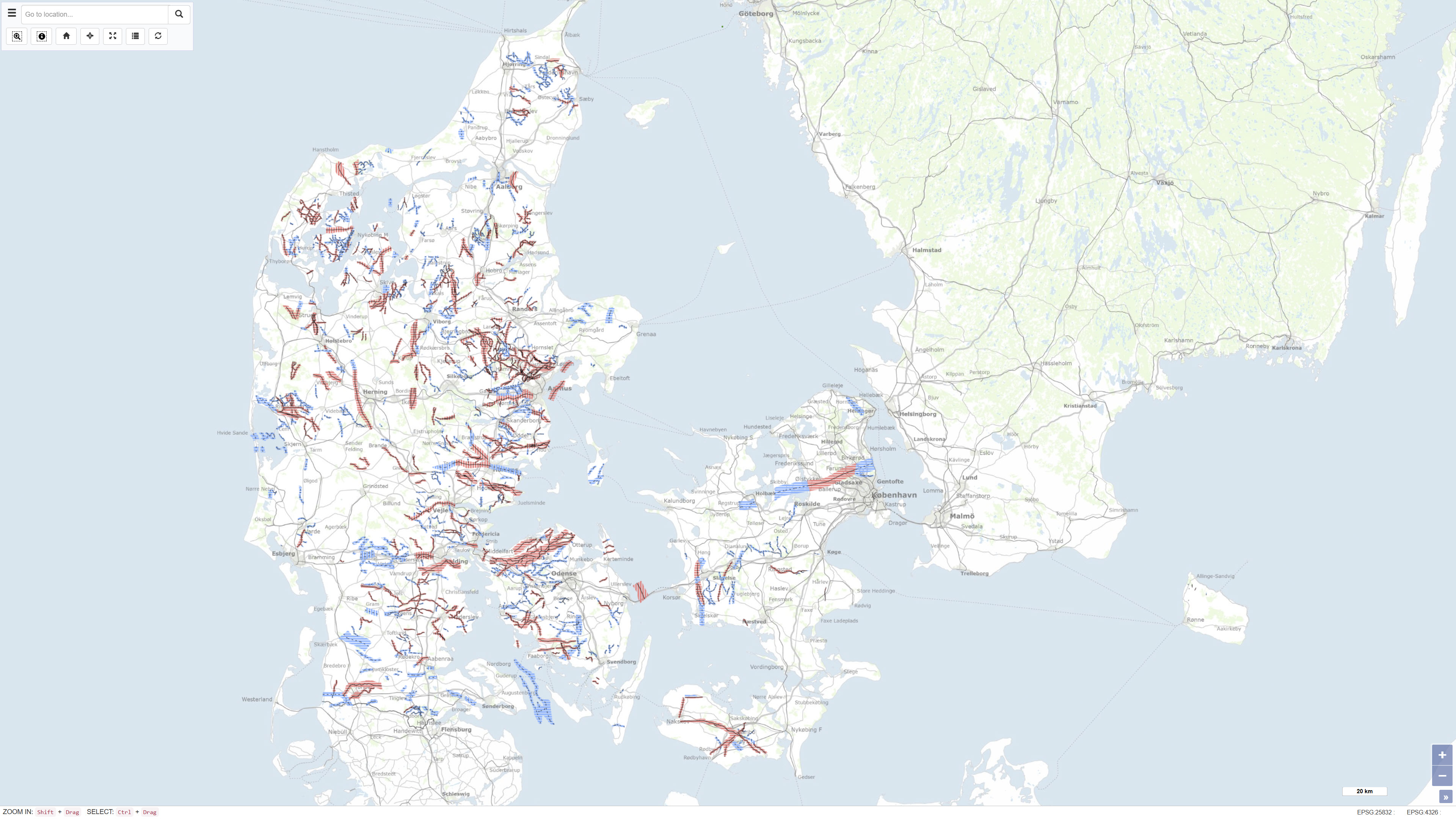
The dataset represents a nationwide mapping of buried valleys in Denmark. The map depicts the occurrence, distribution and general geometry of mapped buried valleys in the Danish subsurface. Buried valleys are elongated depressions in the subsurface that are today fully or partly infilled with younger sediments. In Denmark, the majority of mapped buried valleys are interpreted to have formed during repeated glaciations in the Quaternary period. The valleys are typically 0.5–2 km wide and may reach depths of up to approximately 400 m. The dataset is based on interpretation of geophysical data, primarily TEM and SkyTEM surveys, supplemented by seismic data and borehole information. The mapping provides a national overview of buried valleys and forms a key basis for understanding the geological framework of the subsurface.
-
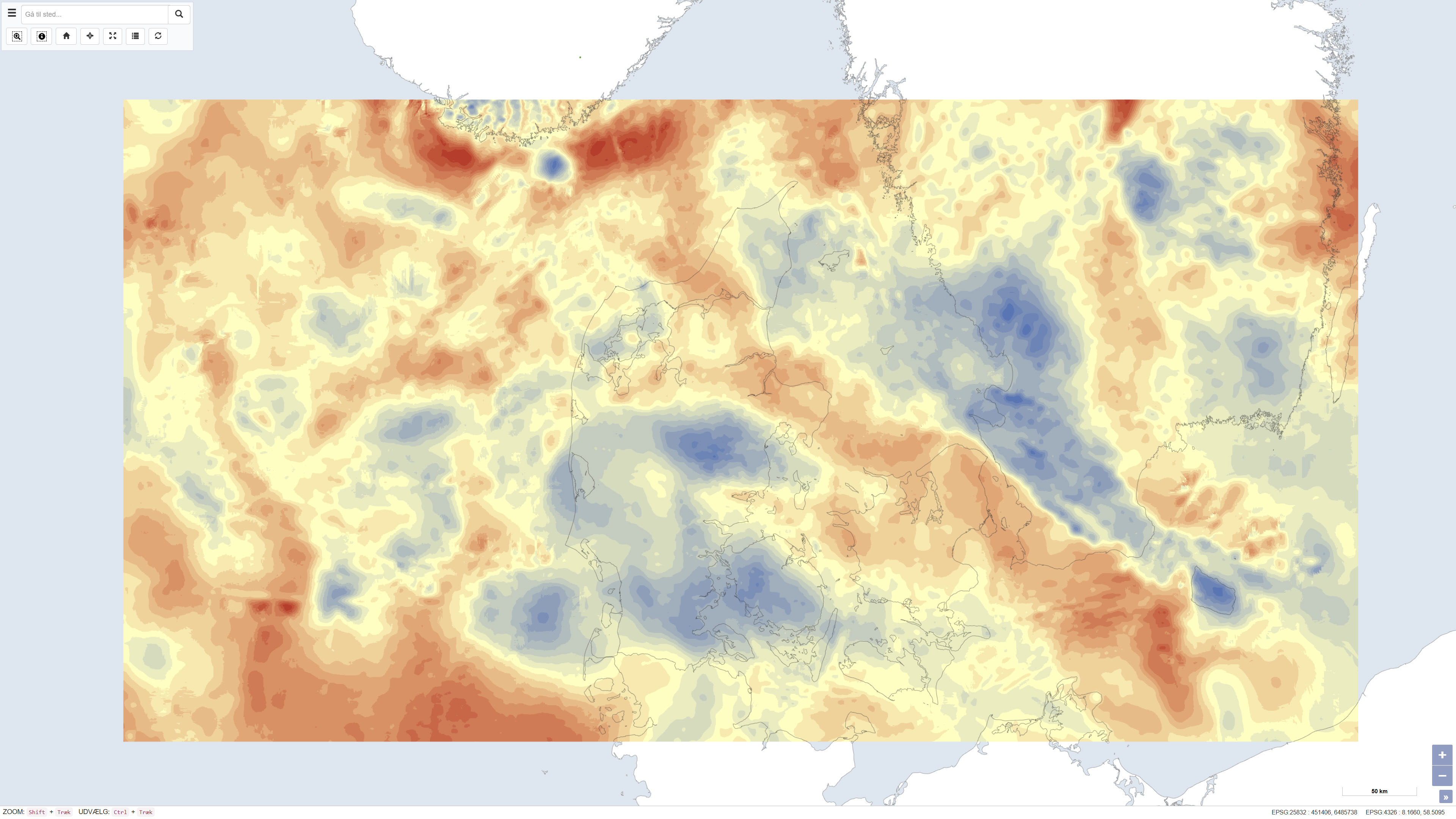
The dataset presents Bouguer gravity anomalies on land and free-air gravity anomalies in Danish marine areas based on gravity measurements from the national gravity database. The Bouguer anomaly is terrain corrected and is used to investigate variations in subsurface mass distribution, while the free-air anomaly at sea reflects variations in the gravity field without full terrain correction. Gravity anomalies are expressed in milligals (mGal). The dataset was produced by DTU Space and represents a consolidated gravimetric foundation for geological and geophysical analyses in Denmark.
-
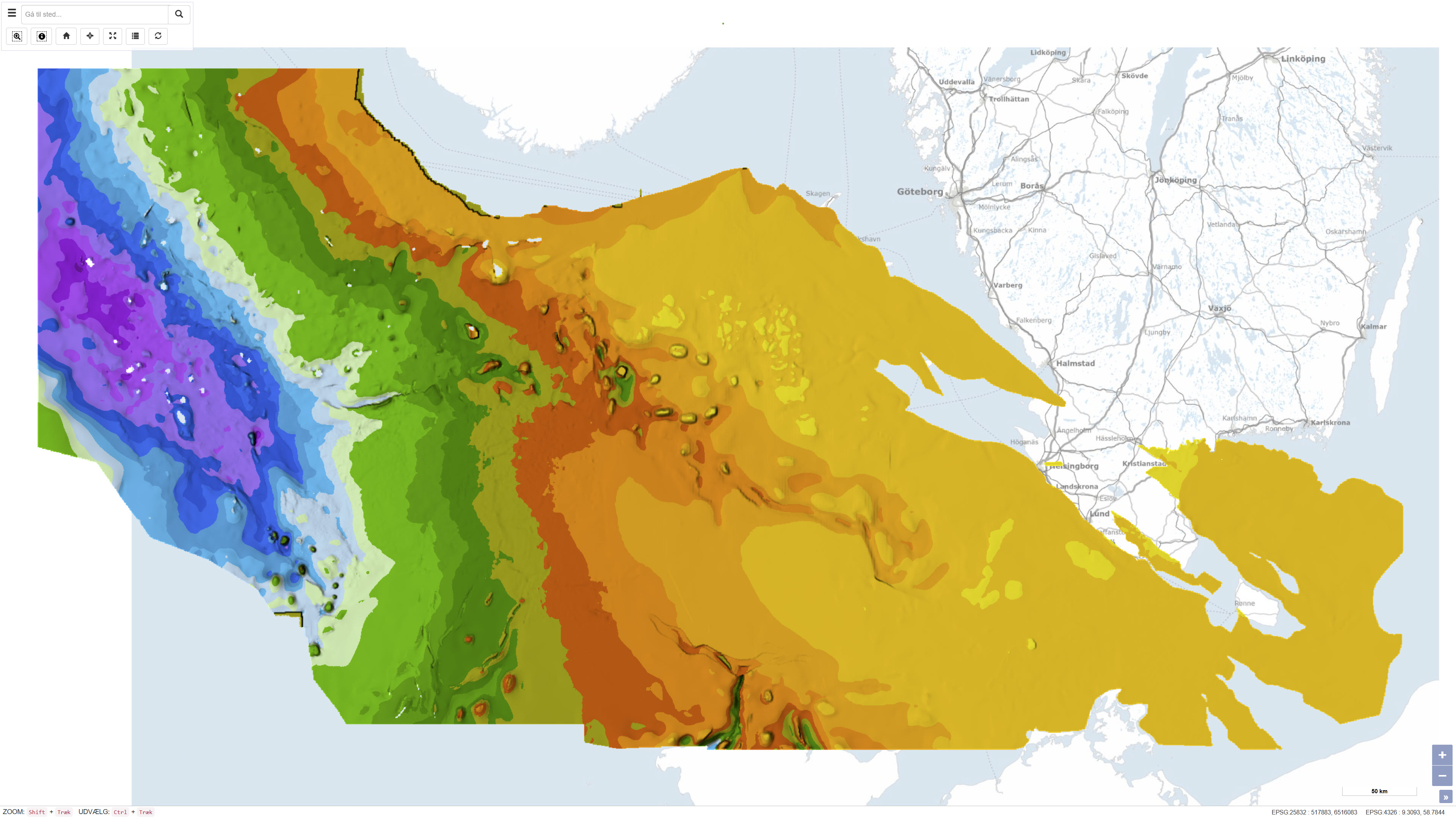
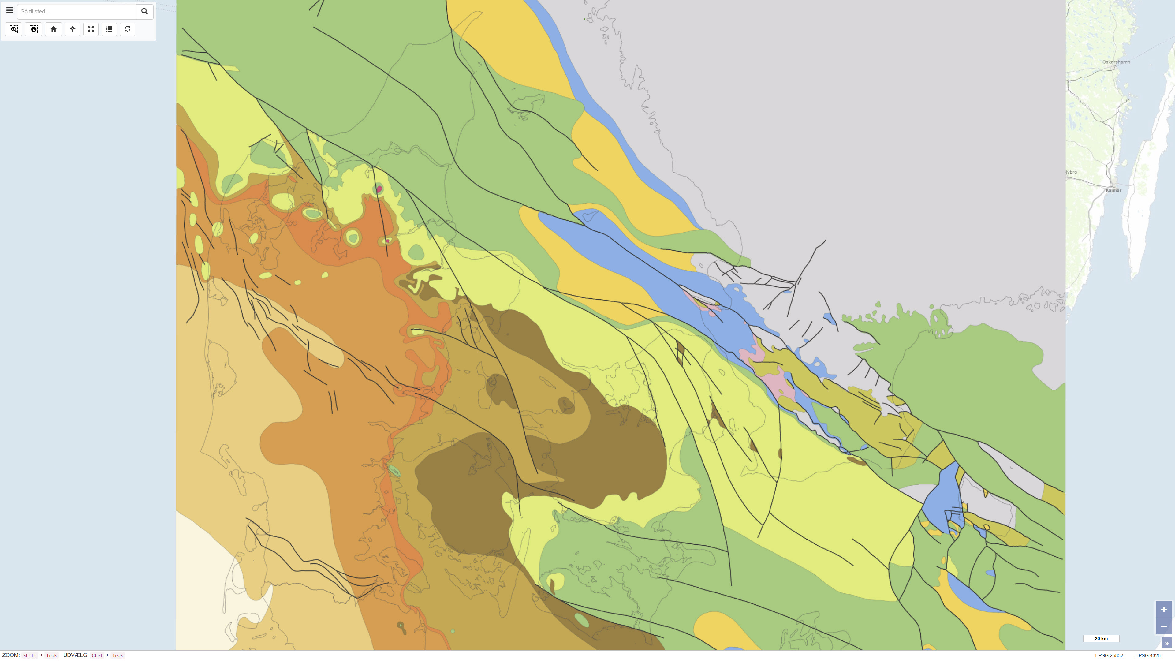
This dataset represents the structure and topography of the Top Chalk surface, i.e. the top of the Chalk Group (including Upper Cretaceous to Danian), in the Danish subsurface. The map illustrates regional variations in the depth and structural configuration of the chalk surface from the central North Sea to the eastern Danish areas. It is based on an integrated geological and geophysical interpretation of seismic profiles, well data and earlier mapping. The map provides an essential basis for geological, geophysical and subsurface reservoir analyses.
-
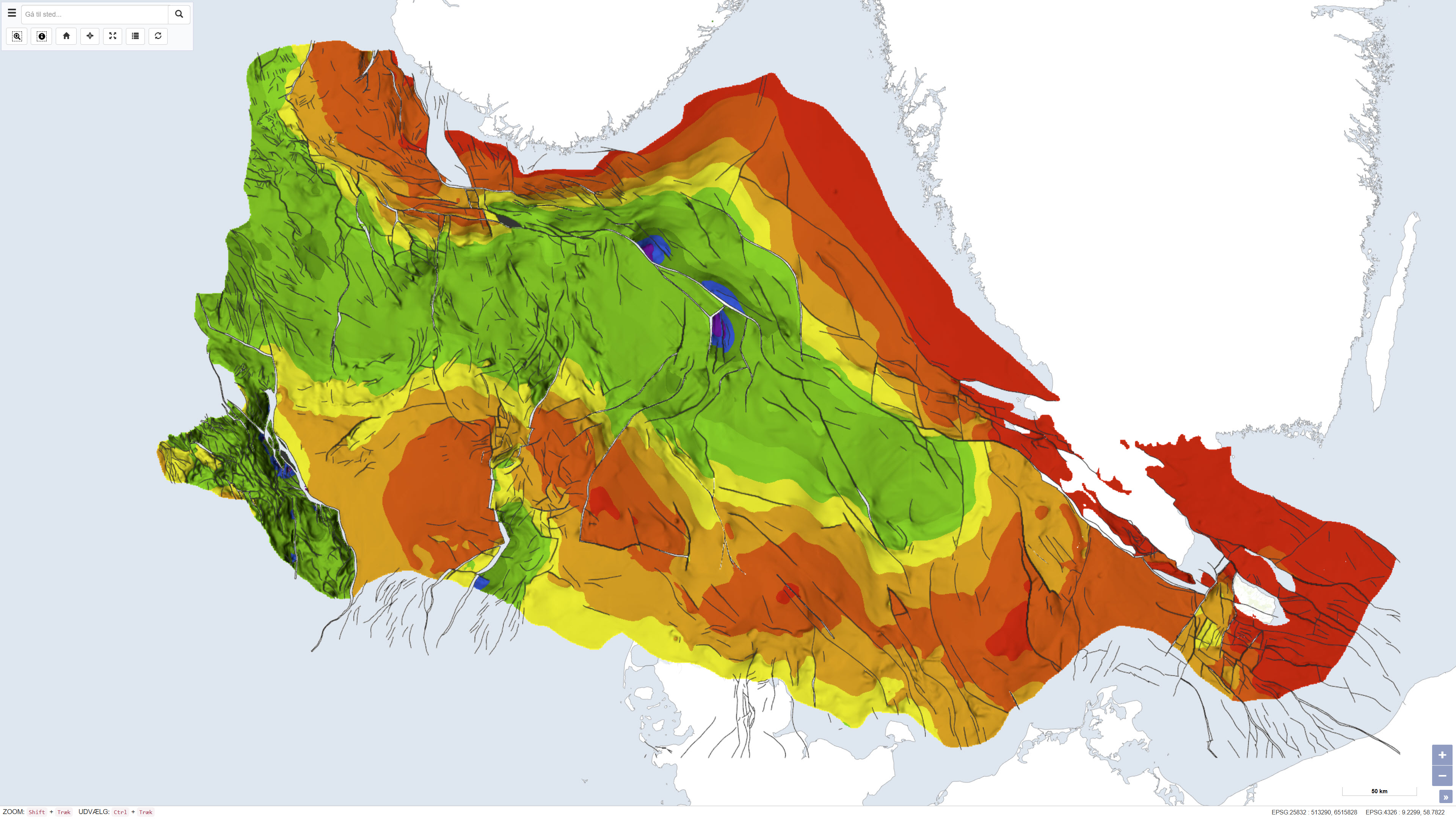
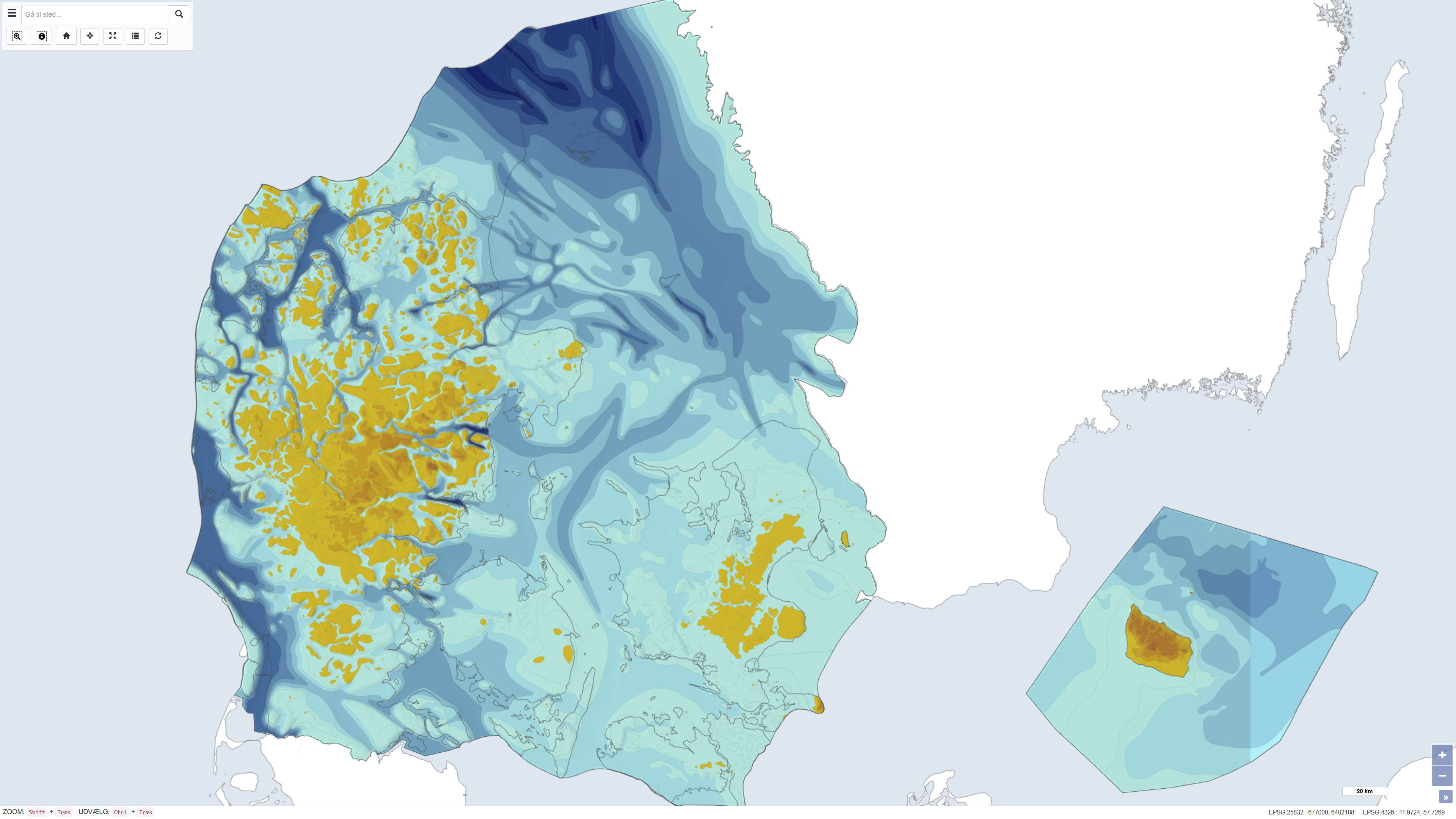
This dataset depicts the depth to the top of the pre-Zechstein succession in the Danish subsurface. The map represents the structural surface beneath the Zechstein evaporites and provides a regional overview of the geological framework of the subsurface. The dataset is based on interpretation of seismic data, deep boreholes and previous geological mapping and was produced as part of the Geological Survey of Denmark map series no. 45. The map is used as a reference for regional structural geology and subsurface modelling.
-
This dataset is based on the Geological Survey of Denmark map series no. 45 and represents a compiled geological map product produced in the early 1990s. The map is based on existing geological maps, seismic surveys, and previous interpretations, providing a regional overview of the geological conditions within the mapped area. The dataset forms part of the national mapping activities of the Geological Survey of Denmark and was published in 1994.
-
This dataset represents the pre-Quaternary surface topography of Denmark, including Kattegat, internal waters and the sea around Bornholm. The map provides a paleotopographic relief of the surface that existed prior to deposition of Quaternary sediments, compiled from geological borehole data, seismic surveys and topographic sources. It includes polygons with 25 m contour intervals, a 500 m grid and boundary delineations, usable in combination with a standard elevation model to determine Quaternary cover thickness. The base map was hand-drawn at 1:250,000 scale and forms a nationwide thematic map product. The map is described in DGU map series no. 44, 1994.
-
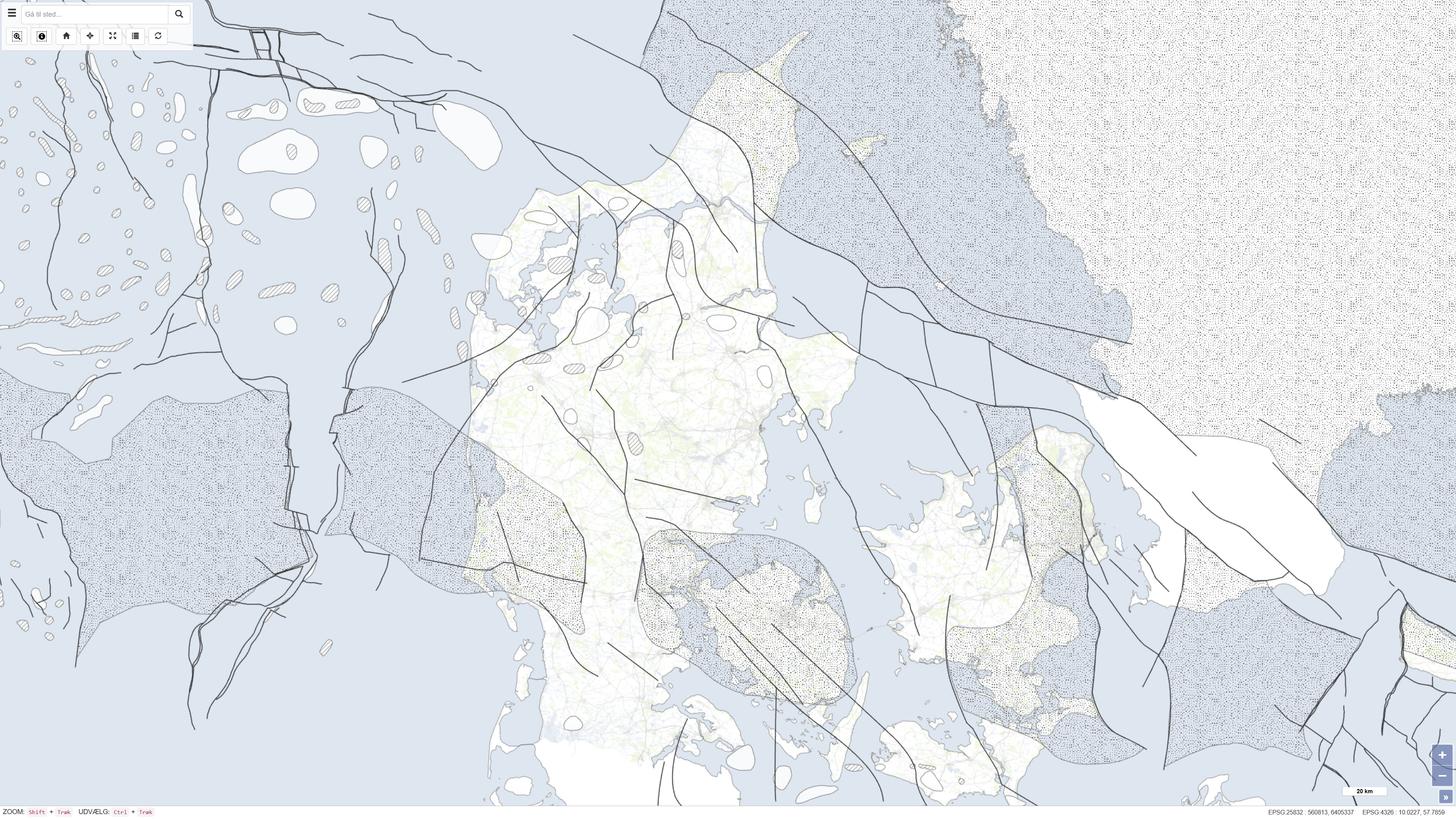
This dataset represents a geological map of the pre-Quaternary surface in Denmark, compiled by Håkansson & Pedersen (1992). The map illustrates the geological delineation and extent of pre-Quaternary formations beneath the Quaternary deposits and is based on geological observations, borehole data and previous interpretations. The dataset provides a regional overview of the pre-Quaternary geological surface and its characteristics as a basis for further geological interpretation. Reference: Stenestad, E. 1982: Karst. Varv, 4, pp. 113-119.
-
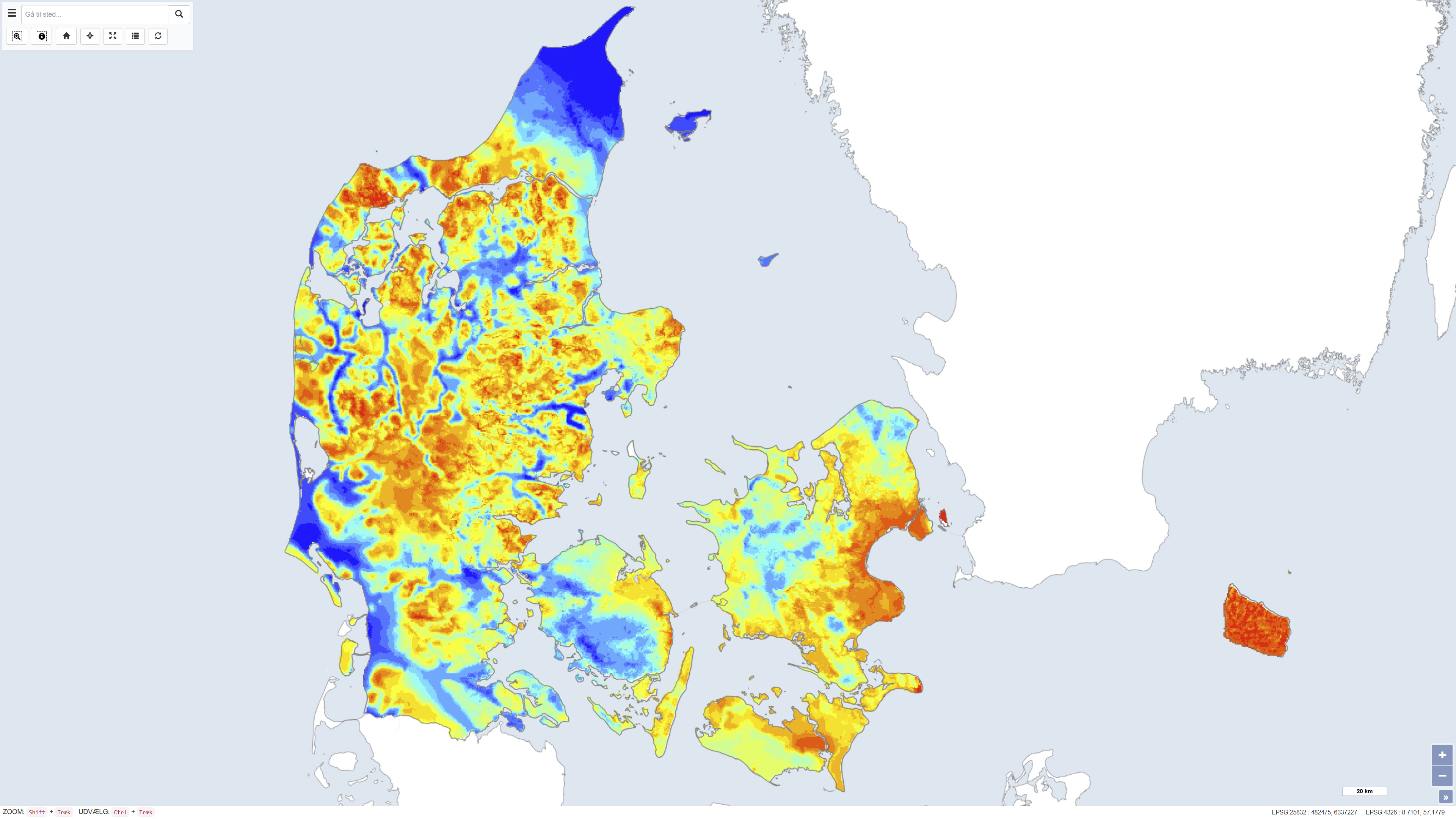
The dataset shows the thickness of Quaternary deposits in Denmark. The thickness has been calculated as the difference between surface elevation and the depth to the top of the pre-Quaternary deposits. The map provides a nationwide overview of variations in Quaternary thickness and is used in geological, hydrogeological and planning-related contexts.