 Arctic SDI catalogue
ZEVIP
Type of resources
Available actions
Topics
Keywords
Contact for the resource
Provided by
Formats
Representation types
Update frequencies
status
-

Zero Emission Vehicle Infrastructure Program (ZEVIP) and Electric Vehicle and Alternative Fuel Infrastructure Deployment Initiative (EVAFIDI) qualitative, quantitative, and geographic data set derived from the program database. This data defines the project number, the number of chargers, the name of the promoter, the type of connector, the address, the city, the province, the postal code, the geographical coordinates, the status, the opening date, and the type of contribution agreement for each project funded by the program. The Canada Infrastructure Bank’s (CIB) Charging and Hydrogen Refuelling Infrastructure Initiative (CHRI) aims to reduce transportation sector greenhouse gas emissions by accelerating the private sector’s rollout of large-scale ZEV chargers and hydrogen refuelling stations, helping to spur the market for private investment. Through this initiative, the CIB has dedicated a minimum of $500 million to support the federal government’s goals as part of Canada’s 2030 Emissions Reduction Plan. Technology funding current to April 1 2025.
-
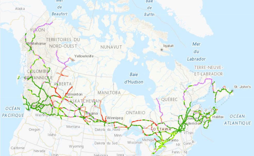
The Zero Emission Vehicle Infrastructure Program (ZEVIP) aims at addressing the lack of charging infrastructure in Canada, one of the key barriers to zero emission vehicle adoption by increasing the availability of localized charging where Canadians live, work, travel and play. This Planning Map for Public EV Charging Infrastructure identifies priority areas and accounts for available charging infrastructure and expected charging needs with a focus on public corridor charging. To optimize web performance when using the map, it is recommended you zoom into the areas you are exploring. Priority areas are identified on a scale ranging from lowest to highest priority. Public Corridor Charging includes the EV charging needs of those travelling longer distances on highways and major roads. The objective is to ensure that EV drivers can travel over the majority of Canada’s road network connecting most communities in an EV without being limited on vehicle range. The map identifies priority locations within 1.6 kilometres of major roads based on criteria such as, traffic, expected EV adoption and distance between chargers