 Arctic SDI catalogue
Geological Survey of Sweden
Type of resources
Available actions
Topics
Keywords
Contact for the resource
Provided by
Years
Formats
Service types
Resolution
-
SGU Berggrundsgeologi - Fennoskandiska sk?lden - OneGeology-Europe projektet. Detta ?r en demonstrationsstj?nst inom projektet OneGeology-Europe med syfte att visa harmoniserade ?ldrar och leverera GeoSciML som svar p? GetFeatureInfo
-
This service is a joint contribution by the geological surveys in Finland, Norway and Sweden to the OneGeology initiative. The Geological Map of Fennoscandian Shield outlines the main features of Finland's, Norway's and Sweden's bedrock geology. The map is composed of data resulting from several mapping campaigns, performed over decades and compiled and archived in digital format. Due to the variation of quality and scales of different mapping campaigns the level of accuracy in the underlying national database is variable. This service includes layers showing bedrock areas defined by lithology, dyke swarms and tectonic structures.
-
This service shows an overview of Sweden's bedrock and soils (meaning unconsolidated deposits) in the scale of 1:1M. The service contains layers showing bedrock lithology, dyke swarms, bedrock structures and unconsolidated deposits (mainly quaternary) covering the whole of Sweden. The information is complied from various surveys and existing maps throughout the country, and is a highly generalised product intended to give an overview on a national level.
-
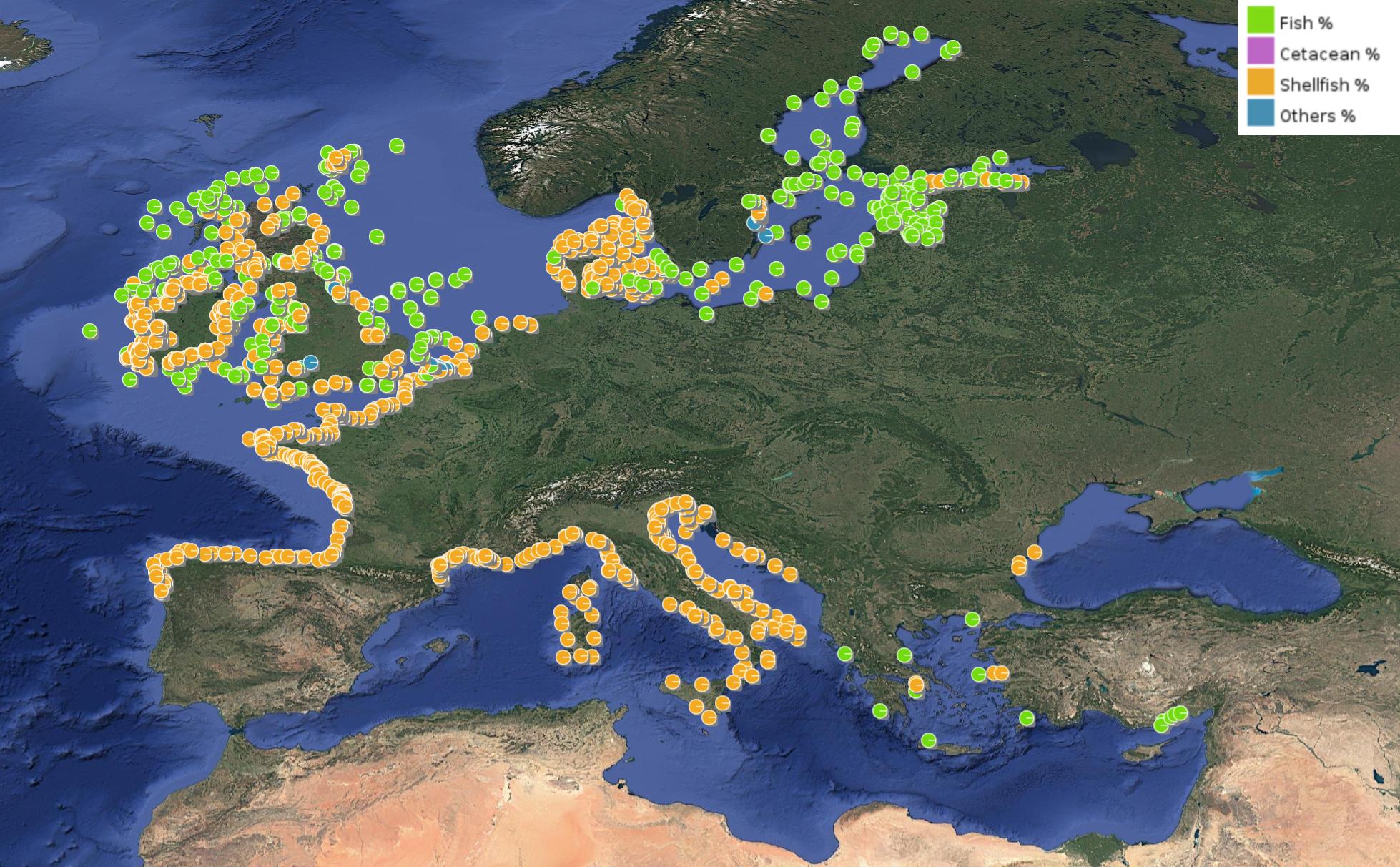
This product displays for Cadmium, positions with percentages of all available data values per group of animals that are present in EMODnet regional contaminants aggregated datasets, v2024. The product displays positions for all available years.
-
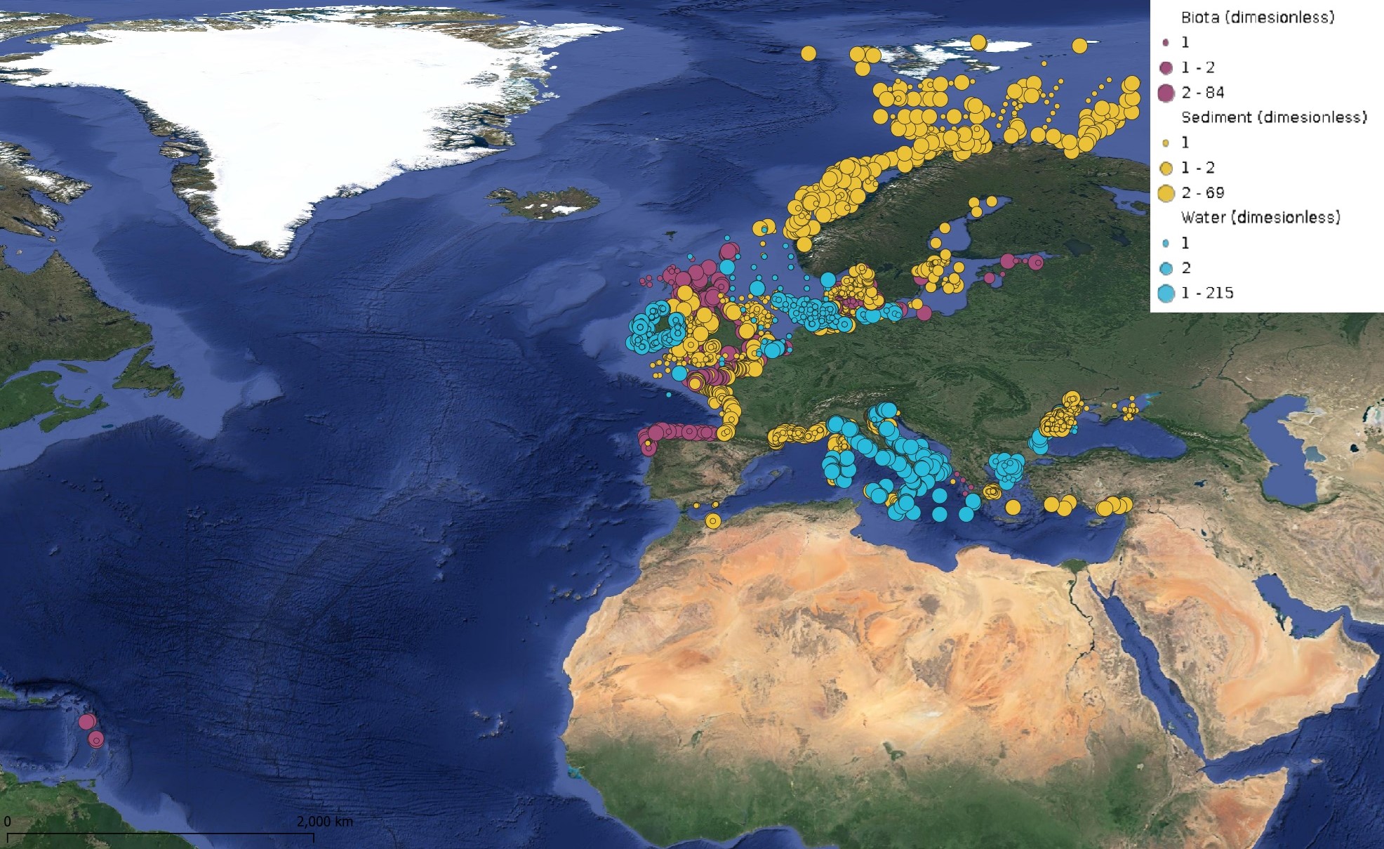
This product displays for Fluoranthene, positions with values counts that have been measured per matrix for each year and are present in EMODnet regional contaminants aggregated datasets, v2024. The product displays positions for every available year.
-
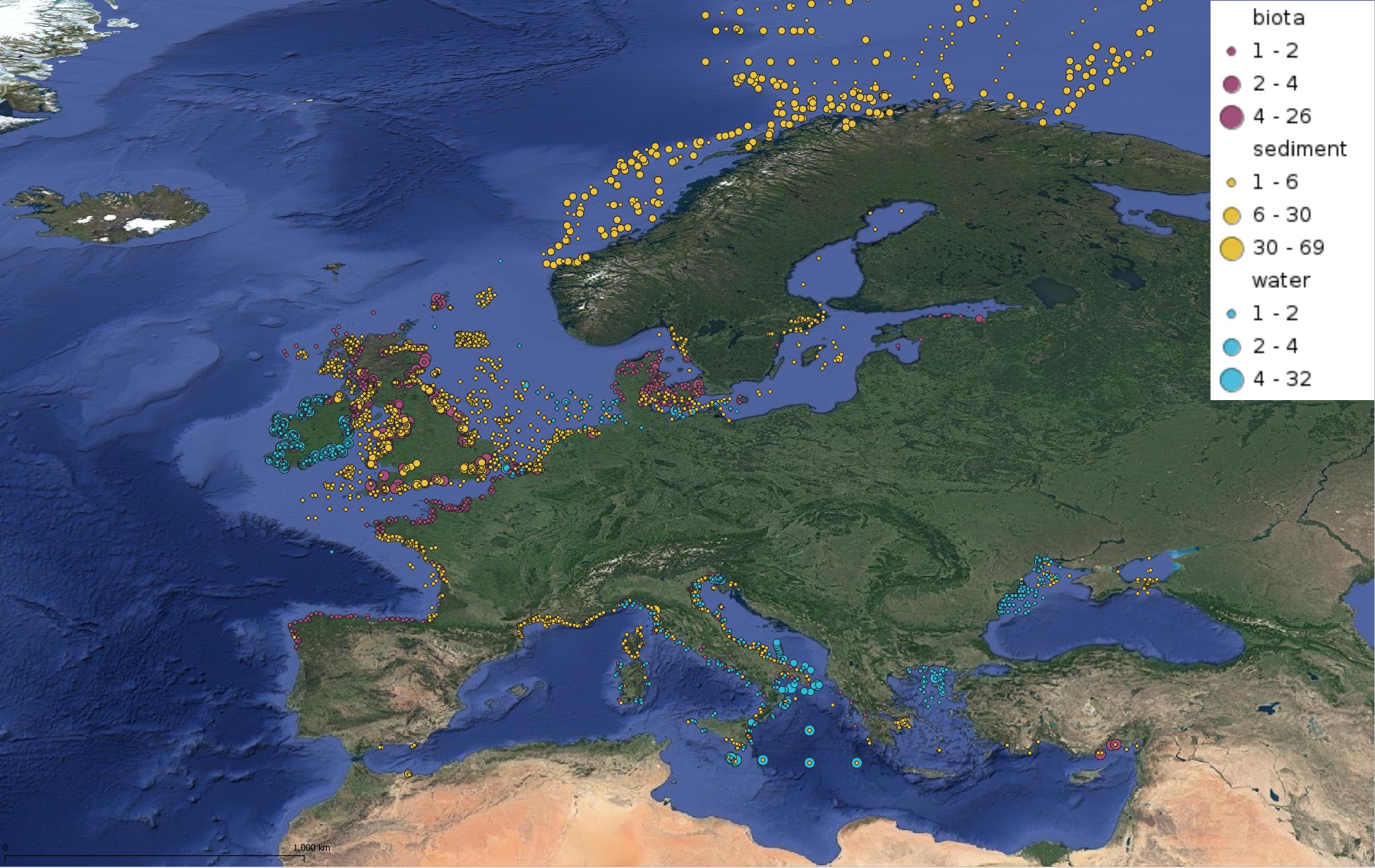
This product displays for Anthracene, positions with values counts that have been measured per matrix and are present in EMODnet regional contaminants aggregated datasets, v2022. The product displays positions for all available years.
-
This product displays for Triphenyltin, positions with values counts that have been measured per matrix and are present in EMODnet regional contaminants aggregated datasets, v2024. The product displays positions for all available years.
-
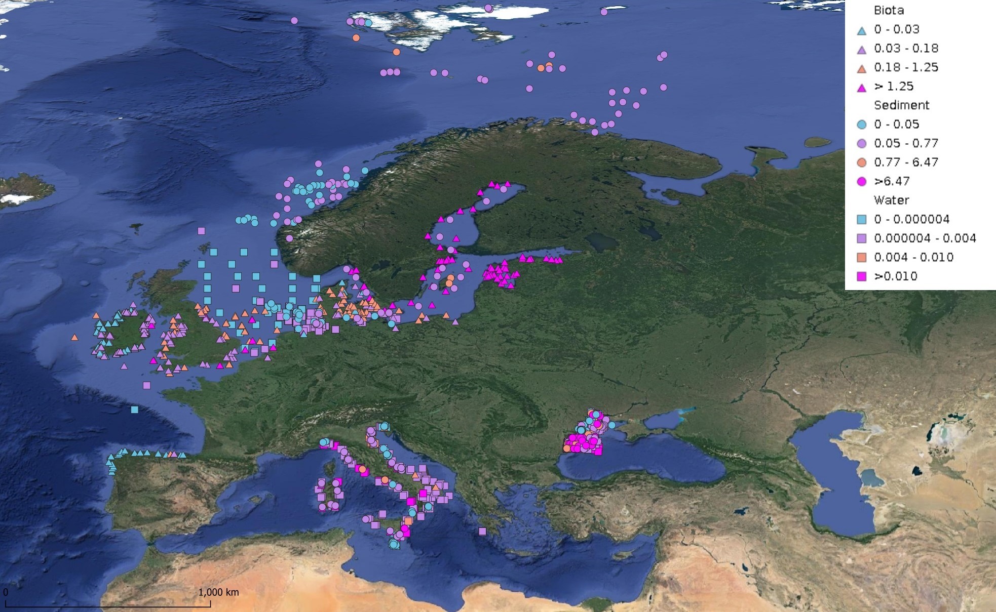
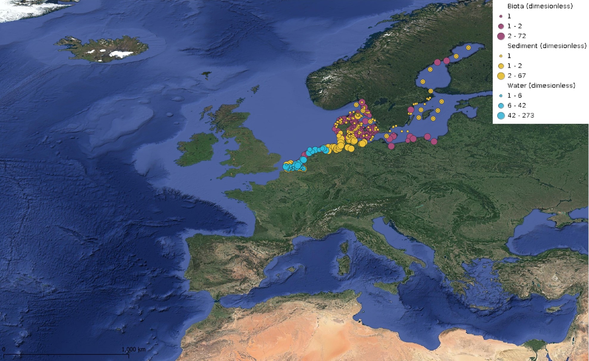
This product displays for Hexachlorobenzene, median values since 2012 that have been measured per matrix and are present in EMODnet regional contaminants aggregated datasets, v2024. The median values ranges are derived from the following percentiles: 0-25%, 25-75%, 75-90%, >90%. Only "good data" are used, namely data with Quality Flag=1, 2, 6, Q (SeaDataNet Quality Flag schema). For water, only surface values are used (0-15 m), for sediment and biota data at all depths are used.
-
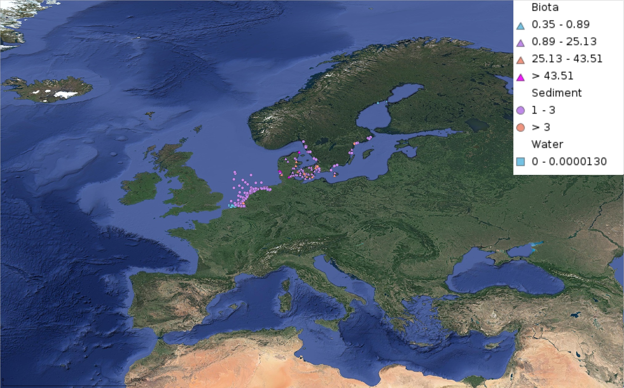
This product displays for Triphenyltin, median values of the last 6 available years that have been measured per matrix and are present in EMODnet regional contaminants aggregated datasets, v2022. The median values ranges are derived from the following percentiles: 0-25%, 25-75%, 75-90%, >90%. Only "good data" are used, namely data with Quality Flag=1, 2, 6, Q (SeaDataNet Quality Flag schema). For water, only surface values are used (0-15 m), for sediment and biota data at all depths are used.
-
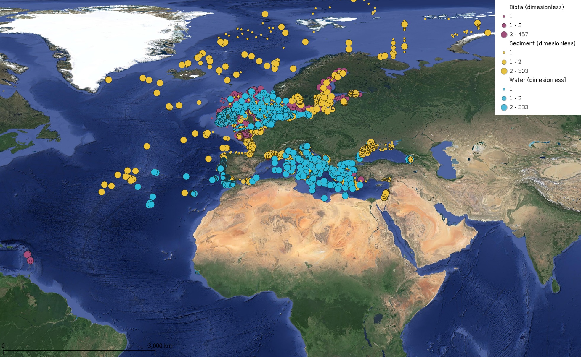
This product displays for Nickel, positions with values counts that have been measured per matrix and are present in EMODnet regional contaminants aggregated datasets, v2024. The product displays positions for all available years.