 Arctic SDI catalogue
Arctic
Type of resources
Categories
Available actions
Topics
Keywords
Contact for the resource
Provided by
Years
Formats
Representation types
Update frequencies
status
Service types
Scale
Resolution
-
Near real time imagery from multiple NASA instruments
-
Tjenesten inneholder topografiske kart i malestokken 1:1M - 1:300
-
Tjenesten inneholder topografiske kart i malestokken 1:1M.
-
This project is part of a joint effort between The Conservation of Arctic Flora and Fauna (CAFF) and the Protection off Arctic Marine Environment (PAME) Working Groups to implement actions related to the Arctic Invasive Alien Species Strategy and Action Plan. PHASE I REPORT
-
This map server from the National Snow and Ice Data Center (NSIDC) provides cryospheric data and information pertinent to the Northern Hemisphere. Map images and source data are provided through Open Geospatial Consortium, Inc. (OGC) protocols (WMS, WFS, and WCS). For other related OGC data sets from NSIDC, see also the Atlas of the Cryosphere at: http://nsidc.org/data/atlas/. If you have questions, comments or suggestions, please contact NSIDC User Services at +1.303.492.6199 or nsidc@nsidc.org.
-
%20density%20along%20a%20latitudinal%20gradient%20of%20sea-ice%20conditions.jpg)
PURPOSE: Ringed seals (Pusa hispida) rely on sea ice as habitat throughout their life history and inhabit a broad latitudinal range with diverse sea-ice conditions. Anthropogenic climate warming is triggering poleward species redistributions, highlighting the importance of understanding how species distributions and abundance vary along latitudinal gradients. Using ringed seals as a model species, the purpose was to estimate density via aerial surveys along a latitudinal gradient in the eastern Canadian Arctic to investigate latitudinal trends in the ringed seals response to regional variation in sea-ice conditions. DESCRIPTION: Ringed seals (Pusa hispida) rely on sea ice as habitat throughout their life history and inhabit a broad latitudinal range with diverse sea-ice conditions, making them a model species to study patterns in density along a spatial-environmental gradient. We estimated the density of ringed seals from systematic aerial surveys along a latitudinal gradient in the eastern Canadian Arctic to investigate latitudinal trends in the ringed seals response to regional variation in sea-ice conditions. Ringed seals exhibited similar densities at lower and intermediate latitudes, while higher latitudes displayed an order of magnitude lower ringed seal density. This shift is concurrent with the transition in ice conditions from predominantly first-year ice at lower latitudes to primarily multiyear ice at higher latitudes. These findings indicate that the variation in icescapes across the ringed seal’s vast range influences their density. The shift in sea-ice conditions may also have consequences for biological productivity that supports their diet. Our results highlight a likely non-uniform response of ringed seals to ongoing sea-ice recession across the Arctic.
-

The Geonetwork Catalog of the Arctic Biodiversity Data Service (ABDS) https://abds.is/ is an integral component of the Conservation of Arctic Flora and Fauna (CAFF) initiative https://www.caff.is/. CAFF is a working group of the Arctic Council dedicated to addressing the conservation challenges facing Arctic biodiversity and promoting sustainable management practices in the region. As part of CAFF's mandate, the ABDS aims to provide a comprehensive and accessible repository of biodiversity-related data and information specific to the Arctic. The Geonetwork Catalog within ABDS serves as a centralized platform for discovering, accessing, and sharing geospatial datasets relevant to Arctic biodiversity conservation and management. It hosts a diverse range of spatial data layers, including species distribution maps, habitat classifications, ecosystem assessments, land cover maps, and more. These datasets are sourced from various contributors, including scientific research projects, monitoring programs, government agencies, indigenous knowledge holders, and non-governmental organizations. Hereafter you can find the WMS, WFS and GeoNetwork connections.
-
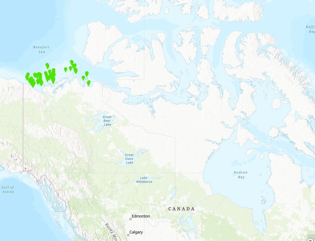
The objective of this project was to gather data to develop a model of the food web of the lower trophic levels of the nearshore area of the Beaufort Sea. Sampling took place from 2005 to 2008 using the CCGS Nahidik. The multidisciplinary character of the Nahidik program produced measurements of biology/ecology (primary production, phytoplankton, zooplankton, benthos, fish), chemical and physical oceanography, contaminants, geology and hydro acoustics. The data were collected in July and August of each year. The Nahidik program provided data to provide a baseline for future studies as well as an information source for environmental assessment.
-

Polygons denoting concentrations of sea pens, small and large gorgonian corals and sponges on the east coast of Canada have been identified through spatial analysis of research vessel survey by-catch data following an approach used by the Northwest Atlantic Fisheries Organization (NAFO) in the Regulatory Area (NRA) on Flemish Cap and southeast Grand Banks. Kernel density analysis was used to identify high concentrations and the area occupied by successive catch weight thresholds was used to identify aggregations. These analyses were performed for each of the five biogeographic zones of eastern Canada. The largest sea pen fields were found in the Laurentian Channel as it cuts through the Gulf of St. Lawrence, while large gorgonian coral forests were found in the Eastern Arctic and on the northern Labrador continental slope. Large ball-shaped Geodia spp. sponges were located along the continental slopes north of the Grand Banks, while on the Scotian Shelf a unique population of the large barrel-shaped sponge Vazella pourtalesi was identified. The latitude and longitude marking the positions of all tows which form these and other dense aggregations are provided along with the positions of all tows which captured black coral, a non-aggregating taxon which is long-lived and vulnerable to fishing pressures. These polygons identify sponge grounds from the broader distribution of sponges in the region as sampled by Cosmos gear in the Eastern Arctic biogeographic zone. A 40 kg minimum threshold for the sponge catch was identified as the weight that separated the sponge ground habitat from the broader distribution of sponges with these research vessel tow data and gear type.
-

This dataset contains the data reported in Wesley R Ogloff, Randi A Anderson, David J Yurkowski, Cassandra D Debets, W Gary Anderson, Steven H Ferguson, Spatiotemporal variation of ringed seal blubber cortisol levels in the Canadian Arctic, Journal of Mammalogy, 2022;, gyac047, https://doi.org/10.1093/jmammal/gyac047 Cite this data as: Wesley R Ogloff, Randi A Anderson, David J Yurkowski, Cassandra D Debets, W Gary Anderson, Steven H Ferguson. 2022 Spatiotemporal variation of ringed seal blubber cortisol levels in the Canadian Arctic. Arctic and Aquatic Research Division, Fisheries and Oceans Canada, Winnipeg, MB. https://open.canada.ca/data/en/dataset/e1c6b350-0159-11ed-8212-1860247f53e3