 Arctic SDI catalogue
5 m
Type of resources
Available actions
Topics
Keywords
Contact for the resource
Provided by
Years
Formats
Resolution
-

The Woody Vegetation Layer is a new product that aims at providing information about presence or absence of woody vegetation of any type across Europe without any differentiation of height, size or nature and without masking forested areas. It includes isolated trees or permanent crops such as orchards. This helps users understand the distribution of these features across different regions and provide an “all tree layer” that users can use to derive their own application. The production of the HRL Small Landscape Features is coordinated by EEA in the frame of Copernicus, the Earth observation component of the European Union’s Space programme. The product is a raster dataset with 5-meter grid spacing (spatial resolution), distributed as 100 x 100 km tiles that are fully conformant with the EEA reference grid.
-
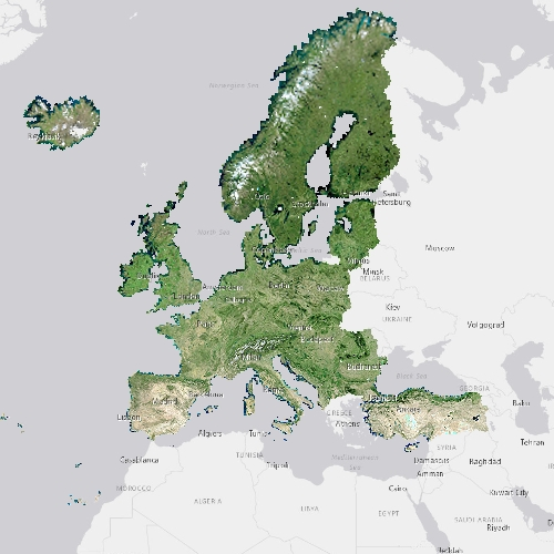
The pan-European High Resolution (HR) Image Mosaic 2012 provides HR1 (High Resolution: 5 meter) coverage over Europe. The surface covered by the image dataset is 5.8 million square kilometres and has a spatial resolution of 5 meters. The imagery is composed during specific acquisition windows in 2011, 2012 and 2013. Coverage 2 acquisitions are expected to be 6 weeks away from Coverage 1, down to a minimum of 2 weeks for northern countries, including United Kingdom. The ± 6 weeks criteria might not be strictly applied over Atlantic Islands and French DOMs (seasonal changes are limited in the equatorial DOMs). Images are derived from the following satellite sensors: RapidEye constellation The mosaic primarily is used as input data in the production of various Copernicus Land Monitoring Service (CLMS) datasets and services, such as land cover maps and high resolution layers on land cover characteristic and can be also useful for CLMS users for visualizations and classifications on land. The input imagery for the creation of the mosaic is provided by ESA. Due to license restrictions, HR Image Mosaic 2012 is only available as a web service (WMS), and not for data download.
-

High Resolution land cover characteristics for the 2018 reference year. Small woody landscape features are important vectors of biodiversity and provide information on fragmentation of habitats with a direct potential for restoration while also providing a link to hazard protection and green infrastructure, amongst others. VHR_IMAGE_2018 made available in the ESA Copernicus DWH will be the main data source for the detection of small woody features identifiable within the given image resolution. The Small Woody Features (SWFs) layer contains woody linear and patchy elements but will not be further differentiated into trees, hedges, bushes and scrub. The spatial pattern shall be limited to linear structures and isolated patches on the basis of geometric characteristics.
-

Vegagerðin heldur skrá í stafrænum kortagrunni um vegi í náttúru Íslands, öðrum en þjóðvegum, þar sem umferð vélknúinna ökutækja er heimil, sbr. 2. mgr. 7. gr. vegalaga, nr. 80/2007. Skipulagsstofnun sér til þess að Vegagerðinni berist upplýsingar um vegi í viðkomandi sveitarfélagi til skráningar og birtingar. Nánari upplýsingar um vegi náttúru Íslands má finna í lögum nr. 60/2013 um náttúruvernd (https://www.althingi.is/lagas/nuna/2013060.html), í reglugerð nr. 260/2018 um vegi í náttúru Íslands (https://island.is/reglugerdir/nr/0260-2018) og í leiðbeiningum Skipulagsstofnunar „Vegir í náttúru Ísland - um gerð vegaskráar og högun og skil á gögnun“ https://assets.ctfassets.net/8k0h54kbe6bj/4zBeAilu5B0h5m6DAP00Z8/ac6908c0160ddb64a2e689c042e9d011/Vegir-i-natturu-Islands.pdf
-

Vegagerðin rekur umferðarteljara víða um land sem telja ökutæki samfellt alla daga ársins og upplýsingar frá meira en helmingi þeirra berast sjálfvirkt til Vegagerðarinnar og eru þær upplýsingar aðgengilegar í þessari þjónustu. Umferðargreinar mæla fjölda ökutækja en auk þess mæla þeir t.d. hraða ökutækja. Aðrir umferðarteljarar skrá eingöngu fjölda ökutækja. Slíkir teljarar eru tengdir flestum veðurstöðvum auk nokkurra sem standa sér. Upplýsingar úr umferðargreinum og umferðarteljurum sem eru tengdir veðurstöðvum eru sóttar að jafnaði nokkrum sinnum á klukkustund, en upplýsingar frá teljurum sem ekki eru tengdir veðurstöðvum, berast Vegagerðinni sjaldnar.
-

Small Woody Features are important vectors of biodiversity and provide information on fragmentation of habitats with a direct potential for restoration while also providing a link to hazard protection and green infrastructure, amongst others. Optical VHR coverage over Europe 2021 was made available in the ESA Copernicus DWH and, together with Sentinel 2 was the main data source for the detection of small woody features identifiable within the given image resolution. The production of the HRL Small Woody Features is coordinated by EEA in the frame of Copernicus, the Earth observation component of the European Union’s Space programme. The product is a raster dataset with 5-meter grid spacing (spatial resolution), distributed as 100 x 100 km tiles that are fully conformant with the EEA reference grid.
-
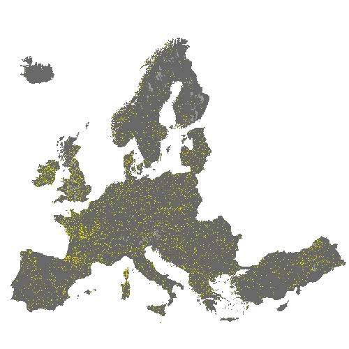
The HRL Small Woody Features (SWF) is a new Copernicus Land Monitoring Service (CMLS) product, which provides harmonized information on linear structures such as hedgerows, as well as patches (200 m² ≤ area ≤ 5000 m²) of woody features across the EEA39 countries. Small woody landscape features are important vectors of biodiversity and provide information on fragmentation of habitats with a direct potential for restoration while also providing a link to hazard protection and green infrastructure, amongst others. The SWF layer contains woody linear, and small patchy elements, but is not differentiated into trees, hedges, bushes and scrub. The spatial pattern are limited to linear structures and isolated patches (patchy structures) on the basis of geometric characteristics. Additional Woody Features (AWF) are also included in this product. They consist of woody structures that do not fulfil the SWF geometric specifications but which are connected to valid SWFs structures. VHR imagery (DEIMOS-2, Pleiades 1A, Pleiades 1B, GeoEye-1, SPOT 6, SPOT 7, WorldView-2, WorldView-3 images from 2015) made available in the ESA Copernicus DWH are the main data source for the detection of small woody features identifiable within the given image resolution. The dataset is available for the 2015 reference year and is produced in three different formats. This metadata corresponds to the SWF 5m spatial resolution raster layer, which distinguishes between SWF (code =1) and AWF (code =3) ). This layer is derived from the SWF vector product in order to be more in line with other HR layers, and for allowing raster processing of the results. It describes the SWF landscape according to the high resolution of the input data, but without taking into account the possible small geometric inaccuracy of the vector product (due to VHR geometric imprecision, automatic processing such as smoothing, etc.). The geometric resolution is consistent with the EEA reference grid.