 Arctic SDI catalogue
400000
Type of resources
Available actions
Topics
Keywords
Contact for the resource
Provided by
Formats
Representation types
Update frequencies
status
Scale
-
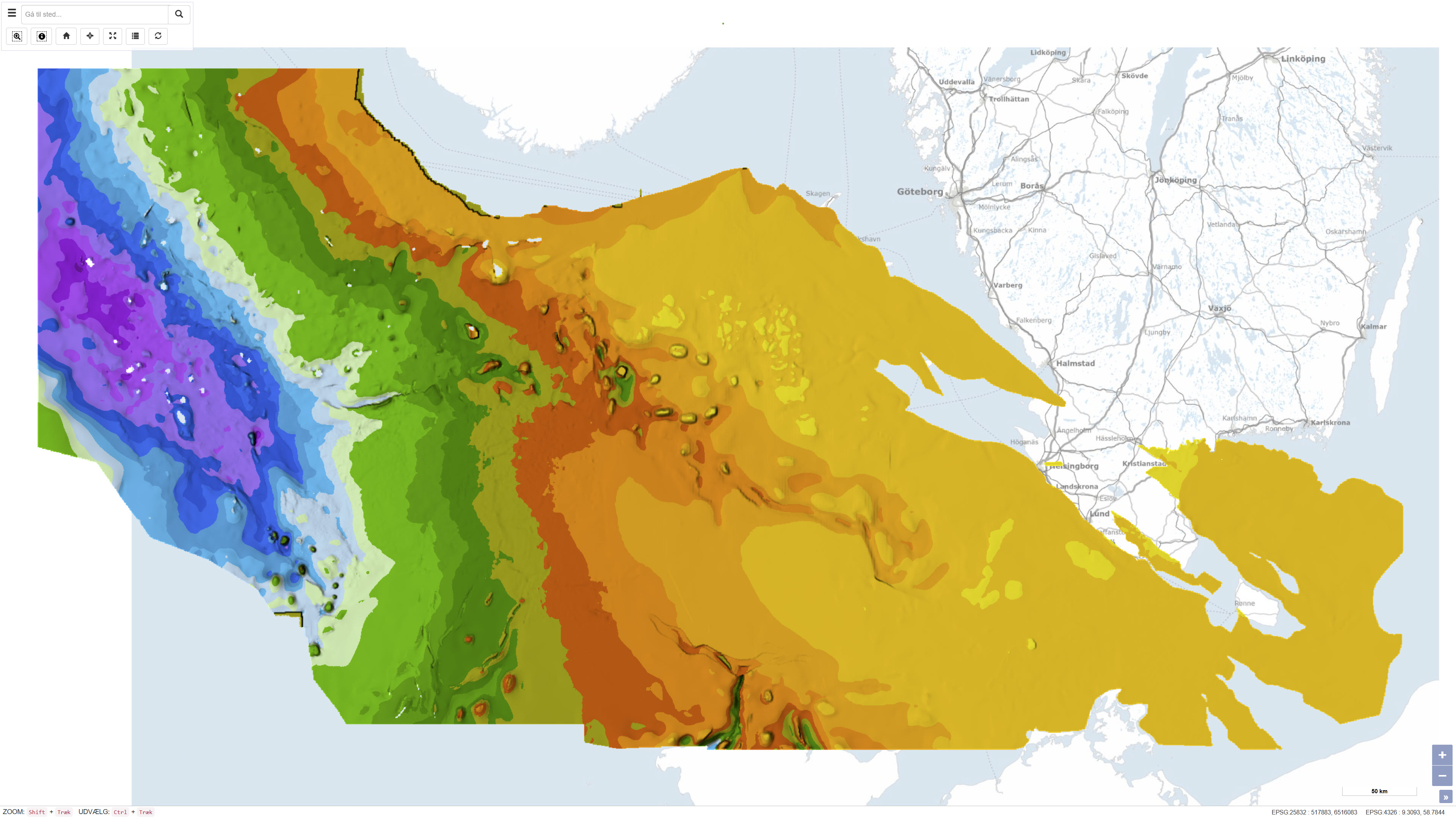
This dataset represents the structure and topography of the Top Chalk surface, i.e. the top of the Chalk Group (including Upper Cretaceous to Danian), in the Danish subsurface. The map illustrates regional variations in the depth and structural configuration of the chalk surface from the central North Sea to the eastern Danish areas. It is based on an integrated geological and geophysical interpretation of seismic profiles, well data and earlier mapping. The map provides an essential basis for geological, geophysical and subsurface reservoir analyses.
-
The dataset comprises a combined geological map of the Danish Basin showing the distribution, depth conditions, and thickness variations of the Top Triassic and Jurassic–Lower Cretaceous units. The maps illustrate the regional structure and stratigraphic framework of the basin and provide an overview of its geological development from the Late Triassic to the Early Cretaceous. The presentation is based on a synthesis of borehole data, seismic information, and stratigraphic interpretations and is produced at a scale of 1:400.000. The maps were published in 1991 as part of the DGU Map Series No. 30.
-
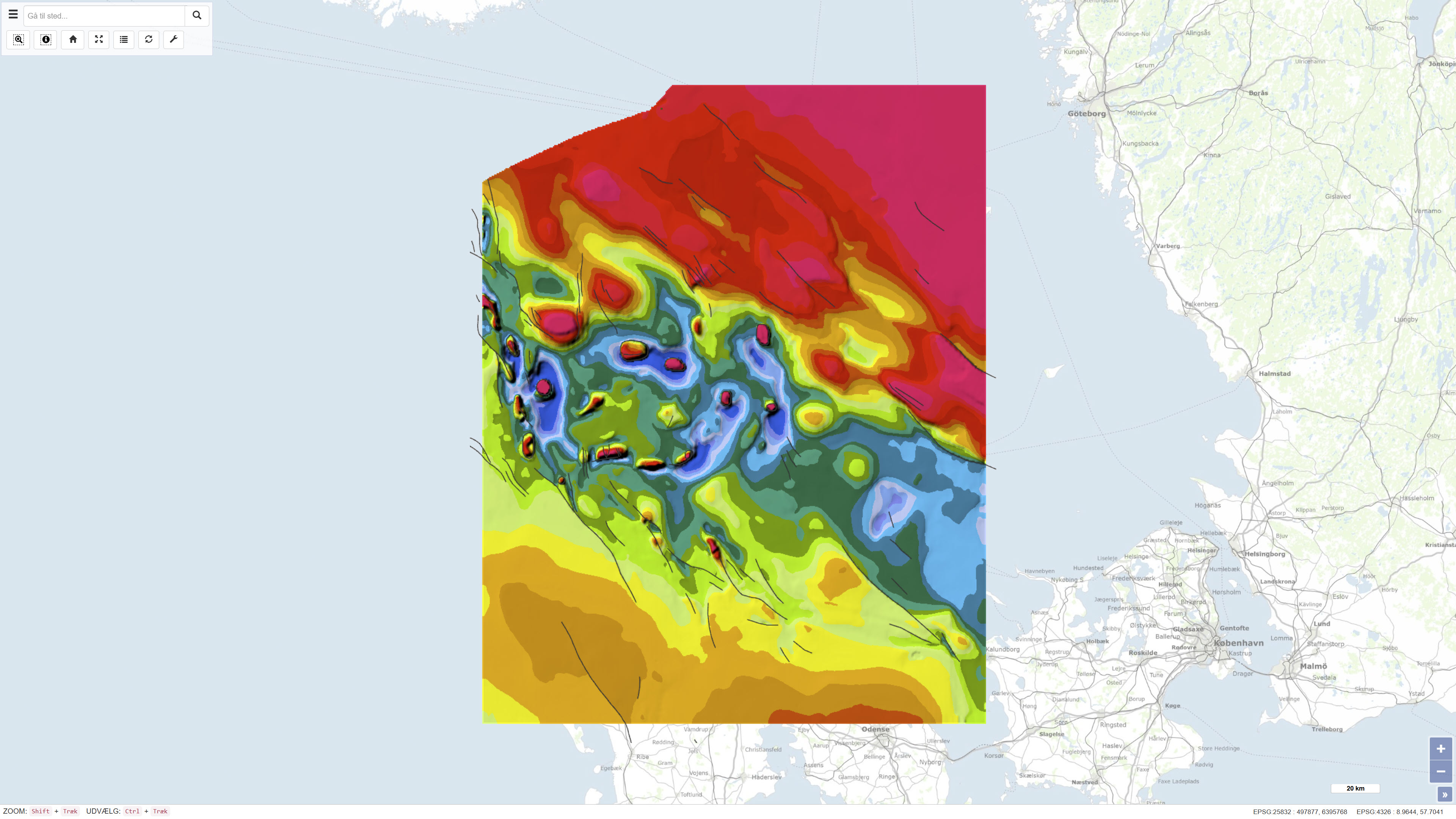
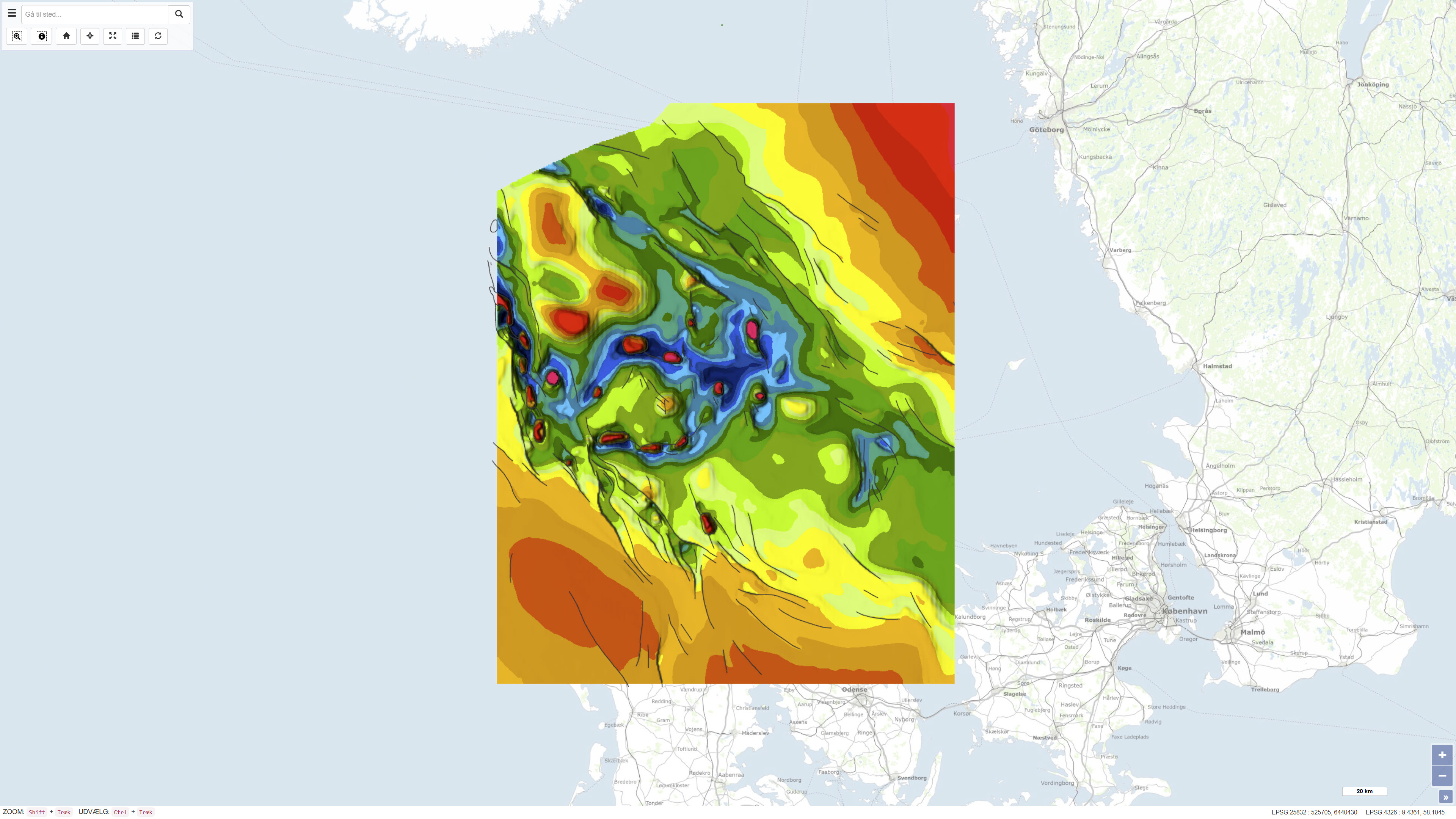
The dataset comprises a geological map of the Danish Basin at a scale of 1:400,000 presenting regional thematic maps of the Base Chalk and the Chalk Group. The map was published in 1993 as part of the DGU Map Series no. 29 and was produced as part of regional geological mapping of the basin. The mapping is based on interpretation of seismic data supplemented by information from deep onshore and offshore boreholes. The dataset consists of several thematic sub-maps that together show the depth to the Base Chalk and the vertical thickness (isochore) of the Chalk Group. The map covers the Danish Basin and adjacent areas and was produced to support regional structural and stratigraphic interpretation.