 Arctic SDI catalogue
Format
Rest
Type of resources
Available actions
Topics
Keywords
Contact for the resource
Provided by
Formats
Representation types
Update frequencies
status
Scale
From
1
-
1
/
1
-
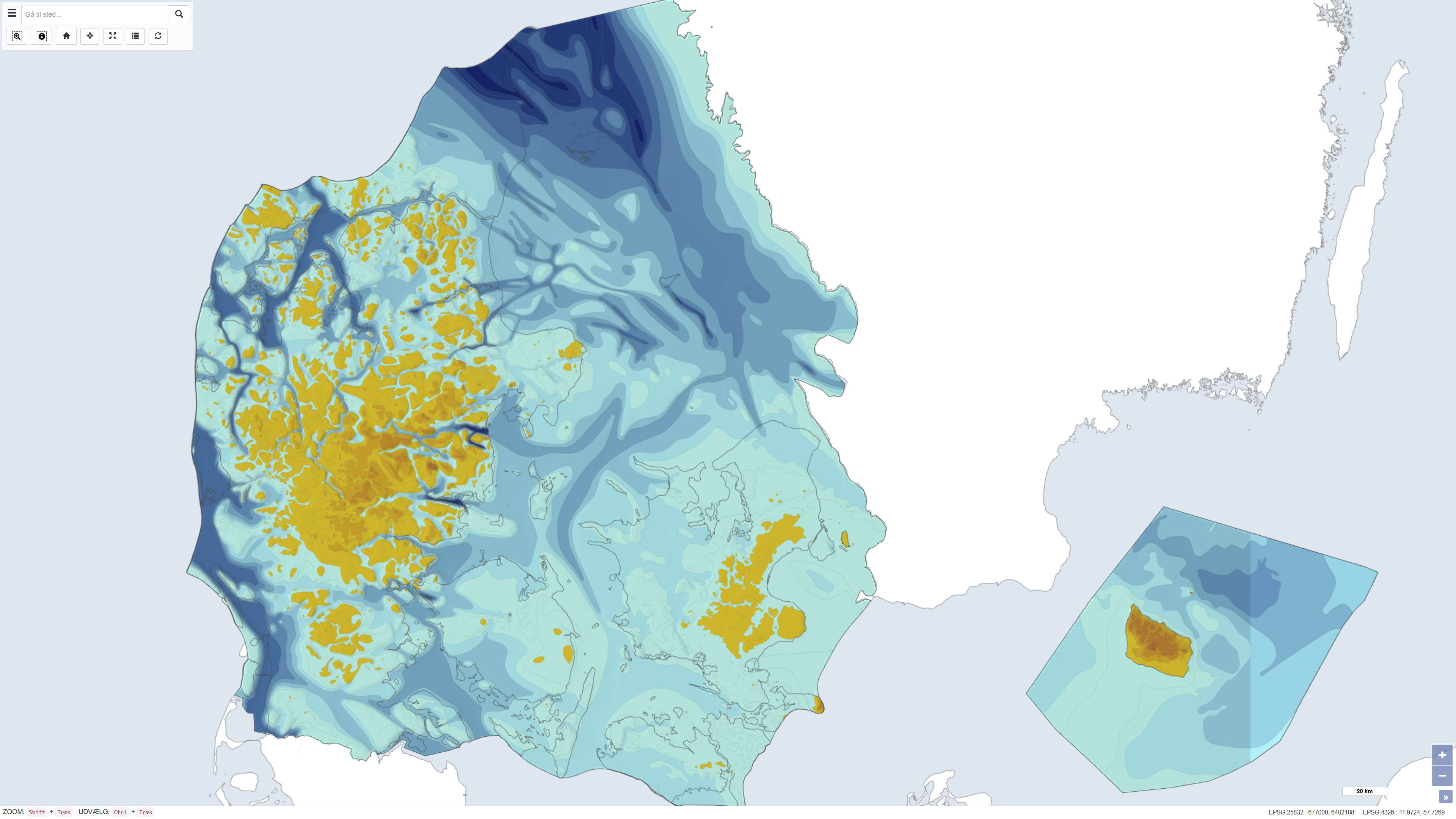
This dataset represents the pre-Quaternary surface topography of Denmark, including Kattegat, internal waters and the sea around Bornholm. The map provides a paleotopographic relief of the surface that existed prior to deposition of Quaternary sediments, compiled from geological borehole data, seismic surveys and topographic sources. It includes polygons with 25 m contour intervals, a 500 m grid and boundary delineations, usable in combination with a standard elevation model to determine Quaternary cover thickness. The base map was hand-drawn at 1:250,000 scale and forms a nationwide thematic map product. The map is described in DGU map series no. 44, 1994.