 Arctic SDI catalogue
Earthquakes
Type of resources
Available actions
Topics
Keywords
Contact for the resource
Provided by
Years
Formats
Representation types
Update frequencies
status
Service types
-

This is a magnitude 5.0 earthquake scenario under Lake Ontario, very close to Toronto. This fault is not known to be active but demonstrates a plausible earthquake scenario for Toronto region.
-
The National Earthquake Scenario Catalogue, presents the probable shaking, damage, loss and consequences from hypothetical earthquakes that could impact Canadians. It considers only damage to buildings, and their inhabitants, from earthquake shaking, and therefore does not include damage to critical infrastructure or vehicles. Losses from secondary hazards, such as aftershocks, liquefaction, landslides, or fire following are also not currently included. The information is provided at the approximate scale of Census dissemination areas, and is intended to support planning and emergency management activities in earthquake prone regions. This project is run by the Geological Survey of Canada's Public Safety Geoscience Program.
-

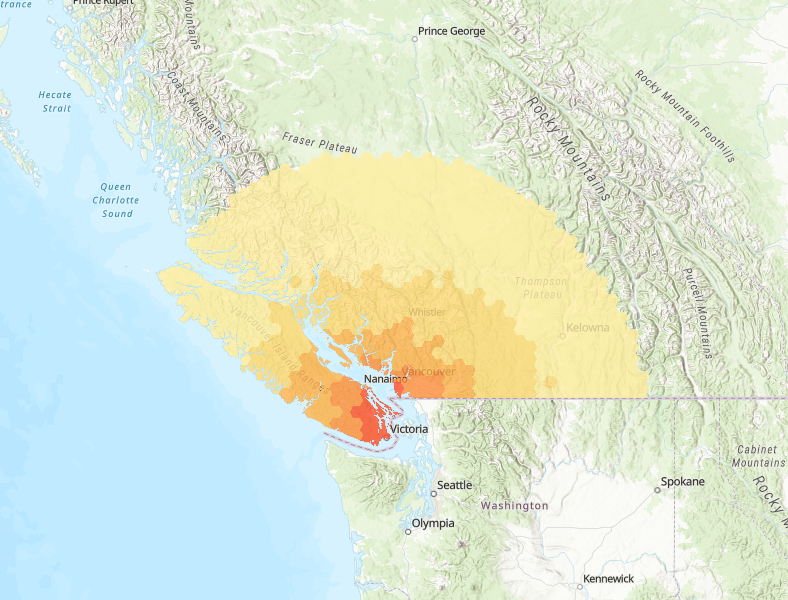
In 1997, a magnitude 4.6 earthquake occurred 3 to 4 km beneath the Strait of Georgia. This scenario visualizes the effects of that event if it had a magnitude of 7.0, and represents a strong ground shaking event that could strike Metro Vancouver.
-
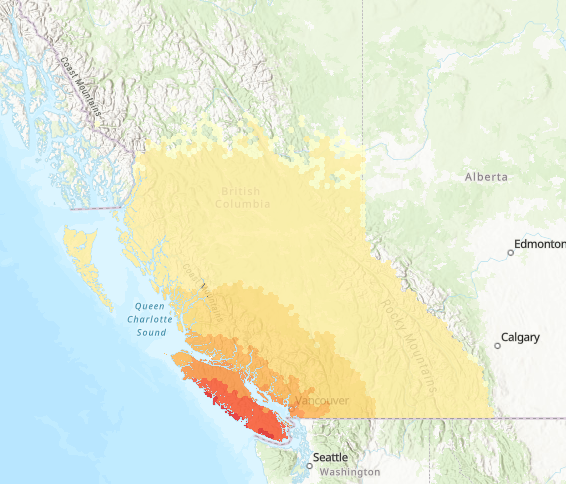
Full rupture of the Cascadia interface fault, the fault defining the boundary between the North American and Pacific Ocean plates. This magnitude 9.0 event, often referred to as ‘The Big One’, affects most communities in southwestern British Columbia.
-

A magnitude 5 earthquake scenario along an unnamed fault located about 15 km north-northeast of Burnaby City Hall and directly south of Mt Elsay. This fault is not known to be active, but this scenario represents a small but damaging event in the North Shore Mountains.
-

Magnitude 5.2 earthquake scenario along the Vedder Fault which runs northeast along Vedder Mountain. This earthquake is located about 18 km east of Abbotsford City Hall. This fault is not known to be active, but this scenario represents a small but damaging event near Abbotsford town centre.
-

The Denali Fault spans over 200km of the Yukon Territory, and is a significant source of seismic hazard. This magnitude 7.4 earthquake scenario, centered near small communities along the Alaska Highway, visualizes the effects of a severe earthquake that could be produced by this fault.
-
In 2015, a magnitude 4.7 earthquake occurred 60 km beneath Sidney, BC. This scenario visualizes the effects of that event if it had a magnitude of 7.1.
-

Magnitude 4.9 earthquake scenario along the Vedder Fault which runs northeast along Vedder Mountain. This earthquake is located about 18 km east of Abbotsford City Hall. This fault is not known to be active, but this scenario represents a small but damaging event near Abbotsford town centre.
-

Ottawa planning scenario using the 2010 Val-de-bois, QC earthquake hypocentre and fault plane geometry from Ma & Motazedian, 2012 and Atkinson & Assatourians, 2010. This scenario uses a larger magnitude event than those that have been observed to date for that location, within bounds of the national seismic hazard model. Maximum magnitude of 7.95 is obtained from CanSHM6 for GATINEAU region.