 Arctic SDI catalogue
Ecosystem monitoring
Type of resources
Topics
Keywords
Contact for the resource
Provided by
Formats
Representation types
Update frequencies
status
-
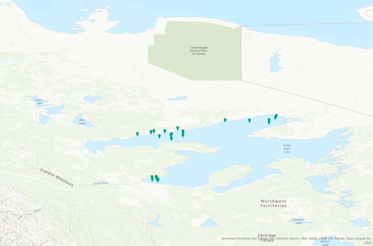
PURPOSE: This study is part of a two-decade series of research aimed to provide a comprehensive synthesis of the effects of harvest and environmental change on fisheries in Great Bear Lake. The main objectives are to assess demographic traits and the current status of harvested species, with a focus on evaluating sustainable harvest levels of lake trout, a cold-adapted species with a relatively narrow thermal niche. As part of this research, trends in water quality and primary productivity are monitored to evaluate potential effects of change on fisheries. DESCRIPTION: Great Bear Lake, one of the largest lakes in North America, contains culturally and recreationally important fish species. Great Bear Lake is located in the sub-Arctic and Arctic Circle. As part of a two-decade series of research aimed to provide a comprehensive synthesis of the effects of harvest and environmental change on fisheries in Great Bear Lake, the main objectives of this study are to assess demographic traits and the current status of harvested species, with a focus on evaluating sustainable harvest levels of lake trout, a cold-adapted species with a relatively narrow thermal niche. As part of this research, trends in water quality and primary productivity are monitored to evaluate potential effects of change on fisheries. From 2021 to 2024, surface water temperature data was collected at depths of 0.1 to 1.0 meters using an RBR Maestro3 through partnered community-led and community/Fisheries and Oceans Canada/university partner collaborative sampling. The project has strong community involvement, including youth through the Guardian Program, to facilitate capacity building and community leadership in the long-term monitoring of Great Bear Lake fisheries and the aquatic ecosystem. This data is an extension of baseline data sets on water quality on the lake. These data will contribute to a better understanding cumulative impacts of climate change on the functioning of large northern lake ecosystems and provide a benchmark for monitoring further change. This data will be important for developing effective strategies for maintaining community-led aquatic monitoring and managing natural resources, particularly fish, which are expected to be increasingly important to communities with declines in other country foods such as caribou. We acknowledge the data were collected in the Sahtú Settlement Area and are made publicly available with the agreement of the Délı̨nę Renewable Resources Council (Délı̨nę Ɂehdzo Got’ı̨nę (Renewable Resources Council)). Collaborators include: the Community of Délı̨nę partners (data collection), Délı̨nę Renewable Resource Council, Sahtú Renewable Resource Board, and University of Manitoba. Community of Délı̨nę partners and field workers that participated in data collection include Chris Yukon, Archie Vital, Ted Mackienzo, Daniel Baton, Lloyd Baton, Simon Neyelle, and Stanley Ferdanan. Funding and logistical support was provided by: Northwest Territories Cumulative Impact Monitoring, Sahtú Renewable Resource Board, the Polar Continental Shelf Program and Fisheries and Oceans Canada.
-
PURPOSE: As a part of a two-decade series of research, this study aims to provide a comprehensive synthesis of the effects of harvest and environmental change on fisheries in Great Bear Lake. The main objectives are to assess demographic traits and the current status of harvested species, with a focus on evaluating sustainable harvest levels of lake trout, a cold-adapted species with a relatively narrow thermal niche. As part of this research, trends in water quality and primary productivity are monitored to evaluate potential effects of change on fisheries. DESCRIPTION: Great Bear Lake, one of the largest lakes in North America, contains culturally and recreationally important fish species. Great Bear Lake is located in the sub-Arctic and Arctic Circle. As part of a two-decade series of research aimed to provide a comprehensive synthesis of the effects of harvest and environmental change on fisheries in Great Bear Lake, the main objectives of this study are to assess demographic traits and the current status of harvested species, with a focus on evaluating sustainable harvest levels of lake trout, a cold-adapted species with a relatively narrow thermal niche. As part of this research, trends in water quality and primary productivity are monitored to evaluate potential effects of change on fisheries. From 2012 to 2019, surface water temperature data was collected at depths of 0.1 to 1.0 meters using a Hydrolab Series 5 Data Sonde Multiparameter instrument through partnered community-led and community/Fisheries and Oceans Canada/university partners collaborative sampling. The project has strong community involvement, including youth through the Guardian Program, to facilitate capacity building and community leadership in the long-term monitoring of Great Bear Lake fisheries and the aquatic ecosystem. This data is an extension of baseline data sets on water quality on the lake. These data will contribute to a better understanding cumulative impacts of climate change on the functioning of large northern lake ecosystems and provide a benchmark for monitoring further change. This data will be important for developing effective strategies for maintaining community-led aquatic monitoring and managing natural resources, particularly fish, which are expected to be increasingly important to communities with declines in other country foods such as caribou. We acknowledge the data were collected in the Sahtú Settlement Area and are made publicly available with the agreement of the Délı̨nę Renewable Resources Council (Délı̨nę Ɂehdzo Got’ı̨nę (Renewable Resources Council)). Collaborators include: the Community of Délı̨nę partners (data collection), Délı̨nę Renewable Resource Council, University of Manitoba, University of Queens, University of British Columbia, University of Alberta, Environment and Climate Change Canada, and Great Lakes Fisheries Commission, Sahtú Renewable Resource Board. Community of Délı̨nę partners and field workers that participated in data collection include Daniel Baton, Morris Betsidea, Joey Dillion, Jade English, Stanley Ferdanan, Bruce Kenny, Elaine Kenny, Darren Kenny, Greg Kenny, Joseph Kenny, Rocky Kenny, Ted Mackienzo, George Menacho, Bobby Modeste, Gina Nyelle, Brent Taniton, Allison Tatti, Gerald Tutcho, Archie Vital, Barbara Yukon, Caroline Yukon, Chris Yukon, and Cyre Yukon. Funding and logistical support was provided by: Northwest Territories Cumulative Impact Monitoring, Natural Sciences and Engineering Research Council of Canada, Environment and Climate Change Canada, Sahtú Renewable Resource Board, the Polar Continental Shelf Program, and Fisheries and Oceans Canada.
-

The RADARSAT Constellation is the evolution of the RADARSAT Program with the objective of ensuring data continuity, improved operational use of Synthetic Aperture Radar (SAR) and improved system reliability. The three-satellite configuration provides daily revisits of Canada's vast territory and maritime approaches, as well as daily access to 90% of the world's surface. RCM is tasked solely by the Government of Canada, to acquire data, first and foremost in support of Government of Canada services and needs. RCM data and services contributes to ensuring the safety and security of Canadians; monitoring and protecting the environment; monitoring of climate change; managing Canada’s natural resources; and stimulating innovation, research and economic development. In addition to these core user areas, there are expected to be a wide range of ad hoc uses of RADARSAT Constellation data in many different applications within the public and private sectors, both in Canada and internationally. The current data set reflects the acquisition plans that are designed to meet the RCM SAR imaging demands of the Government of Canada. These are being made available publicly in advance of the acquisitions. To meet the data needs of the Government of Canada, acquisitions may be changed without notice. After their acquisition and processing, the RCM image products listed in the current data set, will be delivered to the Earth Observation Data Management System - EODMS (https://www.eodms-sgdot.nrcan-rncan.gc.ca/index-en.html) portal of Natural Resources Canada. Users can register to the EODMS portal as public users to retrieve the RCM image products. For those requiring a greater access to RCM imagery consisting of product types or spatial resolutions not available to public users: you may apply to upgrade your public account to an ‘RCM external vetted entity’ EODMS user type account. For more information on this process, please contact the Canadian Space Agency using the information available at the following link : https://www.asc-csa.gc.ca/eng/satellites/radarsat/access-to-data/how-to-become-a-user.asp Publication frequency : I. Future acquisition plans are published every two weeks for a two-week window that starts two weeks from the publication date. As an example, acquisition plan published on April 1st covers acquisitions from April 14 to 27. The next plan is published on April 14th and covers from April 28 to May 11. II. Past acquisitions plans are published monthly and covers a period of one month from the first to the last day As an example, acquisition plan published on April 1st covers acquisition made between the March 1 and March 31. The next plan covers the month of April.