Reptiles
Type of resources
Available actions
Topics
Keywords
Contact for the resource
Provided by
Years
Formats
Representation types
Update frequencies
status
Service types
-

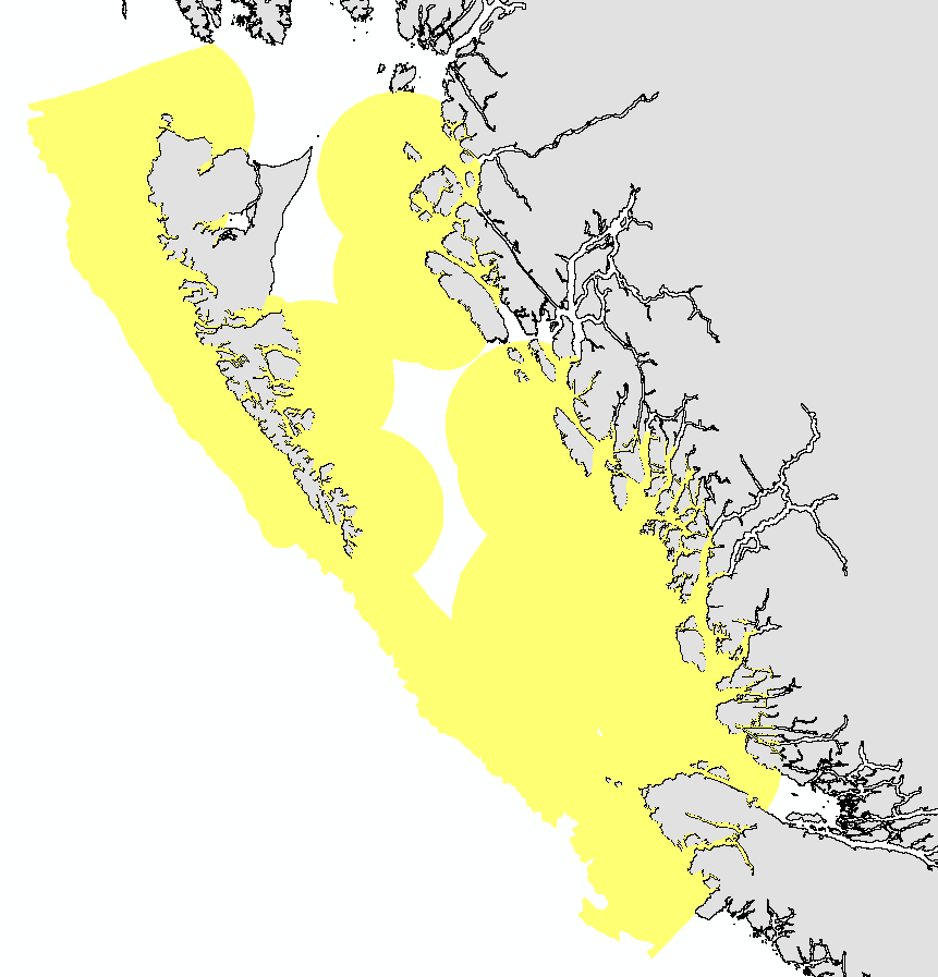
This layer details Important Areas (IAs) relevant to key vertebrate species other than fish and cetaceans in the Pacific North Coast Integrated Management Area (PNCIMA). This data was mapped to inform the selection of marine Ecologically and Biologically Significant Areas (EBSA). Experts have indicated that these areas are relevant based upon their high ranking in one or more of three criteria (Uniqueness, Aggregation, and Fitness Consequences). The distribution of IAs within ecoregions is used in the designation of EBSAs. Canada’s Oceans Act provides the legislative framework for an integrated ecosystem approach to management in Canadian oceans, particularly in areas considered ecologically or biologically significant. DFO has developed general guidance for the identification of ecologically or biologically significant areas. The criteria for defining such areas include uniqueness, aggregation, fitness consequences, resilience, and naturalness. This science advisory process identifies proposed EBSAs in Canadian Pacific marine waters, specifically in the Strait of Georgia (SOG), along the west coast of Vancouver Island (WCVI, southern shelf ecoregion), and in the Pacific North Coast Integrated Management Area (PNCIMA, northern shelf ecoregion). Initial assessment of IAs in PNCIMA was carried out in September 2004 to March 2005 with spatial data collection coordinated by Cathryn Clarke. Subsequent efforts in WCVI and SOG were conducted in 2009, and may have used different scientific advisors, temporal extents, data, and assessment methods. WCVI and SOG IA assessment in some cases revisits data collected for PNCIMA, but should be treated as a separate effort. Other datasets in this series detail IAs for birds, cetaceans, coral and sponges, fish, geographic features, and invertebrates. Though data collection is considered complete, the emergence of significant new data may merit revisiting of IAs on a case by case basis.
-

The data in this dataset represent an amalgamation of sea turtle sighting, stranding, and entrapment events, mainly near Newfoundland and Labrador (NL), Canada. This document summarises the detection events data for Leatherback (Dermochelys coriacea), Loggerhead (Caretta caretta), and Green (Chelonia mydas) Turtles that has been collected from opportunistic and systematic survey sources, plus stranding and entrapment records, in the waters of NL from 1946 to 2023. To a much lesser extent there are also detection records for the southern Gulf of St. Lawrence. Scotian Shelf, and northeastern U.S. waters. These detection records are mostly derived from opportunistic reports, so there are rarely data for a report that includes measures of the observer effort expended to make the detection, and rarely associated imagery. During DFO aerial surveys there are measures of effort in most cases, enabling the turtle sightings reports to be used in habitat modelling (e.g., Mosnier et al. 2018). Most of the information variables (such as “Date”, “Latitude”, “Longitude”, “Number of Animals”) have been obtained from the detection report. In some cases data for variables such as “Location Reliability”, “ID Reliability”, “Platform”, and “Strand or Entrapment Outcome” were derived from interpretation of the comments associated with the report, if available. For description of the variables in the dataset see the Data Dictionary. References: Mosnier, A., Gosselin, J.-F., Lawson, J., Plourde, S., and Lesage, V. 2018. Predicting seasonal occurrence of leatherback turtles (Dermochelys coriacea) in eastern Canadian waters from turtle and sunfish (Mola mola) sighting data and habitat characteristics. Can. J. Zool. 97: 464-478. https://doi.org/10.1139/cjz-2018-0167
-
These datasets represent various marine species whose locations have been identified either via automated satellite tracking of tagged organisms or through direct human observation: surveys (shipborne or aerial), photography, and/or genetic sampling. This can be useful for assessing abundance, population structure, habitat use, and behavior. Each species layer represents a collection of known point locations. Each collection is aggregated from multiple data sources and/or survey periods. Each location contains attributes for further information about the time of the observation and who collected it. These collections are assembled and disseminated at the Pacific Islands Ocean Observing System (PacIOOS). As additional data sources are obtained, these collections may continue to grow over time.
 Arctic SDI catalogue