 Arctic SDI catalogue
Topografi
Type of resources
Available actions
Keywords
Contact for the resource
Provided by
Years
Representation types
Update frequencies
status
Service types
Scale
-
Geocache Landskap er en cachet karttjeneste som benytter en livaktig kartografi for å kommunisere informasjon om natur og landskap (topografi) på en lettoppfattelig, informativ og morsom måte. Tjenesten dekker fastlands-Norge og inneholder bl.a informasjon om høydeforhold, vann, arealdekke, veinett, bebyggelse og stedsnavn Build: 19405
-
%20-%20datas%C3%A6t.jpg)
The dataset represents a hillshade derived from the Danish Digital Terrain Model 2007 (DHM/Terrain 2007). The hillshade is produced as a cartographic overlay layer designed to enhance terrain forms and topographic structures in the Danish landscape. The dataset is suitable for visual analysis and map presentation and can be used as a background layer together with other thematic datasets. The hillshade is based on the DHM/Terrain model, which represents terrain elevation relative to mean sea level (DVR90), with buildings, vegetation and other surface objects removed. The original terrain model is based on nationwide airborne LiDAR surveys collected during 2005–2007 and subsequently processed and quality assured.
-
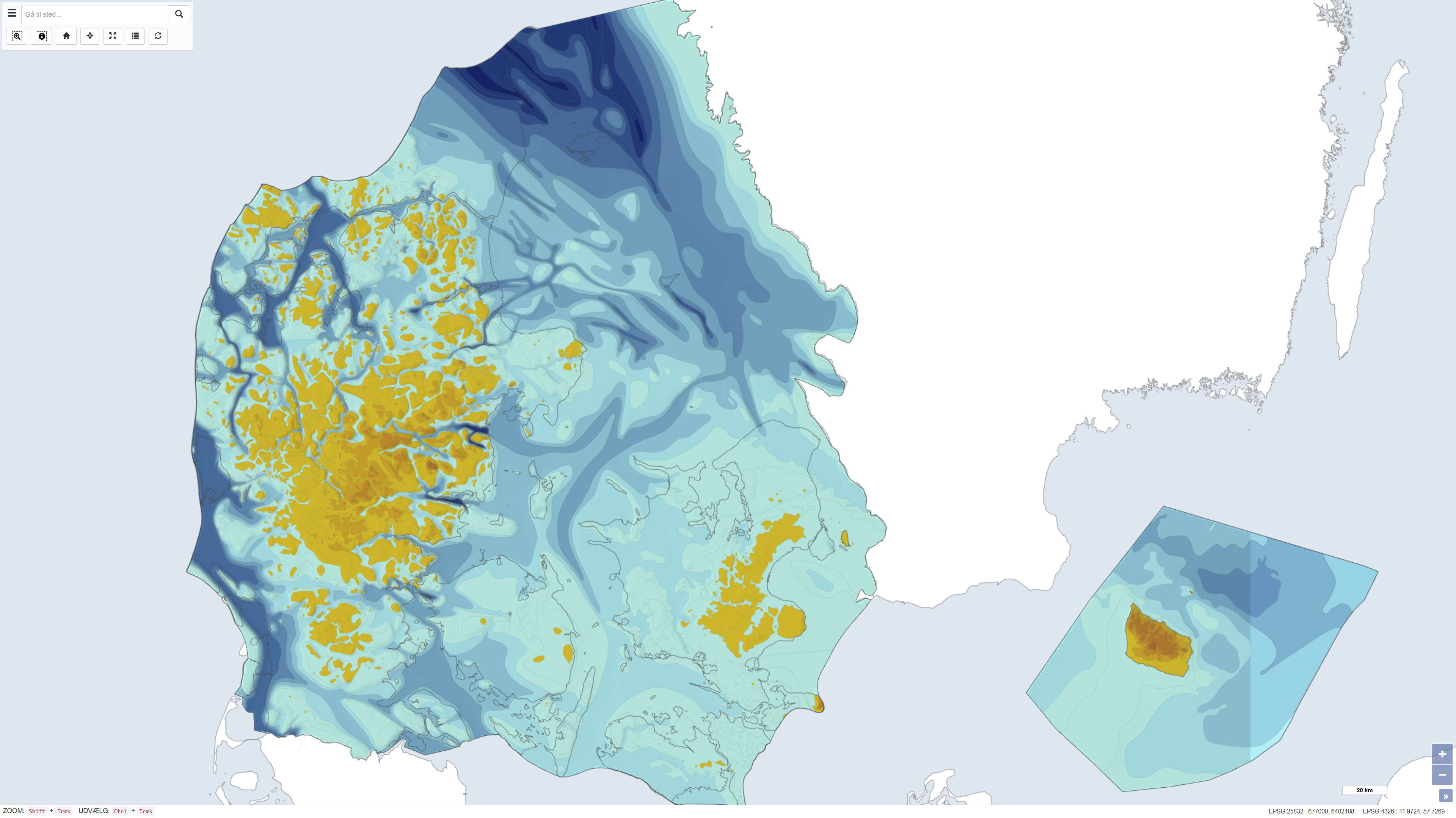
This dataset represents the pre-Quaternary surface topography of Denmark, including Kattegat, internal waters and the sea around Bornholm. The map provides a paleotopographic relief of the surface that existed prior to deposition of Quaternary sediments, compiled from geological borehole data, seismic surveys and topographic sources. It includes polygons with 25 m contour intervals, a 500 m grid and boundary delineations, usable in combination with a standard elevation model to determine Quaternary cover thickness. The base map was hand-drawn at 1:250,000 scale and forms a nationwide thematic map product. The map is described in DGU map series no. 44, 1994.
-
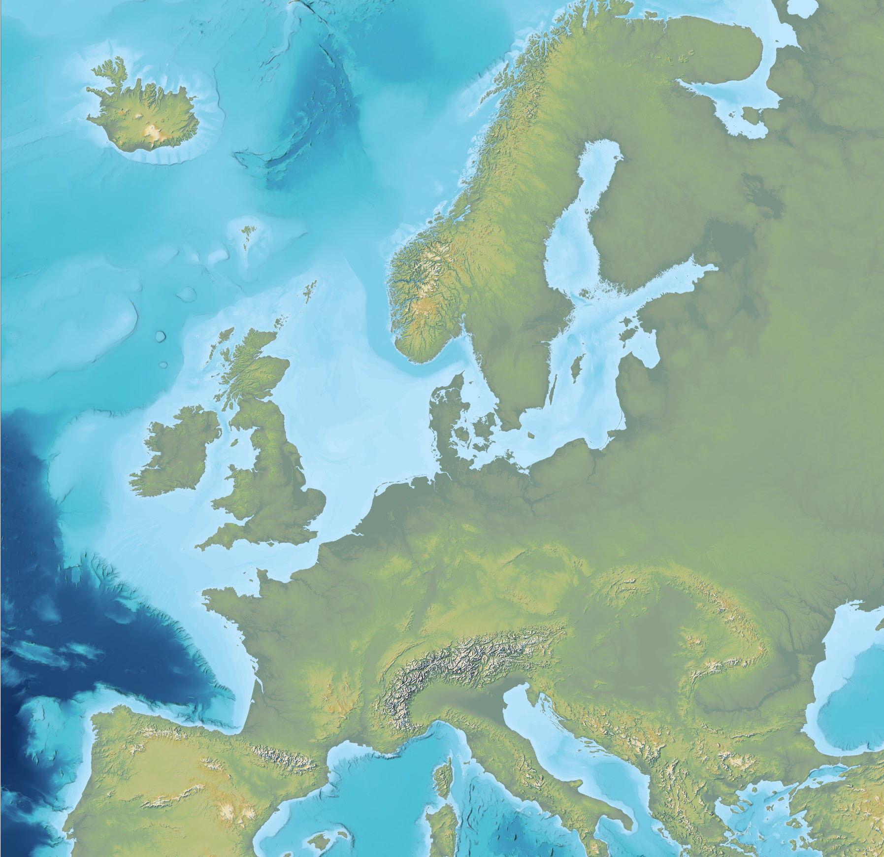
The dataset is an Imhof-inspired cartographic base map combining topography and bathymetry, covering European countries and adjacent marine areas. The map has been constructed by merging several existing digital elevation models, with topography primarily based on EU-DEM v1.1 and the Shuttle Radar Topography Mission (SRTM), and bathymetry derived from the General Bathymetric Chart of the Oceans (GEBCO). The dataset provides a continuous surface integrating land and marine areas and has been developed with a focus on visual quality and regional applications.
-
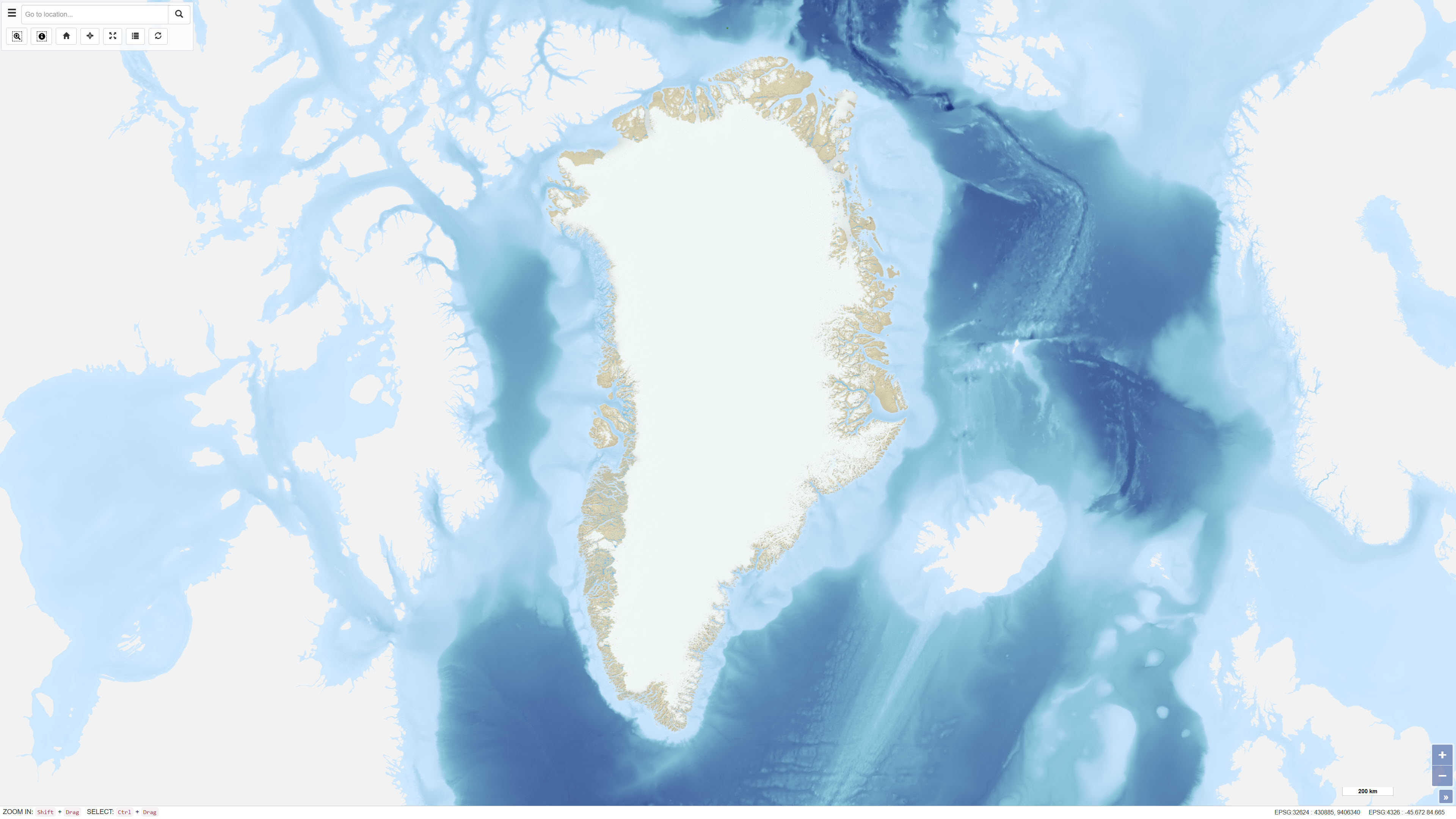
The topographic map of Greenland at a scale of 1:250.000 is based on data collected from the 1930s through the 1970s and 1980s. These data formed the basis for the production of a series of 1:250.000 scale topographic map sheets, which continue to serve as the primary topographic reference for large parts of Greenland. Mapping of areas prior to 1970 was based on several historical map series, including 18 map sheets at a scale of 1:300.000 covering North Greenland produced by Lauge Koch between 1932 and 1940, 1:250,000 scale mapping of parts of Northeast Greenland conducted by the Geodetic Institute in the 1930s, and complete national coverage at 1:250.000 produced by the American Army Map Service in the 1950s. The digital topographic map of North and Northeast Greenland has been produced by the Geological Survey of Denmark and Greenland (GEUS) since 1977, based on high-precision digital photogrammetry using aerial photographs. The dataset has primarily been used as a topographic reference for geological mapping at scales of 1:100.000 and 1:500.000.
-
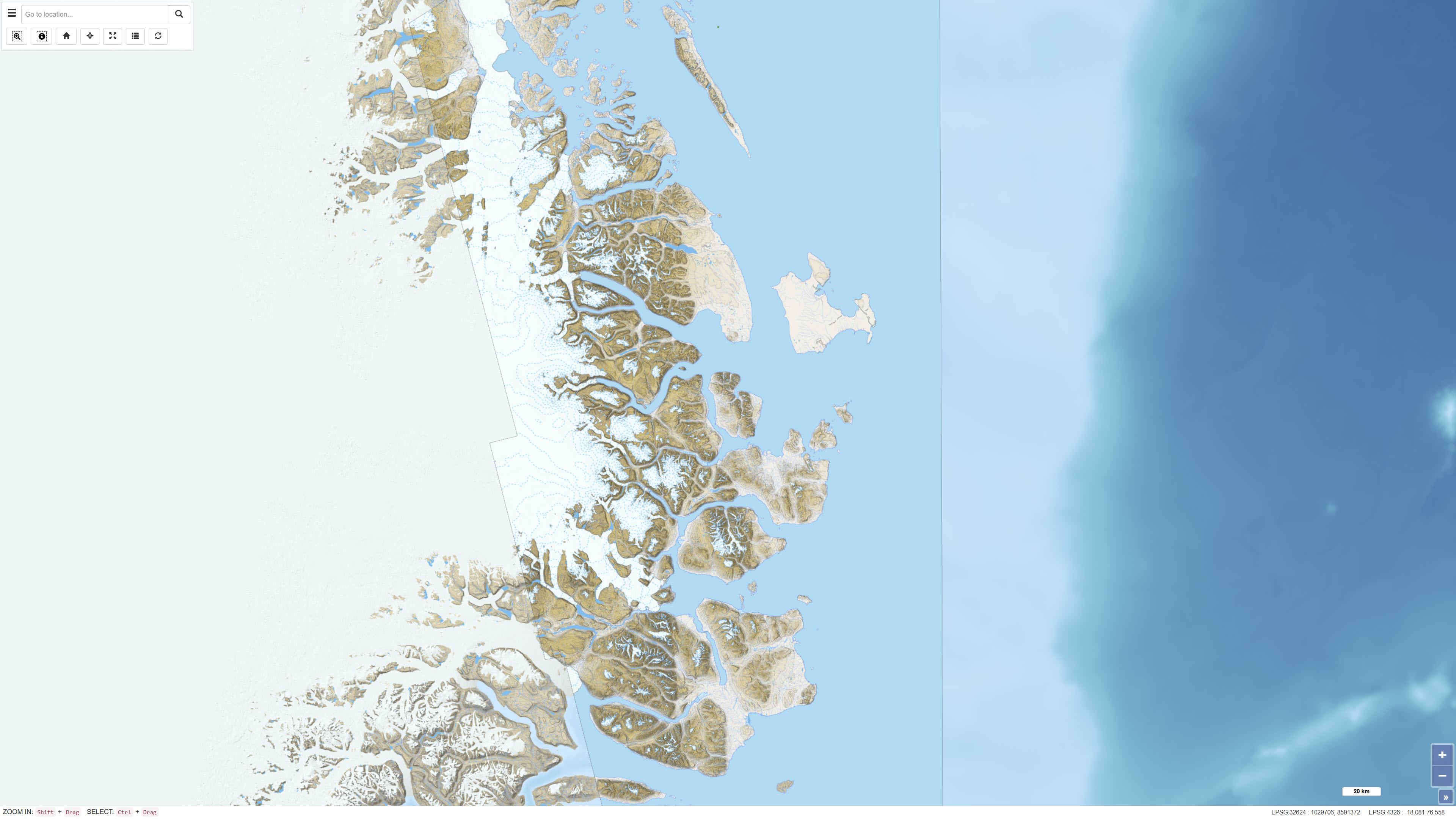
The dataset comprises a topographic map of Northeast Greenland delivered as a digital elevation model (DEM) with a spatial resolution of 8 metres. The DEM is provided as GeoTIFF and represents a seamless elevation surface covering the study area. The dataset was produced using input data from the ArcticDEM project, which is based on stereo imagery from the DigitalGlobe WorldView-1, WorldView-2 and WorldView-3 satellites. The elevation model integrates selected DEM strips recorded between 2012 and 2015 and has been processed to ensure consistency and continuity across the mosaic.
-
The dataset is based on OpenStreetMap (OSM) data downloaded from the official OpenStreetMap distribution platform. The data have subsequently been processed and published as a customised web service. OpenStreetMap is an open, crowdsourced geospatial dataset that is continuously maintained and updated by a global community of contributors. The dataset contains vector-based geographic features, including transport networks, buildings, land use, hydrography, natural features, and points of interest. The data are used as a background map and reference dataset for map visualisation and spatial analysis at local, regional, and national scales. Data content and quality vary geographically and depend on contributor activity.