 Arctic SDI catalogue
DXF
Type of resources
Available actions
Topics
Keywords
Contact for the resource
Provided by
Formats
Representation types
Update frequencies
status
-
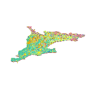
To support improved groundwater geoscience knowledge for southern Ontario, a regional 3-D model of the surficial geology of southern Ontario has been developed as a part of a collaboration between the Ontario Geological Survey and the Geological Survey of Canada. Covering approximately 66,870 km2 in area, the model is a synthesis of existing geological models, surficial geology mapping, and subsurface data. The model is a simplified 9-layer reclassification of numerous mapped local surficial sediment formations in places over 200 m thick with a total volume of approximately 2,455 km3. The model integrates 1:50,000 scale surficial geology mapping with 90 m bathymetrically corrected topographic digital elevation model (DEM) and 8 existing local 3-D models. Archival subsurface data include 10,237 geotechnical and stratigraphic boreholes, 3,312 picks from geophysical surveys, 15,902 field mapping sites and sections, 537 monitoring and water supply wells and 282,995 water well records. Roughly corresponding to regional aquifer and aquitard layers, primary model layers are (from oldest to youngest): Bedrock, Basal Aquifer, Lower Sediment, Regional Till, Post Regional Till Channel Fill, Glaciofluvial Sediment, Post Regional Till Mud, Glaciolacustrine Sand and Recent Sediment / Organics. Modelling was completed using an implicit modelling application (LeapFrog®) complemented by an expert knowledge approach to data classification and rules-based Expert System procedure for data interpretation and validation. An iterative cycle of automated data coding, intermediate model construction and manual data corrections, expert evaluations, and revisions lead to the final 3-D model. A semi-quantitative confidence assessment has been made for each model layer surface based on data quality, distribution and density. This surficial geology model completes the development of a series of regional 3-D geological and hydrogeological models for southern Ontario.
-
The Atlas of Canada Base Maps provide coverage of the entire Canadian landmass. Data elements are feature coded and structurally clean. Base map components are available in five scales and a number of data exchange formats. The 1:2 million and 1:7.5 million scales are the primary bases for all Atlas products. The 1:30 million scale data have been generalized from the two larger scales. The data set covers: drainage (coastlines, rivers, lakes), boundaries (federal, provincial, district, dividing lines), transportation (primary and secondary highways, selected ferry routes, rail networks), populated places, national parks. Atlas information is two-dimensional layered vector data.