 Arctic SDI catalogue
Keyword
Bornholm
Type of resources
Available actions
Topics
Keywords
Contact for the resource
Provided by
Formats
Representation types
Update frequencies
status
Scale
From
1
-
1
/
1
-
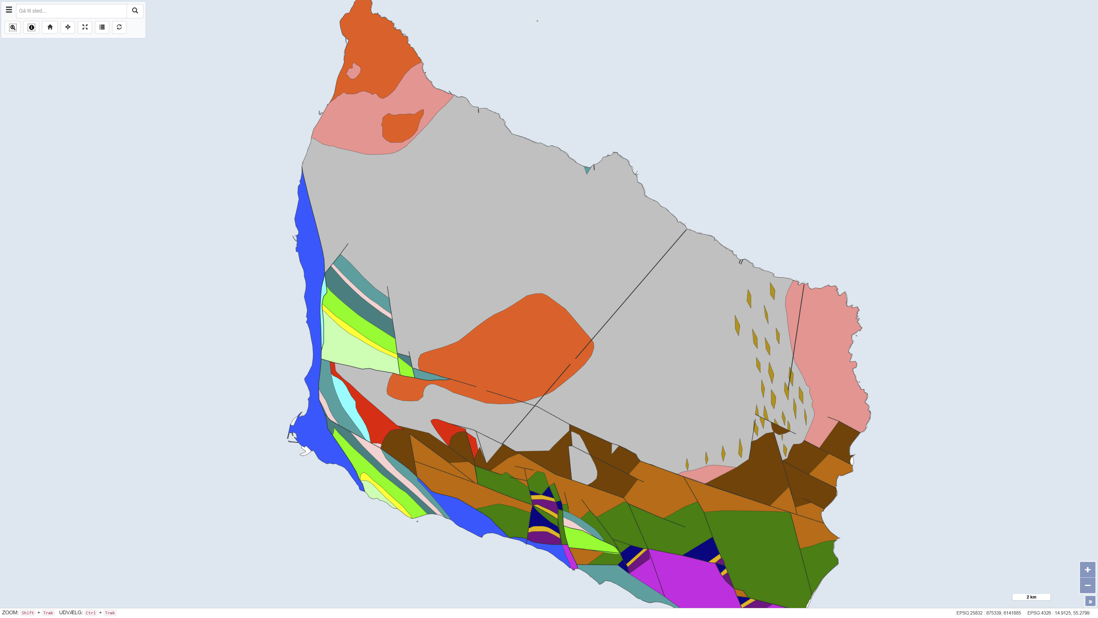
The dataset shows the pre-Quaternary surface of Bornholm and illustrates the distribution of pre-Quaternary rock units and geological structures beneath the Quaternary deposits. The map is based on geological interpretations carried out by Helge Gry in 1960 and 1969 and was published in the journal VARV in 1977. The pre-Quaternary geology of Bornholm differs significantly from the rest of Denmark and is characterised by complex fault systems and a combination of crystalline basement and sedimentary rocks. The map represents a historical, synthesised overview of the pre-Quaternary surface and remains an important reference in geological studies.