 Arctic SDI catalogue
Scientific research
Type of resources
Available actions
Topics
Keywords
Contact for the resource
Provided by
Formats
Representation types
Update frequencies
status
-

The Fieldnotes dataset represents the anticipated locations of DFO Science field operations for 2020-2021 in the North Pacific and Arctic oceans, as well as in the coastal and interior waters of British Columbia and the Yukon.
-

The Fieldnotes dataset represents anticipated locations of science field research and monitoring to be conducted throughout the year by Fisheries and Oceans Canadas' Pacific Science team and collaborators in the Northeast Pacific and Arctic oceans, and in the coastal and interior waters of British Columbia and Yukon.
-

Fisheries and Oceans Canada (DFO) conducts research and undertakes monitoring surveys of the marine and freshwater environment in support of sustainable fisheries, healthy aquatic ecosystems and living resources, and safe and effective marine services. In an effort to effectively inform and ensure Canadians feel engaged in the delivery of its science mandate, DFO produces Fieldnotes, an annual compendium of planned science field operations in the North Pacific and Arctic oceans, as well as in the coastal and interior waters of British Columbia and Yukon.
-

The Fieldnotes dataset represents the anticipated locations of DFO Science field operations for 2022-2023 in the North Pacific and Arctic oceans, as well as in the coastal and interior waters of British Columbia and the Yukon.
-

Geographic bathymetric grid data at 100 m x 100 m pixel resolution. Datum: WGS84 Collaboration of Canada, the United States of America and the European Union as part of the Atlantic Ocean Research Alliance's second project under the Galway Statement. Project mapped the North Atlantic seafloor along a transect from Halifax, Canada to Tromsø, Norway to further the understanding of marine habitats, conservation and navigation. Chief Scientist / Primary Investigator name: Paola Travaglini Platform: CCGS Louis S. St- Laurent (Canadian heavy icebreaker) Device 1 type: Multibeam echo-sounder (sonar) Device 1 manufacturer: Kongsberg Device 1 model: EM122, hull installed behind ice protection window Data and Data format: 100 m resolution grid of bathymetry BAG format: Bathymetric Attributed Grid Object Navigation and positioning: Trimble GNSS receiver + antennas Applanix POS/MV v5 inertial measuring system Horizontal Datum: WGS84 (G1762) Tidal correction: Zero tide applied: tides are not well known for the major part of the data and tides over very deep water are generally negligible. Sound Velocity Profile measurements: In-situ sound velocity profiles were applied. Note on accuracy/S-44 survey standards: Considering the intended output from this survey (IHO Order 1a - Areas shallower than 100 metres where under-keel clearance is less critical but features of concern to surface shipping may exist.) and using an average depth of 2000m as ‘d’ in the IHO Standard Equation - the allowable Total Vertical Uncertainty (TVU) must be < 26m which indeed the data has achieved (by comparison with overlapping datasets from other surveys/agency data). IHO Order 1a Horizontal positioning accuracy: 5.0 m + 5% of depth (95% Confidence level)(~105 m at a mean depth of 2000 m) Vertical positioning accuracy: 2.5 m < 26 m = Sqrt((0.5 m)^2+(0.013 x 2000 m)^2)
-

Geographic bathymetric grid data at 100 m x 100 m pixel resolution. Datum: WGS84 Collaboration of Canada, the United States of America and the European Union as part of the Atlantic Ocean Research Alliance's fifth project under the Galway Statement. Project mapped the North Atlantic seafloor along a transect from Halifax, Canada to Tromsø, Norway to further the understanding of marine habitats, conservation and navigation. Chief Scientist / Primary Investigator name: Paola Travaglini Platform: CCGS Louis S. St- Laurent (Canadian heavy icebreaker) Device 1 type: Multibeam echo-sounder (sonar) Device 1 manufacturer: Kongsberg Device 1 model: EM122 behind an ice protection window Data and Data format: 100 m resolution grid of bathymetry BAG format: Bathymetric Attributed Grid Object Navigation and positioning: Trimble GNSS receiver + antennae Applanix POS/MV v5 inertial measuring system Horizontal Datum: WGS84 (G1762) Tidal correction: Zero tide applied: tides are not well known for the major part of the data and tides over very deep water are generally negligible. Sound Velocity Profile measurements: In-situ sound velocity profiles were applied. Note on accuracy/S-44 survey standards: Considering the intended output from this survey (IHO Order 1a - Areas shallower than 100 metres where under-keel clearance is less critical but features of concern to surface shipping may exist.) and using an average depth of 2000 m as ‘d’ in the IHO Standard Equation - the allowable Total Vertical Uncertainty (TVU) must be < 26m which indeed the data has achieved (by comparison with overlapping datasets from other surveys/agency data). IHO Order 1a Horizontal positioning accuracy: 5.0 m + 5% of depth (95% Confidence level)(~105 m at a mean depth of 2000 m) Vertical positioning accuracy: 2.5 m < 26.0 m = Sqrt((0.5 m)^2+(0.013 x 2000 m)^2)
-
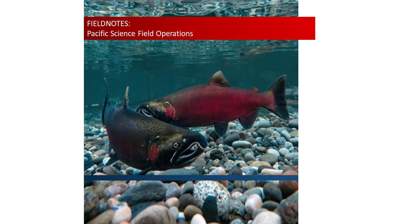
The Fieldnotes dataset represents the anticipated locations of DFO Science field operations in the North Pacific and Arctic oceans, as well as in the coastal and interior waters of British Columbia and the Yukon.
-

Rocky Mountain Ridged Mussels (Gonidea angulata) are listed under the Species at Risk Act (SARA) as a species of special concern and have been re-assessed by the Committee on the Status of Endangered Wildlife in Canada (COSEWIC) as endangered. These fresh water mussels are only found in Canada in the Okanagan Valley of British Columbia. As a continuation of previous work and to inform future assessments and conservation efforts within this geographic range, seven easily accessible sites known to have high densities of G. angulata were selected as prospective index sites to monitor relative abundance (i.e. mussel bed density) using snorkel surveys. For lake sites, a two-stage sampling design was conducted using transects and quadrats. For the river site, cumulative counts from sides of the river were collected. Some sites were sampled only once while others were sampled multiple times from 2011-2016. Mean mussel densities across all surveys ranged from 0.19 to 2.86 mussels/m2, corresponding to site abundance estimates ranging from 102 to 3,276 mussels. Depth measurements were also taken at most sites to inform the Fish Water Management Tool of the Okanagan Water Management Board.
-

The Fieldnotes dataset represents the anticipated locations of DFO Science field operations for 2021-2022 in the North Pacific and Arctic oceans, as well as in the coastal and interior waters of British Columbia and the Yukon.
-
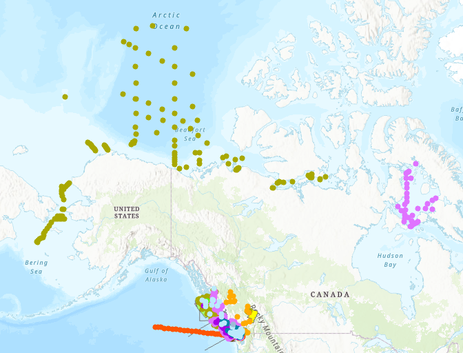
The Fieldnotes dataset represents anticipated locations of science field research and monitoring to be conducted throughout the year by Fisheries and Oceans Canadas' Pacific Science team and collaborators in the Northeast Pacific and Arctic oceans, and in the coastal and interior waters of British Columbia and Yukon.