Urban planning
Type of resources
Available actions
Topics
Keywords
Contact for the resource
Provided by
Formats
Representation types
Update frequencies
status
-
In the Capital Urban Lands Plan (2015), Land designations identify the desired uses for federal urban lands in relation to the role they play for the Capital in a given location. Each land designation provides policy direction for an ensemble of sites that serve similar functions. https://ncc-ccn.gc.ca/our-plans/capital-urban-lands-plan https://ncc-website-2.s3.amazonaws.com/documents/Capital-Urban-Lands-plan.pdf#page=45
-

Study area of the Capital Urban Lands Plan as of 2015. https://ncc-ccn.gc.ca/our-plans/capital-urban-lands-plan https://ncc-website-2.s3.amazonaws.com/documents/Capital-Urban-Lands-plan.pdf#page=10
-

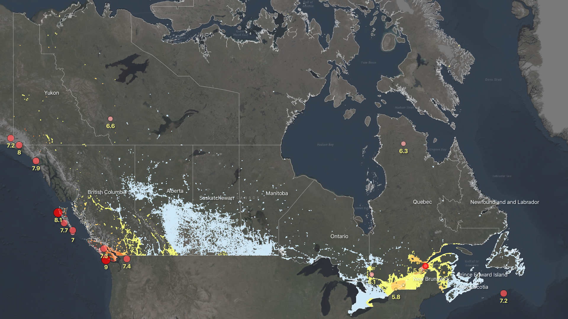
The Probabilistic Seismic Risk Model for Canada introduces a structured framework of indicators that profile the physical, social and economic dimensions of earthquake risk at the neighborhood scale. Risk metrics include measures of building damage and collapse probability, life safety and expected economic losses. An overall risk rating is also provided which aggregates the physical, social, and economic dimensions of risk. The probabilistic assessment reports information based on both the ‘total’ impact as well as the ‘percentage’ impact. It considers only damage to buildings, and their inhabitants, from earthquake shaking, and therefore does not include damage to critical infrastructure or vehicles. Losses from secondary hazards, such as aftershocks, liquefaction, landslides, or fire following are also not currently included. The information is provided at the approximate scale of Census dissemination areas, and is intended to support planning and emergency management activities in earthquake prone regions. This project is run by the Geological Survey of Canada's Public Safety Geoscience Program. For inquiries related to Canada's Seismic Risk Model, please contact Tiegan E. Hobbs at tiegan.hobbs@nrcan-rncan.gc.ca. If you are looking for our end-user interface or any associated documentation, please visit www.RiskProfiler.ca.
-

Non-georeferenced model of downtown Montreal (2011) covering the electoral districts of Peter-McGill and Saint-Jacques (partially). The data under this model has no legal value.**This third party metadata element was translated using an automated translation tool (Amazon Translate).**
-

Geospatial data for public transit agencies in Canada, with information on stop locations, route locations, route types, level of service, wheel chair access, bike access, and more.
 Arctic SDI catalogue