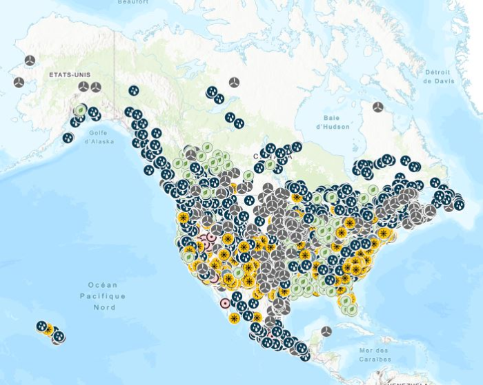
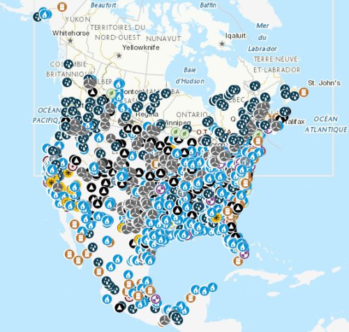
 Arctic SDI catalogue
Hydropower
Type of resources
Available actions
Topics
Keywords
Contact for the resource
Provided by
Formats
Representation types
Update frequencies
status
-
The Magpie River ramping rate study (2000–2017) investigated the ecological effects of hydroelectric flow regulation on fish, invertebrates, and water quality in the Magpie and Batchawana rivers in the Algoma Region of Ontario. Conducted under a Fisheries and Oceans Canada–Brookfield Renewable partnership, the study employed a Before-After-Control-Impact (BACI) design to assess whether ramping rate restrictions at the Steephill Falls Waterpower Facility improved downstream conditions. Initial restrictions (2002–2005) were later removed, allowing unrestricted flow changes until 2017. In this dataset, monthly sampling from spring to fall included chlorophyll a and water chemistry at multiple sites to monitor productivity and detect irregularities. Analyses followed APHA standard methods, with chlorophyll a, pH, alkalinity, and conductivity processed at Fisheries and Oceans Canada, and major ions and nutrients at the Great Lakes Forestry Centre in Sault Ste. Marie, Ontario. Findings contribute to understanding flow management impacts on river ecosystems.
-

Fisheries and Oceans Canada (DFO) Maritime Science Branch has collected grain size data from sediment and water column samples using bottle samples, sediment cores, and sediment grabs as part of numerous research projects not only in the Atlantic provinces, but also worldwide. The data collected by DFO focuses on the fine grained (<1mm) particles as these are both a source of food and means of contaminant transport. Grain size data are used to study the fate and distribution of complimentary chemistries like heavy metals, pesticides, hydrocarbons, aquaculture waste as well as a variety of physical processes such as the resuspension and transport of sediment.
-

This dataset identifies potential low head hydropower development sites across Canada, based on a comprehensive review of existing studies and resource databases. Low head hydropower refers to sites where the vertical drop (head) is 15 meters or less. Sites included in this dataset also have an estimated generation capacity of 50 megawatts (MW) or less. The original database was developed by Hatch Ltd. for Natural Resources Canada (NRCan) as part of a national low head hydropower market assessment. It integrates data from multiple sources, including provincial inventories, prior Hatch studies, and legacy fieldwork records. To enhance data completeness, NRCan subsequently revised the database by supplementing missing site names, river names, and geographic coordinates where possible. The finalized dataset comprises 2,629 potential low head hydropower sites distributed across Canada. It is provided in the form of provincial and territorial shapefiles, each containing detailed site-level attributes. Attributes include site name, river name, site ID, source of information, local map number, geographic coordinates (X and Y), site region, presence of a dam, grid connection status, Indigenous affiliation, catchment area, mean annual flow, rated discharge, gross head, penstock length and diameter, estimated installed capacity, dedicated transmission line length, site comments, and Indigenous reserve name. Disclaimer: This dataset was developed to support preliminary assessments of low head hydropower potential in Canada and is subject to the following limitations: • The original database was compiled from various secondary sources, including data provided by third-party contributors and Hatch Ltd.’s own records. Some of these sources date back several decades. The data provided has not necessarily undergone independent verification for its accuracy, completeness, or validity. • NRCan undertook a data revision process involving manual review and geolocation using publicly available mapping tools (e.g., Google Maps) to address missing information. Where geographic coordinates could not be reliably determined, this is explicitly indicated in the dataset. • Site conditions may have changed over time due to natural processes or human activities. NRCan does not accept responsibility for any impact such changes may have on the accuracy or validity of the dataset’s observations, conclusions, or recommendations. • The inclusion of a site in this dataset does not imply technical, economic, or environmental feasibility. Any potential development would require further investigation, including detailed field studies, environmental assessments, and comprehensive technical and financial evaluations. This dataset is provided for informational purposes only and is not intended to serve as the sole basis for investment, planning, or development decisions. Users are strongly advised to undertake independent due diligence, including site-specific assessments and technical evaluations, prior to making any decisions based on the dataset. By accessing or using this dataset, users acknowledge and accept these terms and limitations. The dataset providers expressly disclaim any responsibility or liability for consequences resulting from the use, interpretation, or reliance on the information contained herein. Use of this dataset is entirely at the user’s own risk, and users assume full responsibility for any actions or decisions made based on its contents. This disclaimer is provided in accordance with applicable laws and regulations. By utilizing the dataset, users agree to release the dataset providers from any legal claims, damages, or liabilities that may arise from such use.
-

A tidal resource assessment dataset for the Quatsino Sound region, British Columbia, was developed, including temporal maximum, mean, and minimum velocity magnitudes, standard deviations, and power density. The dataset was generated using a high-resolution 2D depth-averaged hydrodynamic model based on the Telemac-Mascaret solver, with Natural Neighbor interpolation applied for raster creation. This newly published dataset is the first in a series of regional tidal energy maps for Canada. Developed by CanmetENERGY Ottawa in collaboration with partners, these maps aim to support effective project planning and development by providing comprehensive tidal resource data across the country. Disclaimer: Potential errors in the model results may arise from inherent limitations in the topo-bathymetric data accuracy, assumptions in boundary conditions, approximations within the numerical methods, and the input data used in the numerical modeling. These factors introduce uncertainties that can affect the overall model outcomes. The model is subject to the following conditions: • Topo-bathymetric data: Obtained from electronic navigational charts and the Canadian Hydrographic Service’s (CHS) NONNA-10 Bathymetric Data packages, consolidating CHS-managed digital bathymetric sources with a maximum resolution of 10 m. • Tidal and current harmonic components: Used as boundary conditions from the TPXO9 global tidal model. • Model calibration and validation: Performed using data from Acoustic Doppler Current Profilers (ADCP), surface elevations recorded at CHS tidal stations, and Lagrangian drifter measurements. • Interpolation method: Dataset outputs were generated with Natural Neighbor interpolation, which assumes smoothly varying data and may not capture sharp local gradients or features. • Modeled estimates: All values for velocity magnitudes, velocity standard deviations, and power density are modeled estimates and not direct field measurements. This dataset is intended for preliminary assessment of tidal projects only. It should not be the sole basis for making critical decisions or investments. We strongly recommend further validation and in-depth analysis. Users are responsible for conducting their own due diligence and additional research to verify the data's accuracy and relevance for specific applications. By accessing and using this dataset, users acknowledge and accept these disclaimers. The providers of this dataset explicitly absolve themselves of any responsibility or liability for any consequences arising from the use, reliance upon, or interpretation of this dataset. Users are advised that their use of the dataset is at their own risk, and they assume full responsibility for any actions or decisions made based on the information contained therein. This disclaimer is in accordance with applicable laws and regulations, and by accessing or utilizing the dataset, users agree to release the providers of this dataset from any legal claims, damages, or liabilities that may arise from such use.
-
Stations containing prime movers, electric generators, and auxiliary equipment for converting mechanical, chemical into electric energy with an installed capacity of 1 Megawatt or more generated from renewable energy, including biomass, hydroelectric, pumped-storage hydroelectric, geothermal, solar, and wind. Mapping Resources implemented as part of the North American Cooperation on Energy Information (NACEI) between the Department of Energy of the United States of America, the Department of Natural Resources of Canada, and the Ministry of Energy of the United Mexican States. The participating Agencies and Institutions shall not be held liable for improper or incorrect use of the data described and/or contained herein. These data and related graphics, if available, are not legal documents and are not intended to be used as such. The information contained in these data is dynamic and may change over time and may differ from other official information. The Agencies and Institutions participants give no warranty, expressed or implied, as to the accuracy, reliability, or completeness of these data. Parent Collection: [North American Cooperation on Energy Information, Mapping Data](https://open.canada.ca/data/en/dataset/aae6619f-f9f3-435d-bc32-42decd58b674)
-
Stations containing prime movers, electric generators, and auxiliary equipment for converting mechanical, chemical, and/or fission energy into electric energy with an installed capacity of 100 megawatts or more. Mapping Resources implemented as part of the North American Cooperation on Energy Information (NACEI) between the Department of Energy of the United States of America, the Department of Natural Resources of Canada, and the Ministry of Energy of the United Mexican States. The participating Agencies and Institutions shall not be held liable for improper or incorrect use of the data described and/or contained herein. These data and related graphics, if available, are not legal documents and are not intended to be used as such. The information contained in these data is dynamic and may change over time and may differ from other official information. The Agencies and Institutions participants give no warranty, expressed or implied, as to the accuracy, reliability, or completeness of these data. Parent Collection: [North American Cooperation on Energy Information, Mapping Data](https://open.canada.ca/data/en/dataset/aae6619f-f9f3-435d-bc32-42decd58b674)
-
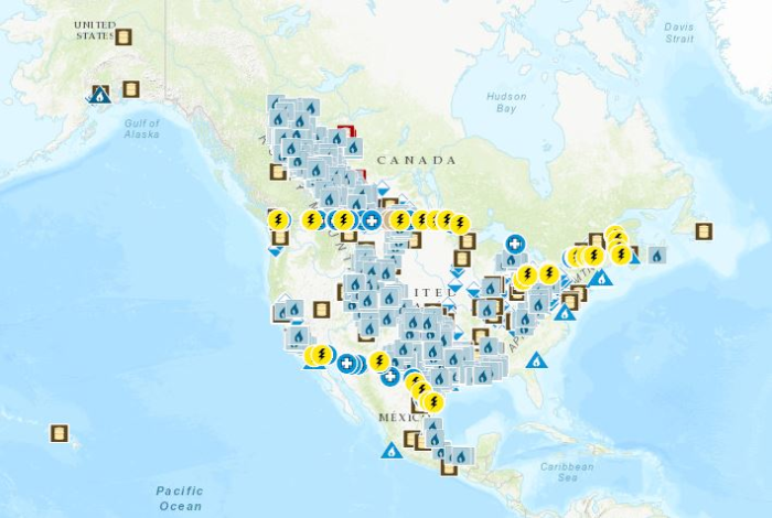
Mapping Resources on energy infrastructure and potential implemented as part of the North American Cooperation on Energy Information (NACEI) between the Department of Energy of the United States of America, the Department of Natural Resources of Canada, and the Ministry of Energy of the United Mexican States. [Natural Gas Processing Plants](https://open.canada.ca/data/en/dataset/636b9550-3700-4e66-8259-5cfc8159a784): Facilities designed to recover natural gas liquids from a stream of natural gas. These facilities control the quality of the natural gas to be marketed. [Refineries](https://open.canada.ca/data/en/dataset/57e7bc4c-680b-4640-9fa1-ded7ce186fab): Facilities that separate and convert crude oil or other feedstock into liquid petroleum products, including upgraders and asphalt refineries. [Liquefied Natural Gas Terminals](https://open.canada.ca/data/en/dataset/e08eec16-7c7a-4253-9bee-ea640d400a54): Natural gas onshore facilities used to receive, unload, load, store, gasify, liquefy, process and transport by ship, natural gas that is imported from a foreign country, exported to a foreign country, or for interior commerce. [Power Plants, 100 MW or more](https://open.canada.ca/data/en/dataset/40fbe40c-01cd-49d3-8add-0d20ed64c90d): Stations containing prime movers, electric generators, and auxiliary equipment for converting mechanical, chemical, and/or fission energy into electric energy with an installed capacity of 100 megawatts or more. [Renewable Power Plants, 1 MW or more](https://open.canada.ca/data/en/dataset/490db619-ab58-4a2a-a245-2376ce1840de): Stations containing prime movers, electric generators, and auxiliary equipment for converting mechanical, chemical into electric energy with an installed capacity of 1 Megawatt or more generated from renewable energy, including biomass, hydroelectric, pumped-storage hydroelectric, geothermal, solar, and wind. [Natural Gas Underground Storage](https://open.canada.ca/data/en/dataset/07b63e0e-09bb-4c4f-b057-63a58d40553a): Sub-surface facilities used for storing natural gas. The facilities are usually hollowed-out salt domes, geological reservoirs (depleted oil or gas field) or water bearing sands (called aquifers) topped by an impermeable cap rock. Border Crossings: [Electric transmission lines](https://open.canada.ca/data/en/dataset/35c51098-5cd8-44b0-b1cd-c8ce2f5dae89), [liquids pipelines](https://open.canada.ca/data/en/dataset/82053097-6b4f-44d9-a750-549df44b36b4) and [gas pipelines](https://open.canada.ca/data/en/dataset/e313db89-4219-4a5e-a543-772a86068710). [Solar Resource, NSRDB PSM Global Horizontal Irradiance (GHI)](https://open.canada.ca/data/en/dataset/9554ed18-6ab2-477f-9545-da091eba762f): Average of the hourly Global Horizontal Irradiance (GHI) over 17 years (1998-2014). Data extracted from the National Solar Radiation Database (NSRDB) developed using the Physical Solar Model (PSM) by National Renewable Energy Laboratory ("NREL"), Alliance for Sustainable Energy, LLC, U.S. Department of Energy ("DOE"). [Solar Resource, NSRDB PSM Direct Normal Irradiance (DNI)](https://open.canada.ca/data/en/dataset/a2dd0554-03f8-4edc-a3b3-67b47c5c9d6d): Average of the hourly Direct Normal Irradiance (DNI) over 17 years (1998-2014). Data extracted from the National Solar Radiation Database (NSRDB) developed using the Physical Solar Model (PSM) by National Renewable Energy Laboratory ("NREL"), Alliance for Sustainable Energy, LLC, U.S. Department of Energy ("DOE"). The participating Agencies and Institutions shall not be held liable for improper or incorrect use of the data described and/or contained herein. These data and related graphics, if available, are not legal documents and are not intended to be used as such. The information contained in these data is dynamic and may change over time and may differ from other official information. The Agencies and Institutions participants give no warranty, expressed or implied, as to the accuracy, reliability, or completeness of these data.