 Arctic SDI catalogue
Ocean floor
Type of resources
Topics
Keywords
Contact for the resource
Provided by
Formats
Representation types
Update frequencies
status
-

Radiocarbon dates are derived from organic samples collected through marine and coastal expeditions of the Geological Survey of Canada Atlantic and Pacific. These efforts were conducted primarily to better understand the spatial and temporal coverage of sediments and seabed-fast marine ice during the last deglaciation. The quality of these data varies - ranging from imprecise bulk samples and more accurate AMS estimates derived from single shell fragments. These data are ordered in the menu in 1000 year divisions. By default, only conventional radiocarbon ages are displayed, and reservoir-corrected and measured ages are hidden.
-

The shallow substrate bottom type model was created to support near shore habitat modelling. Data sources include both available observations of bottom type and environmental predictor layers including oceanographic layers, fetch, and bathymetry and its derivatives. Using weighted random forest classification from the ranger R package, the relationship between observed bottom type and predictor layers can be determined, allowing bottom type to be classified across the study areas. The predicted raster files are classified as follows: 1) Rock, 2) Mixed, 3) Sand, 4) Mud The categorical substrate model domains are restricted to the extent of the input bathymetry layers (see data sources) which is 5 km from the 50 m depth contour.
-

This deep water substrate bottom type model was created to aid in habitat modeling, and to complement the nearshore bottom patches. It was created from a combination of bathymetrically-derived layers in addition to bottom type observations. Using random forest classification, the relationship between observed substrates and bathymetric derivatives was estimated across the entire area of interest. The raster is categorized into: 1) Rock, 2) Mixed, 3) Sand, 4) Mud
-

Geographic bathymetric grid data at 100 m x 100 m pixel resolution. Datum: WGS84 Collaboration of Canada, the United States of America and the European Union as part of the Atlantic Ocean Research Alliance's second project under the Galway Statement. Project mapped the North Atlantic seafloor along a transect from Halifax, Canada to Tromsø, Norway to further the understanding of marine habitats, conservation and navigation. Chief Scientist / Primary Investigator name: Paola Travaglini Platform: CCGS Louis S. St- Laurent (Canadian heavy icebreaker) Device 1 type: Multibeam echo-sounder (sonar) Device 1 manufacturer: Kongsberg Device 1 model: EM122, hull installed behind ice protection window Data and Data format: 100 m resolution grid of bathymetry BAG format: Bathymetric Attributed Grid Object Navigation and positioning: Trimble GNSS receiver + antennas Applanix POS/MV v5 inertial measuring system Horizontal Datum: WGS84 (G1762) Tidal correction: Zero tide applied: tides are not well known for the major part of the data and tides over very deep water are generally negligible. Sound Velocity Profile measurements: In-situ sound velocity profiles were applied. Note on accuracy/S-44 survey standards: Considering the intended output from this survey (IHO Order 1a - Areas shallower than 100 metres where under-keel clearance is less critical but features of concern to surface shipping may exist.) and using an average depth of 2000m as ‘d’ in the IHO Standard Equation - the allowable Total Vertical Uncertainty (TVU) must be < 26m which indeed the data has achieved (by comparison with overlapping datasets from other surveys/agency data). IHO Order 1a Horizontal positioning accuracy: 5.0 m + 5% of depth (95% Confidence level)(~105 m at a mean depth of 2000 m) Vertical positioning accuracy: 2.5 m < 26 m = Sqrt((0.5 m)^2+(0.013 x 2000 m)^2)
-

Geographic bathymetric grid data at 100 m x 100 m pixel resolution. Datum: WGS84 Collaboration of Canada, the United States of America and the European Union as part of the Atlantic Ocean Research Alliance's fifth project under the Galway Statement. Project mapped the North Atlantic seafloor along a transect from Halifax, Canada to Tromsø, Norway to further the understanding of marine habitats, conservation and navigation. Chief Scientist / Primary Investigator name: Paola Travaglini Platform: CCGS Louis S. St- Laurent (Canadian heavy icebreaker) Device 1 type: Multibeam echo-sounder (sonar) Device 1 manufacturer: Kongsberg Device 1 model: EM122 behind an ice protection window Data and Data format: 100 m resolution grid of bathymetry BAG format: Bathymetric Attributed Grid Object Navigation and positioning: Trimble GNSS receiver + antennae Applanix POS/MV v5 inertial measuring system Horizontal Datum: WGS84 (G1762) Tidal correction: Zero tide applied: tides are not well known for the major part of the data and tides over very deep water are generally negligible. Sound Velocity Profile measurements: In-situ sound velocity profiles were applied. Note on accuracy/S-44 survey standards: Considering the intended output from this survey (IHO Order 1a - Areas shallower than 100 metres where under-keel clearance is less critical but features of concern to surface shipping may exist.) and using an average depth of 2000 m as ‘d’ in the IHO Standard Equation - the allowable Total Vertical Uncertainty (TVU) must be < 26m which indeed the data has achieved (by comparison with overlapping datasets from other surveys/agency data). IHO Order 1a Horizontal positioning accuracy: 5.0 m + 5% of depth (95% Confidence level)(~105 m at a mean depth of 2000 m) Vertical positioning accuracy: 2.5 m < 26.0 m = Sqrt((0.5 m)^2+(0.013 x 2000 m)^2)
-

This data set is a generalized characterization of the offshore and inshore environments of Canada’s Pacific Ocean. Compiled from various sources to depict the biogenic habitats, pelagic habitats, and general bottom types such as offshore and inshore by depth strata.
-

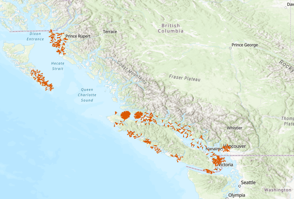
Photographs of the seabed have been collected during marine expeditions of the Geological Survey of Canada Atlantic and Pacific for over 50 years. Typically, a sequence of 10 to 20 photos are taken at a single station as the vessel drifts with prevailing winds and currents and the camera is repeatedly lowered to and raised from the seafloor. The suite of photos from each station may best be considered a representative ensemble from the proximal area. Only in the more recent expeditions, where differential GPS and ultra-short baseline positioning is used in camera positioning, is the relative positional information given for each photo meaningful in interpreting the sequence as a transect. Reduced-scale, thumbnail photos are displayed for the sequence of photos taken at each station. Each photo is labelled with the expedition id, the station number and the photo number.
-
The Department of Fisheries and Oceans (DFO) Science Branch has designed a multispecies dive survey protocol to provide unbiased, coast wide monitoring of benthic invertebrate stocks (as may be required under the updated Fisheries Act) and associated habitat information for a suite of benthic marine invertebrate species (Green (Strongylocentrotus droebachiensis), Purple (S. purpuratus) and Red Sea Urchin (Mesocentrotus franciscanus), Geoduck (Panopea generosa), Giant Red Sea Cucumber (Apostichopus californicus), Northern Abalone (Haliotis kamtschatkana), and Sunflower Sea Star (Pycnopodia helianthoides)). Based on information available at this time, the proposed survey design can provide estimates of coast wide stock status for Red Sea Urchin and Giant Red Sea Cucumber, and relative abundance indices for Geoduck, Green Sea Urchin, Purple Sea Urchin, Northern Abalone and Sunflower Sea Star. The new protocol was tested through a series of pilot surveys conducted on a subset of areas of the BC coast each September from 2016-2021. Design of the pilot surveys was based on previous dive survey data and experience and demonstrated the practical feasibility of the protocol, while also gathering preliminary information to guide recommendations about the statistical design of the survey. The dataset consists of a relational database containing tables representing each component of the survey methodology. The primary component of the survey is a transect location. Along each transect, systematically spaced quadrats are sampled, and on each quadrat, substrate observations are recorded, multiple species of algae are recorded, and multiple individual invertebrates are measured or counted. The tables are linked by transect number and quadrat number.
-

The Geological Survey of Canada (Atlantic and Pacific) has collected marine survey field records on marine expeditions for over 50 years. This release makes available the results of an ongoing effort to scan and convert our inventory of analog marine survey field records (seismic, sidescan and sounder) to digital format. These records were scanned at 300 dpi and converted into JPEG2000 format. Typically, each of these files was between 1 to 2 gbyte in size before compression and compressed by a factor of 10:1. Empirical tests with a number of data sets suggest that there is minimal visual distortion of the scanned data at this level of compression. In this KML file, scanned data are available in a reduced-scale thumbnail format and a compressed full-resolution JPEG2000 format.
-

This dataset contains observations of species occurrences from seafloor imagery collected by the remotely operated underwater vehicle (ROV) during the 2012 Expedition to Cobb Seamount. The ROV operated by Fisheries and Oceans Canada was a customized Deep Ocean Engineering Phantom HD2+2 which collected photographic images from 12 transects ranging from 35 m to 211 m in depth.