Census data
Type of resources
Available actions
Topics
Keywords
Contact for the resource
Provided by
Years
Formats
Representation types
Update frequencies
status
Service types
-

This product contains 23,887 digitally restored 1971 census enumeration area (EA) boundaries for the 33 census metropolitan areas (CMA) defined by the 2011 census. EAs are the smallest geographical unit for the release of 1971 census statistics. These EA boundaries can be aggregated to the census agglomeration (CA) or the CMA level. The restored EA boundaries also include 1971 population and dwelling statistics. The areas covered by the restored EA polygons account for 61.8% Canada’s total population in 1971. The purpose of the data set is to provide a historical geography in a digital format. It is intended to be used for reference, mapping and for spatial and time series analyses. These boundaries were produced by Statistics Canada, Environment, Energy and Transportation Statistic Division in 2017. The restored 1971 EA boundaries are provided as a single spatial layer. They are also available in Statistics Canada, 2017, “Restoration of the 1971 enumeration area polygons for Canada's largest cities,” Environmental Statistics: Boundary Files, Catalogue no. 16-510-X.
-

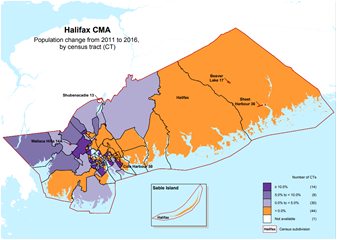
A thematic map shows the spatial distribution of one or more specific data themes for standard geographic areas. Thematic maps include: Population Age Income Language of work Instruction in the official minority language
-

The Census Program Data Viewer (CPDV) is an advanced web-based data visualization tool that helps make statistical information more interpretable by presenting key indicators in a statistical dashboard. It also enables users to easily compare indicator values and identify relationships between indicators.
-
This product provides population counts for 2001 and 2016 for 105 census subdivisions (CSDs) for which the forest sector is a major source of employment income—defined by Natural Resources Canada as 20% or more of total CSD income excluding government transfers. These files were produced by Statistics Canada, Environment, Energy and Transportation Statistics Division, 2018, special tabulation from the 2001 and 2016 Census of Population; Natural Resources Canada, Canadian Forest Services, Economic Analysis Division; Canada’s National Forest Inventory (NFI), 2016, Grouped kNN Map layers, http://tree.pfc.forestry.ca (accessed April 7, 2017). Data from the 2016 Census of Population were used to identify the 105 census subdivisions. Note that changes occur to the number and the boundaries of CSDs between censuses. Adjustments were made to CSD boundaries to account for changes. Some data were suppressed for data quality reasons or to meet the confidentiality requirements of the Statistics Act. Income data were available for 3,675 of 5,162 CSDs. This analysis may therefore underreport the total number of communities for which the forest sector is a major economic driver. Note that a decline in the percentage of forest sector income may be due to a decrease in forest sector income or an increase in income from other sources. The reference period for income data in the Census of Population is the calendar year prior to the census. The forest sector includes North American Industry Classification codes 113 – forestry and logging, 1153 – support activities for forestry and logging, 321 – wood product manufacturing and 322 – paper product manufacturing. These files will also be accessible as web services on the Government of Canada web site Open Maps. (http://open.canada.ca/en/open-maps)
-
This product provides population counts for 2001 and 2016 for 105 census subdivisions (CSDs) for which the forest sector is a major source of employment income—defined by Natural Resources Canada as 20% or more of total CSD income excluding government transfers. These files were produced by Statistics Canada, Environment, Energy and Transportation Statistics Division, 2018, special tabulation from the 2001 and 2016 Census of Population; Natural Resources Canada, Canadian Forest Services, Economic Analysis Division; Canada’s National Forest Inventory (NFI), 2016, Grouped kNN Map layers, http://tree.pfc.forestry.ca (accessed April 7, 2017). Data from the 2016 Census of Population were used to identify the 105 census subdivisions. Note that changes occur to the number and the boundaries of CSDs between censuses. Adjustments were made to CSD boundaries to account for changes. Some data were suppressed for data quality reasons or to meet the confidentiality requirements of the Statistics Act. Income data were available for 3,675 of 5,162 CSDs. This analysis may therefore underreport the total number of communities for which the forest sector is a major economic driver. Note that a decline in the percentage of forest sector income may be due to a decrease in forest sector income or an increase in income from other sources. The reference period for income data in the Census of Population is the calendar year prior to the census. The forest sector includes North American Industry Classification codes 113 – forestry and logging, 1153 – support activities for forestry and logging, 321 – wood product manufacturing and 322 – paper product manufacturing.
-
The Labour Force Distribution (LFD) maps are derived from the CanEcumene 2.0 Geodatabase using custom tabulations of census-based labour force data. These LFD maps were calculated for each of the five major natural resource sectors in Canada: Forestry, Fisheries, Agriculture, Minerals, and Petroleum and Coal. The measure used is the labour force of each sector as a proportion of the goods-producing sectors in the economy. Labour force proportions were first calculated at the individual community level, and then interpolated on a regional level using GIS (see Eddy et. al. 2020 for more detail). In effect, these maps show the strong importance of Canada’s natural resource sectors in various regions of the country. The darker the tone in each map indicates a region’s higher degree of dependency on a given sector for their economic livelihood.
-
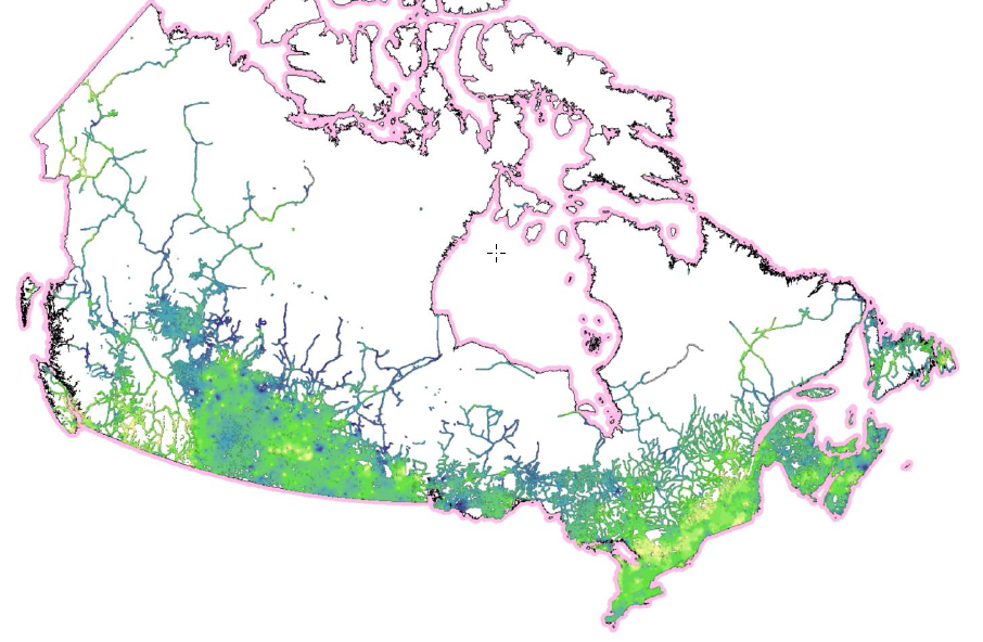
“Ecumene” is a term used by geographers, meaning “inhabited lands.” Populated places in the ecumene database are referenced using natural boundaries, as opposed to administrative or census boundaries, and provide a more suitable means for integrating socio-economic data with ecological and environmental data in a region. The Canadian Ecumene GeoDatabase 3.0 includes the custom boundaries for more than 3,000 populated areas across Canada, many of which were derived from remote-sensing “night-lights” imagery. Each ecumene place has a corresponding set of attributes pertaining to place name, province, ecozone, indigenous communities, and other descriptive information, as well as an initial custom set of demographic variables derived from Statistics Canada Census and National Household Survey data for 2001, 2006, 2011 and 2016. A number of additional layers are also included that map the extents of Canada's ecumene in alternate ways, using transportation and utility networks, nightlights imagery, and population density. (NOTE: In the list below, the V2 Shape, KML, and TIFF files have not changed for the CanEcumene 3.0) Provided layer: The Canadian Ecumene (CanEcumene) 3.0 GIS Database ============================================================================================ Database Citation (Update): Eddy, B.G., Muggridge, M., LeBlanc, R., Osmond, J., Kean, C., and Boyd, E. 2023. The CanEcumene 3.0 GIS Database. Federal Geospatial Platform (FGP), Natural Resources Canada. https://open.canada.ca Methods Publication Citation: Eddy B, Muggridge M, LeBlanc R, Osmond J, Kean C, Boyd E (2020) An Ecological Approach for Mapping Socio-Economic Data in Support of Ecosystems Analysis: Examples in Mapping Canada’s Forest Ecumene. One Ecosystem 5: e55881. https://doi.org/10.3897/oneeco.5.e55881
-

The RVI/CVI database is derived from the CanEcumene 3.0 GDB (Eddy, et. al. 2023) using a selection of socio-economic variables identified in Eddy and Dort (2011) that aim to capture the overall state of socio-economic conditions of communities as ‘human habitats’. This dataset was developed primarily for application in mapping socio-economic conditions of communities and regions for environmental and natural resource management, climate change adaptation, Impact Assessments (IAs) and Regional Assessments (RAs), and Cumulative Effects Assessment (CEA). The RVI/CVI is comprised of five sub-indicators: 1) population change, 2) age structure, 3) education levels, 4) employment levels, and 5) real estate values. Index values are based on percentile ranks of each sub-indicator, and averaged for each community, and for three ranked groups: 1) all of Canada, 2) by province, and 3) by population size. The data covers the Census periods of 2001, 2006, 2011 (NHS), 2016, and 2021. The index is mapped in two ways: 1) as ‘points’ for individual communities (CVI), and 2) as ‘rasters’ for spatial interpolation of point data (RVI). These formats provide an alternative spatial framework to conventional StatsCan CSD framework. (For more information on this approach see Eddy, et. al. 2020). ============================================================================================ Eddy, B.G., Muggridge, M., LeBlanc, R., Osmond, J., Kean, C., and Boyd, E. 2023. The CanEcumene 3.0 GIS Database. Federal Geospatial Platform (FGP), Natural Resources Canada. https://gcgeo.gc.ca/viz/index-en.html?keys=draft-3f599fcb-8d77-4dbb-8b1e-d3f27f932a4b Eddy B.G., Muggridge M, LeBlanc R, Osmond J, Kean C, Boyd E. 2020. An Ecological Approach for Mapping Socio-Economic Data in Support of Ecosystems Analysis: Examples in Mapping Canada’s Forest Ecumene. One Ecosystem 5: e55881. https://doi.org/10.3897/oneeco.5.e55881 Eddy, B.G.; Dort, A. 2011. Integrating Socio-Economic Data for Integrated Land Management (ILM): Examples from the Humber River Basin, western Newfoundland. Geomatica, Vol. 65, No. 3, p. 283-291. doi:10.5623/cig2011-044.
-
The Indigenous Populations of Canada map is derived from the CanEcumene 2.0 Geodatabase using custom tabulations of census-based population data. Indigenous communities within the level of the census sub-division (CSD) were identified using a combination of sources from census field data (see Eddy et. al. 2020 for more details). This map shows the percent of Indigenous population in CanEcumene 2.0 communities using graduated symbols, overlaid upon a population density raster. The larger the symbol, the higher the percentage of Indigenous population in that area. The darker the colour in the underlying raster, the denser is the general population. This map illustrates how the majority of Indigenous populations reside in locations outside of the denser populated areas of Canada.
 Arctic SDI catalogue