 Arctic SDI catalogue
Ecosystems
Type of resources
Available actions
Topics
Keywords
Contact for the resource
Provided by
Years
Formats
Representation types
Update frequencies
status
Service types
-

The National Ecological Framework for Canada's "Landform by Ecodistrict” series contains tables that provide regional landform information for components within the ecodistrict framework polygon. It provides landform codes and their English and French-language descriptions as well as information about the percentage of the polygon that the component occupies. Regional landforms generally describe a region and include the various shapes of the land surface resulting from a variety of actions such as deposition or sedimentation (eskers, lacustrine basins), erosion (gullies, canyons), and earth crust movements (mountains). The regional landform classes are: plateau or tableland, hill and mountain, organic wetland, plain, scarp or valley.
-

The National Ecological Framework for Canada's "Surface Form by Ecodistrict" dataset contains tables that provide surface form information for components within the ecodistrict framework polygon. It provides surface form codes and their English and French-language descriptions as well as information about the percentage of the polygon that the component occupies. Surface form descriptions describe assemblages of slopes or recurring patterns of forms that occur at the earth's surface. When applied to consolidated materials (material that has been transformed to hard rock), it refers to the form produced after modification by geological processes. The mineral soil surface forms are: dissected; hummocky (irregular); inclined; level, rolling; ridged; steep; terraced; undulating. The wetland surface forms are: bog; fen; marsh; swamp.
-

The National Ecological Framework for Canada's "Elevation by Ecozone” dataset provides elevation information for ecozone framework polygons, in meters. It includes codes and descriptions for minimum elevation, maximum elevation, mean elevation and the difference in elevation.
-

The National Ecological Framework for Canada's "Elevation by Ecoregion” dataset provides elevation information for ecoregion framework polygons, in meters. It includes codes and descriptions for minimum elevation, maximum elevation, mean elevation and the difference in elevation.
-
The National Ecological Framework for Canada (v2.2) provides a consistent, national spatial framework that allows various ecosystems to be described, monitored and reported on. It provides standard ecological units that allow different jurisdictions and disciplines to use common communication and reporting, and a common ground to report on the state of the environment and the sustainability of ecosystems in Canada. The framework was developed between 1991 and 1999 by the Ecosystems Science Directorate, Environment Canada and the Center for Land and Biological Resources Research, Agriculture and Agri-Food Canada. Over 100 federal and provincial agencies, non-governmental organizations and private sector companies contributed to its development. For more information, visit: www.agr.gc.ca/atlas/metadata/3ef8e8a9-8d05-4fea-a8bf-7f5023d2b6e1
-

The National Ecological Framework for Canada's "Surface Form by Ecoregion" dataset contains tables that provide surface form information for components within the ecoregion framework polygon. It provides surface form codes and their English and French-language descriptions as well as information about the percentage of the polygon that the component occupies. Surface form descriptions describe assemblages of slopes or recurring patterns of forms that occur at the earth's surface. When applied to consolidated materials (material that has been transformed to hard rock), it refers to the form produced after modification by geological processes. The mineral soil surface forms are: dissected; hummocky (irregular); inclined; level, rolling; ridged; steep; terraced; undulating. The wetland surface forms are: bog; fen; marsh; swamp.
-
The National Ecological Framework for Canada provides a consistent, national spatial framework that allows various ecosystems to be described, monitored and reported on. It provides standard ecological units that allow different jurisdictions and disciplines to use common communication and reporting, and a common ground to report on the state of the environment and the sustainability of ecosystems in Canada. The framework was developed between 1991 and 1999 by the Ecosystems Science Directorate, Environment Canada and the Center for Land and Biological Resources Research, Agriculture and Agri-Food Canada. Over 100 federal and provincial agencies, non-governmental organizations and private sector companies contributed to its development.
-

The National Ecological Framework for Canada's "Permafrost by Ecoprovince” dataset contains tables that provide permafrost information within the ecoprovince framework polygon. It provides permafrost codes and their English and French language descriptions as well as information about the percentage of the polygon that the component occupies. Permafrost is defined as a state of the ground, whether soil or rock, that remains at or below a temperature of 0° C for long periods (NRC, Permafrost Subcommittee, 1988). The minimum period is from one winter, through the following summer, and into the next winter; however, most permafrost has existed for much longer. This formal definition considers only the temperature of the ground, and thus permafrost is a strictly thermal phenomenon, and not a material. At temperatures below 0° C , almost all of the soil moisture occurs in the form of ground ice. Ground ice usually exists at temperature close to its melting point and so is liable to melt if the ground warms. The extent and nature of permafrost, including estimated ice content and typical ground ice forms are derived from the map "Canada - Permafrost" (Natural Resources Canada, 1995).
-

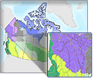
The “Terrestrial Ecozones of Canada” dataset provides representations of ecozones. An ecozone is the top level of the four levels of ecosystems that the National Ecological Framework for Canada defines. The framework divides Canada into 15 terrestrial ecozones that define its ecological mosaic on a sub-continental scale. Ecozones represent an area of the earth’s surface as large and very generalized ecological units. These units are characterized by interactive and adjusting abiotic and biotic factors.
-

The National Ecological Framework for Canada's "Soil Texture by Ecozone” dataset contains tables that provide soil texture information within the ecozone framework polygon. It provides soil texture codes and their English and French language descriptions as well as the percentage of the polygon that the component occupies. Soil texture indicates the relative proportions of the various soil separates (sand, silt, clay) as described by classes of texture. Soil separates are mineral particles, 2.0 mm in diameter and include: gravel 0.2 -7.5 cm and cobbles 7.5-25.0 cm. There are 12 texture group classes definitions and one class definition for Not Applicable (which indicates, for example, water, ice or urban areas).