 Arctic SDI catalogue
Petroleum industry
Type of resources
Available actions
Topics
Keywords
Contact for the resource
Provided by
Formats
Representation types
Update frequencies
status
-

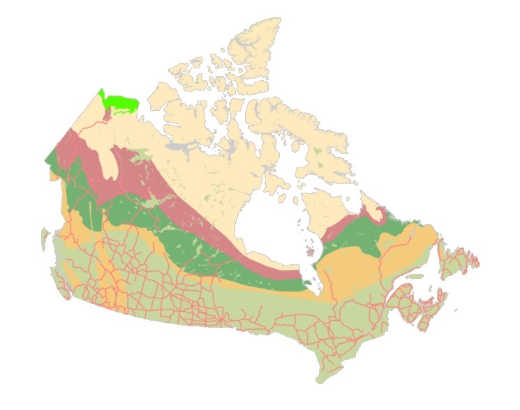
The Environmental Studies Research Fund (ESRF) Regions are legally described in Part I and Part II of the Schedule in the Environmental Studies Research Fund Regions Regulations in the Canada Petroleum Resources Act. This data collection is for illustrative purposes only and includes: • 1 dataset illustrating ESRF prescribed regions 1 to 31 as they are described in the ESRF Regions Regulations. • 1 dataset illustrating the areas where levies are no longer applied to ESRF prescribed regions. These areas include lands that are described in the ESRF Regions Regulations but have since been devolved to the Government of Yukon or the Government of Northwest Territories as part of the 2003 Yukon Devolution and 2014 Northwest Territories Devolution, respectively. Once the Yukon Act and Northwest Territories Act came into effect, lands subject to devolution were no longer considered frontier lands or Canada lands, and therefore no longer subject to ESRF levies under the Canada Petroleum Resources Act. The geospatial extents used in this dataset represent those identified in the Devolution Agreements. Future updates to Part II, section 3 of the Schedule in the ESRF Regions Regulations will reflect the Yukon and Northwest Territories Devolutions. • 3 maps (National, North, South). • 1 table compiling the historical levies for each ESRF prescribed region. Context: The Environmental Studies Research Fund (ESRF) is a research program which sponsors environmental and social studies designed to assist in the decision-making process related to oil and gas exploration and development on Canada's frontier lands. The ESRF is directed by a 12-member Management Board which includes representation from the federal government, the Canada-Newfoundland and Labrador Offshore Petroleum Board (C-NLOPB), the Canada-Nova Scotia Offshore Energy Regulator (CNSOER), the oil and gas industry, and the public. The ESRF is administered by a secretariat which resides in the Offshore Management Division in Natural Resources Canada. Since 1987, the ESRF has received its legislative mandate through the Canada Petroleum Resources Act. The ESRF regions are described in the Environmental Studies Research Fund Regions Regulations. As well, the Canada-Newfoundland and Labrador Atlantic Accord Implementation Act and the Canada–Nova Scotia Offshore Petroleum Resources Accord Implementation and Offshore Renewable Energy Management Act provide legislative direction in the southern ESRF regions. Funding for ESRF is collected annually through levies paid by lease-holding oil and gas companies active in a specific ESRF region. In accordance with the legislation, levies are recommended by the Management Board to the Ministers of Natural Resources and Crown-Indigenous Relations and Northern Affairs for approval. Levies in the southern regions in areas governed by an offshore Accord are subject to final approval by the respective offshore regulator (i.e., the C-NLOPB, or the CNSOER). Levies are calculated by multiplying the levy rate of a region by the number of hectares of land under lease. The ESRF has sponsored studies on biodiversity; environmental effects and monitoring; social and economic issues; ice, icebergs, and ice detection; oil spill research and countermeasures; sea bottom ice scour; sediment transport; Indigenous Knowledge; and waves.
-

This dataset represents the Environmental and Socio-economic Assessments (ESA) submitted to the Canada Energy Regulator (CER). The CER has made this and other ESAs available through an online search tool called BERDI (Biophysical Socio-Economic Regional Data and Information). Data extraction methodology is available on the BERDI website. Pipelines represented in this layer include a start and end point.
-

In August 2025 the Major Projects Office was launched, with the mandate to advance major projects in Canada and streamline federal regulatory project approval. This dataset was created to provide open access to key information about the projects and transformative strategies that have been referred to the Major Projects Office. This dataset can be layered with other data available on the Open Science and Data Platform. By accessing this data, users can conduct more comprehensive analyses to support evidence-based decision-making and inform regulatory processes including future impact assessments. Please visit the Major Projects Office for more information.
-

The assessments layer represents all assessments undertaken under the Impact Assessment Act, including those that continue under the provisions of the Canadian Environmental Assessment Act, 2012. It includes assessments undertaken by the Impact Assessment Agency and other federal authorities as posted on the Canadian Impact Assessment Registry Internet site. The location of a given assessment included in the dataset is approximate and is based on information submitted by proponents, if applicable. More than one location may be identified for a given assessment. This dataset does not include information related to the footprint. Additional information about this dataset is available on the Canadian Impact Assessment Registry Internet site.
-
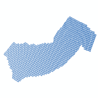
The Beaufort Sea and Mackenzie Delta dataset comes from the Petroleum and Environmental Management Tool (PEMT). The online tool was decommissioned in 2019 and the data was transferred to Open Data in order to preserve it. The PEMT was originally developed in 2009 to help guide development in the Canadian Arctic by Indian and Northern Affairs Canada (INAC). The online tool mapped the sensitivities of a variety of Arctic features, ranging from whales to traditional harvesting, across the Arctic. The tool was intended to aid government, oil and gas companies, Aboriginal groups, resource managers and public stakeholders in better understanding the geographic distribution of areas which are sensitive for environmental and socio-economic reasons. The study area and analytical resolution was defined using the oil and gas leasing grid within the Beaufort Sea. The study area has been the scene of oil and gas exploration activity since 1957. Oil was first discovered at Atkinson Point in 1969 and major gas fields in the early 1970s. Such finds spurred the proposal of the Mackenzie Valley Pipeline in 1974 and the addition of exploration and investment offshore. Exploration and drilling continued both onshore and offshore until the mid-1970s with the release of the Berger Report, which recommended a 10-year moratorium on the construction of the pipeline. After the release of the Berger Report, the pace of onshore activity declined but offshore exploration escalated in the 1980s. Offshore exploration was facilitated with innovative operating techniques and new offshore platforms that extended the ability to operate in the short open-water season and ice. With the minor exception of the small onshore gas field at Ikhil, no oil or gas has been commercially produced in the area. DISCLAIMER: Please refer to the PEMT Disclaimer document or the Resource Constraints - Use Limitation in the Additional Information section below. Note: This is one of the 3 (three) datasets included in the PEMT application which includes the High Arctic and Eastern Arctic datasets.
-
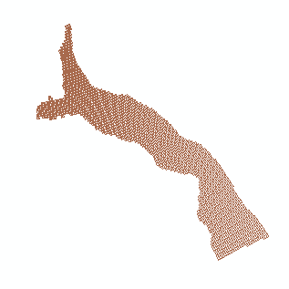
The Eastern Arctic dataset comes from the Petroleum and Environmental Management Tool (PEMT). The online tool was decommissioned in 2019 and the data was transferred to Open Data in order to preserve it. The PEMT was originally developed in 2009 to help guide development in the Canadian Arctic by Indian and Northern Affairs Canada (INAC). The online tool mapped the sensitivities of a variety of Arctic features, ranging from whales to traditional harvesting, across the Arctic. The tool was intended to aid government, oil and gas companies, Aboriginal groups, resource managers and public stakeholders in better understanding the geographic distribution of areas which are sensitive for environmental and socio-economic reasons. The study area is located east of Baffin Island, Nunavut and encompasses marine habitat in Baffin Bay and Davis Strait. The boundaries of the study area are based on NOGB leasing grids applied in the Eastern Arctic, under which exploration and production licenses may be issued. Although portions of the study area hold high oil and gas potential and several small oil fields and substantial reserves of gas have been found since the 1960s in the north Baffin region, exploration for oil and gas has been limited to seismic operations and geological field work. DISCLAIMER: Please refer to the PEMT Disclaimer document or the Resource Constraints - Use Limitation in the Additional Information section below. Note: This is one of the 3 (three) datasets included in the PEMT application which includes the Beaufort Sea and Mackenzie Delta and High Arctic datasets.
-
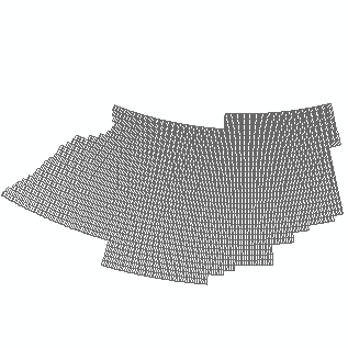
The High Arctic dataset comes from the Petroleum and Environmental Management Tool (PEMT). The online tool was decommissioned in 2019 and the data was transferred to Open Data in order to preserve it. The PEMT was originally developed in 2009 to help guide development in the Canadian Arctic by Indian and Northern Affairs Canada (INAC). The online tool mapped the sensitivities of a variety of Arctic features, ranging from whales to traditional harvesting, across the Arctic. The tool was intended to aid government, oil and gas companies, Aboriginal groups, resource managers and public stakeholders in better understanding the geographic distribution of areas which are sensitive for environmental and socio-economic reasons. The study area is located in the High Arctic Archipelago and contains both marine and terrestrial components. The boundaries of the study area are based on the NOGB leasing grids applied in the High Arctic, under which exploration, significant discovery and production licenses may be issued. The Sverdrup Basin (and Lancaster Sound) has the highest known oil and gas potential of the sedimentary basins of the Arctic Islands (Nunavut Planning Commission 2000) and it is expected that there is oil and gas potential on Melville Island and Bathurst Island (Sivummut Economic Development Strategy Group 2003). To date, no gas has been produced, and 321,470 m³ of oil has been produced from the Bent Horn oil field (Morrell et al. 1995). DISCLAIMER: Please refer to the PEMT Disclaimer document or the Resource Constraints - Use Limitation in the Additional Information section below. Note: This is one of the 3 (three) datasets included in the PEMT application which includes the Beaufort Sea and Mackenzie Delta and Eastern Arctic datasets.
-
The "Starter Kits" of the Canadian Geospatial Data Infrastructure (CGDI) are curated bundles of geospatial data delivered as a service. These kits are the result of a user needs assessment commissioned by Natural Resources Canada (NRCan), with a primary focus on addressing the specific requirements of Indigenous Peoples. Within these kits, you'll discover a selection of data provided as a service from a collection of over 71,000 datasets falling under the "Nature and Environment" category sourced from CGDI's Federal and Provincial/Territorial partners. These Starter Kits have been thoughtfully crafted into four thematic or geographic areas of Canada: a) British Columbia, b) Northwest Territories, c) Climate Change across Canada, d) And Water Resources across Canada. Each of these kits represents diverse areas and data categories, offering new users a compact, comprehensive, and user-friendly gateway to explore a wide array of information provided by the CGDI.