 Arctic SDI catalogue
Protected Areas
Type of resources
Available actions
Topics
Keywords
Contact for the resource
Provided by
Years
Formats
Representation types
Update frequencies
status
Service types
Scale
-
-
-
-
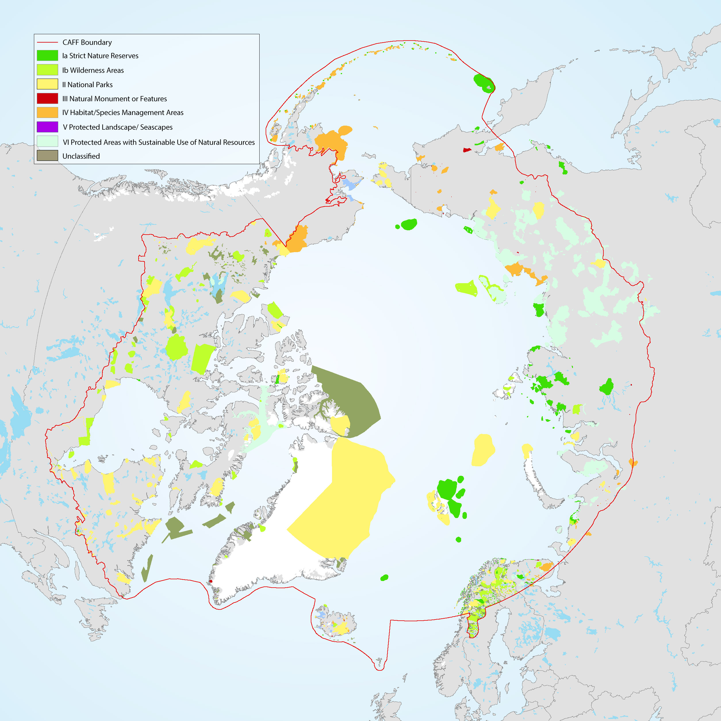
The Conservation of Arctic Flora and Fauna (CAFF) and Protection of the Arctic Marine Environment (PAME) working groups of the Arctic Council developed this update on the 2017 indicator report (CAFF-PAME 2017). It provides an overview of the status and trends of protected areas in the Arctic and an overview of Other Effective area-based Conservation Measures. The data used represents the results of the 2020 update to the Arctic Protected Areas Database submitted by each of the Arctic Council member states.
-

Defines areas protected from harvesting activities by Order-in-Council as per part 13 of the Forest Act.
-
%20-%20datas%C3%A6t.jpg)
The dataset contains polygons representing selected protected and regulated areas in Greenland relevant to mineral activities. The areas include UNESCO World Heritage Sites, nature protection areas, and zones with specific restrictions or prohibitions on mineral activities. The dataset is converted from a WFS service provided by the Ministry of Mineral Resources in Greenland and is used as a geographic reference in the assessment of exploration and exploitation licences. The polygons represent administrative boundaries and do not constitute a legally binding representation of current legislation.
-

The Canadian Protected and Conserved Areas Database (CPCAD) is the authoritative source of data on protected and conserved areas in Canada. The database consists of the most up-to-date spatial and attribute data on marine and terrestrial protected areas in all governance categories recognized by the International Union for Conservation of Nature (IUCN), as well as Other effective area-based conservation measures (OECMs, or conserved areas) across the country. Indigenous Protected and Conserved Areas (IPCAs) are also included if they are recognized as protected or conserved areas. CPCAD adheres to national reporting standards and is freely available to the public. CPCAD is compiled and managed by Environment and Climate Change Canada (ECCC), in collaboration with federal, provincial, territorial, and other reporting authorities that provide the data. The database contains combined data from all these Canadian reporting authorities, who have determined that their areas meet the Canadian criteria as protected or conserved areas. CPCAD is used by a wide range of organizations, including governments, environmental non-governmental organizations (ENGOs), academia, land managers, industry, and the general public. CPCAD supports many of the Government of Canada’s priorities including Canada’s national reporting on protected areas, Canada’s international reporting on protected areas as a result of Canada’s commitments under the United Nations Convention on Biological Diversity, and Canada’s protected areas program by providing baseline information. More detailed information on CPCAD is available by downloading the User Manual. The data is current as of the date of the most recent revision. For prior years, please reach out to scf-geocarto-cws-geomapping@ec.gc.ca.