 Arctic SDI catalogue
Regions
Type of resources
Topics
Keywords
Contact for the resource
Provided by
Years
Formats
Representation types
Update frequencies
status
Service types
-

In 2021, the Canada Coast Guard (CCG) and Fisheries and Oceans Canada updated its administrative boundaries following the creation a new Arctic region. There are now 4 administrative regions in CCG (Western, Arctic, Central and Atlantic). DFO and Coast Guard Arctic Regions developed these regions in partnership with the people they serve; this important decision will lead to stronger programs and services to better meet the unique needs of our Arctic communities. DFO and CCG operations and research cover Canada's land and waters to the international boundaries (EEZ) and are in no way limited to the boundaries drawn in the map.
-
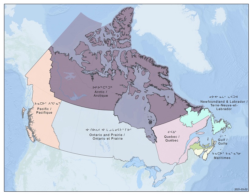
In 2021, the Canada Coast Guard (CCG) and Fisheries and Oceans Canada (DFO) updated its administrative boundaries following the creation a new Arctic region.There are now 7 administrative regions in DFO (Pacific, Arctic, Ontario and Prairie, Quebec, Gulf, Maritimes, Newfoundland and Labrador). DFO and Coast Guard Arctic Regions developed these regions in partnership with the people they serve; this important decision will lead to stronger programs and services to better meet the unique needs of our Arctic communities.DFO and CCG operations and research cover Canada's land and waters to the international boundaries (EEZ) and are in no way limited to the boundaries drawn in the map.
-
The Atlas of Canada Base Maps provide coverage of the entire Canadian landmass. Data elements are feature coded and structurally clean. Base map components are available in five scales and a number of data exchange formats. The 1:2 million and 1:7.5 million scales are the primary bases for all Atlas products. The 1:30 million scale data have been generalized from the two larger scales. The data set covers: drainage (coastlines, rivers, lakes), boundaries (federal, provincial, district, dividing lines), transportation (primary and secondary highways, selected ferry routes, rail networks), populated places, national parks. Atlas information is two-dimensional layered vector data.