 Arctic SDI catalogue
GDB
Type of resources
Available actions
Topics
Keywords
Contact for the resource
Provided by
Years
Formats
Representation types
Update frequencies
status
Scale
Resolution
-
Eelgrass (Zostera marina) is important to waterfowl such as Atlantic Brant (Branta bernicla hrota), Canada Goose (Branta canadensis), American Black Duck (Anas rubripes), Common Goldeneye (Bucephala clangula) and Barrow's Goldeneye (Bucephala islandica). In New Brunswick eelgrass can be found along the Gulf of St. Lawrence, in protected harbours. Within this dataset are the results eelgrass land-cover classifications using either satellite or aerial photography for eight harbours: Bouctouche (46 30’N, 64 39’W); Cocagne (46.37 N, -64.60 W); Miscou (47.90 N, -64.55 W); Neguac (47.25 N, -65.03 W); Richibucto (46.70 N, -64.80 W); Saint-Simon (47.77 N, -64.76 W); Tabusintac (47.33 N, -64.93 W); and Tracadie (47.55 N, -64.88 W). Information on each dataset is provided: Visible orthorectified aerial photography was used to classify polygons containing eelgrass in Cocagne Harbour. Field data for image training and validation were collected along transects in summer 2008 using a dGPS positioned towfish holding sidescan sonar and a video camera that was later transcribed as XY geographic points to describe eelgrass presence and a qualitative description of density. The area was flown for photography on September 24, 2008. eCognition Developer 8 software was used to segment the imagery, essentially polygons. Polygons were then classified manually for the presence of eelgrass. Using field data revealed eelgrass presence to be mapped correctly 87.2% of the time.
-
Corine Land Cover Change 2006-2012 (CHA0612) is one of the Corine Land Cover (CLC) datasets produced within the frame the Copernicus Land Monitoring Service referring to changes in land cover / land use status between the years 2006 and 2012. CHA is derived from satellite imagery by direct mapping of changes taken place between two consecutive inventories, based on image-to-image comparison. CLC service has a long-time heritage (formerly known as "CORINE Land Cover Programme"), coordinated by the European Environment Agency (EEA). It provides consistent and thematically detailed information on land cover and land cover changes across Europe. CLC datasets are based on the classification of satellite images produced by the national teams of the participating countries - the EEA members and cooperating countries (EEA39). National CLC inventories are then further integrated into a seamless land cover map of Europe. The resulting European database relies on standard methodology and nomenclature with following base parameters: 44 classes in the hierarchical 3-level CLC nomenclature; minimum mapping unit (MMU) for status layers is 25 hectares; minimum width of linear elements is 100 metres. Change layers have higher resolution, i.e. minimum mapping unit (MMU) is 5 hectares for Land Cover Changes (CHA), and the minimum width of linear elements is 100 metres. The CLC service delivers important data sets supporting the implementation of key priority areas of the Environment Action Programmes of the European Union as e.g. protecting ecosystems, halting the loss of biological diversity, tracking the impacts of climate change, monitoring urban land take, assessing developments in agriculture or dealing with water resources directives. part of the European Copernicus Programme coordinated by the European Environment Agency, providing environmental information from a combination of air- and space-based observation systems and in-situ monitoring.
-
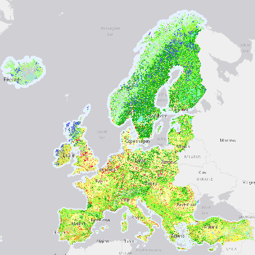
Corine Land Cover 2006 (CLC2006) is one of the Corine Land Cover (CLC) datasets produced within the frame the Copernicus Land Monitoring Service referring to land cover / land use status of year 2006. CLC service has a long-time heritage (formerly known as "CORINE Land Cover Programme"), coordinated by the European Environment Agency (EEA). It provides consistent and thematically detailed information on land cover and land cover changes across Europe. CLC datasets are based on the classification of satellite images produced by the national teams of the participating countries - the EEA members and cooperating countries (EEA39). National CLC inventories are then further integrated into a seamless land cover map of Europe. The resulting European database relies on standard methodology and nomenclature with following base parameters: 44 classes in the hierarchical 3-level CLC nomenclature; minimum mapping unit (MMU) for status layers is 25 hectares; minimum width of linear elements is 100 metres. Change layers have higher resolution, i.e. minimum mapping unit (MMU) is 5 hectares for Land Cover Changes (LCC), and the minimum width of linear elements is 100 metres. The CLC service delivers important data sets supporting the implementation of key priority areas of the Environment Action Programmes of the European Union as e.g. protecting ecosystems, halting the loss of biological diversity, tracking the impacts of climate change, monitoring urban land take, assessing developments in agriculture or dealing with water resources directives. part of the European Copernicus Programme coordinated by the European Environment Agency, providing environmental information from a combination of air- and space-based observation systems and in-situ monitoring.
-

Corine Land Cover Change 2000-2006 (CHA0006) is one of the Corine Land Cover (CLC) datasets produced within the frame the Copernicus Land Monitoring Service referring to changes in land cover / land use status between the years 2000 and 2006. CHA is derived from satellite imagery by direct mapping of changes taken place between two consecutive inventories, based on image-to-image comparison. CLC service has a long-time heritage (formerly known as "CORINE Land Cover Programme"), coordinated by the European Environment Agency (EEA). It provides consistent and thematically detailed information on land cover and land cover changes across Europe. CLC datasets are based on the classification of satellite images produced by the national teams of the participating countries - the EEA members and cooperating countries (EEA39). National CLC inventories are then further integrated into a seamless land cover map of Europe. The resulting European database relies on standard methodology and nomenclature with following base parameters: 44 classes in the hierarchical 3-level CLC nomenclature; minimum mapping unit (MMU) for status layers is 25 hectares; minimum width of linear elements is 100 metres. Change layers have higher resolution, i.e. minimum mapping unit (MMU) is 5 hectares for Land Cover Changes (CHA), and the minimum width of linear elements is 100 metres. The CLC service delivers important data sets supporting the implementation of key priority areas of the Environment Action Programmes of the European Union as e.g. protecting ecosystems, halting the loss of biological diversity, tracking the impacts of climate change, monitoring urban land take, assessing developments in agriculture or dealing with water resources directives. part of the European Copernicus Programme coordinated by the European Environment Agency, providing environmental information from a combination of air- and space-based observation systems and in-situ monitoring.
-
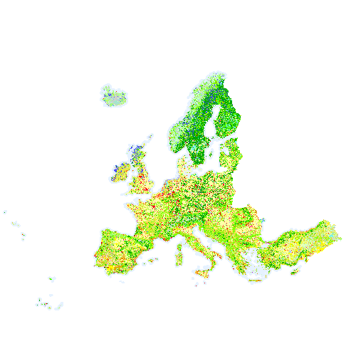
Corine Land Cover 2018 (CLC2018) is one of the Corine Land Cover (CLC) datasets produced within the frame the Copernicus Land Monitoring Service referring to land cover / land use status of year 2018. CLC service has a long-time heritage (formerly known as "CORINE Land Cover Programme"), coordinated by the European Environment Agency (EEA). It provides consistent and thematically detailed information on land cover and land cover changes across Europe. CLC datasets are based on the classification of satellite images produced by the national teams of the participating countries - the EEA members and cooperating countries (EEA39). National CLC inventories are then further integrated into a seamless land cover map of Europe. The resulting European database relies on standard methodology and nomenclature with following base parameters: 44 classes in the hierarchical 3-level CLC nomenclature; minimum mapping unit (MMU) for status layers is 25 hectares; minimum width of linear elements is 100 metres. Change layers have higher resolution, i.e. minimum mapping unit (MMU) is 5 hectares for Land Cover Changes (LCC), and the minimum width of linear elements is 100 metres. The CLC service delivers important data sets supporting the implementation of key priority areas of the Environment Action Programmes of the European Union as e.g. protecting ecosystems, halting the loss of biological diversity, tracking the impacts of climate change, monitoring urban land take, assessing developments in agriculture or dealing with water resources directives. part of the European Copernicus Programme coordinated by the European Environment Agency, providing environmental information from a combination of air- and space-based observation systems and in-situ monitoring.
-
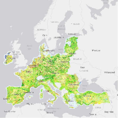
Corine Land Cover 1990 (CLC1990) is one of the Corine Land Cover (CLC) datasets produced within the frame the Copernicus Land Monitoring Service referring to land cover / land use status of year 1990. CLC service has a long-time heritage (formerly known as "CORINE Land Cover Programme"), coordinated by the European Environment Agency (EEA). It provides consistent and thematically detailed information on land cover and land cover changes across Europe. CLC datasets are based on the classification of satellite images produced by the national teams of the participating countries - the EEA members and cooperating countries (EEA39). National CLC inventories are then further integrated into a seamless land cover map of Europe. The resulting European database relies on standard methodology and nomenclature with following base parameters: 44 classes in the hierarchical 3-level CLC nomenclature; minimum mapping unit (MMU) for status layers is 25 hectares; minimum width of linear elements is 100 metres. Change layers have higher resolution, i.e. minimum mapping unit (MMU) is 5 hectares for Land Cover Changes (LCC), and the minimum width of linear elements is 100 metres. The CLC service delivers important data sets supporting the implementation of key priority areas of the Environment Action Programmes of the European Union as e.g. protecting ecosystems, halting the loss of biological diversity, tracking the impacts of climate change, monitoring urban land take, assessing developments in agriculture or dealing with water resources directives. part of the European Copernicus Programme coordinated by the European Environment Agency, providing environmental information from a combination of air- and space-based observation systems and in-situ monitoring.
-
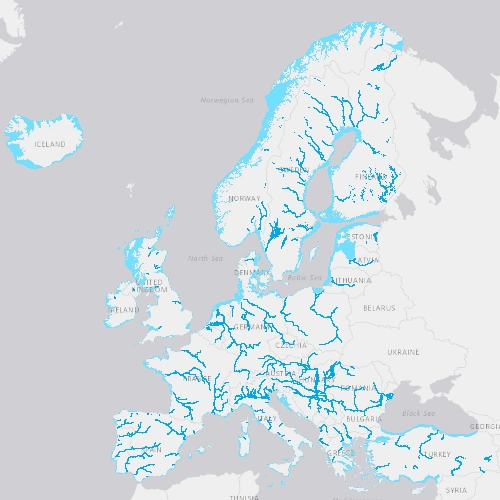
EU-Hydro is a dataset for all EEA38 countries and the United Kingdom providing photo-interpreted river network, consistent of surface interpretation of water bodies (lakes and wide rivers), and a drainage model (also called Drainage Network), derived from EU-DEM, with catchments and drainage lines and nodes. The EU-Hydro dataset is distributed in separate files (river network and drainage network) for each of the 35 major basins of the EEA38 + UK area, in GDB and GPKG formats. The production of EU-Hydro and the derived layers was coordinated by the European Environment Agency in the frame of the EU Copernicus programme.
-

This metadata refers to CLMS N2K 2006 product, the Copernicus Land Cover/Land Use (LC/LU) status map, with 2006 as reference year for the classification, tailored to the needs of biodiversity monitoring in selected Natura2000 sites: 4790 sites of natural and semi-natural grassland formations listed in Annex I of the Habitats Directive, including a 2 km buffer zone surrounding the sites and covering an area of 631.820 km² across Europe (EU27, the United Kingdom and Switzerland). The product includes three Emerald sites in Switzerland. LC/LU has been extracted from VHR satellite data and other available data. This metadata specifically refers to the revision of the 2006 N2K status map carried out during the production of the 2018 update. The production of N2K updates was coordinated by the European Environment Agency (EEA) in the frame of the EU Copernicus programme.
-
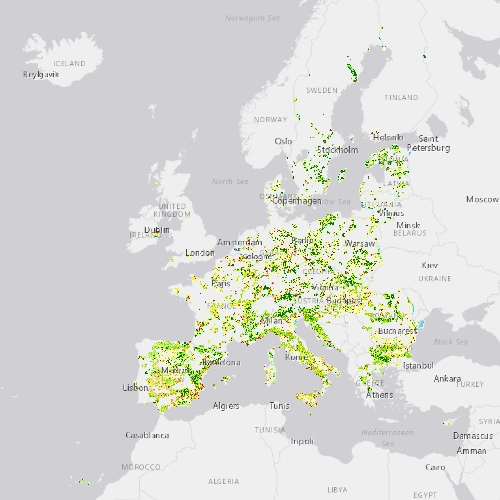
This metadata refers to CLMS N2K 2018 product, the Copernicus Land Cover/Land Use (LC/LU) status map, with 2018 as reference year for the classification, tailored to the needs of biodiversity monitoring in selected Natura2000 sites: 4790 sites of natural and semi-natural grassland formations listed in Annex I of the Habitats Directive, including a 2 km buffer zone surrounding the sites and covering an area of 631.820 km² across Europe (EU27, the United Kingdom and Switzerland). The product includes three Emerald sites in Switzerland. LC/LU has been extracted from VHR satellite data and other available data. The production of N2K updates was coordinated by the European Environment Agency (EEA) in the frame of the EU Copernicus programme.
-
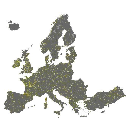
The HRL Small Woody Features (SWF) is a new Copernicus Land Monitoring Service (CMLS) product, which provides harmonized information on linear structures such as hedgerows, as well as patches (200 m² ≤ area ≤ 5000 m²) of woody features across the EEA39 countries. Small woody landscape features are important vectors of biodiversity and provide information on fragmentation of habitats with a direct potential for restoration while also providing a link to hazard protection and green infrastructure, amongst others. The SWF layer contains woody linear, and small patchy elements, but is not differentiated into trees, hedges, bushes and scrub. The spatial pattern are limited to linear structures and isolated patches (patchy structures) on the basis of geometric characteristics. Additional Woody Features (AWF) are also included in this product. They consist of woody structures that do not fulfil the SWF geometric specifications but which are connected to valid SWFs structures. VHR imagery (DEIMOS-2, Pleiades 1A, Pleiades 1B, GeoEye-1, SPOT 6, SPOT 7, WorldView-2, WorldView-3 images from 2015) made available in the ESA Copernicus DWH are the main data source for the detection of small woody features identifiable within the given image resolution. The dataset is available for the 2015 reference year and is produced in three different formats. This metadata corresponds to the SWF vector layer, which separates the SWF class into Linear (code = 1) and Patchy (code = 2). Additional Woody Features are represented with code = 3. This is the primary product of the Small Woody Features mapping, and thus also the one with most detail. The vector data set can be downloaded in Geodatabase and Geopackage formats.