 Arctic SDI catalogue
Baffin Bay
Type of resources
Available actions
Topics
Keywords
Contact for the resource
Provided by
Years
Formats
Representation types
Update frequencies
status
Service types
-
%20density%20along%20a%20latitudinal%20gradient%20of%20sea-ice%20conditions.jpg)
PURPOSE: Ringed seals (Pusa hispida) rely on sea ice as habitat throughout their life history and inhabit a broad latitudinal range with diverse sea-ice conditions. Anthropogenic climate warming is triggering poleward species redistributions, highlighting the importance of understanding how species distributions and abundance vary along latitudinal gradients. Using ringed seals as a model species, the purpose was to estimate density via aerial surveys along a latitudinal gradient in the eastern Canadian Arctic to investigate latitudinal trends in the ringed seals response to regional variation in sea-ice conditions. DESCRIPTION: Ringed seals (Pusa hispida) rely on sea ice as habitat throughout their life history and inhabit a broad latitudinal range with diverse sea-ice conditions, making them a model species to study patterns in density along a spatial-environmental gradient. We estimated the density of ringed seals from systematic aerial surveys along a latitudinal gradient in the eastern Canadian Arctic to investigate latitudinal trends in the ringed seals response to regional variation in sea-ice conditions. Ringed seals exhibited similar densities at lower and intermediate latitudes, while higher latitudes displayed an order of magnitude lower ringed seal density. This shift is concurrent with the transition in ice conditions from predominantly first-year ice at lower latitudes to primarily multiyear ice at higher latitudes. These findings indicate that the variation in icescapes across the ringed seal’s vast range influences their density. The shift in sea-ice conditions may also have consequences for biological productivity that supports their diet. Our results highlight a likely non-uniform response of ringed seals to ongoing sea-ice recession across the Arctic.
-

PURPOSE: The focus of this research is on changes in the distribution of killer whales in the Canadian Arctic, which is within the field of marine biogeography and marine megafauna. Our research details change in killer whale presence and ties it to changes in sea ice coverage. These are novel results, presenting trends in the arrival and departure dates of killer whales into the eastern Canadian Arctic for the first time. We go on to discuss the impacts of these changes on other aspects of Arctic ecosystems and how increasing in killer whale presence might affect other species and the management of those species in Canada. Killer whales are a widespread species of interest, especially in the Canadian Arctic as their presence is tied to multiple aspects of a region rapidly changing from the effects of climate change. DESCRIPTION: This study examines 20 years of killer whale (Orcinus orca) sightings in the eastern Canadian Arctic, drawing from a comprehensive sighting database spanning 1850-2023. Despite inherent biases favoring data collection near communities and coastal areas, spatiotemporal analyses reveal significant shifts in killer whale distribution linked to changing sea ice conditions. We developed a clustering metric representing the mean distance to the five nearest sightings and results show that killer whales are progressively moving away from historically high-use areas and that sighting locations are becoming more dispersed over time. A significant year × sea ice interaction indicates observations occur earlier during their arrival period at lower sea ice concentrations over time, suggesting that declining sea ice concentration contributes to earlier arrival. Conversely, for departure periods, killer whales are observed farther south later in the year, likely linked to earlier freeze-up at higher latitudes, and are overall observed later into the year over time. This trend has led to a near doubling of their average presence from 26 days in 2002 to 48 days in 2023 (27 July to 13 September) reflecting an extended open-water season. These findings underscore the prolonged seasonal use of Arctic regions by killer whales, driven by diminishing sea ice and expanding openwater habitat. Such shifts highlight potential implications for Arctic marine ecosystems as killer whales increasingly overlap with endemic species.
-

Fisheries and Oceans Canada and Environment and Climate Change Canada (Northern Contaminants program) have been working with Nunavut community Hunters and Trappers Organizations and the Nunavut Wildlife Management Board consistently since 1980 to collect samples from harvested ringed seals. The majority of seals were measured in the field by Inuit hunters who recorded date of kill, sex and blubber depth at sternum (0.5 cm). The data from the harvested animals are used to evaluate stressors and overall seal health, in the Canadian Arctic.
-
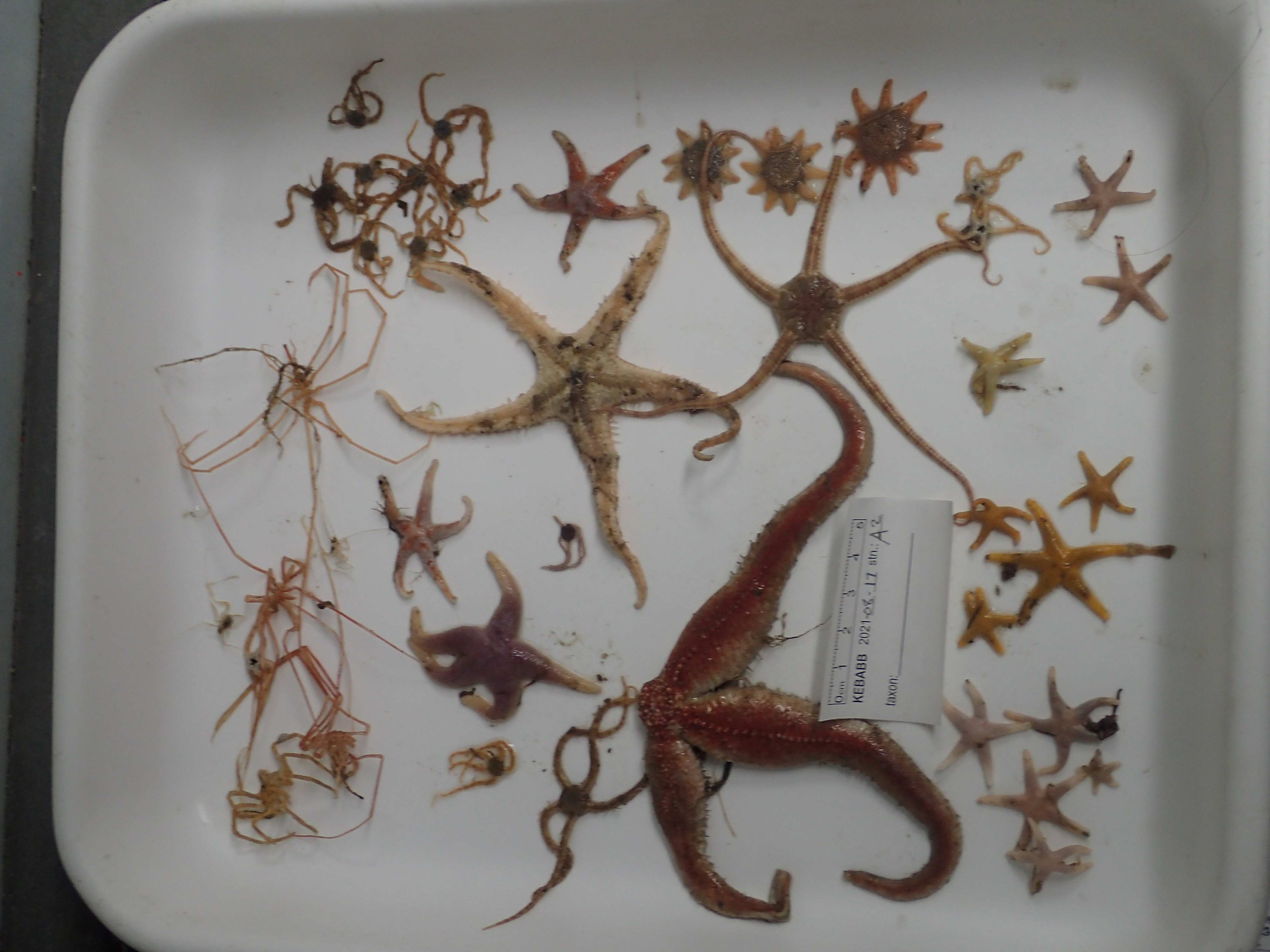
This resource documents a dataset of epifauna occurrences collected in 2021 during The Knowledge and Ecosystem-Based Approach in Baffin Bay (KEBABB) program developed by the Department of Fisheries and Oceans Canada (DFO) in collaboration with university partners. The overall objective of KEBABB is to characterize the variability and trends in physical, chemical, and biological oceanographic conditions and food webs supporting fisheries in the connected ecosystems of western Baffin Bay and Lancaster Sound. In 2021, DFO expanded the KEBABB program to Barrow Strait (KEBABS-Knowledge and Ecosystem-Based Approach in Barrow Strait), a key productive area of the Tallurutiup Imanga National Marine Conservation Area. The study took place in the Eastern Canadian Arctic (mainly in Baffin Bay, Davis Strait and Barrow Strait). Sampling is done along transects at fixed stations in the study area. Catches are collected with a 1.5 m Agassiz trawl (5 mm mesh net) for 3 minutes bottom-contact time at a target speed of 1.5 knots and with a 3 m benthic beam trawl (6.4 mm mesh net) for 15 minutes bottom-contact time at a target speed of 3 knots. A total of 16 stations were sampled for epifauna in 2021 between 85-850 m depth. Epibenthic invertebrates are identified to the lowest possible taxonomic level and photographed. All unknown specimens are frozen. In the lab, the identifications are validated or refined with the photos and the frozen specimens. The data are presented in Darwin Core and are separated in two files: The “Activité_épifaune_KEBABB_epifauna_event_en” file which contains information about missions, stations and deployments, which are presented under a hierarchical activity structure. The “Occurrence_épifaune_KEBABB_epifauna_en” file that contains the taxonomic occurrences. Further details on sampling can be found in the following report: Pućko, M., Charette, J., Tremblay P., Brulotte S., St-Denis B., Ciastek S., Hedges, K., Kuzyk, Z., Roy V., and Michel, C. 2022. An ecosystem-based approach in the eastern Arctic: KEBABB/S (Knowledge and Ecosystem-Based Approach in Baffin Bay/Barrow Strait) 2021 expedition report. Can. Manuscr. Rep. Fish. Aquat. Sci. 3250: viii + 58 p. https://publications.gc.ca/collections/collection_2022/mpo-dfo/Fs97-4-3250-eng.pdf USE LIMITATION: To ensure scientific integrity and appropriate use of the data, we would encourage you to contact the data custodian.
-

This layer represents important areas for the Harp seal (Pagophilus groenlandicus). It includes the three main pupping areas for this species and migratory pathways used by Harp seals to migrate between its summering (Baffin Bay) and wintering (Gulf of St. Lawrence and Newfoundland and Labrador coasts) areas. Note that this dataset do not represent the Harp seal distribution. Reference: DFO. 2020. 2019 Status of Northwest Atlantic Harp Seals, Pagophilus groenlandicus. DFO Can. Sci. Advis. Sec. Sci. Advis. Rep. 2020/020.
-
In September 2009, a ship-based study was carried out in the Davis Strait/southern Baffin Bay along a range of transects covering the area between the west coast of Greenland and Baffin Island (Canada) from 68-72º N . Water temperature, salinity and in situ chlorophyll a (chl. a) measured in 0-500 m depths followed the general hydrographical characteristics of the late summer situation. Surface chl. a concentration based on remote sensing satellite data from September 2009 supported these findings. Measurement of in situ chl. a concentrations revealed a maximum in the subsurface (30-50 m water depths). Thus, spatial distribution of the phytoplankton bloom was often restricted to subsurface rather than the surface waters and therefore not detected by the remote sensing during September.
-

This layer represents the Harp seal (Pagophilus groenlandicus) distribution. During the summer, the Harp seal is in Arctic and it migrates south of its distribution range during the fall. It migrates back to the Arctic after the moulting period which occurs in April and May. Reference: DFO. 2020. 2019 Status of Northwest Atlantic Harp Seals, Pagophilus groenlandicus. DFO Can. Sci. Advis. Sec. Sci. Advis. Rep. 2020/020.
-
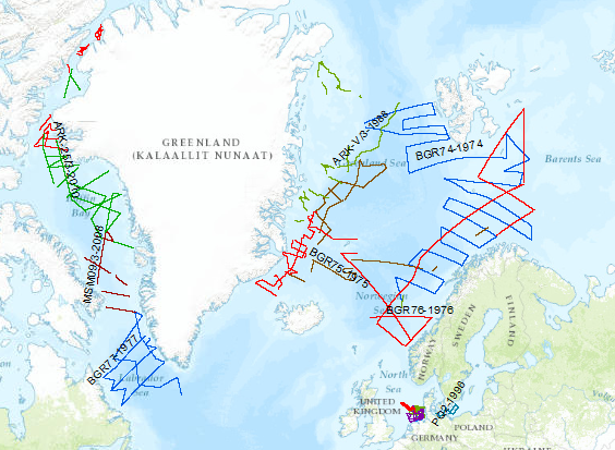
During the period from 1974 to 2010 various cruises from BGR acquired seismic lines worldwide. The aim of these marine expeditions was a detailed survey of the geological structure.
-

An exploratory project on the taxonomic and genetic diversity of decapods in three ocean subregions (Northeast Pacific, Canadian Arctic, and Northwest Atlantic), which were sampled in 2022, was undertaken by the Arctic Working Group under the Canada-U.S. Fisheries and Climate Collaboration between Fisheries and Oceans Canada (DFO) and the National Marine Fisheries Service (NMFS) of the National Oceanic and Atmospheric Administration (NOAA). This collaboration framework aims to pool Canadian and U.S. data to explore the impacts of broad-scale climate change on marine biodiversity. In early summer 2022, a sampling protocol with the selection of targeted decapods was provided to DFO and NOAA collaborators. Targeted genera were collected from a total of 10 research programs across three ocean subregions and four marine regions. The Northeast Pacific samples were collected in the Bering Sea during the Northern Bering Sea Ecosystem and Surface Trawl Survey, and the Eastern and Northern Bering Sea Continental Shelf Bottom Trawl Survey of Groundfish and Invertebrate Fauna onboard the F/V Northwest Explorer, F/V Alaska Knight and F/V Vesteraalen. In the Western Canadian Arctic (mainly from Beaufort Sea and Amundsen Gulf), specimens were collected during DFO’s Canadian Beaufort Sea – Marine Ecosystem Assessment (CBS-MEA) survey onboard the F/V Frosti. In Eastern Canadian Arctic (mainly from Baffin Bay and Davis Strait), specimens were collected during DFO’s Knowledge and Ecosystem-Based Approach in Baffin Bay (KEBABB) survey onboard the CCGS Amundsen and DFO’s North Atlantic Fisheries Organization (NAFO) Subarea 0B survey onboard the R/V Tarajoq. In the Estuary and Gulf of St. Lawrence (EGSL), specimens were collected from coastal surveys (scallops, sea cucumber, snow crab, and whelk surveys) onboard the CCGS Leim and offshore during the Ecosystemic Survey onboard the CCGS Teleost. Decapods were collected from various sampling gears (benthic beam trawl, modified Atlantic Western IIA otter trawl, Bacalao trawl, shrimp trawl, Digby scallop dredge, or modified sea cucumber dredge) and identified to the lowest possible taxonomic level and photographed, when possible. All specimens were frozen at sea (n = 995). In the lab, the identifications were validated or refined with the photos and the frozen specimens. DNA was extracted for 87 specimens and a section of COI gene was amplified in order to be sequenced using Sanger method. Sequences were compared with existing data using The Basic Local Alignment Search Tool (BLAST) in the National Center for Bio-technology Information Nucleotide database (NCBI-nt, including the GenBank database) to compare scientific names, where available. The present dataset includes 391 decapod species occurrences. DNA was extracted for a subset of 87 specimens (COI gene); sequences are publicly available on BOLD data portal under project code DDAO (see supporting document "citations_references.csv" for more information). The data are presented in Darwin Core format and are separated in three files: The "Activité_décapodes_DDAO_decapods_event_en" file contains information about missions, stations and deployments, which are presented under a hierarchical activity structure. The "Occurrence_décapodes_DDAO_decapods_en" file contains the taxonomic occurrences. The "ADN_décapodes_DDAO_decapods_DNA_en" file contains the DNA derived data. For further details, please refer to the technical report available in the supporting document named "citations_references.csv". USE LIMITATION: To ensure scientific integrity and appropriate use of the data, we would encourage you to contact the data custodian.