 Arctic SDI catalogue
Topographie
Type of resources
Available actions
Keywords
Contact for the resource
Provided by
Years
Formats
Representation types
Update frequencies
status
Service types
Scale
-
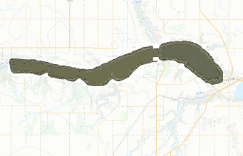
The’ Qu'Appelle Valley Lakes system – Topography and Imagery’ series consists of topographic and imagery data for lakes within the Qu'Appelle River Valley in central Saskatchewan. This data was collected in the fall of 2008 and consists of contour lines, shorelines, spot heights, tile index, and imagery
-
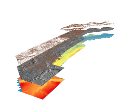
One meter hillshade generated from full feature DEM. LiDAR Services International (LSI), a Calgary-based LiDAR company completed an airborne LiDAR survey for the Redberry Lake Biosphere Reserve (RLBR) and Agriculture and Agri-Foods Canada (AAFC) in October 2011. The project involved collection of LiDAR data for a 362.97 km2 block area, 252.77 km2 for Redberry Lake and 110.20 km2 for AAFC northwest of Saskatoon, SK.
-

One meter digital elevation model generated from LiDAR point files. LiDAR Services International (LSI), a Calgary-based LiDAR company completed an airborne LiDAR survey for the Redberry Lake Biosphere Reserve (RLBR) and Agriculture and Agri-Foods Canada (AAFC) in October 2011. The project involved collection of LiDAR data for a 362.97 km2 block area, 252.77 km2 for Redberry Lake and 110.20 km2 for AAFC northwest of Saskatoon, SK.
-

One meter hillshade generated from bare earth DEM. LiDAR Services International (LSI), a Calgary-based LiDAR company completed an airborne LiDAR survey for the Redberry Lake Biosphere Reserve (RLBR) and Agriculture and Agri-Foods Canada (AAFC) in October 2011. The project involved collection of LiDAR data for a 362.97 km2 block area, 252.77 km2 for Redberry Lake and 110.20 km2 for AAFC northwest of Saskatoon, SK.
-

Digital Elevation Model (DEM) created from LiDAR data captured by McElhanney Consulting Services Ltd (MCSL). The DEM represent s the elevation of the landscape covered by this project.
-

Hillshade created from the Swift Current LiDAR Project 2009 – DEM. The hillshade provides a 3 D effect for the landscape covered by this project.
-
LiDAR data collected in the fall of 2011 and spring 2012 for AAFC owned water control structures in the Pheasant Creek, Roughbark, Moosomin,Braddock, Maple Creek, Eastend, Altawan, Admiral, Russell Creek, Cadillac-Gouveneur, Cypress, Middle Creek and Lafleche areas.
-

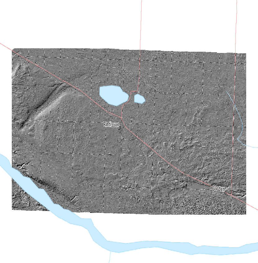
The Agriculture and Agri-Food Canada’s LiDAR Projects dataset was created from existing spatial data. It contains the footprints (outlines) of all the LiDAR data that is openly distributed by Agriculture and Agri-Food Canada. LiDAR (Light Detection And Ranging) is a method of acquiring survey points using optical remote sensing technology. The dataset indicates basic information about the location, source and properties of the data.
-

One meter digital elevation model generated from bare earth LiDAR points. LiDAR Services International (LSI), a Calgary-based LiDAR company completed an airborne LiDAR survey for the Redberry Lake Biosphere Reserve (RLBR) and Agriculture and Agri-Foods Canada (AAFC) in October 2011. The project involved collection of LiDAR data for a 362.97 km2 block area, 252.77 km2 for Redberry Lake and 110.20 km2 for AAFC northwest of Saskatoon, SK.
-

The AAFC Infrastructure Flood Mapping in Saskatchewan 1 meter Full Feature DEM are the full feature DEMs created at a 1 m interval for the capture area of Saskatchewan. The full feature grid point elevations were derived from the highest point in the High Vegetation class. At coordinates with no High Vegetation points the elevation of the corresponding bare earth grid point was applied.