 Arctic SDI catalogue
Hydrographie
Type of resources
Available actions
Keywords
Contact for the resource
Provided by
Years
Formats
Representation types
Update frequencies
status
Service types
Scale
-

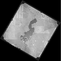
50 cm Aerial photography for the Pasqua, Crooked, Echo, and Round Lakes within the Qu'Appelle Valley River system in Saskatchewan
-
Series of Panchromatic orthophotos for 4 reservoir areas, Duncairn, LaFleche, Moosomin, Gouverneur taken in 2005. The photos were meant to coincide at a time when the reservoirs where at high flood supply levels (FSL).
-
Des données topographiques portant sur les lacs de la vallée de la rivière Qu'Appelle, dans le centre de la Saskatchewan. Ces données ont été recueillies à l'automne 2008 et comprennent les courbes de niveau, les lignes de rivage, les cotes altimétriques, et l'index des pavés. Pour plus d'information, consulter : http://ouvert.canada.ca/data/fr/dataset/d838afd0-8918-42e1-acdd-8c69f9b5a7e1
-

Mapping of watersheds in the territory of Quebec City.**This third party metadata element was translated using an automated translation tool (Amazon Translate).**
-
Weekly and monthly sea surface temperature of the North Sea and the Baltic Sea.
-

Flight lines for the Pasqua, Crooked, Echo, and Round Lakes area within the Qu'Appelle Valley River system in Saskatchewan
-
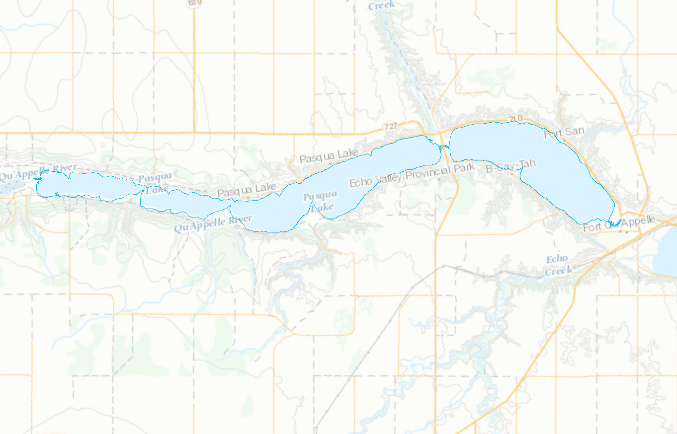
Shorelines for the Pasqua, Crooked, Echo, and Round Lakes within the Qu'Appelle Valley River system in Saskatchewan
-
**CHS NONNA data has been updated: April 1, 2026** The Canadian Hydrographic Service (CHS) offers a complete inventory of bathymetric data free to the general public for non-navigational use called 'CHS NONNA' for the 'NON-NAvigational' purpose of the data. The product is available in a spatial resolution of 10 metres or 100 metres. To directly access the CHS NONNA Data Portal please follow this link - https://data.chs-shc.ca/login (Note: The data portal is NOT compatible with Internet Explorer browser). Terms of Use The Canadian Hydrographic Service (CHS) NONNA Data products are for NON-NAVIGATIONAL USE ONLY. Please see the Open Data Licence below and the CHS NONNA LICENCE viewable on https://data.chs-shc.ca/login and downloadable with the NONNA data, for the full terms and conditions governing the use of this data. ----- PRODUCT DESCRIPTION ----- The CHS NONNA-10 NONNA-100 and NONNA Package Bathymetric Data products represent a consolidation of digital bathymetric sources managed by the CHS in Canadian jurisdiction. The « NONNA » refers to NON-NAvigational. The « 10 » or « 100 » references the approximate resolution (in metres) of the data. NONNA Packages A NONNA Package is a ZIP file containing a collection of NONNAP datasets to ease the download of large amounts of high resolution data. Packages are currently available for data sources of approximately 10 metre resolution. The «P10 » refers to the Packages and approximate resolution (in metres) of the data. The CHS NONNA-10 individual product coverage (resolution) is as follows: - South of 68°N the products = 0.1° latitude X 0.1° longitude (0.0001 degrees) - 68°N-80°N the products = 0.1° latitude X 0.2° longitude (0.0002 degrees) - 80°N and north the products = 0.1° latitude X 0.4° longitude (0.0004 degrees) The CHS NONNA-100 individual product coverage (resolution) is as follows: - South of 68°N the products = 1° latitude X 1° longitude (0.001 degrees) - 68°N-80°N the products = 1° latitude X 2° longitude (0.002 degrees) - 80°N and north the products = 1° latitude X 4° longitude (0.004 degrees) The CHS NONNA-P10 Packages are ZIP files that contain product coverage (resolution) defined as: - South of 68°N the products = 1° latitude X 1° longitude (0.0001 degrees) - 68°N-80°N the products = 1° latitude X 2° longitude (0.0002 degrees) - 80°N and north the products = 1° latitude X 4° longitude (0.0004 degrees) ----- DATUM ----- All CHS NONNA data sources are horizontally referenced to the World Geodetic System 1984 (WGS84) ESPG:4326 and vertically referenced to Chart Datum (CD), a tidal or water level datum that is locally derived and, of which, the depth of water should seldom fall below. For more information on vertical references visit: https://tides.gc.ca/en/vertical-datum-chart-references ----- DATA PRESENTATION ----- CHS NONNA products adhere to the following naming convention: NONNAXXX_SouthwestCorner Example: NONNAP10_4360N07940W - NONNAP10 = the product NONNAP10 - 4360N07940W = the southwest corner of the NONNA cell. These products are available to view, query and download via the CHS NONNA Data Portal. The following formats are available for download: - 32-bit GeoTIFF - ASCII++ (XYZ) - CSAR - BAG These formats can be opened using various GIS applications. Alternatively, the CHS NONNA products can be accessed via Web Map Service (WMS), Web Coverage Service (WCS) or Web Map Tile Service (WMTS) links: - WMS https://nonna-geoserver.data.chs-shc.ca/geoserver/wms?request=GetCapabilities - WMTS https://nonna-geoserver.data.chs-shc.ca/geoserver/gwc/service/wmts?request=GetCapabilities - WCS https://nonna-geoserver.data.chs-shc.ca/geoserver/wcs?request=GetCapabilities **Note** Gaps in the data may be visible where modern surveys have not yet been conducted, the data is not updated to Chart Datum (CD) or where legacy data has not yet been digitized. In addition, there may be data sources removed from the Data Portal for further processing in the CHS’ Bathymetric Database, and will not be available until such work is complete. Data sources included in the NONNA products may not have been subjected to the same level of quality assurance as those in official navigational products. **Help** New users of the CHS NONNA Data Portal are encouraged to fully review the 'CHS NONNA Data Portal Guidance Document' (PDF) which is available below in the RESOURCES section of this page.
-

Contour Lines for the Pasqua, Crooked, Echo, and Round Lakes within the Qu’Appelle Valley river system in Saskatchewan