 Arctic SDI catalogue
tunnel
Type of resources
Available actions
Topics
Keywords
Contact for the resource
Provided by
Years
Formats
Representation types
Update frequencies
status
Service types
Resolution
-

Part of the Nova Scotia Topographic Database (NSTDB), the roads and railroads theme layer is updated and maintained from aerial photography and collected in the field with mobile GPS, Field inspections verify road way types such as surface and number of lanes. Road feature codes and their descriptions are provided with the download in a NSTDB feature code table. Data download also available via GeoNova: https://nsgi.novascotia.ca/WSF_DDS/DDS.svc/DownloadFile?tkey=fhrTtdnDvfytwLz6&id=15 Map service view also available via GeoNova: https://nsgiwa.novascotia.ca/arcgis/rest/services/BASE/BASE_NSTDB_10k_Roads_UT83/MapServer?f=jsapi
-

Montreal manages a fleet of road structures for which the City is partially or completely responsible for their inspections. The set presents the inventory of road structures on the territory, including also the general condition index (ICG). Road structures include bridges, footbridges, noise barriers, tunnels, retaining walls, snow docks, and culverts. WARNING: This data is published to provide a better understanding of the City's assets, but should under no circumstances be used for engineering calculations.**This third party metadata element was translated using an automated translation tool (Amazon Translate).**
-
Part of the Nova Scotia Topographic Database (NSTDB), the roads and railroads theme layer is updated and maintained from aerial photography and collected in the field with mobile GPS, Field inspections verify road way types such as surface and number of lanes. Road feature codes and their descriptions are provided with the download in a NSTDB feature code table. Data download also available via GeoNova: https://nsgi.novascotia.ca/WSF_DDS/DDS.svc/DownloadFile?tkey=fhrTtdnDvfytwLz6&id=15 Map service view also available via GeoNova: https://nsgiwa.novascotia.ca/arcgis/rest/services/BASE/BASE_NSTDB_10k_Roads_UT83/MapServer?f=jsapi
-

The Road Structures on the highway that are maintained by the Ministry. Highway structures include bridges, culverts (greater than or equal to 3m diameter), retaining walls (perpendicular height greater than or equal to 2m), sign bridges, tunnels/snowsheds. Information is recorded in the Bridge Management Information System (BMIS)
-
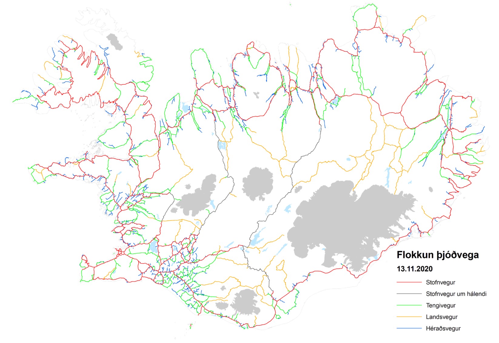
Þjóðvegir sem eru í umsjón Vegagerðarinnar. Línugögn: Miðlína þjóðvega sem heyra undir Vegagerðina skv. vegalögum. Gögnin innhalda m.a. upplýsingar um yfirborð og flokkun vegakerfisins, auk staðsetningu jarðganga. Einnig upplýsingar um yfirborðsmerkingar Punktgögn: Brýr og ræsi þ.m.t. göngubrýr yfir þjóðvegi. Ýmsar upplýsingar fylgja brúnum s.s. breidd, lengd, gerð brúarvirkis ofl. Umferðarmerki, skráning á gerð fer eftir reglugerð nr.289/1995 með síðari breytingum. Áningastaðir.
-
The USGS Transportation service from The National Map (TNM) is based on TIGER/Line data provided through U.S. Census Bureau and supplemented with HERE road data to create tile cache base maps. Some of the TIGER/Line data includes limited corrections done by USGS. Transportation data consists of roads, railroads, trails, airports, and other features associated with the transport of people or commerce. The data include the name or route designator, classification, and location. Transportation data support general mapping and geographic information system technology analysis for applications such as traffic safety, congestion mitigation, disaster planning, and emergency response. The National Map transportation data is commonly combined with other data themes, such as boundaries, elevation, hydrography, and structures, to produce general reference base maps. The National Map viewer allows free downloads of public domain transportation data in either Esri File Geodatabase or Shapefile formats. For additional information on the transportation data model, go to http://nationalmap.gov/transport.html.
-
The USGS Transportation service from The National Map (TNM) is based on TIGER/Line data provided through U.S. Census Bureau and road data from U.S. Forest Service. Some of the TIGER/Line data includes limited corrections done by USGS. Transportation data consists of roads, railroads, trails, airports, and other features associated with the transport of people or commerce. The data include the name or route designator, classification, and location. Transportation data support general mapping and geographic information system technology analysis for applications such as traffic safety, congestion mitigation, disaster planning, and emergency response. The National Map transportation data is commonly combined with other data themes, such as boundaries, elevation, hydrography, and structures, to produce general reference base maps. The National Map download client allows free downloads of public domain transportation data in either Esri File Geodatabase or Shapefile formats. For additional information on the transportation data model, go to http://nationalmap.gov/transport.html.