 Arctic SDI catalogue
20 m
Type of resources
Available actions
Topics
Keywords
Contact for the resource
Provided by
Years
Formats
Scale
Resolution
-
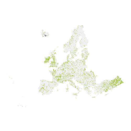
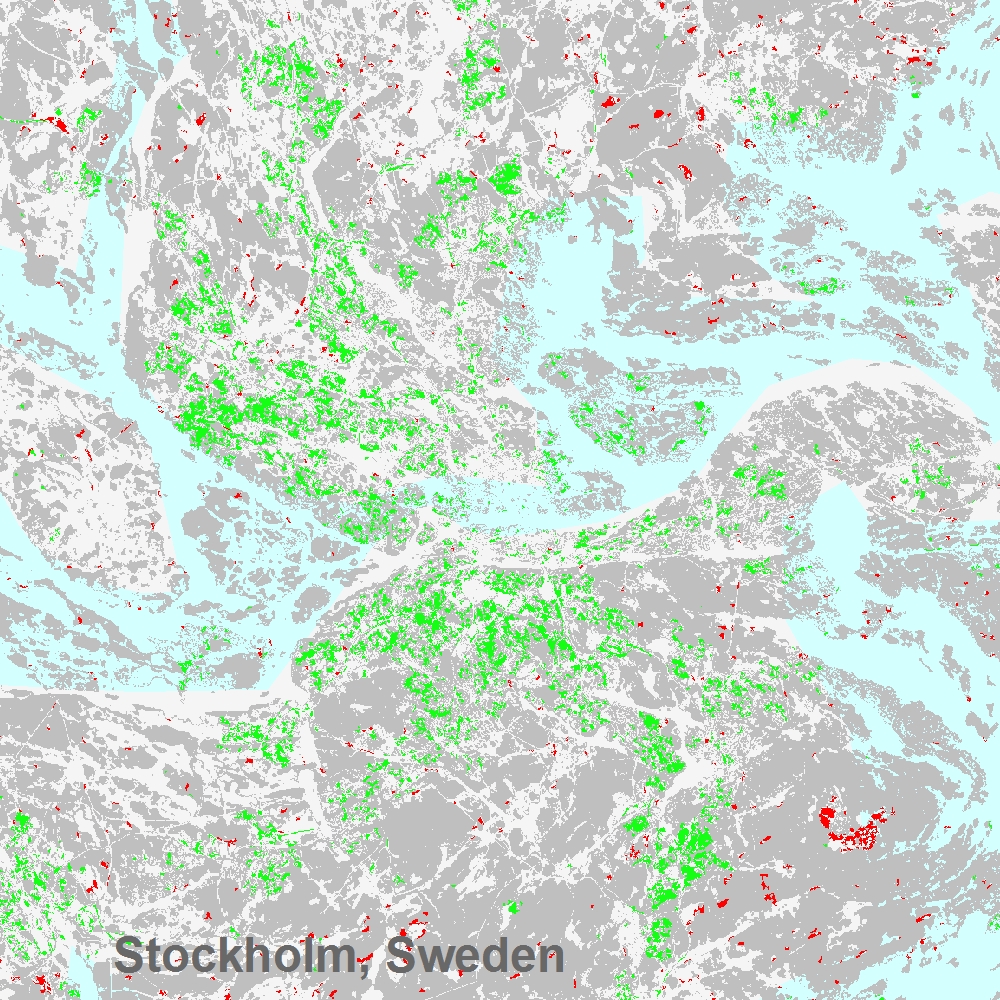
The main high resolution grassland product is the Grassland layer, a grassland/non-grassland mask for the EEA39. This grassy and non-woody vegetation baseline product includes all kinds of grasslands: managed grassland, semi-natural grassland and natural grassy vegetation. It is a binary status layer for the 2015 reference year mapping grassland and all non-grassland areas in 20m and (aggregated) 100m pixel size and for the 2018 reference year - in 10m and (aggregated) 100m pixel size. The production of the high resolution grassland layers was coordinated by the European Environment Agency (EEA) in the frame of the EU Copernicus programme.
-
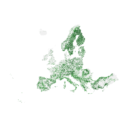
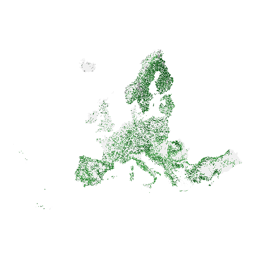
The high resolution forest product consists of three types of (status) products and additional change products. The status products are available for the 2012, 2015 and 2018 reference years: 1. Tree cover density providing level of tree cover density in a range from 0-100%; 2. Dominant leaf type providing information on the dominant leaf type: broadleaved or coniferous; 3. A Forest type product. The forest type product allows to get as close as possible to the FAO forest definition. In its original (20m) resolution it consists of two products: 1) a dominant leaf type product that has a MMU of 0.5 ha, as well as a 10% tree cover density threshold applied, and 2) a support layer that maps, based on the dominant leaf type product, trees under agricultural use and in urban context (derived from CLC and high resolution imperviousness 2009 data). For the final 100m product trees under agricultural use and urban context from the support layer are removed. The high resolution forest change products comprise a simple tree cover density change product for 2012-2015 (% increase or decrease of real tree cover density changes). The production of the high resolution forest layers was coordinated by the European Environment Agency (EEA) in the frame of the EU Copernicus programme.
-
The Copernicus High Resolution Forest Layer Tree Cover Change Mask (TCCM) 2012-2015 raster product provides information on the change between the reference years 2012 and 2015 and consists of 4 thematic classes (unchanged areas with no tree cover / new tree cover / loss of tree cover / unchanged areas with tree cover) at 20m spatial resolution and covers EEA38 area and the United Kingdom. The production of the High Resolution Forest layers was coordinated by the European Environment Agency (EEA) in the frame of the EU Copernicus programme. The High Resolution Forest product consists of three types of (status) products and additional change products. The status products are available for the 2012, 2015 and 2018 reference years: 1. Tree cover density providing level of tree cover density in a range from 0-100%; 2. Dominant leaf type providing information on the dominant leaf type: broadleaved or coniferous; 3. A Forest type product. The forest type product allows to get as close as possible to the FAO forest definition. In its original (20m) resolution it consists of two products: 1) a dominant leaf type product that has a MMU of 0.5 ha, as well as a 10% tree cover density threshold applied, and 2) a support layer that maps, based on the dominant leaf type product, trees under agricultural use and in urban context (derived from CLC and high resolution imperviousness 2009 data). For the final 100m product trees under agricultural use and urban context from the support layer are removed. You can read more about the product here: https://land.copernicus.eu/en/products/high-resolution-layer-tree-cover-density/tree-cover-change-mask-2012-2015.
-

The High Resolution Layer (HRL) Grassland Change 2015-2018 raster product at 20m resolution provides information on changes in grassland vegetation cover between the reference years 2015 and 2018. The thematic classes indicate all non-grassland areas, grassland gain and grassland loss, unchanged grassland in both years and unverified grassland gain and loss areas for the pan-European area of EEA38 and the United Kingdom. The production of the High Resolution grassland layers was coordinated by the European Environment Agency (EEA) in the frame of the EU Copernicus programme. This dataset is provided as 20 meter rasters in 100 x 100 km tiles grouped according to the EEA38 countries and the United Kingdom (fully conformant with the EEA reference grid). The HRL Grassland layer is the main High Resolution grassland product. This grassy and non-woody vegetation baseline product includes all kinds of grasslands: managed grassland, semi-natural grassland and natural grassy vegetation. It is a binary status layer for the 2015 reference year mapping grassland and all non-grassland areas in 20m and (aggregated) 100m pixel size and, for the 2018 reference year, in 10m and (aggregated) 100m pixel size. You can read more about the product here: https://land.copernicus.eu/en/products/high-resolution-layer-grassland/grassland-change-2015-2018.
-
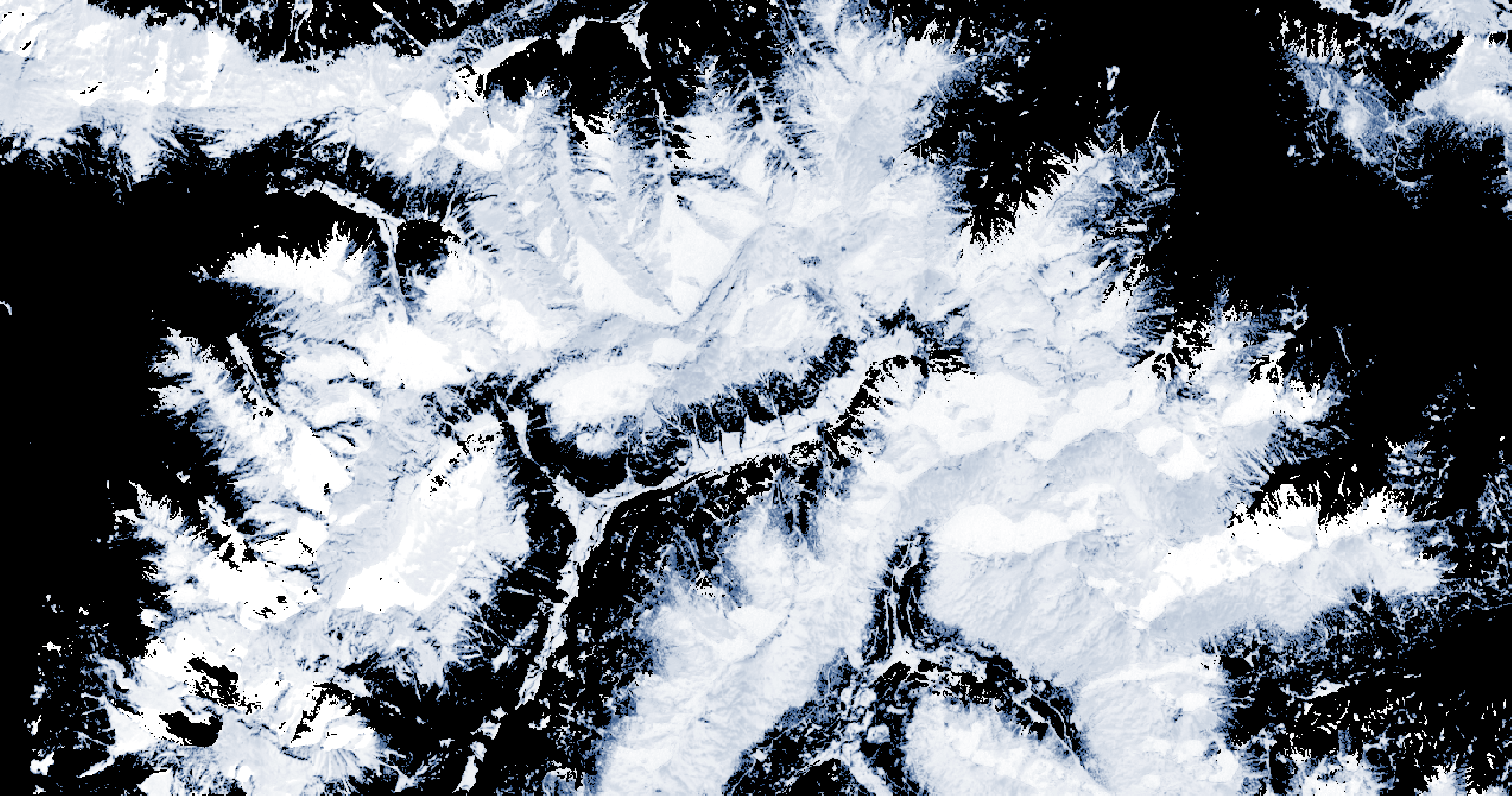
The Copernicus Fractional Snow Cover (FSC) product is generated in near real-time for the entire EEA38 and the United Kingdom, based on optical satellite data from the Sentinel-2 constellation. The product provides the fraction of the surface covered by snow at the top of canopy (FSC-TOC) and on ground (FSC-OG) per pixel as a percentage (0% – 100%) with a spatial resolution of 20 m x 20 m. FSC is one of the products of the pan-European High-Resolution Snow & Ice service (HR-S&I), which are provided at high spatial resolution (20 m x 20 m and 60 m x 60 m), from the Sentinel-2 and Sentinel-1 constellations data from September 1, 2016 onwards. The FSC product is distributed in raster files covering an area of 110 km by 110 km with a pixel size of 20 m by 20 m in UTM/WGS84 projection, which corresponds to the Sentinel-2 input L1C product tile. Each product is composed of seven separate files corresponding to the different layers of the product, and another metadata file. You can read more about the FSC product here: https://land.copernicus.eu/en/products/snow/fractional-snow-cover.
-
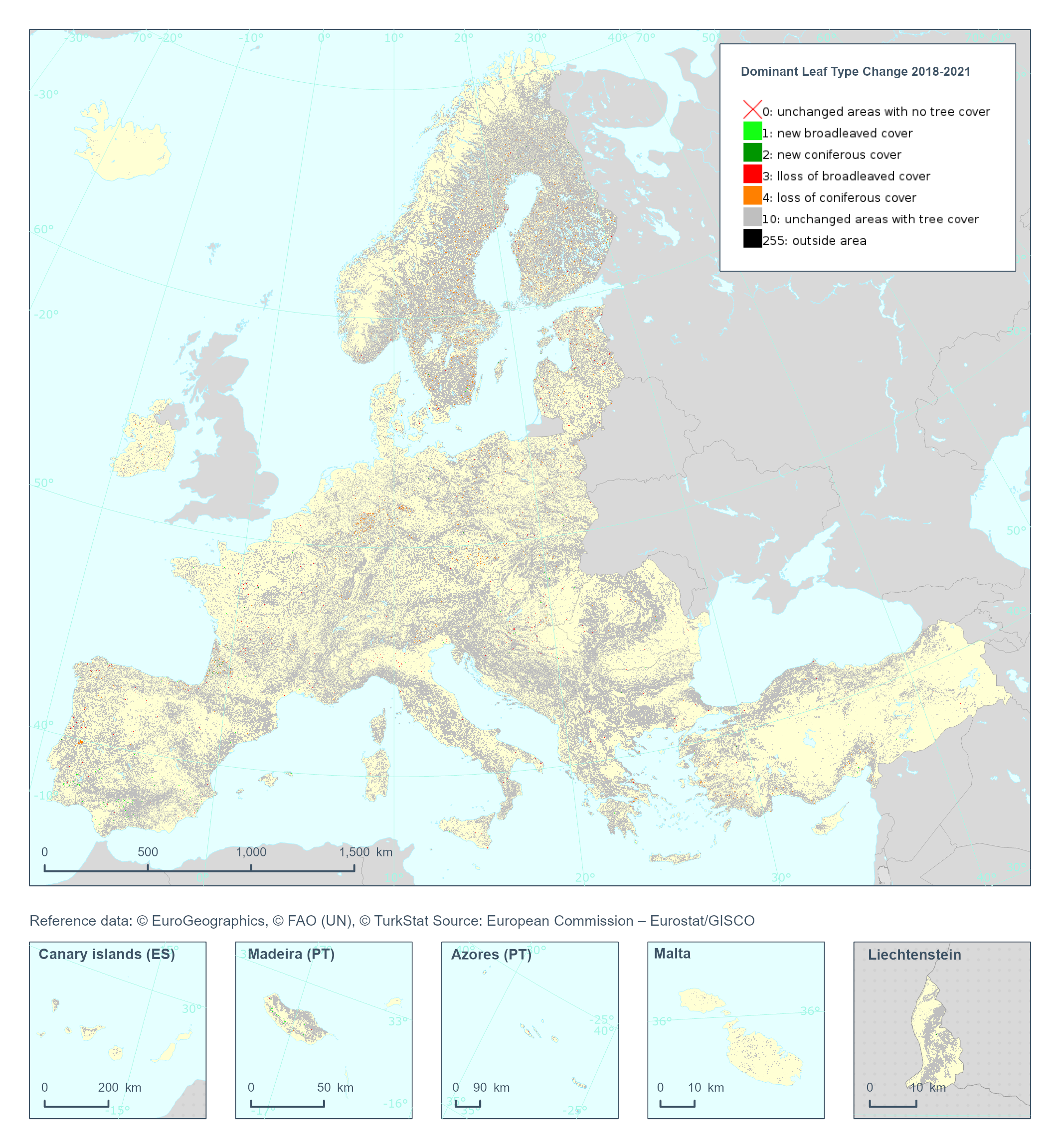
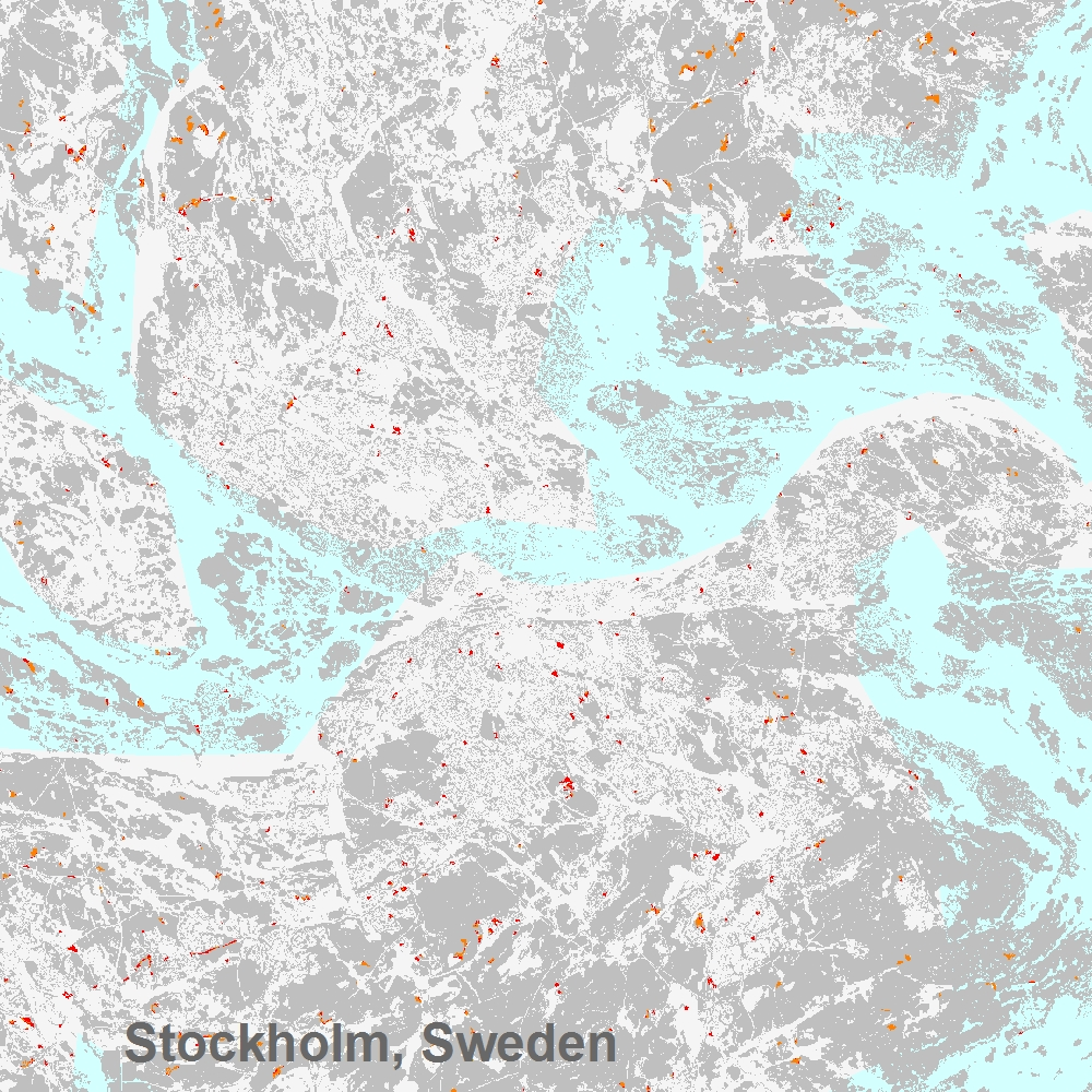
The High Resolution Layer Dominant Leaf Type Change (DLTC) 2018-2021 raster product provides information on the change between the reference years 2018 and 2021 and consists of 7 thematic classes (unchanged areas with no tree cover / new broadleaved cover / new coniferous cover / loss of broadleaved cover / loss of coniferous cover / unchanged areas with tree cover / potential change among dominant leaf types). This dataset is provided in 20 meter rasters (fully conformant with the EEA reference grid) in 100 x 100 km tiles covering the EEA38 countries. The production of the high resolution forest layers was coordinated by the European Environment Agency (EEA) in the frame of the EU Copernicus programme. This dataset includes data from the French Overseas Territories (DOMs)
-
This metadata refers to the Copernicus High Resolution Layer Forest product Dominant Leaf Type Change (DLTC) 2015-2018. The DLTC raster product provides information on the change between the reference years 2015 and 2018 and consists of 7 thematic classes (unchanged areas with no tree cover / new broadleaved cover / new coniferous cover / loss of broadleaved cover / loss of coniferous cover / unchanged areas with tree cover / potential change among dominant leaf types) at 20m spatial resolution and covers the full of EEA38 area and the United Kingdom. The production of the High Resolution Forest layers was coordinated by the European Environment Agency (EEA) in the frame of the EU Copernicus programme. The High Resolution Forest product consists of three types of (status) products and additional change products. The status products are available for the 2012, 2015 and 2018 reference years: 1. Tree cover density providing level of tree cover density in a range from 0-100%; 2. Dominant leaf type providing information on the dominant leaf type: broadleaved or coniferous; 3. A Forest type product. The forest type product allows to get as close as possible to the FAO forest definition. In its original (20m) resolution it consists of two products: 1) a dominant leaf type product that has a MMU of 0.5 ha, as well as a 10% tree cover density threshold applied, and 2) a support layer that maps, based on the dominant leaf type product, trees under agricultural use and in urban context (derived from CLC and high resolution imperviousness 2009 data). For the final 100m product trees under agricultural use and urban context from the support layer are removed. You can find more information about the product here: https://land.copernicus.eu/en/products/high-resolution-layer-dominant-leaf-type/dominant-leaf-type-change-2015-2018.
-
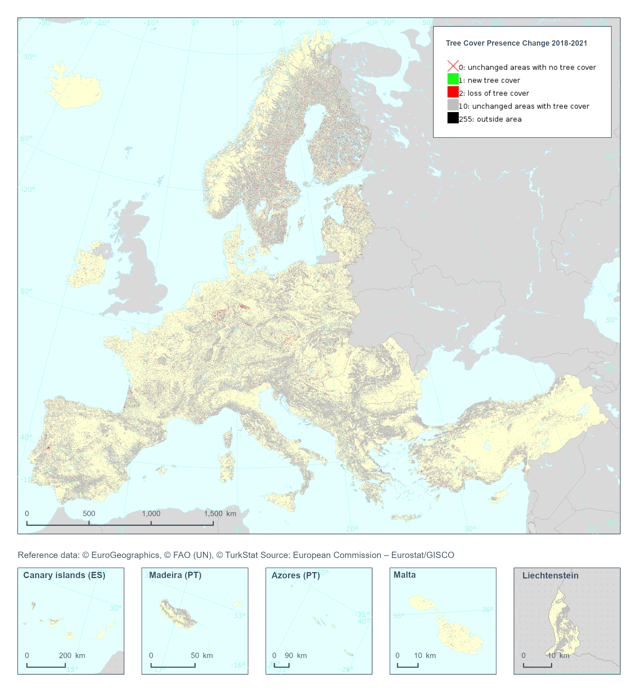
The Copernicus High Resolution Layer Tree Cover Precense Change (TCPC) 2018-2021 raster product provides information on the change between the reference years 2018 and 2021 and consists of 4 thematic classes (unchanged areas with no tree cover / new tree cover / loss of tree cover / unchanged areas with tree cover). The class 255 = outside area is predefined by the 100m boundary layer and remains unchanged. This layer for previous reference year compraissions is called Tree Cover Change Mask (TCCM). This dataset is provided in 20 meter rasters (fully conformant with the EEA reference grid) in 100 x 100 km tiles covering the EEA38 countries. The production of the high resolution forest layers was coordinated by the European Environment Agency (EEA) in the frame of the EU Copernicus programme. Confidence layer available for the dataset. This dataset includes data from the French Overseas Territories (DOMs)
-
The Copernicus Persistent Snow Area (PSA) product is generated annually for the entire EEA38 and the United Kingdom, based on the Fractional Snow Cover (FSC) information. It provides the extent of the persistent snow cover, i.e. the area where snow is present throughout the hydrological year with a spatial resolution of 20 m x 20 m. This metadata refers to the PSA product distributed in raster files as tiles aligned with Sentinel-2 (UTM/WGS84) at 20 m x 20 m GSD. It is also available in another projection as tiles aligned with the Pan-European High-Resolution Layers in the European 20 m x 20 m grid (ETRS89 LAEA - EPSG: 3035). It is typically released on an annual basis with a release date in October, after the end of the hydrological year. Each product is composed of two separate files corresponding to the different layers of the product, and another metadata file. PSA is one of the products of the pan-European High-Resolution Snow & Ice service (HR-S&I), which are provided at high spatial resolution (20 m x 20 m and 60 m x 60 m), from the Sentinel-2 and Sentinel-1 constellations data from September 1, 2016 onwards. You can read more about the PSA product here: https://land.copernicus.eu/en/products/snow/high-resolution-persistent-snow-area.