 Arctic SDI catalogue
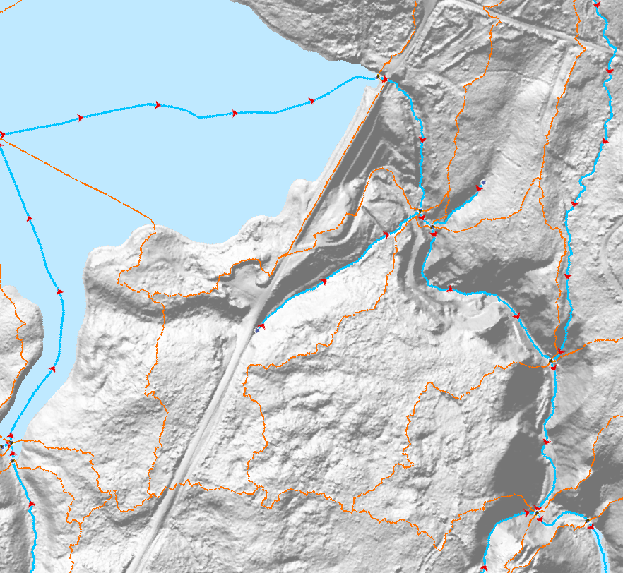
Watercourses
Type of resources
Available actions
Topics
Keywords
Contact for the resource
Provided by
Formats
Representation types
Update frequencies
status
Scale
-

A tidal resource assessment dataset for the Quatsino Sound region, British Columbia, was developed, including temporal maximum, mean, and minimum velocity magnitudes, standard deviations, and power density. The dataset was generated using a high-resolution 2D depth-averaged hydrodynamic model based on the Telemac-Mascaret solver, with Natural Neighbor interpolation applied for raster creation. This newly published dataset is the first in a series of regional tidal energy maps for Canada. Developed by CanmetENERGY Ottawa in collaboration with partners, these maps aim to support effective project planning and development by providing comprehensive tidal resource data across the country. Disclaimer: Potential errors in the model results may arise from inherent limitations in the topo-bathymetric data accuracy, assumptions in boundary conditions, approximations within the numerical methods, and the input data used in the numerical modeling. These factors introduce uncertainties that can affect the overall model outcomes. The model is subject to the following conditions: • Topo-bathymetric data: Obtained from electronic navigational charts and the Canadian Hydrographic Service’s (CHS) NONNA-10 Bathymetric Data packages, consolidating CHS-managed digital bathymetric sources with a maximum resolution of 10 m. • Tidal and current harmonic components: Used as boundary conditions from the TPXO9 global tidal model. • Model calibration and validation: Performed using data from Acoustic Doppler Current Profilers (ADCP), surface elevations recorded at CHS tidal stations, and Lagrangian drifter measurements. • Interpolation method: Dataset outputs were generated with Natural Neighbor interpolation, which assumes smoothly varying data and may not capture sharp local gradients or features. • Modeled estimates: All values for velocity magnitudes, velocity standard deviations, and power density are modeled estimates and not direct field measurements. This dataset is intended for preliminary assessment of tidal projects only. It should not be the sole basis for making critical decisions or investments. We strongly recommend further validation and in-depth analysis. Users are responsible for conducting their own due diligence and additional research to verify the data's accuracy and relevance for specific applications. By accessing and using this dataset, users acknowledge and accept these disclaimers. The providers of this dataset explicitly absolve themselves of any responsibility or liability for any consequences arising from the use, reliance upon, or interpretation of this dataset. Users are advised that their use of the dataset is at their own risk, and they assume full responsibility for any actions or decisions made based on the information contained therein. This disclaimer is in accordance with applicable laws and regulations, and by accessing or utilizing the dataset, users agree to release the providers of this dataset from any legal claims, damages, or liabilities that may arise from such use.
-

Provinces and Territories Basemap - Canada Provinces basemap file created to generate boundary polygons for use in small scale, medium and large scales. Simple Grey Basemap - This basemap is only in simple grey and white to be used as a backdrop in applications or geomatics projects. Line features represent provincial and territorial boundaries, international boundaries, exclusive economic zones, arcs extending to the North Pole, state boundaries, Canadian, USA and foreign countries rivers. Polygon features representing waterbodies in Canada, USA and foreign countries.
-

This dataset identifies potential low head hydropower development sites across Canada, based on a comprehensive review of existing studies and resource databases. Low head hydropower refers to sites where the vertical drop (head) is 15 meters or less. Sites included in this dataset also have an estimated generation capacity of 50 megawatts (MW) or less. The original database was developed by Hatch Ltd. for Natural Resources Canada (NRCan) as part of a national low head hydropower market assessment. It integrates data from multiple sources, including provincial inventories, prior Hatch studies, and legacy fieldwork records. To enhance data completeness, NRCan subsequently revised the database by supplementing missing site names, river names, and geographic coordinates where possible. The finalized dataset comprises 2,629 potential low head hydropower sites distributed across Canada. It is provided in the form of provincial and territorial shapefiles, each containing detailed site-level attributes. Attributes include site name, river name, site ID, source of information, local map number, geographic coordinates (X and Y), site region, presence of a dam, grid connection status, Indigenous affiliation, catchment area, mean annual flow, rated discharge, gross head, penstock length and diameter, estimated installed capacity, dedicated transmission line length, site comments, and Indigenous reserve name. Disclaimer: This dataset was developed to support preliminary assessments of low head hydropower potential in Canada and is subject to the following limitations: • The original database was compiled from various secondary sources, including data provided by third-party contributors and Hatch Ltd.’s own records. Some of these sources date back several decades. The data provided has not necessarily undergone independent verification for its accuracy, completeness, or validity. • NRCan undertook a data revision process involving manual review and geolocation using publicly available mapping tools (e.g., Google Maps) to address missing information. Where geographic coordinates could not be reliably determined, this is explicitly indicated in the dataset. • Site conditions may have changed over time due to natural processes or human activities. NRCan does not accept responsibility for any impact such changes may have on the accuracy or validity of the dataset’s observations, conclusions, or recommendations. • The inclusion of a site in this dataset does not imply technical, economic, or environmental feasibility. Any potential development would require further investigation, including detailed field studies, environmental assessments, and comprehensive technical and financial evaluations. This dataset is provided for informational purposes only and is not intended to serve as the sole basis for investment, planning, or development decisions. Users are strongly advised to undertake independent due diligence, including site-specific assessments and technical evaluations, prior to making any decisions based on the dataset. By accessing or using this dataset, users acknowledge and accept these terms and limitations. The dataset providers expressly disclaim any responsibility or liability for consequences resulting from the use, interpretation, or reliance on the information contained herein. Use of this dataset is entirely at the user’s own risk, and users assume full responsibility for any actions or decisions made based on its contents. This disclaimer is provided in accordance with applicable laws and regulations. By utilizing the dataset, users agree to release the dataset providers from any legal claims, damages, or liabilities that may arise from such use.
-

The National Hydro Network (NHN) focuses on providing a quality geometric description and a set of basic attributes describing Canada's inland surface waters. It provides geospatial digital data compliant with the NHN Standard such as lakes, reservoirs, watercourses (rivers and streams), canals, islands, drainage linear network, toponyms or geographical names, constructions and obstacles related to surface waters, etc. The best available federal and provincial data are used for its production, which is done jointly by the federal and interested provincial and territorial partners. The NHN is created from existing data at the 1:50 000 scale or better. The NHN data have a great potential for analysis, cartographic representation and display and will serve as base data in many applications. The NHN Work Unit Limits were created based on Water Survey of Canada Sub-Sub-Drainage Area.
-

The hydrographic features of the CanVec series include watercourses, water linear flow segments, hydrographic obstacles (falls, rapids, etc.), waterbodies (lakes, watercourses, etc.), permanent snow and ice features, water wells and springs. The Hydrographic features theme provides quality vector geospatial data (current, accurate, and consistent) of Canadian hydrographic phenomena. It aims to offer a geometric description and a set of basic attributes on hydrographic features that comply with international geomatics standards, seamlessly across Canada. The CanVec multiscale series is available as prepackaged downloadable files and by user-defined extent via a Geospatial data extraction tool. Related Products (Open Maps Links): [Topographic Data of Canada - CanVec Series](https://open.canada.ca/data/en/dataset/8ba2aa2a-7bb9-4448-b4d7-f164409fe056)
-
The Canadian Hydrospatial Network (CHN) is an analysis-ready geospatial network of features that help enable the modelling of surface water flow in Canada. The six main layers and feature types are: flowlines, waterbodies, catchments, catchment aggregates, work units, and hydro nodes. Where possible the CHN is derived from high resolution source data such as Light Detection and Ranging (LiDAR) derived Digital Elevation Models (DEMs) and aerial imagery, to name a few. If existing provincial or territorial hydrographic networks meet the standards, they are incorporated into the CHN, otherwise automatic extraction methods are used on the high-resolution source data. To provide full network connectivity, if neither of these methods is possible in a region, the NHN is converted into the CHN until higher-resolution source data is available. Additional value-added attributes are included in the CHN to aid modelling, such as stream order and reach slope. The CHN physical model and features are also closely aligned and harmonized with the USGS 3DHP hydrographic network, which aids trans-border modelling. Where possible geonames (i.e. toponyms) are also added. The CHN is produced and disseminated by hydrologically connected geographic areas called work units. Work units can contain just one watershed, several small adjacent watersheds outletting into a large body of water, or be one of many parts of a larger watershed. In all cases, the features of a work unit are hydrologically connected. This is a more natural approach to data delivery, in comparison to data that is split into tiles. A generalized work unit index file is provided in the downloads to help users decide which files to download. For more information on the CHN please visit the project webpage: https://natural-resources.canada.ca/canadian-hydrospatial-network
-

This collection is a legacy product that is no longer supported. It may not meet current government standards. The North American Atlas data are standardized geospatial data sets at 1:10,000,000 scale. A variety of basic data layers (e.g. roads, railroads, populated places, political boundaries, hydrography, bathymetry, sea ice and glaciers) have been integrated so that their relative positions are correct. This collection of data sets forms a base with which other North American thematic data may be integrated. The North American Atlas data are intended for geographic display and analysis at the national and continental level. Any data outside of Canada, Mexico, and the United States of America included in the North American Atlas data sets is strictly to complete the context of the data.