 Arctic SDI catalogue
GeoBase
Type of resources
Categories
Available actions
Topics
Keywords
Contact for the resource
Provided by
Formats
Representation types
Update frequencies
status
-

The National Rail Network (NRWN) is a geometric and attributive description of the Canadian rail network. The NRWN product consists of the features classes: Track Segment, Railway Crossing, Railway Station, Marker Post, Junction and Railway Structure. Descriptive attributes include amongst others: Track Classification, Track Name, Track Operator, Track User, Track Owner, Subdivision Name, Junction Type, Crossing Type, Level of Crossing, Warning System, Transport Canada Identifier, Station Name, Station Type, Station User, Structure Type.
-

Temporal analysis of changes in Quebec city based on GeoAI features automatically extracted from satellite images acquired in 2006 and 2022. Simple geospatial analysis enables the detection of features present in 2022 that were not already there in 2006. The addition of new buildings is a good indicator of urban development and/or sprawl. GeoAI enables temporal coverage of various areas in Canada, thus providing a useful tool for change detection and trend analysis at high resolution. While the series is still fairly new, and such examples are limited for the time being, NRCan strives to gradually increase its GeoAI data offering for both spatial and temporal coverage. For more information about the GeoAI - GeoBase Series, please visit the following link: https://open.canada.ca/data/en/dataset/74738ff5-5367-5958-9aee-98fffdcd1876
-
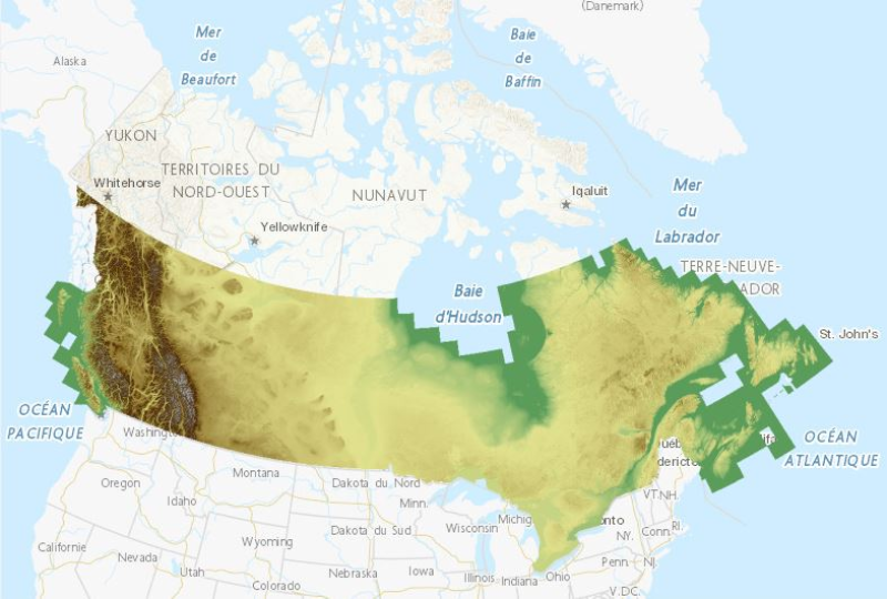
This is a legacy product that is no longer supported. It may not meet current government standards. The Canadian Digital Surface Model (CDSM) is part of Natural Resources Canada's altimetry system designed to better meet the users' needs for elevation data and products. The 0.75-second (~20 m) CDSM consists of a derived product from the original 1-second (30 m) Shuttle Radar Topographic Mission (SRTM) digital surface model (DSM). In these data, the elevations are captured at the top of buildings, trees, structures, and other objects rather than at ground level. A CDSM mosaic can be obtained for a pre-defined or user-defined extent. The coverage and resolution of a mosaic varies according to the extent of the requested area. Derived products such as slope, shaded relief and colour shaded relief maps can also be generated on demand by using the Geospatial-Data Extraction tool. Data can then be saved in many formats. The pre-packaged GeoTiff datasets are based on the National Topographic System of Canada (NTS) at the 1:50 000 scale; the NTS index file is available in the Resources section in many formats.
-

Temporal analysis of changes for Victoria, British Columbia, based on GeoAI features automatically extracted from satellite images acquired in the 2000s, 2010s and 2020s. Simple geospatial analysis intersecting Statistics Canada's Open Database of Buildings, version 3 (ODB v3) with GeoAI multidate building features enables the detection of buildings observed in the 2000s, 2010s and 2020s. The addition of new buildings is a good indicator of urban development and/or sprawl. Using the same approach, GeoAI multidate roads enable the detection of Statistics Canada's National Roads Network (NRN) segments present in the 2000s, 2010s and 2020s. The development of new roads is also indicator of urban development and/or sprawl. Complementarily, an analysis of changes in the forest coverage from the GeoAI datasets is done between the 2000s and the 2020s. This analysis reflects the gains and losses between both dates. GeoAI enables temporal coverage of various areas in Canada, thus providing a useful tool for change detection and trend analysis at high resolution. While the series is still fairly new, and such examples are limited for the time being, NRCan strives to gradually increase its GeoAI data offering for both spatial and temporal coverage. For more information about the GeoAI - GeoBase Series, please visit the following link: https://open.canada.ca/data/en/dataset/74738ff5-5367-5958-9aee-98fffdcd1876
-

Temporal analysis of changes in Trois-Rivières, Québec, based on GeoAI features automatically extracted from satellite images acquired in 2013 and 2021-22. Simple geospatial analysis intersecting Statistics Canada's Open Database of Buildings, version 3 (ODB v3) with GeoAI multidate building features enables the detection of buildings observed in 2021-22 that were not detected in 2013. The addition of new buildings is a good indicator of urban development and/or sprawl. GeoAI enables temporal coverage of various areas in Canada, thus providing a useful tool for change detection and trend analysis at high resolution. While the series is still fairly new, and such examples are limited for the time being, NRCan strives to gradually increase its GeoAI data offering for both spatial and temporal coverage. For more information about the GeoAI - GeoBase Series, please visit the following link: https://open.canada.ca/data/en/dataset/74738ff5-5367-5958-9aee-98fffdcd1876
-

Temporal analysis of changes in Winnipeg, Manitoba, based on GeoAI features automatically extracted from satellite images acquired in 2013 and 2023. Simple geospatial analysis enables the detection of features present in 2023 that were not already there in 2013. The addition of new buildings is a good indicator of urban development and/or sprawl. Complementarily, an analysis of changes in the forest coverage from the GeoAI datasets is done. This analysis reflects the gains and losses between both dates. GeoAI enables temporal coverage of various areas in Canada, thus providing a useful tool for change detection and trend analysis at high resolution. While the series is still fairly new, and such examples are limited for the time being, NRCan strives to gradually increase its GeoAI data offering for both spatial and temporal coverage. For more information about the GeoAI - GeoBase Series, please visit the following link: https://open.canada.ca/data/en/dataset/74738ff5-5367-5958-9aee-98fffdcd1876
-

Temporal analysis of changes in the Iqaluit region, Nunavut, based on GeoAI features automatically extracted from satellite images acquired in 2012 and 2022. Simple geospatial analysis intersecting GeoAI multidate building features enables the detection of buildings observed in 2022 that were not detected in 2012. The addition of new buildings is a good indicator of urban development and/or sprawl. GeoAI enables temporal coverage of various areas in Canada, thus providing a useful tool for change detection and trend analysis at high resolution. While the series is still fairly new, and such examples are limited for the time being, NRCan strives to gradually increase its GeoAI data offering for both spatial and temporal coverage. For more information about the GeoAI - GeoBase Series, please visit the following link: https://open.canada.ca/data/en/dataset/74738ff5-5367-5958-9aee-98fffdcd1876
-
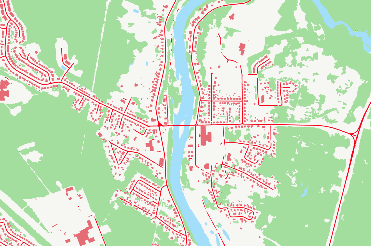
GeoAI are buildings, hydrography, forests, and roads automatically extracted using Deep Learning models applied to a source dataset, typically aerial or satellite images. The primary aim of GeoAI is to increase Canada's availability of high-resolution foundational geospatial data for both spatial and temporal coverage. The infrastructure and expertise put in place by NRCan enables a rapid, efficient, and scalable data creation process through the use of leading-edge technology and Artificial Intelligence models. Published datasets for a given source can be revisited at a later date as more accurate models are developed and put into production. For now, only static files are available, but as the series develops, new products and services will be added. Several use cases of GeoAI data for change detection have been created. To view them, please follow the links below: - Iqaluit: https://open.canada.ca/data/en/dataset/ef29513d-a007-408c-beba-65f86e7b5b01 - Calgary: https://open.canada.ca/data/en/dataset/bd07b597-5166-4b62-ae9c-245b3c62ea03 - Québec City: https://open.canada.ca/data/en/dataset/4026720e-f7fb-478e-a58f-c62ebe20005d - Winnipeg: https://open.canada.ca/data/en/dataset/a6874aac-cfcd-4b92-bb3f-6031eedb5b57 - Victoria: https://open.canada.ca/data/en/dataset/f011c7b9-f79e-42f8-9481-9bf9788bb189 - Trois-Rivières: https://open.canada.ca/data/en/dataset/2b11a323-52c2-43d5-9c09-bc4b15b1bcc8
-

Temporal analysis of changes in Calgary, Alberta, based on GeoAI features automatically extracted from satellite images acquired in 2011 and 2021. Simple geospatial analysis intersecting Statistics Canada's Open Database of Buildings, version 3 (ODB v3) with GeoAI multidate building features enables the detection of buildings observed in 2021 that were not detected in 2011. The addition of new buildings is a good indicator of urban development and/or sprawl. Using the same approach, GeoAI multidate roads enable the detection of Statistics Canada's National Roads Network (NRN) segments present in 2021 and/or in 2011. The development of new roads is also indicator of urban development and/or sprawl. Complementarily, an analysis of changes in the forest coverage from the GeoAI datasets is done. This analysis reflects the gains and losses between both dates.. GeoAI enables temporal coverage of various areas in Canada, thus providing a useful tool for change detection and trend analysis at high resolution. While the series is still fairly new, and such examples are limited for the time being, NRCan strives to gradually increase its GeoAI data offering for both spatial and temporal coverage. For more information about the GeoAI - GeoBase Series, please visit the following link: https://open.canada.ca/data/en/dataset/74738ff5-5367-5958-9aee-98fffdcd1876
-

This collection is a legacy product that is no longer supported. It may not meet current government standards. This inventory presents chronologically the satellite images acquired, orthorectified and published over time by Natural Resources Canada. It is composed of imagery from the Landsat7 (1999-2003) and RADARSAT-1 (2001-2002) satellites, as well as the CanImage by-product and the control points used to process the images. Landsat7 Orthorectified Imagery: The orthoimage dataset is a complete set of cloud-free (less than 10%) orthoimages covering the Canadian landmass and created with the most accurate control data available at the time of creation. RADARSAT-1 Orthorectified Imagery: The 5 RADARSAT-1 images (processed and distributed by RADARSAT International (RSI) complete the landsat 7 orthoimagery coverage. They are stored as raster data produced from SAR Standard 7 (S7) beam mode with a pixel size of 15 m. They have been produced in accordance with NAD83 (North American Datum of 1983) using the Universal Transverse Mercator (UTM) projection. RADARSAT-1 orthoimagery were produced with the 1:250 000 Canadian Digital Elevation Data (CDED) and photogrammetric control points generated from the Aerial Survey Data Base (ASDB). CanImage -Landsat7 Orthoimages of Canada,1:50 000: CanImage is a raster image containing information from Landsat7 orthoimages that have been resampled and based on the National Topographic System (NTS) at the 1:50 000 scale in the UTM projection. The product is distributed in datasets in GeoTIFF format. The resolution of this product is 15 metres. Landsat7 Imagery Control Points: the control points were used for the geometric correction of Landsat7 satellite imagery. They can also be used to correct vector data and for simultaneously displaying data from several sources prepared at different scales or resolutions.