Geography
Type of resources
Available actions
Topics
Keywords
Contact for the resource
Provided by
Years
Formats
Representation types
Update frequencies
status
Service types
Scale
-

The 2022 Census Subdivision Boundary File depicts the boundaries of all 5,180 census subdivisions (CSDs), which combined, cover all of Canada. It contains the unique identifier (UID), name and type, as well as the UIDs, names and types (where applicable) of selected higher geographic levels. The 2022 Census Subdivision Boundary File is portrayed in Lambert conformal conic projection (North American Datum of 1983 [NAD83]). The 2022 Census Subdivision Boundary File is available as a national file.
-

The 2022 Census Subdivision Boundary File depicts the boundaries of all 5,180 census subdivisions (CSDs), which combined, cover all of Canada. It contains the unique identifier (UID), name and type, as well as the UIDs, names and types (where applicable) of selected higher geographic levels. The 2022 Census Subdivision Boundary File is portrayed in Lambert conformal conic projection (North American Datum of 1983 [NAD83]). The 2022 Census Subdivision Boundary File is available as a national file.
-

Health regions are administrative areas defined by provincial ministries of health. These administrative areas represent geographic areas of responsibility for hospital boards or regional health authorities. Health regions, being provincial administrative areas, are subject to change. For complete Canadian coverage, each of the northern territories as well as the province of Prince Edward Island represents a single health region.
-

The 2023 Census Subdivision Boundary File depicts the boundaries of all 5,173 census subdivisions (CSDs), which combined, cover all of Canada. It contains the unique identifier (UID), name and type, as well as the UIDs, names and types (where applicable) of selected higher geographic levels. The 2023 Census Subdivision Boundary File is portrayed in Lambert conformal conic projection (North American Datum of 1983 [NAD83]). The 2023 Census Subdivision Boundary File is available as a national file.
-

The 2025 Census Subdivision Boundary File depicts the boundaries of all 5,054 census subdivisions, which combined, cover all of Canada. It contains the unique identifier (UID), name and type, as well as the UIDs, names and types (where applicable) of selected higher geographic levels. The 2025 Census Subdivision Boundary File is portrayed in Lambert conformal conic projection (North American Datum of 1983 [NAD83]) and is available as a national file.
-

The 2024 Census Subdivision Boundary File depicts the boundaries of all 5,028 census subdivisions, which combined, cover all of Canada. It contains the unique identifier (UID), name and type, as well as the UIDs, names and types (where applicable) of selected higher geographic levels. The 2024 Census Subdivision Boundary File is portrayed in Lambert conformal conic projection (North American Datum of 1983 [NAD83]) and is available as a national file.
-

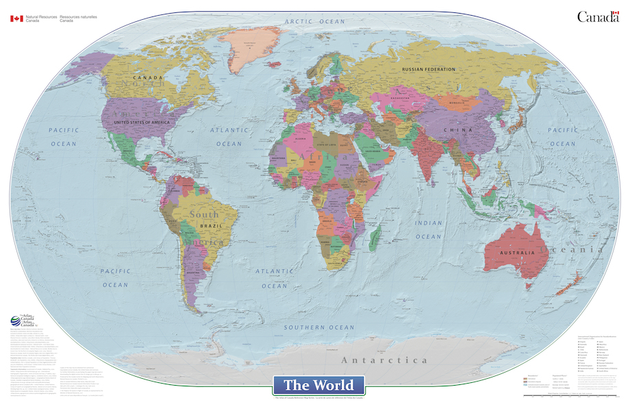
This cartographic digital product is derived from the Atlas of Canada's wall map "The World" (MCR 0046) and "Le monde" (MCR 0046F) published in 2021. The World is a general reference political map focused on the names and international boundaries of sovereign and non-sovereign countries. The information is portrayed using the Winkel II projection at a scale of 1:29 000 000. The dataset includes international boundaries, populated places, and labelled major hydrographic and physical features. In the geodatabase the representation of political boundaries do not necessarily reflect the position of the Government of Canada on all international issues of recognition, sovereignty or jurisdiction; some of the populated places have seasonal populations, while others are research or military bases with no permanent populations; and, there are no attribute information in the geodatabase for the labelled hydrographic and physical features.
-
This map is the base for a series of maps that depict Canada's involvement in a range of topics, including international trade and Canada's participation in various international partnerships and organizations. The dataset includes countries, major rivers, lakes and oceans, pacific island groupings, marine annotations, and country annotations, which are available for download in both English and French. Additionally, static maps of the world as well as each individual continent will be available for download in both English and French.
-

This dataset was compiled as part of a multiyear effort lead by Fisheries and Oceans Canada (DFO) to support sustainable aquaculture regulation in the Coast of Bays, an area of the south coast of Newfoundland. It is the first of a series aiming to provide an oceanographic knowledge baseline of the Coast of Bays. This dataset consists of GIS products and analyses summarized in a spreadsheet. The GIS data include vector shapefiles and raster TIFF images, providing information on the area of interest physical dimensions (e.g. bays area, volume, perimeter, length and width) and other physical characteristics (e.g. tidal volume and freshwater input). A full description of the data and of its use in the context of the motivating project can be found in http://www.dfo-mpo.gc.ca/csas-sccs/Publications/ResDocs-DocRech/2017/2017_076-eng.html. Analyses from this dataset were presented during a Canadian Science Advisory Secretariat (CSAS) meeting which took place in St John’s in March 2015 (http://www.dfo-mpo.gc.ca/csas-sccs/schedule-horraire/2015/03_25-26b-eng.html) and from which a Science Advisory Report (http://www.dfo-mpo.gc.ca/csas-sccs/Publications/SAR-AS/2016/2016_039-eng.html) and Proceedings (http://www.dfo-mpo.gc.ca/csas-sccs/Publications/Pro-Cr/2017/2017_043-eng.html) were published.
-

The dataset includes timeseries of horizontal current speed and direction, vertical current speed, water depth, and temperature at instrument depth from Acoustic Doppler Current Profiler (ADCP) moorings. Data were collected as part of a multiyear effort lead by Fisheries and Oceans Canada (DFO) to support sustainable aquaculture regulation in the Coast of Bays, an area of the south coast of Newfoundland. This dataset is the third of a series aiming to provide an oceanographic knowledge baseline of the Coast of Bays, Newfoundland. It consists of 73 ADCP timeseries varying in length from about 26 days to 235 days collected between 2009 and 2014. Analyses from this dataset were presented during a Canadian Science Advisory Secretariat (CSAS) meeting which took place in St John’s in March 2015 (http://www.dfo-mpo.gc.ca/csas-sccs/schedule-horraire/2015/03_25-26b-eng.html) and from which a Science Advisory Report (http://www.dfo-mpo.gc.ca/csas-sccs/Publications/SAR-AS/2016/2016_039-eng.html), Proceedings (http://www.dfo-mpo.gc.ca/csas-sccs/Publications/Pro-Cr/2017/2017_043-eng.html) and several research documents were published.
 Arctic SDI catalogue