 Arctic SDI catalogue
forest management
Type of resources
Available actions
Topics
Keywords
Contact for the resource
Provided by
Years
Formats
Representation types
Update frequencies
status
Resolution
-

An Agreement Forest Area is a polygon feature that identifies an area of forested private land governed by a Forest Management Agreement. Private companies have agreed, through negotiated agreements with the ministry, to carry out planning and all operational timber management, except protection operations (for example, insect and disease pest control). We are no longer updating this data. It is best suited for historical research and analysis.
-

The Ecological Land Classification (ELC version 2015) for Nova Scotia provides a hierarchical mapping of the province's forest ecosystems into ecosections, ecodistricts and ecoregions. It includes interpretation of the dominant natural disturbance regimes and potential climax forests at the ecosection level.
-

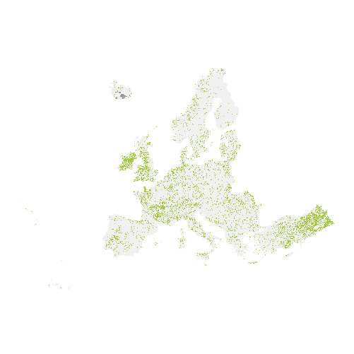
The Copernicus High Resolution Forest Layer Tree Cover Change Mask (TCCM) 2015-2018 raster product provides information on the change between the reference years 2015 and 2018 and consists of 4 thematic classes (unchanged areas with no tree cover / new tree cover / loss of tree cover / unchanged areas with tree cover) at 20m spatial resolution and covers EEA38 area and the United Kingdom. The production of the High Resolution Forest layers was coordinated by the European Environment Agency (EEA) in the frame of the EU Copernicus programme. The High Resolution Forest product consists of three types of (status) products and additional change products. The status products are available for the 2012, 2015 and 2018 reference years: 1. Tree cover density providing level of tree cover density in a range from 0-100%; 2. Dominant leaf type providing information on the dominant leaf type: broadleaved or coniferous; 3. A Forest type product. The forest type product allows to get as close as possible to the FAO forest definition. In its original (20m) resolution it consists of two products: 1) a dominant leaf type product that has a MMU of 0.5 ha, as well as a 10% tree cover density threshold applied, and 2) a support layer that maps, based on the dominant leaf type product, trees under agricultural use and in urban context (derived from CLC and high resolution imperviousness 2009 data). For the final 100m product trees under agricultural use and urban context from the support layer are removed.
-
For most recent Ecological Land Classification data, see: https://data.novascotia.ca/d/q6zd-39t3 The Ecological Land Classification (ELC) for Nova Scotia provides a hierarchical mapping of the province's forest ecosystems into ecosections, ecodistricts and ecoregions. It includes interpretation of the dominant natural disturbance regimes and potential climax forests at the ecosection level.
-
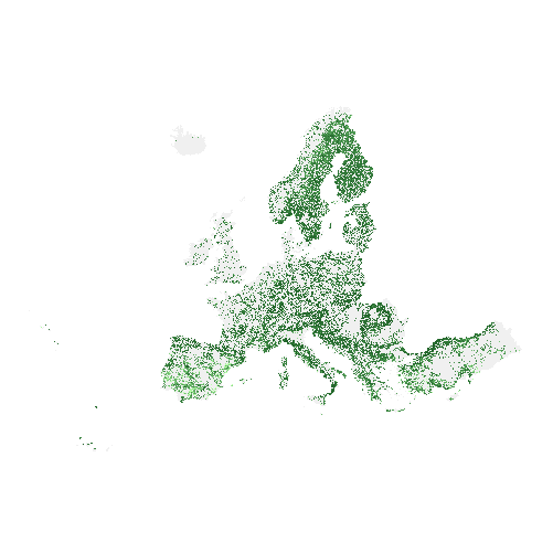
The main high resolution grassland product is the Grassland layer, a grassland/non-grassland mask for the EEA39. This grassy and non-woody vegetation baseline product includes all kinds of grasslands: managed grassland, semi-natural grassland and natural grassy vegetation. It is a binary status layer for the 2015 reference year mapping grassland and all non-grassland areas in 20m and (aggregated) 100m pixel size and for the 2018 reference year - in 10m and (aggregated) 100m pixel size. The production of the high resolution grassland layers was coordinated by the European Environment Agency (EEA) in the frame of the EU Copernicus programme.
-

The high resolution forest product consists of three types of (status) products and additional change products. The status products are available for the 2012, 2015 and 2018 reference years: 1. Tree cover density providing level of tree cover density in a range from 0-100%; 2. Dominant leaf type providing information on the dominant leaf type: broadleaved or coniferous; 3. A Forest type product. The forest type product allows to get as close as possible to the FAO forest definition. In its original (20m) resolution it consists of two products: 1) a dominant leaf type product that has a MMU of 0.5 ha, as well as a 10% tree cover density threshold applied, and 2) a support layer that maps, based on the dominant leaf type product, trees under agricultural use and in urban context (derived from CLC and high resolution imperviousness 2009 data). For the final 100m product trees under agricultural use and urban context from the support layer are removed. The high resolution forest change products comprise a simple tree cover density change product for 2012-2015 (% increase or decrease of real tree cover density changes). The production of the high resolution forest layers was coordinated by the European Environment Agency (EEA) in the frame of the EU Copernicus programme.
-
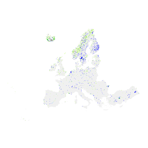
The Copernicus High Resolution Water and Wetness (WAW) 2015 layer is a thematic product showing the occurrence of water and wet surfaces over the period from 2009 to 2015 for the EEA38 area and the United Kingdom . This metadata corresponds to the aggregation of the 20m classified product into a 100m raster. The production of the High Resolution Water and Wetness layers was coordinated by the European Environment Agency (EEA) in the frame of the EU Copernicus programme. Two WAW products are available: - The main Water and Wetness (WAW) product, with defined classes of (1) permanent water, (2) temporary water, (3) permanent wetness and (4) temporary wetness. - The additional expert product: Water and Wetness Probability Index (WWPI). The products show the occurrence of water and indicate the degree of wetness in a physical sense, assessed independently of the actual vegetation cover and are thus not limited to a specific land cover class and their relative frequencies. Data is provided as a mosaic of the full area, and as tiles with a side length of 1000 km x 1000 km. In 2020, due to methodological improvements, the temporary wet class has been reprocessed during the update for the 2018 reference year.
-

The high resolution forest product consists of three types of (status) products and additional change products. The status products are available for the 2012 and 2015 reference years: 1. Tree cover density providing level of tree cover density in a range from 0-100%; 2. Dominant leaf type providing information on the dominant leaf type: broadleaved or coniferous; 3. A Forest type product. The forest type product allows to get as close as possible to the FAO forest definition. In its original (20m) resolution it consists of two products: 1) a dominant leaf type product that has a MMU of 0.5 ha, as well as a 10% tree cover density threshold applied, and 2) a support layer that maps, based on the dominant leaf type product, trees under agricultural use and in urban context (derived from CLC and high resolution imperviousness 2009 data). For the final 100m product trees under agricultural use and urban context from the support layer are removed. The high resolution forest change products comprise a simple tree cover density change product for 2012-2015 (% increase or decrease of real tree cover density changes). The production of the high resolution forest layers was coordinated by the European Environment Agency (EEA) in the frame of the EU Copernicus programme.
-

The main high resolution grassland product is the Grassland layer, a grassland/non-grassland mask for the EEA39. This grassy and non-woody vegetation baseline product includes all kinds of grasslands: managed grassland, semi-natural grassland and natural grassy vegetation. It is a binary status layer for the 2015 reference year mapping grassland and all non-grassland areas in 20m and (aggregated) 100m pixel size and for the 2018 reference year - in 10m and (aggregated) 100m pixel size. The production of the high resolution grassland layers was coordinated by the European Environment Agency (EEA) in the frame of the EU Copernicus programme.
-
The high resolution forest product consists of three types of (status) products and additional change products. The status products are available for the 2012, 2015 and 2018 reference years: 1. Tree cover density providing level of tree cover density in a range from 0-100%; 2. Dominant leaf type providing information on the dominant leaf type: broadleaved or coniferous; 3. A Forest type product. The forest type product allows to get as close as possible to the FAO forest definition. In its original (20m) resolution it consists of two products: 1) a dominant leaf type product that has a MMU of 0.5 ha, as well as a 10% tree cover density threshold applied, and 2) a support layer that maps, based on the dominant leaf type product, trees under agricultural use and in urban context (derived from CLC and high resolution imperviousness 2009 data). For the final 100m product trees under agricultural use and urban context from the support layer are removed. The high resolution forest change products comprise a simple tree cover density change product for 2012-2015 (% increase or decrease of real tree cover density changes). The production of the high resolution forest layers was coordinated by the European Environment Agency (EEA) in the frame of the EU Copernicus programme.