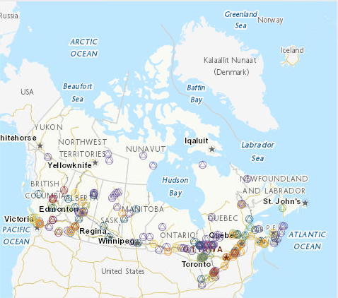
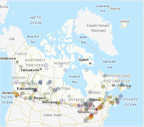
 Arctic SDI catalogue
Web App
Type of resources
Available actions
Topics
Keywords
Contact for the resource
Provided by
Formats
Representation types
Update frequencies
status
-
The Canadian Environmental Sustainability Indicators (CESI) program provides data and information to track Canada's performance on key environmental sustainability issues. The Air pollutant emissions indicators track emissions from human activities of 6 key air pollutants: sulphur oxides (SOX), nitrogen oxides (NOX), volatile organic compounds (VOCs), ammonia (NH3), carbon monoxide (CO) and fine particulate matter (PM2.5). Black carbon, which is a component of PM2.5, produced by combustion, is also reported. Sectoral indicators on air pollutant emissions from the oil and gas industry, transportation, off-road vehicles and mobile equipment and electric utilities provide additional analysis on the largest sources of Canada's air pollutant emissions. For each air pollutant, the indicators are provided at the national and provincial/territorial levels. They also identify the major sources of emissions and provide links to detailed information on air pollutant emissions from facilities. The Air pollutant emissions indicators are intended to inform Canadians and decision makers about progress made towards reducing emissions from human-related sources of air pollutants and about the effectiveness of emission reduction measures in reducing emissions to improve ambient air quality in Canada. Information is provided to Canadians in a number of formats including: static and interactive maps, charts and graphs, HTML and CSV data tables and downloadable reports. See the supplementary documentation for the data sources and details on how the data were collected and how the indicator was calculated. Canadian Environmental Sustainability Indicators: https://www.canada.ca/environmental-indicators
-
The Canadian Environmental Sustainability Indicators (CESI) program provides data and information to track Canada's performance on key environmental sustainability issues. These indicators track facility-based releases to water of 4 substances that are defined as toxic under the Canadian Environmental Protection Act, 1999: mercury, lead, cadmium and arsenic and their compounds. For each substance, data are provided at the national, regional (provincial and territorial) and facility level, as well as by source. The indicators inform Canadians about releases to water of these 4 substances from facilities in Canada. The Releases of harmful substances to water indicators also help the government to identify priorities and develop or revise strategies to inform further risk management and to track progress on policies put in place to reduce or control these 4 substances and water pollution in general.Information is provided to Canadians in a number of formats including: static and interactive maps, charts and graphs, HTML and CSV data tables and downloadable reports. See the supplementary documentation for the data sources and details on how the data were collected and how the indicator was calculated. Canadian Environmental Sustainability Indicators: https://www.canada.ca/environmental-indicators
-
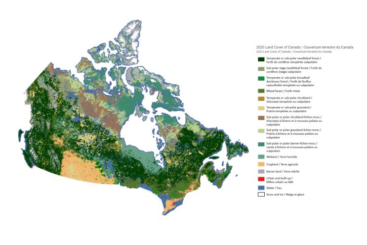
To support the implementation of the Impact Assessment Act, Natural Resources Canada (NRCan) received funding over five years (2018-23) for cumulative effects research to be conducted by three of NRCan’s science sectors – the Canada Centre for Mapping and Earth Observation within the Strategic Policy and Innovation Sector, the Canadian Forest Service, and the Geological Survey of Canada within the Lands and Minerals Sector – to conduct key earth observation, forest, and geoscience research. The overarching goal of this research is to inform regional assessment and related impact assessment processes, with a central focus on making the science and knowledge generated open and accessible to the public via the Open Science and Data Platform . Projects from all three sectors generated authoritative data on the status and trends of ecosystem parameters, as well as provided unique science and technical analysis, synthesis and advice on topics related to the cumulative effects of natural resource development. This Story Map synthesizes the cumulative effects science generated over the past five years. Through the Story Map platform, we hope to illustrate the national scale of this research program and the diversity of locations in Canada within which research has been conducted.
-
The Canadian Environmental Sustainability Indicators (CESI) program provides data and information to track Canada's performance on key environmental sustainability issues. The Air quality indicators track ambient concentrations of fine particulate matter, ground-level ozone, sulphur dioxide, nitrogen dioxide, and volatile organic compounds at the national, regional and urban levels and at local monitoring stations. The national and regional indicators are presented with their corresponding Canadian Ambient Air Quality Standard when available. Canadians are exposed to air pollutants on a daily basis, and this exposure can cause adverse health and environmental effects. Information is provided to Canadians in a number of formats including: static and interactive maps, charts and graphs, HTML and CSV data tables and downloadable reports. See the supplementary documentation for the data sources and details on how the data were collected and how the indicator was calculated. Canadian Environmental Sustainability Indicators: https://www.canada.ca/environmental-indicators
-
2 Billion Trees Program Forests and trees sustain life on Earth. Beyond the jobs that our sustainably managed forests provide, people living in Canada rely on forests for a wealth of benefits. Healthy forest ecosystems sustain thousands of living organisms, supply us with food, provide shelter and shade on a sunny day, clean the air we breathe and the water we drink, and hold spiritual significance for many, particularly within Indigenous cultures. The following 10 tree planting projects (out of 72 projects funded by the 2 Billion Trees program in 2021) are being showcased to highlight the diversity of projects funded across Canada. From the application of traditional ecological knowledge, habitat restoration, increasing tree biodiversity in urban centres, or engaging local residents in an effort to educate people on the importance of nature-based climate solutions, these projects demonstrate that planting trees brings a wealth of benefits for all Canadians, from coast to coast.
-
The Canadian Environmental Sustainability Indicators (CESI) program provides data and information to track Canada's performance on key environmental sustainability issues. The Air pollutant emissions indicators track emissions from human activities of 6 key air pollutants: sulphur oxides (SOX), nitrogen oxides (NOX), volatile organic compounds (VOCs), ammonia (NH3), carbon monoxide (CO) and fine particulate matter (PM2.5). Black carbon, which is a component of PM2.5, produced by combustion, is also reported. Sectoral indicators on air pollutant emissions from the oil and gas industry, transportation, off-road vehicles and mobile equipment and electric utilities provide additional analysis on the largest sources of Canada's air pollutant emissions. For each air pollutant, the indicators are provided at the national and provincial/territorial levels. They also identify the major sources of emissions and provide links to detailed information on air pollutant emissions from facilities. The Air pollutant emissions indicators are intended to inform Canadians and decision makers about progress made towards reducing emissions from human-related sources of air pollutants and about the effectiveness of emission reduction measures in reducing emissions to improve ambient air quality in Canada. Information is provided to Canadians in a number of formats including: static and interactive maps, charts and graphs, HTML and CSV data tables and downloadable reports. See the supplementary documentation for the data sources and details on how the data were collected and how the indicator was calculated. Canadian Environmental Sustainability Indicators: https://www.canada.ca/environmental-indicators
-

The Canadian Environmental Sustainability Indicators (CESI) program provides data and information to track Canada's performance on key environmental sustainability issues. The Water quantity in Canadian rivers indicator provides a national summary of the annual water quantity status in rivers across Canada from 2009 to 2023 and by monitoring station in 2023. The indicator also offers trends that provide an assessment of whether there have been significant observed changes over time in water quantity, of very-high and very-low flows, at monitoring stations across Canada for a 50-year period from 1974 to 2023. Information is provided to Canadians in a number of formats including: static and interactive maps, charts and graphs, HTML and CSV data tables and downloadable reports. See the supplementary documentation for the data sources and details on how the data were collected and how the indicator was calculated. Canadian Environmental Sustainability Indicators: https://www.canada.ca/environmental-indicators