 Arctic SDI catalogue
Aquatic Ecosystems
Type of resources
Available actions
Topics
Keywords
Contact for the resource
Provided by
Years
Formats
Representation types
Update frequencies
status
Service types
-

Across the Canadian North, Arctic Char, Salvelinus alpinus, are culturally important and critical for maintaining subsistence lifestyles and ensuring food security for Inuit. Arctic Char also support economic development initiatives in many Arctic communities through the establishment of coastal and inland commercial char fisheries. The Halokvik River, located near the community of Cambridge Bay, Nunavut, has supported a commercial fishery for anadromous Arctic Char since the late 1960s. The sustainable management of this fishery, however, remains challenging given the lack of biological data on Arctic Char from this system and the limited information on abundance and biomass needed for resolving sustainable rates of exploitation. In 2013 and 2014, we enumerated the upstream run of Arctic Char in this system using a weir normally used for commercial harvesting. Additionally, we measured fish length and used T-bar anchor tags to mark a subset of the run. Subsequently, we estimated population size using capture-mark-recapture (CMR) methods. The estimated number of Arctic Char differed substantially between years. In 2013, 1967 Arctic Char were enumerated whereas in 2014, 14,502 Arctic Char were enumerated. We attribute this marked difference primarily to differences in weir design between years. There was also no significant relationship between daily mean water temperature and number of Arctic Char counted per day in either year of the enumeration. The CMR population estimates of Arctic Char (those ≥450mm in length) for 2013 and 2014 were 35,546 (95% C.I 30,513-49,254) and 48,377 (95% C.I. 37,398-74,601) respectively. The 95% CI overlapped between years, suggesting that inter-annual differences may not be as extreme as what is suggested by the enumeration. The population estimates reported here are also the first estimates of population size for an Arctic Char stock in the Cambridge Bay region using CMR methodology. Overall, the results of this study will be valuable for understanding how population size may fluctuate over time in the region and for potentially providing advice on the sustainable rates of harvest for Halokvik River Arctic Char. Additionally, the results generated here may prove valuable for validating current stock assessment models that are being explored for estimating biomass and abundance for commercial stocks of Arctic Char in the region.
-
PURPOSE: The objective of the program is to gather environmental coastal data to better understand fluctuations in water temperature and its effect on coastal marine species. DESCRIPTION: Bottom and surface water temperatures are monitored in coastal waters of the southern Gulf of St. Lawrence using electronic recording devices attached to navigational buoys or moorings and set to record every two hours. PARAMETERS COLLECTED: Temperature (environmental); point (spatial). NOTES ON QUALITY CONTROL: Data are checked for irregularities. SAMPLING METHODS: Temperature recording devices are installed by fishermen, DFO staff and, since 2000, by the Canadian Coast Guard staff. USE LIMITATION: To ensure scientific integrity and appropriate use of the data, we would encourage you to contact the data custodian.
-

Mean fork length for returning adult Atlantic salmon (Salmo salar) that spent one or two years (1SW and 2SW, respectively) in the marine environment for 16 rivers throughout Eastern Canada spanning an 10° latitudinal gradient. These data were collected as part of monitoring programs for Atlantic salmon returns run by Fisheries and Oceans Canada (DFO). Data from at least eight populations, spanning all provinces in Atlantic Canada, over a 50-year period (1970-2021) will be included in this meta-analysis. These data, as well as mean fork length for returning adult Atlantic salmon from three rivers in Québec (1979-2021) collected as part of monitoring programs for Atlantic salmon returns run by the Ministère de l’Environnement, de la Lutte contre les changements climatiques, de la Faune et des Parcs, Government of Québec, are also available at: http://doi.org/10.17605/OSF.IO/78PWT.
-

PURPOSE: To characterize food webs of freshwater fish communities using stable isotopes DESCRIPTION: Data set containing the carbon, nitrogen, and sulphur stable isotope ratios of fishes caught in the Northwest Miramichi River system PARAMETERS COLLECTED: Species gut contents (ecological); species isotopic signatures (ecological); points (spatial) PHYSICAL SAMPLE DETAILS: Powdered animal tissue SAMPLING METHODS: Invertebrates were sampled via kicknet and were collected 1-4 meters from the shore of each location in one-minute intervals with 5-10 intervals per site. Fish were captured using a variety of net types in order to maximize sampling breadth. Please see below for list of net types and mesh sizes: Large fyke (box, lead line, and cod = 5mm tight, 10mm loose); 6mm beach seine; Site 3: two small fyke nets (box, lead line, and cod = 17mm, 17mm and 10mm tight, and 32mm, 32mm, 20mm loose), one trap net (box = 47.6mm and lead line = 146mm) were used). USE LIMITATION: To ensure scientific integrity and appropriate use of the data, we would encourage you to contact the data custodian.
-
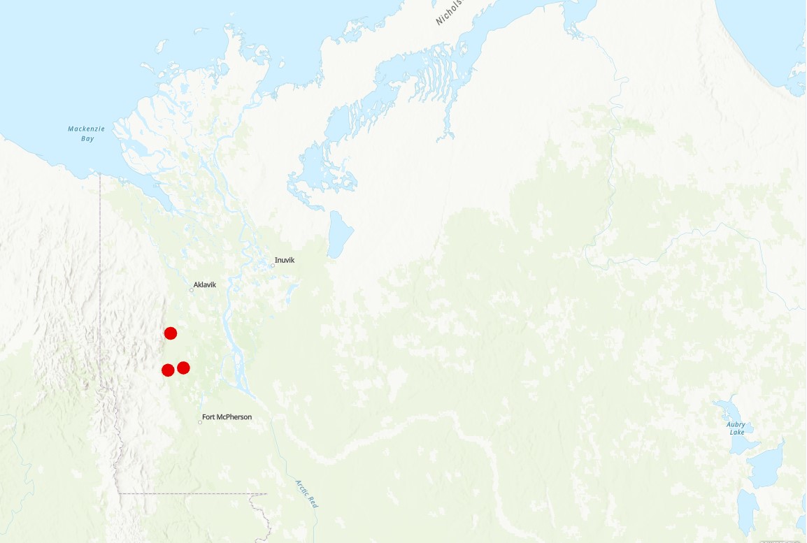
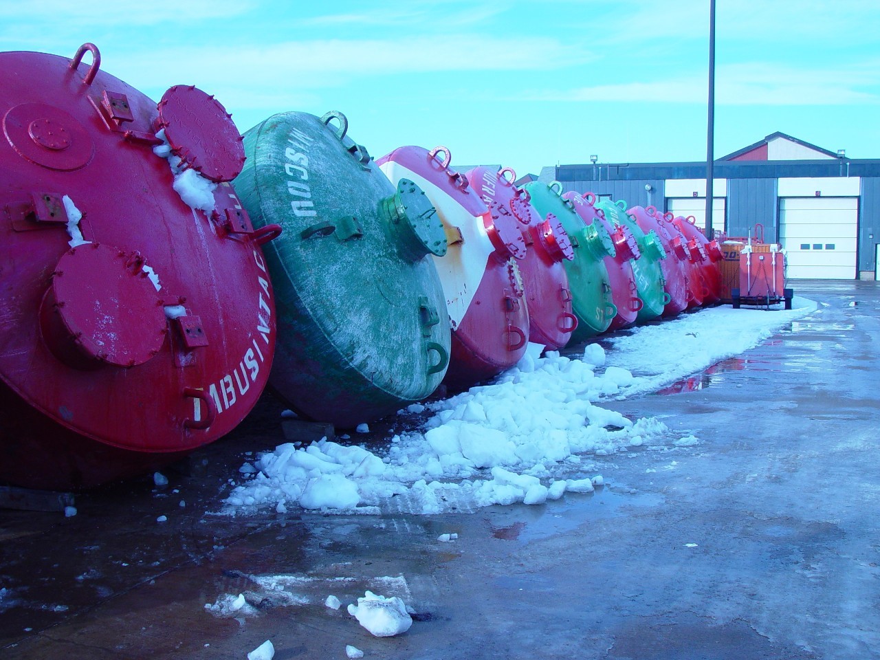
Situated in the Gwich’in settlement Area (GSA), the Rat River is inhabited by anadromous Dolly Varden (Salvelinus malma malma) that are harvested by both Gwich’in and Inuvialuit beneficiaries. The harvest of Dolly Varden from the Rat River occurs during the summer at feeding areas along the coast (by the Inuvialuit) and during upstream migration in the Mackenzie Delta (by both Gwich’in and Inuvialuit). Dolly Varden stocks are co-managed under an Integrated Fisheries Management Plan (IFMP) whose signatories include Fisheries and Oceans Canada (DFO), Gwich'in Renewable Resources Board, Fisheries Joint Management Committee, and Parks Canada Agency. The Rat River Working Group, the co-management body that makes recommendations for harvest levels for Dolly Varden stocks in the GSA, has supported research activities that facilitate implementation of the IFMP, including studies to monitor harvest levels and assess population status. Population studies (e.g., abundance estimates, biological and genetic sampling) and coastal harvest monitoring activities allow for a comprehensive assessment of this stock. The data are used to inform co-management partners on the status of Dolly Varden from the Rat River.
-

PURPOSE: In this study, we examined the structure and function of the Southampton Island marine food web across 149 species of benthic and pelagic invertebrates, fishes, marine mammals and seabirds collected from 2016 to 2019, to provide a baseline for future studies that aim to quantify temporal changes in food web structuring. More specifically,we used a multi-biomarker approach combining stable isotopes and HBIs to: (i) determine the vertical trophic structure of the marine food web, (ii) investigate the contribution of benthic and pelagic-derived prey to the higher trophic level species of the Arctic food web, and (iii) determine the role of ice algae and phytoplankton carbon source use across different trophic levels and compartments (pelagic and benthic). By shedding new light on the functioning of the Southampton Island food web and specifically how the contribution of ice algae and benthic habitat shapes its structure, these results will be relevant to adaptive management and conservation initiatives implemented in response to anthropogenic stressors and climate change. DESCRIPTION: Climate-driven alterations of the marine environment are most rapid in Arctic and subarctic regions, including Hudson Bay in northern Canada, where declining sea ice, warming surface waters and ocean acidification are occurring at alarming rates. These changes are altering primary production patterns that will ultimately cascade up through the food web. Here, we investigated (i) the vertical trophic structure of the Southampton Island marine ecosystem in northern Hudson Bay, (ii) the contribution of benthic and pelagic-derived prey to the higher trophic level species, and (iii) the relative contribution of ice algae and phytoplankton derived carbon in sustaining this ecosystem. For this purpose, we measured bulk stable carbon, nitrogen and sulfur isotope ratios as well as highly branched isoprenoids in samples belonging to 149 taxa, including invertebrates, fishes, seabirds and marine mammals. We found that the benthic invertebrates occupied 4 trophic levels and that the overall trophic system went up to an average trophic position of 4.8. The average δ34S signature of pelagic organisms indicated that they exploit both benthic and pelagic food sources, suggesting there are many interconnections between these compartments in this coastal area. The relatively high sympagic carbon dependence of Arctic marine mammals (53.3 ± 22.2 %) through their consumption of benthic invertebrate prey, confirms the important role of the benthic subweb for sustaining higher trophic level consumers in the coastal pelagic environment. Therefore, a potential decrease in the productivity of ice algae could lead to a profound alteration of the benthic food web and a cascading effect on this Arctic ecosystem. Collaborators: Centre for Earth Observation Science, University of Manitoba, Winnipeg, Manitoba, Canada - R´emi Amiraux, C.J. Mundy, Jens K. Ehn, Z.A. Kuzyk. Quebec-Ocean, Sentinel North and Takuvik, Biology Department, Laval University, Quebec, Quebec, Canada - Marie Pierrejean. Scottish Association for Marine Science, Oban, UK - Thomas A. Brown. Department of Natural Resource Sciences, McGill University, Ste. Anne de Bellevue, Quebec, Canada - Kyle H. Elliott. Department of Biological Sciences, University of Manitoba, Winnipeg, Manitoba, Canada - Steven H. Ferguson, Cory J.D. Matthews, Cortney A. Watt, David J. Yurkowski. School of the Environment, University of Windsor, Windsor, Ontario, Canada - Aaron T. Fisk. Science and Technology Branch, Environment and Climate Change Canada, Ottawa, Ontario, Canada - Grant Gilchrist. College of Fisheries and Ocean Sciences, University of Alaska Fairbanks, Fairbanks, AK, USA - Katrin Iken. Department of Earth Sciences, University of New Brunswick, Fredericton, NB, Canada - Audrey Limoges. Department of Integrative Biology, University of Windsor, Windsor, Ontario, Canada - Oliver P. Love, Wesley R. Ogloff. Department of Arctic Biology, The University Centre in Svalbard, Longyearbyen, Norway - Janne E. Søreide.
-
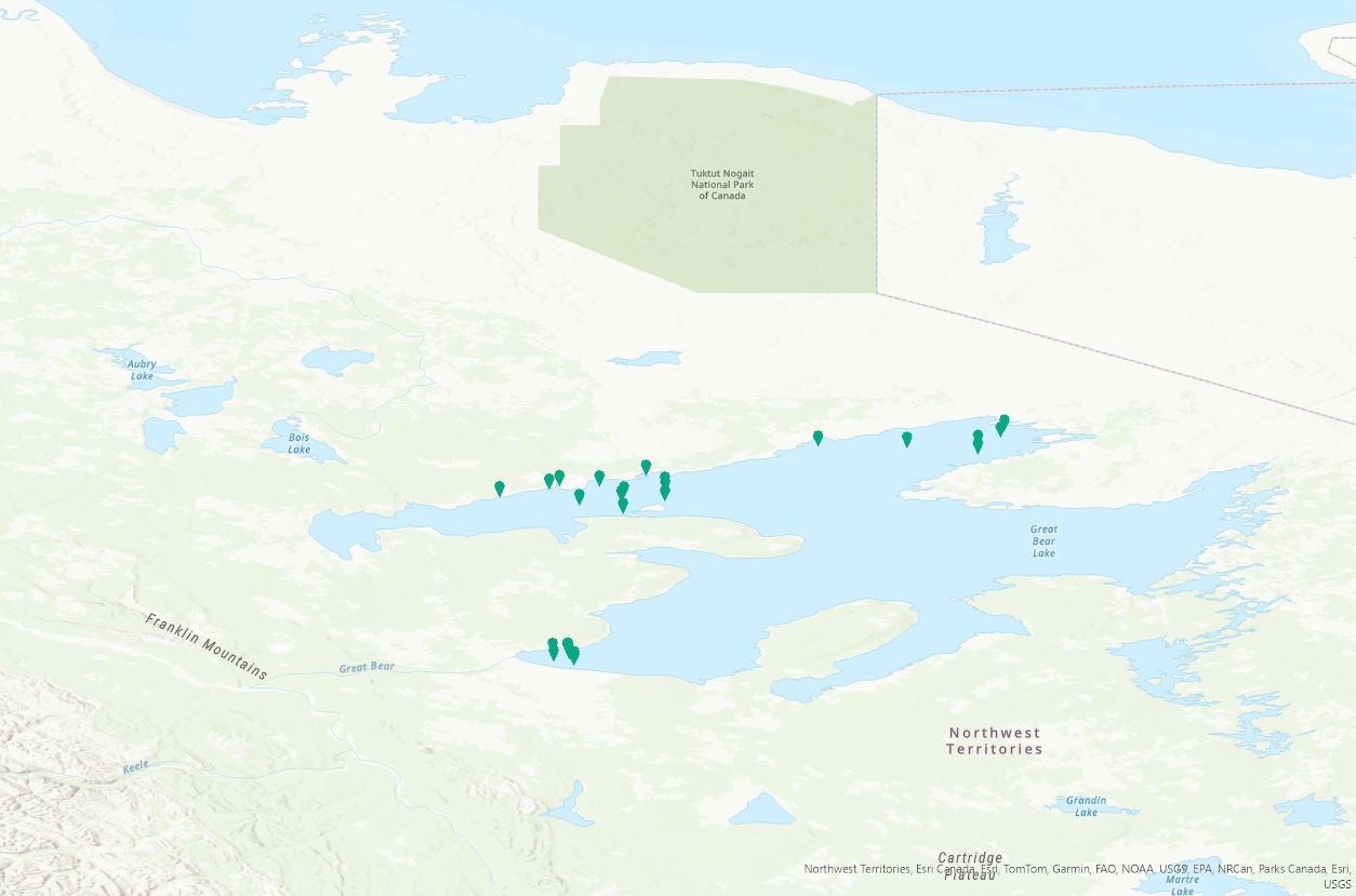
PURPOSE: This study is part of a two-decade series of research aimed to provide a comprehensive synthesis of the effects of harvest and environmental change on fisheries in Great Bear Lake. The main objectives are to assess demographic traits and the current status of harvested species, with a focus on evaluating sustainable harvest levels of lake trout, a cold-adapted species with a relatively narrow thermal niche. As part of this research, trends in water quality and primary productivity are monitored to evaluate potential effects of change on fisheries. DESCRIPTION: Great Bear Lake, one of the largest lakes in North America, contains culturally and recreationally important fish species. Great Bear Lake is located in the sub-Arctic and Arctic Circle. As part of a two-decade series of research aimed to provide a comprehensive synthesis of the effects of harvest and environmental change on fisheries in Great Bear Lake, the main objectives of this study are to assess demographic traits and the current status of harvested species, with a focus on evaluating sustainable harvest levels of lake trout, a cold-adapted species with a relatively narrow thermal niche. As part of this research, trends in water quality and primary productivity are monitored to evaluate potential effects of change on fisheries. From 2021 to 2024, surface water temperature data was collected at depths of 0.1 to 1.0 meters using an RBR Maestro3 through partnered community-led and community/Fisheries and Oceans Canada/university partner collaborative sampling. The project has strong community involvement, including youth through the Guardian Program, to facilitate capacity building and community leadership in the long-term monitoring of Great Bear Lake fisheries and the aquatic ecosystem. This data is an extension of baseline data sets on water quality on the lake. These data will contribute to a better understanding cumulative impacts of climate change on the functioning of large northern lake ecosystems and provide a benchmark for monitoring further change. This data will be important for developing effective strategies for maintaining community-led aquatic monitoring and managing natural resources, particularly fish, which are expected to be increasingly important to communities with declines in other country foods such as caribou. We acknowledge the data were collected in the Sahtú Settlement Area and are made publicly available with the agreement of the Délı̨nę Renewable Resources Council (Délı̨nę Ɂehdzo Got’ı̨nę (Renewable Resources Council)). Collaborators include: the Community of Délı̨nę partners (data collection), Délı̨nę Renewable Resource Council, Sahtú Renewable Resource Board, and University of Manitoba. Community of Délı̨nę partners and field workers that participated in data collection include Chris Yukon, Archie Vital, Ted Mackienzo, Daniel Baton, Lloyd Baton, Simon Neyelle, and Stanley Ferdanan. Funding and logistical support was provided by: Northwest Territories Cumulative Impact Monitoring, Sahtú Renewable Resource Board, the Polar Continental Shelf Program and Fisheries and Oceans Canada.
-

PURPOSE: To gather localized high-quality data for mapping eelgrass distribution in bays and estuaries in the Gulf Region of Atlantic Canada. DESCRIPTION: Between 2018 and 2023, a total of 48 coastal sites in New Brunswick (NB), Prince Edward Island (PE), and Nova Scotia (NS) have been fully processed for eelgrass presence/absence and depth information. An additional 18 sites from the same region and time period (2018–2023) have data collected but not yet fully processed for depth and eelgrass classification. These sites will be incorporated into the dataset as processing is completed. PARAMETERS COLLECTED: Geographic coordinates, timestamp, submerged aquatic vegetation presence. NOTES ON QUALITY CONTROL: BioSonics Visual Aquatic was used to process raw dt4 files by delineating the bottom and submerged aquatic vegetation (SAV) heights. Initial delineation of the estuary bottom was performed using an automated algorithm within the software, followed by manual adjustments to refine the delineation as needed. An algorithm was then used to delineate vegetation, which was edited visually by referring to written ground-truthing notes and underwater photos taken with a GoPro underwater camera with GPS capacity. Expert advice within DFO was used to advise the analysts on best practices and subtleties in the echograms. All efforts were made to ensure vegetation mapped was eelgrass, but in some cases, such as where the acoustic response was not clear or ground-truthing notes were lacking, it is possible that other types of SAV were included. The processed data were exported from BioSonics Visual Aquatic aggregating sets of 10 pings that were in very close proximity. Grouped pings with a vegetation canopy height >= 0.1 m were assigned an eelgrass presence (i.e., "EG_Presence") value of "Y", while grouped pings with a height < 0.1 m were assigned a presence value of "N". SAMPLING METHODS: Acoustic data were collected during the summer or early fall season (varies depending on the site) by the Southern Gulf of St. Lawrence Coalition on Sustainability (Coalition-SGSL) in partnership with Fisheries and Oceans Canada (DFO) Gulf Region. At some sites, the Province of New Brunswick's Department of Agriculture, Aquaculture and Fisheries (NBDAAF) also collected data using their boat. BioSonics MX Aquatic Habitat Echosounder units with a single beam (8.7°) 204.8kHz transducer (mounting height varied depending on the boat used) was used for data collection by all parties. Positioning was achieved using the BioSonics internal GPS through 2020, then subsequently an external GPS unit (Hemisphere S631 RTK GPS) was used to improve positioning from 1-2m accuracy to ~20cm when differential was obtained. BioSonics Visual Acquisition software was used to collect the data. USE LIMITATION: This product is provided as-is and has not been accuracy-assessed against other data. Since there were no transect-independent ground-truthing points surveyed, the accuracy of any interpolated surfaces created from this data cannot be known. Not for use without inclusion of full metadata. The data products are supplied "as they stand" and DFO does not guarantee the integrity, the completeness, or the accuracy. There were issues with the internal GPS of the BioSonics unit, and their impact on positional accuracy has yet to be determined. Beginning in 2021, an external, higher precision GPS unit was used to increase accuracy. Use of various boats and surveyors, as well as analysts, can introduce some inconsistencies in the data collection and analysis between sites and years. Site-specific characteristics such as mixed submerged aquatic vegetation can complicate mapping efforts. Shallow areas can also be challenging to delineate accurately since the bottom and/or the vegetation can extend higher than the mounted transducer. In these cases, a best estimate was used by the analyst. Weather conditions such as wind can affect the accuracy of the results, as the transponder may pitch and roll with the boat, while increased sediment in the water can interfere with the signal. Single-beam acoustic data has a very small focus footprint, which varies with depth, so it should not be considered a comprehensive bottom mapping tool. However, it does provide valuable point data that can indicate presence of vegetation, canopy height, relative depth, and ground-truthing for other mapping techniques (e.g. aerial or satellite imagery). For example, at 1 m depth, the 8.6 degree single-beam used for this work has a footprint of approximately 0.0177 square metres, and at 2 m depth that footprint becomes 0.0711 square metres.
-
PURPOSE: As a part of a two-decade series of research, this study aims to provide a comprehensive synthesis of the effects of harvest and environmental change on fisheries in Great Bear Lake. The main objectives are to assess demographic traits and the current status of harvested species, with a focus on evaluating sustainable harvest levels of lake trout, a cold-adapted species with a relatively narrow thermal niche. As part of this research, trends in water quality and primary productivity are monitored to evaluate potential effects of change on fisheries. DESCRIPTION: Great Bear Lake, one of the largest lakes in North America, contains culturally and recreationally important fish species. Great Bear Lake is located in the sub-Arctic and Arctic Circle. As part of a two-decade series of research aimed to provide a comprehensive synthesis of the effects of harvest and environmental change on fisheries in Great Bear Lake, the main objectives of this study are to assess demographic traits and the current status of harvested species, with a focus on evaluating sustainable harvest levels of lake trout, a cold-adapted species with a relatively narrow thermal niche. As part of this research, trends in water quality and primary productivity are monitored to evaluate potential effects of change on fisheries. From 2012 to 2019, surface water temperature data was collected at depths of 0.1 to 1.0 meters using a Hydrolab Series 5 Data Sonde Multiparameter instrument through partnered community-led and community/Fisheries and Oceans Canada/university partners collaborative sampling. The project has strong community involvement, including youth through the Guardian Program, to facilitate capacity building and community leadership in the long-term monitoring of Great Bear Lake fisheries and the aquatic ecosystem. This data is an extension of baseline data sets on water quality on the lake. These data will contribute to a better understanding cumulative impacts of climate change on the functioning of large northern lake ecosystems and provide a benchmark for monitoring further change. This data will be important for developing effective strategies for maintaining community-led aquatic monitoring and managing natural resources, particularly fish, which are expected to be increasingly important to communities with declines in other country foods such as caribou. We acknowledge the data were collected in the Sahtú Settlement Area and are made publicly available with the agreement of the Délı̨nę Renewable Resources Council (Délı̨nę Ɂehdzo Got’ı̨nę (Renewable Resources Council)). Collaborators include: the Community of Délı̨nę partners (data collection), Délı̨nę Renewable Resource Council, University of Manitoba, University of Queens, University of British Columbia, University of Alberta, Environment and Climate Change Canada, and Great Lakes Fisheries Commission, Sahtú Renewable Resource Board. Community of Délı̨nę partners and field workers that participated in data collection include Daniel Baton, Morris Betsidea, Joey Dillion, Jade English, Stanley Ferdanan, Bruce Kenny, Elaine Kenny, Darren Kenny, Greg Kenny, Joseph Kenny, Rocky Kenny, Ted Mackienzo, George Menacho, Bobby Modeste, Gina Nyelle, Brent Taniton, Allison Tatti, Gerald Tutcho, Archie Vital, Barbara Yukon, Caroline Yukon, Chris Yukon, and Cyre Yukon. Funding and logistical support was provided by: Northwest Territories Cumulative Impact Monitoring, Natural Sciences and Engineering Research Council of Canada, Environment and Climate Change Canada, Sahtú Renewable Resource Board, the Polar Continental Shelf Program, and Fisheries and Oceans Canada.
-

To better understand patterns of temporal and spatial variation of fish assemblages in offshore waters of Lake Winnipeg (Manitoba, Canada), pelagic trawl tows were conducted at lakewide monitoring stations since 2002. Trawl samples collected during spring, summer, and fall from the south basin, channel, and north basin were used to study effects of season and geographic region within the lake on species biomass estimates.