 Arctic SDI catalogue
Border
Type of resources
Available actions
Topics
Keywords
Contact for the resource
Provided by
Formats
Representation types
Update frequencies
status
Scale
-

Border crossings are a feature included on the Official Road Map of Ontario (ORM) for information purposes to the travelling public. Included are highway-land and ferry crossings. It was created as part of the Digital Cartographic Reference Base (DCRB) for the production of the ORM.
-
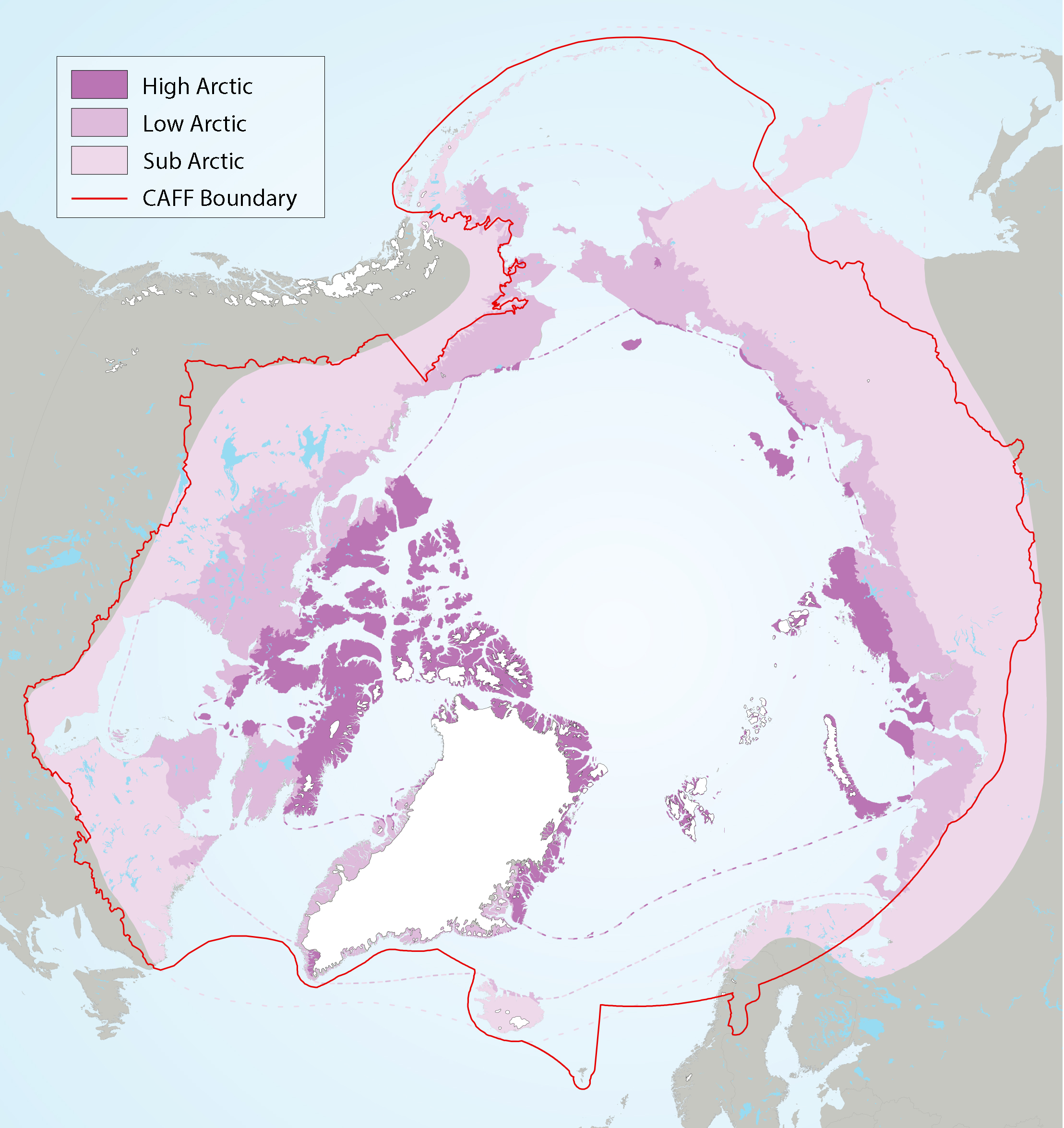
Figure 2-2 Arctic freshwater boundaries from the Arctic Council’s Arctic Biodiversity Assessment developed by CAFF, showing the three sub-regions of the Arctic, namely the high (dark purple), low (purple) and sub-Arctic (light purple)
-
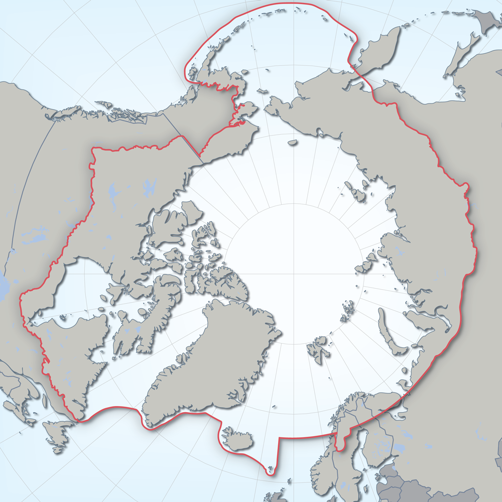
Defines the area covered by the the Conservation of Arctic Flora and Fauna (CAFF) working group of the Arctic Council. Each Arctic Council country was responsible for defining their Arctic boundary.
-

The administrative features of the CanVec series include geopolitical regions (international, territorial and provincial) and populated place names. A wide selection of attributes describe the data. The CanVec multiscale series is available as prepackaged downloadable files and by user-defined extent via a Geospatial data extraction tool. Related Products (Open Maps Links): [Topographic Data of Canada - CanVec Series](https://open.canada.ca/data/en/dataset/8ba2aa2a-7bb9-4448-b4d7-f164409fe056)